Name/Title
Orinda Park Tract Map Blueprint 1882Description
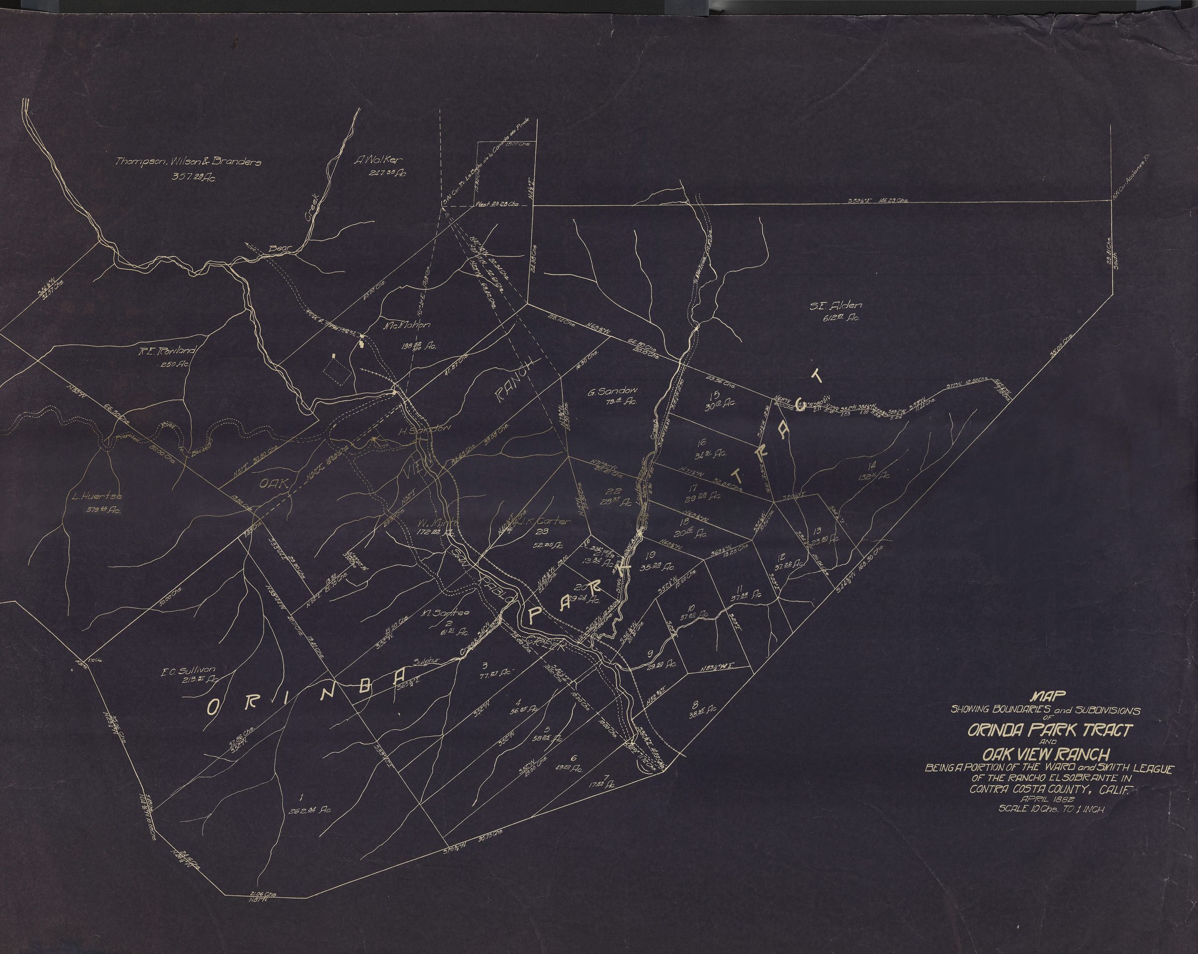
OrindaPark Tract Blueprint 1882
The image depicts a detailed historic map titled "Orinda Park Tract, Oak View Ranch," illustrating boundaries and subdivisions with meticulous line work. It maps out specific land parcels, each labeled with measurements in acres and names such as "F.J. Phelan" and "G. Gordon." Various natural features, like creeks and hills, are represented with wavy lines, adding texture to the landscape depiction. The map notes the location as Contra Costa County, California, within the Rancho Laguna de Los Palos Colorados, at a scale of 10 Chains* to 1 inch. 100 chains. Names listed on the tracts include: Thompson, Wilson, Branders, A. Walker, S.E. Alden, McMahon, R.E Rowland, G. Sandow, H.Sandow, L. Huertsel, W. Minto, J. K. Carter, E. O. Sullivan, M. Santee, and Oak View Rach.
*CHAIN – The unit of length prescribed by law for the survey of the public lands of the United States. The chain is equivalent to 66 feet or 4 rods, poles or perches. 10 square chains equals one acre.Other Name
OHS-Map-OrindaParkTractBlueprint-1882.jpg