Name/Title
Collection of drawings and maps, prior 1965Entry/Object ID
2005.49.1Scope and Content
Acc. No. 05.49.1 (1) thru (84)
Subject or Category: maps
Dates or Period: various
Object: drawings, maps
Description:
A collection of maps, tracings, and drawings of subdivision maps and lot maps. The hand-drawn maps and tracings bear the stamp and/or signature of E.G. Randall, Licensed Surveyor of Oakland, or Licensed Surveyor for the State of California. Non are newer than 1965.
Sizes: various
History of objects: Collection of maps of Alameda, from E.G. Randall, Licensed Surveyor.
List of maps:
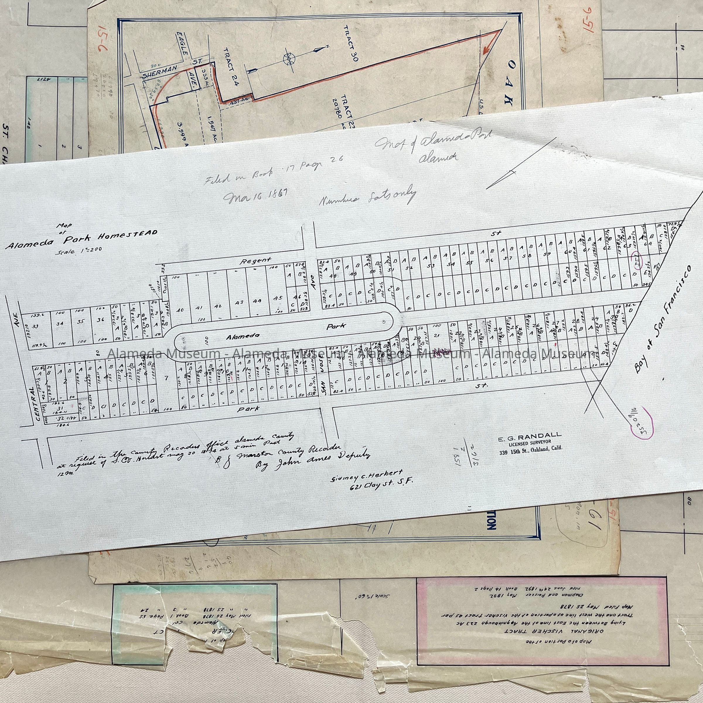
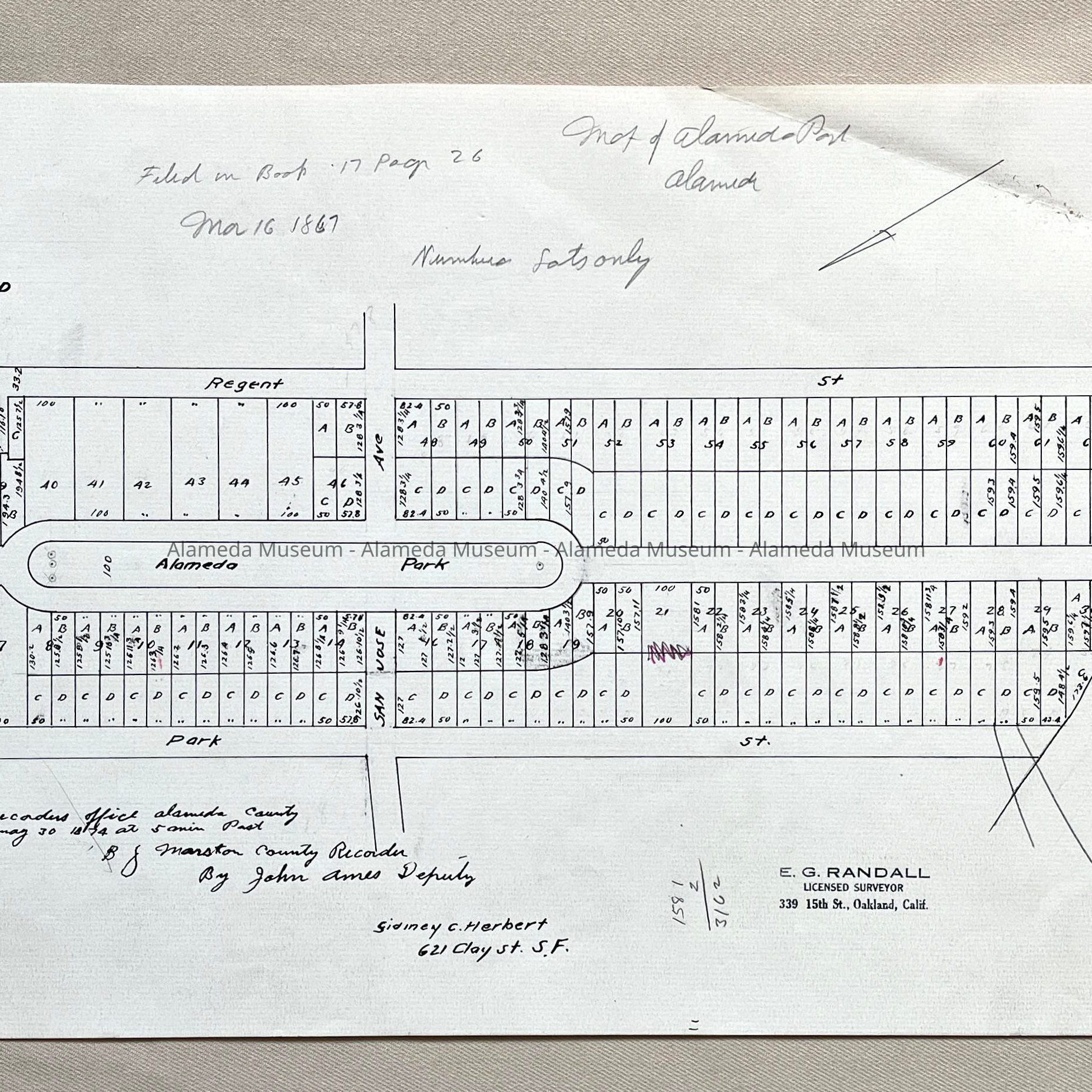
#1: Copy of 1867 or 1874 Map of Alameda Park Homestead
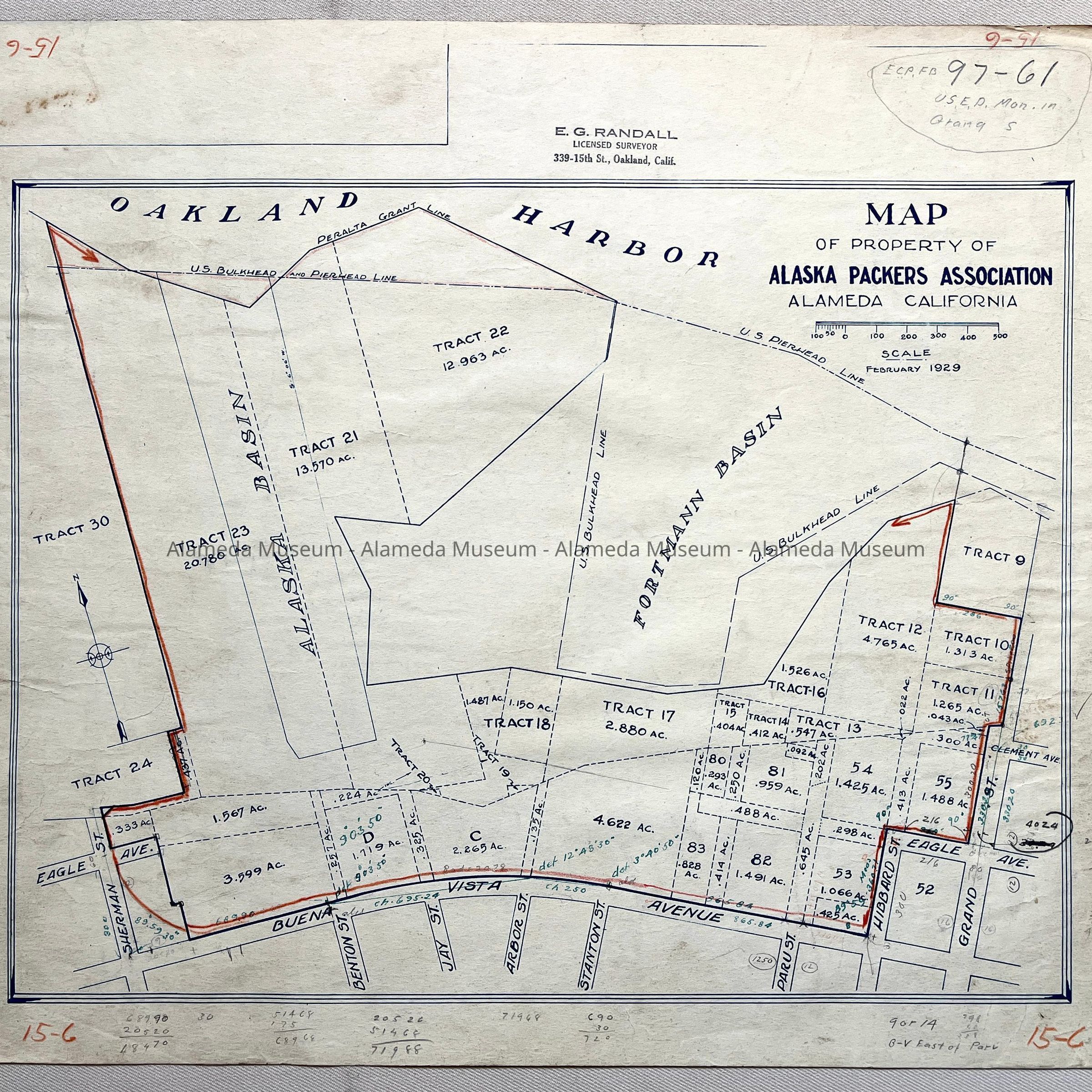
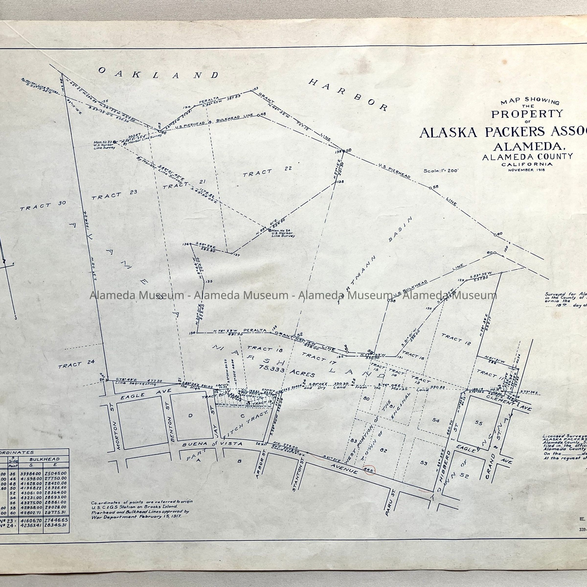
#2: Copy of Map of property of Alaska Packers Association from 1929, with property boundary marked in red grease pencil.
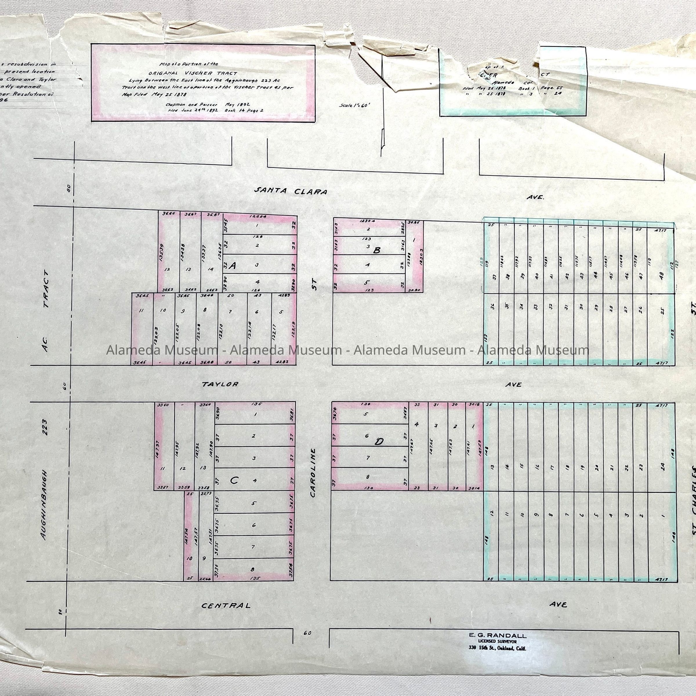
#3: Tracing of Map of portion of original Vischer Tract, by Chapman and Paisser, 1878 and 1892.
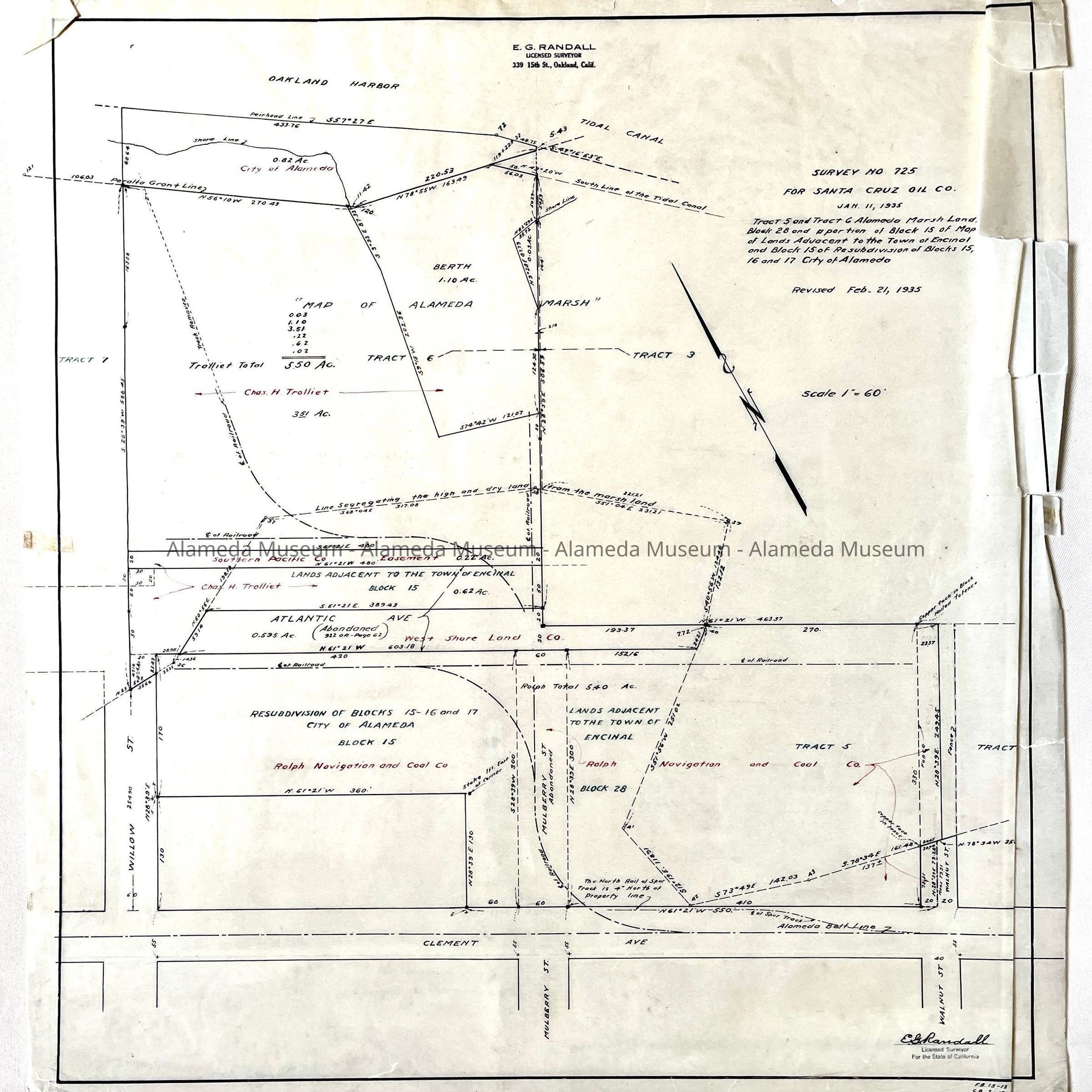
#4: Tracing of Survey 725 for Santa Cruz Oil Co, 1935.
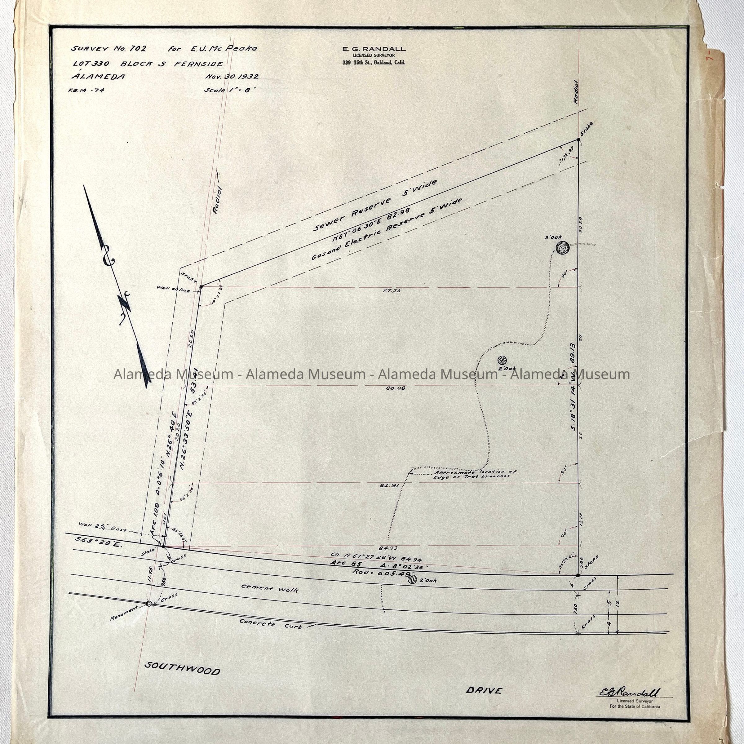
#5: Tracing of Survey No. 702, Lot 330 Block S, Fernside, 1932 for E.J. Mc Peake.
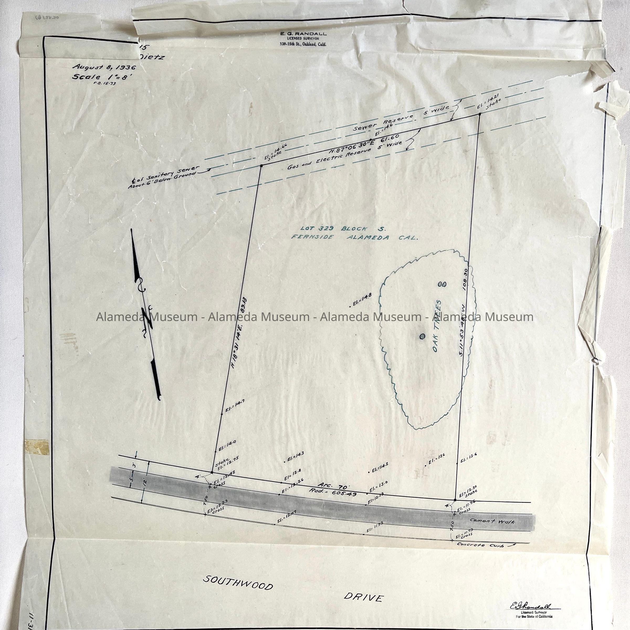
#6: Tracing of Survey Lot 329 Block S, Fernside, with location Oak Trees, Dietz, 1936.
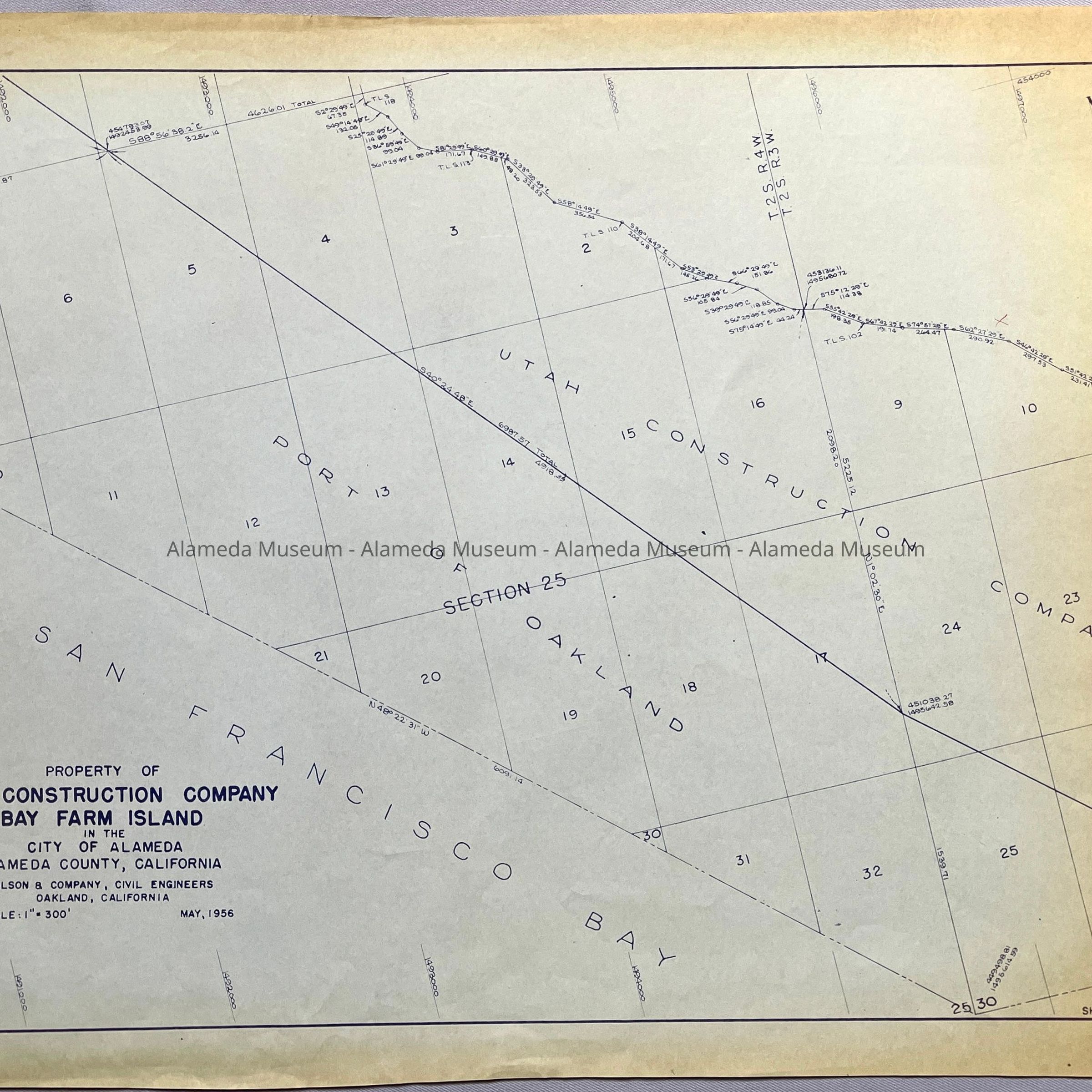
#7: Copy of Map of Property of UTAH Construction Company, Bay Farm Island, 1956
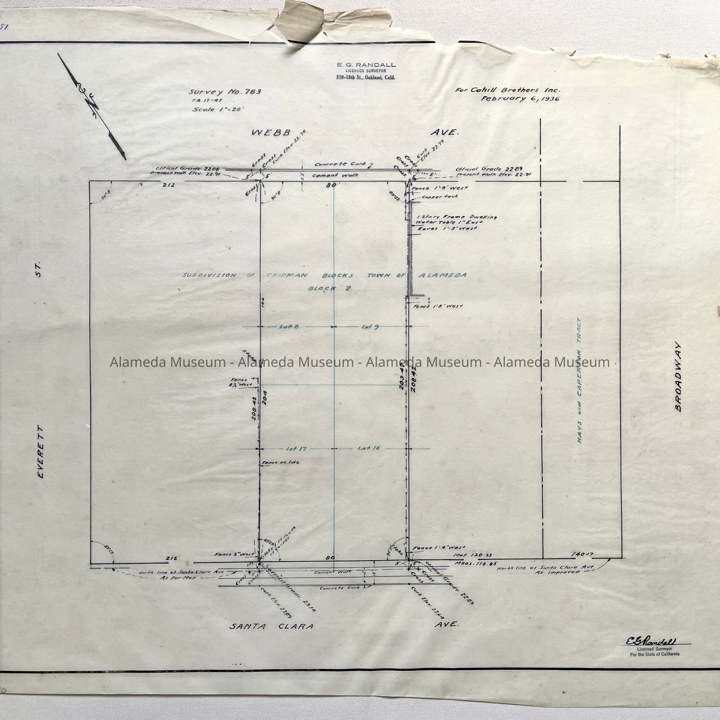
#8: Tracing Survey No. 783, Hays and Caperton Tract, for Cahill Brothers Inc., 1936
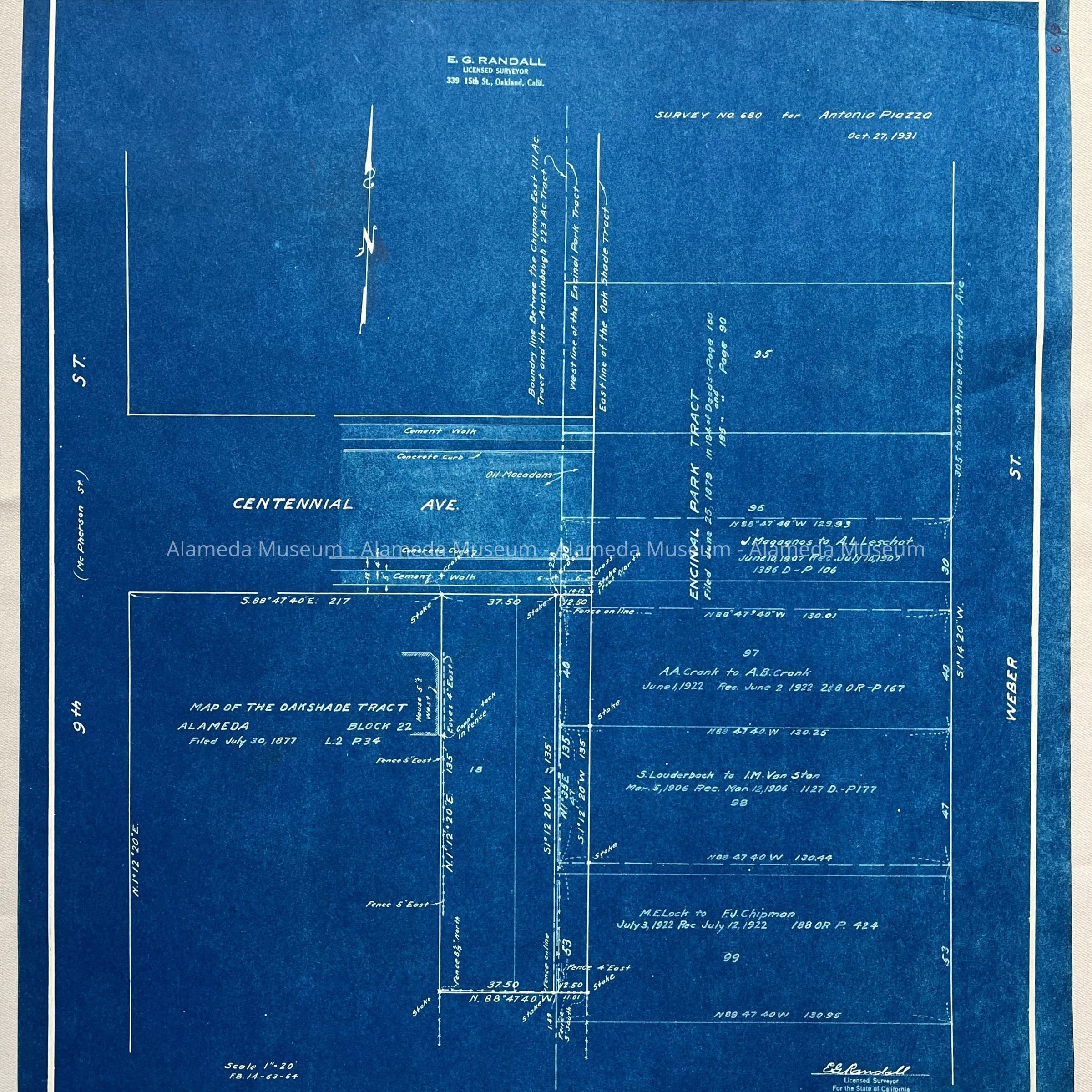
#9: Blueprint map of the Oakshade Tract, Block 22, filed 1877, Survey No. 680 for Antonio Piazza, 1931
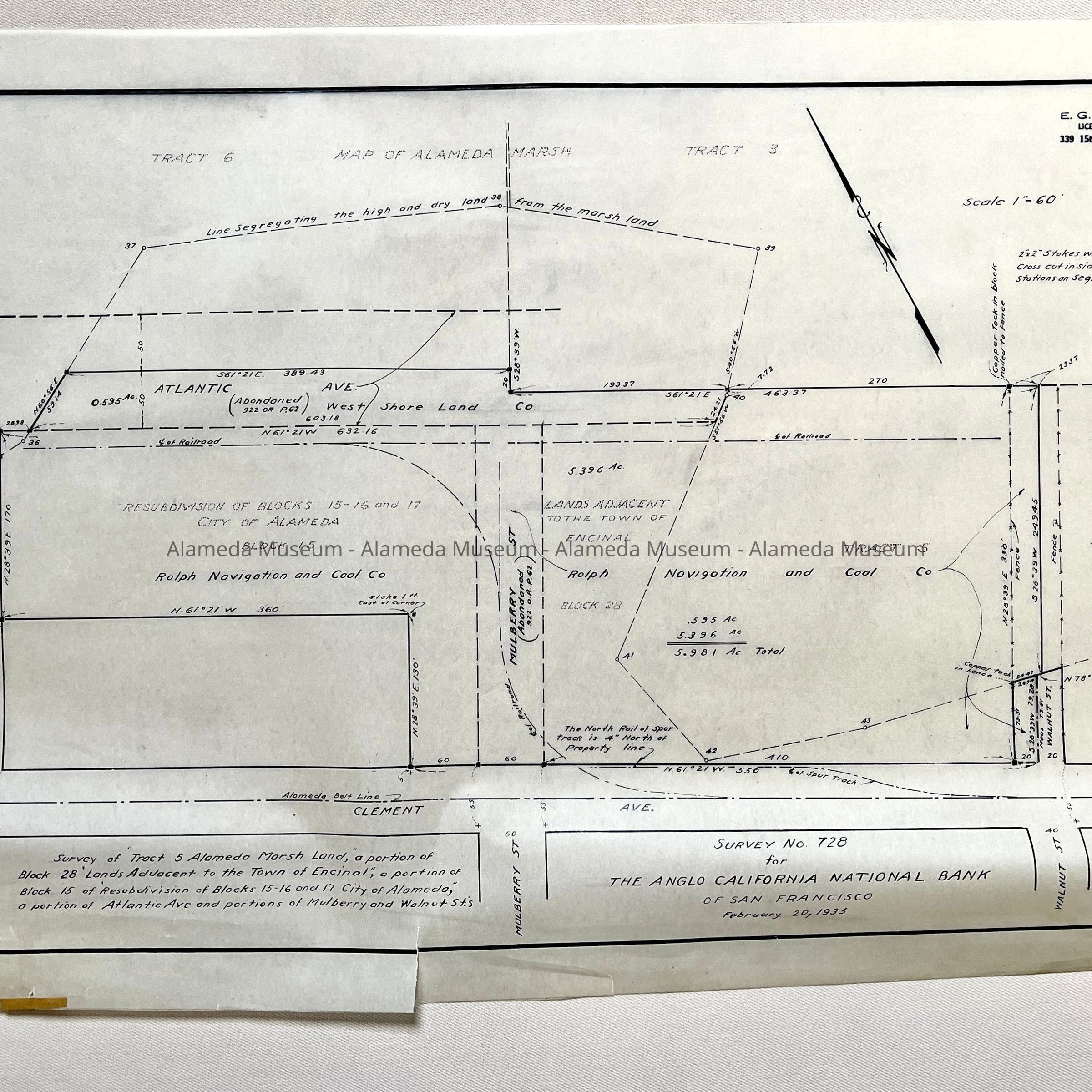
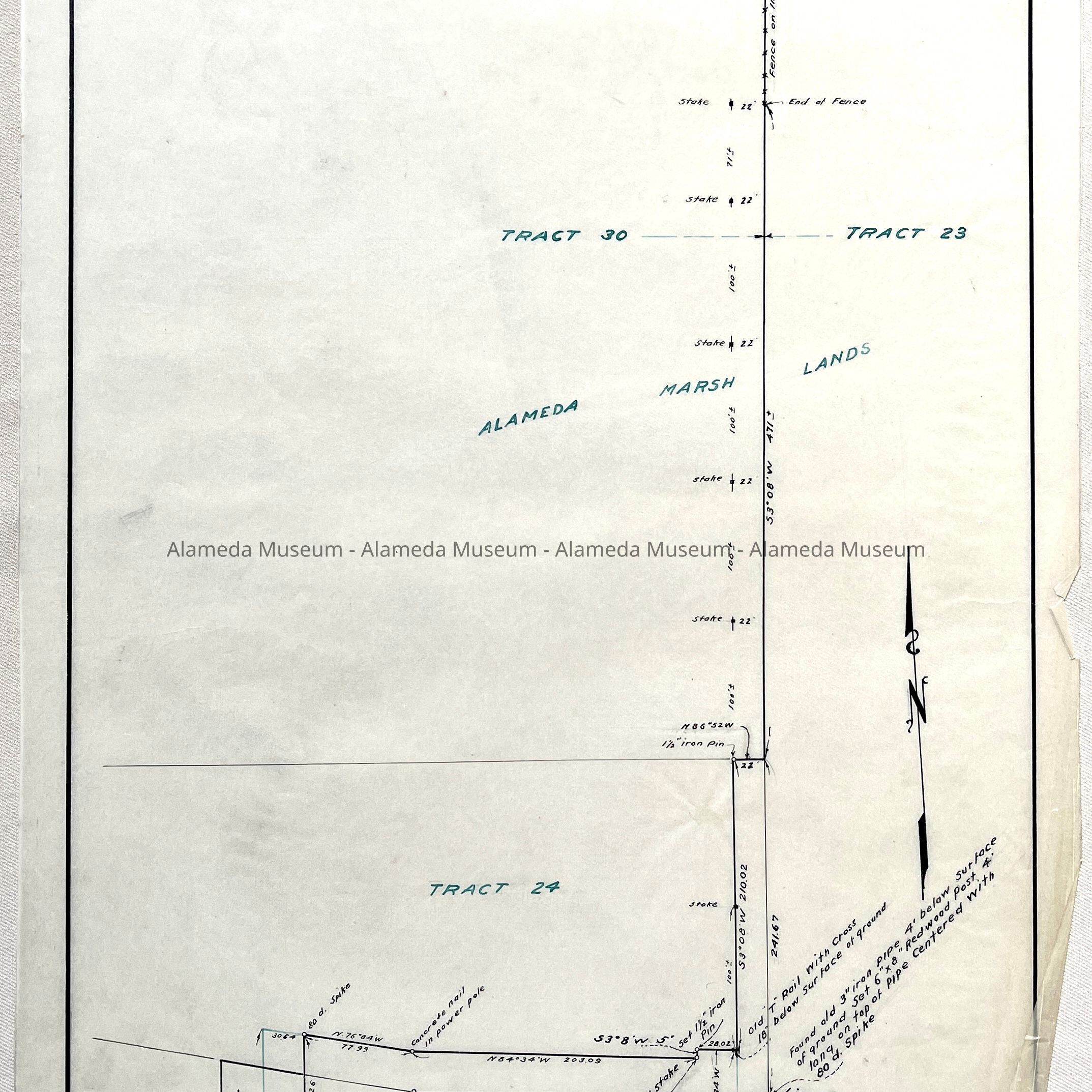
#10: Tracing Map of Alameda Marsh, Survey No. 728 for The Anglo California National Bank of San Francisco, 1935 - covering portion marsh land of Atlantic and Mulberry and Walnut St., of Tract 5, Alameda Marsh Land, Tract 3. Including building by Rolph Navigation and Coal Co.
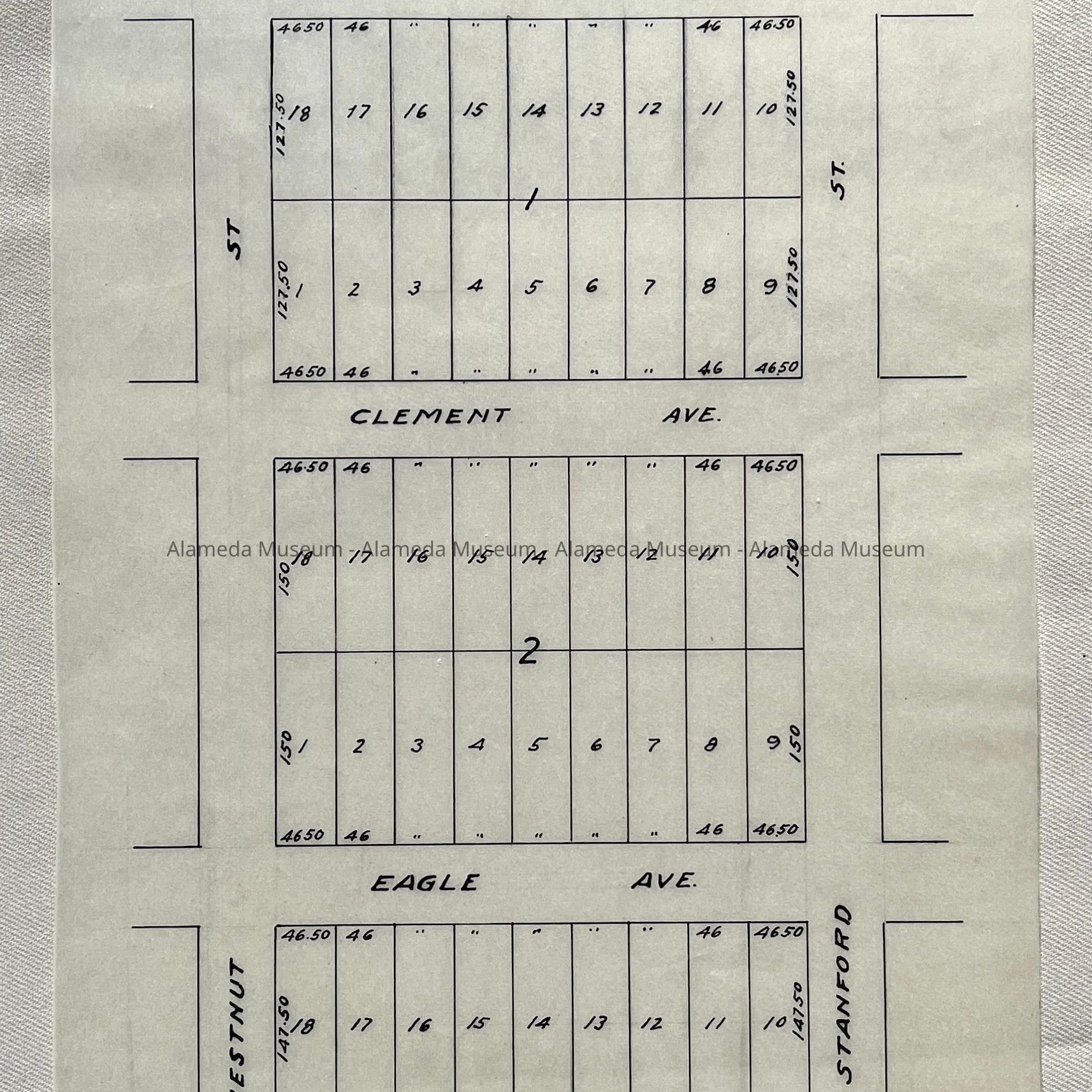
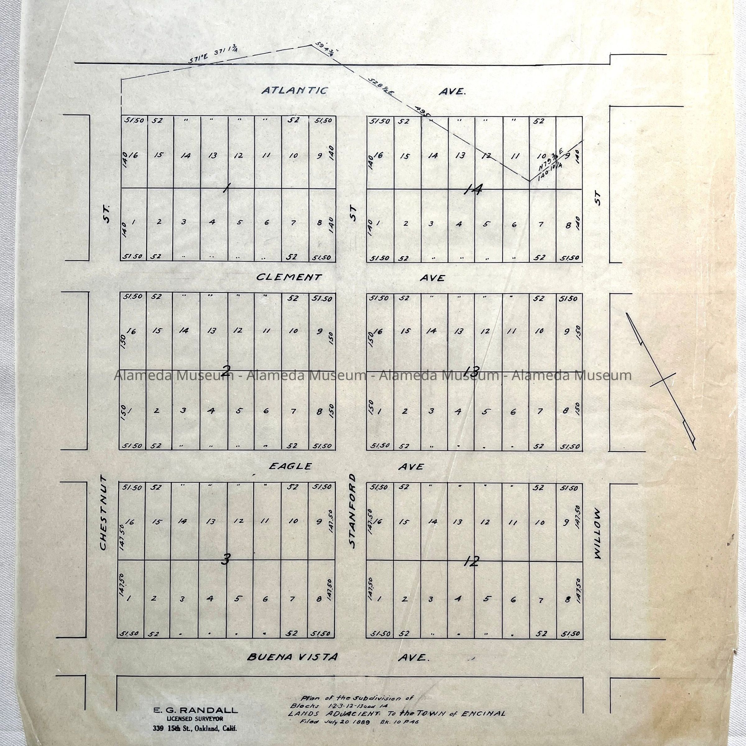
#11: Tracing of Resubdivision Map of Blocks 1-2 and 3, between Atlantic and Buena Vista, and Chestnut and Stanford, filed 1890
#12: Copy Map Alaska Packers Association, 1918.
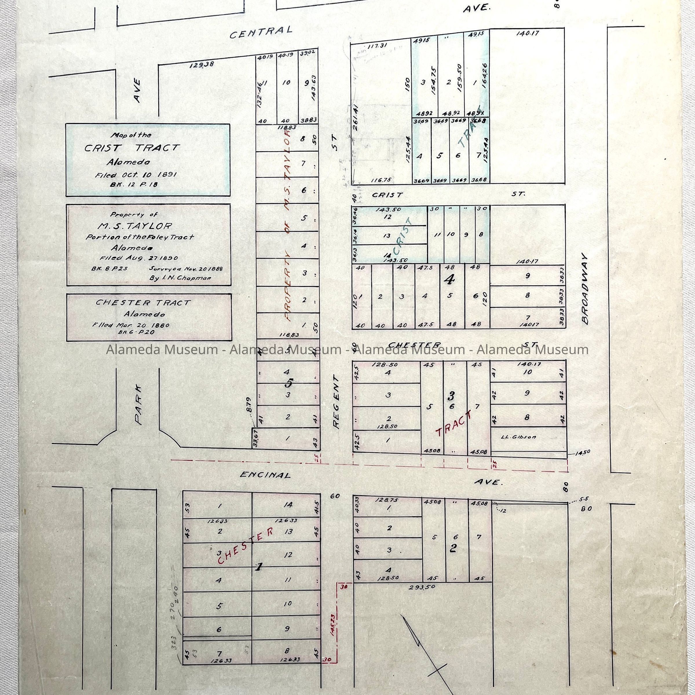
#13: Tracing Map of the Crist Tract (Filed 1891); M.S. Taylor property Filed 1890 (by Chapman); Chester Tract, 1880.
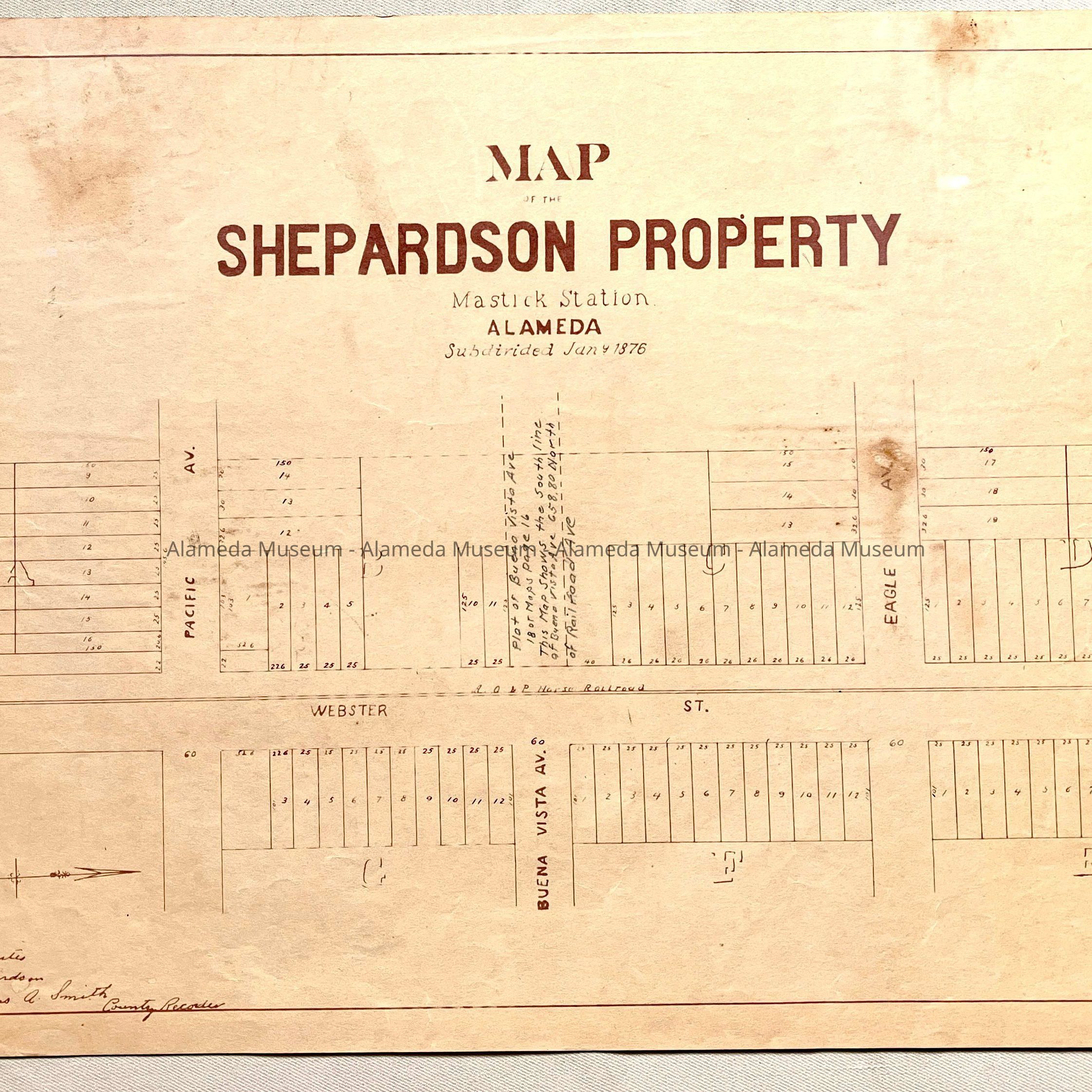
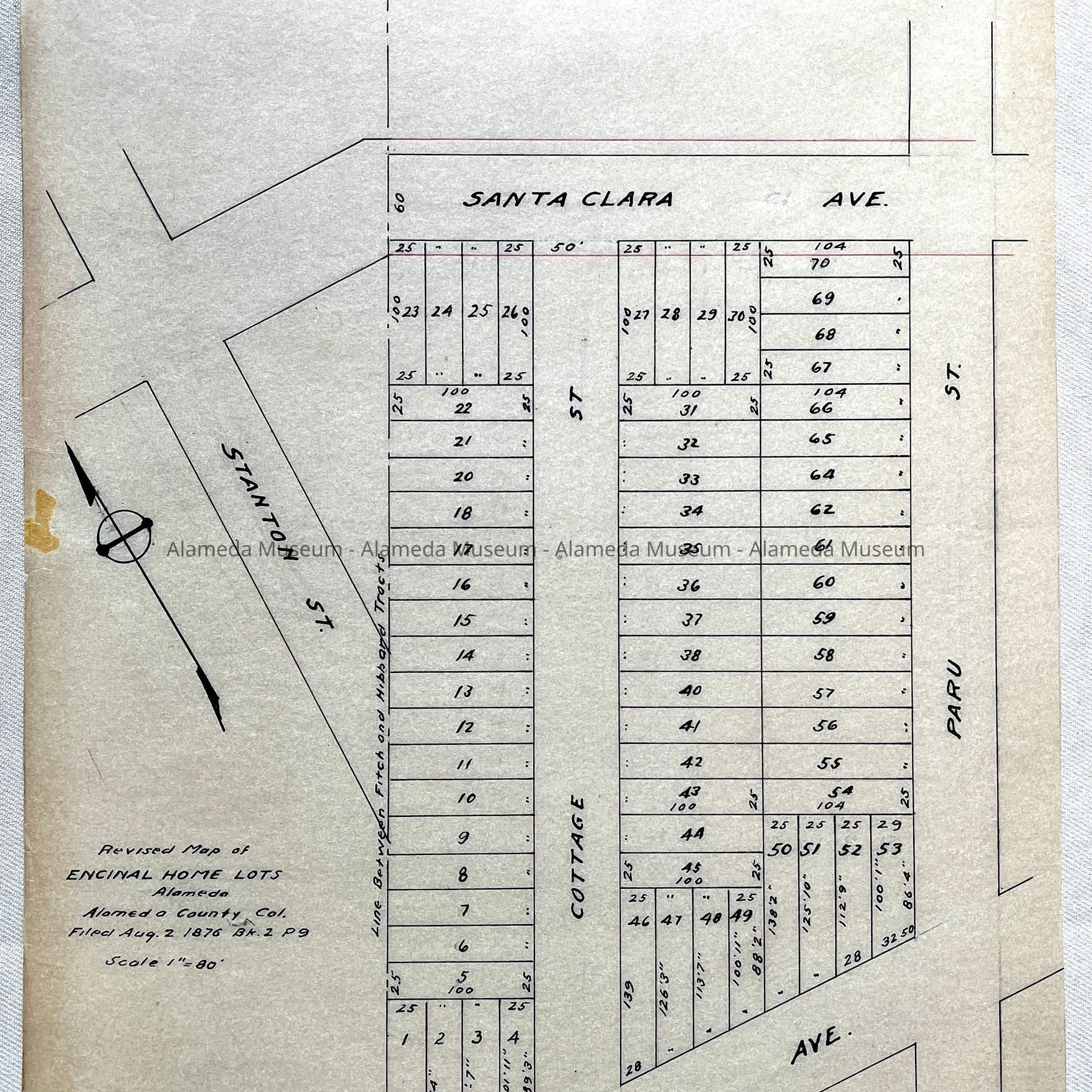
#14: Copy Map of Shepardson Property, Mastic Station, Subdivided 1876.
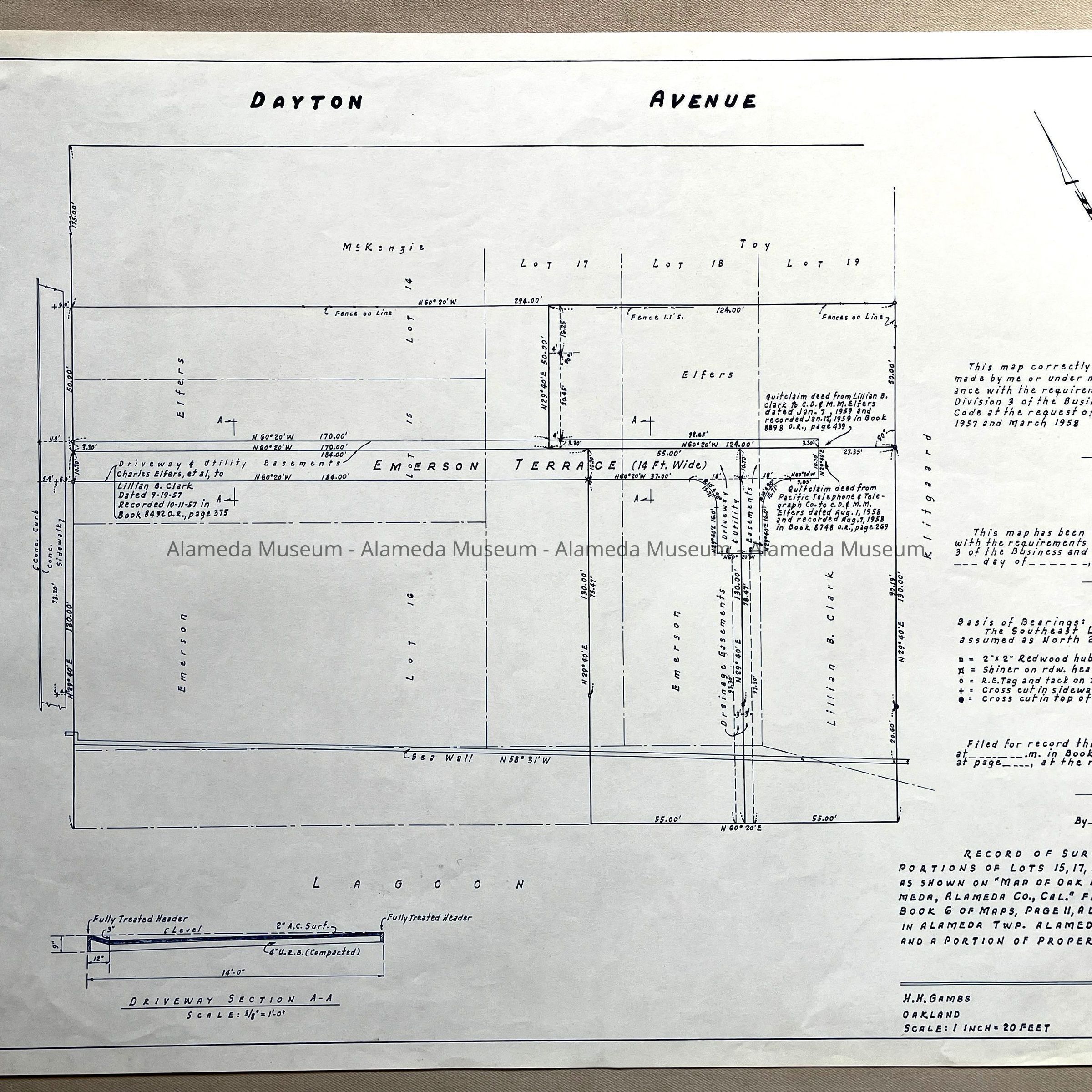
#15: Copy Map of Survey Map Portions of Oak Park Encinal, 1876 and Portion Property of J.S. Emerson ('Emerson Terrace', corner Dayton and Paru).
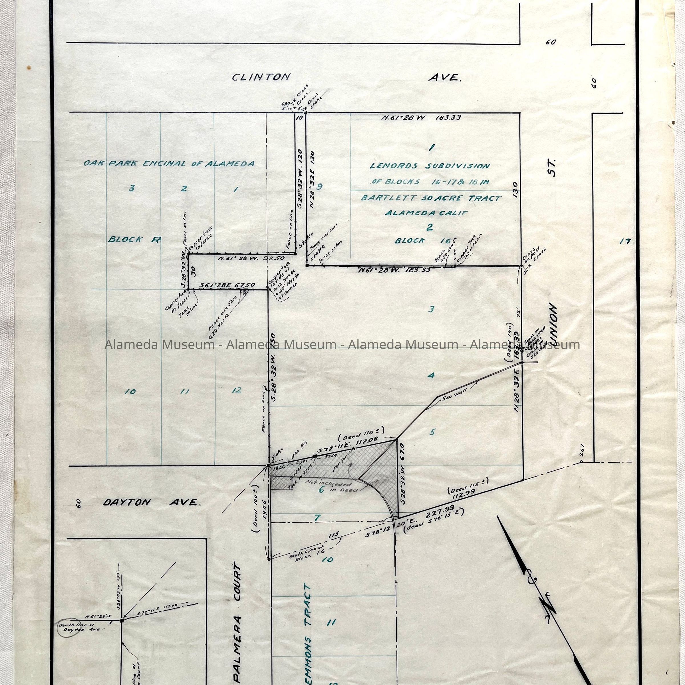
#16: Tracing Survey No. 740, for Mrs. Effie Johnson, 1935 (Lenords subdiision in Bartlett Tract; Oak Park Encinal of Alameda, showing Palmera Court, Emmons Tract, Dayton, Clinton, and Union St.)
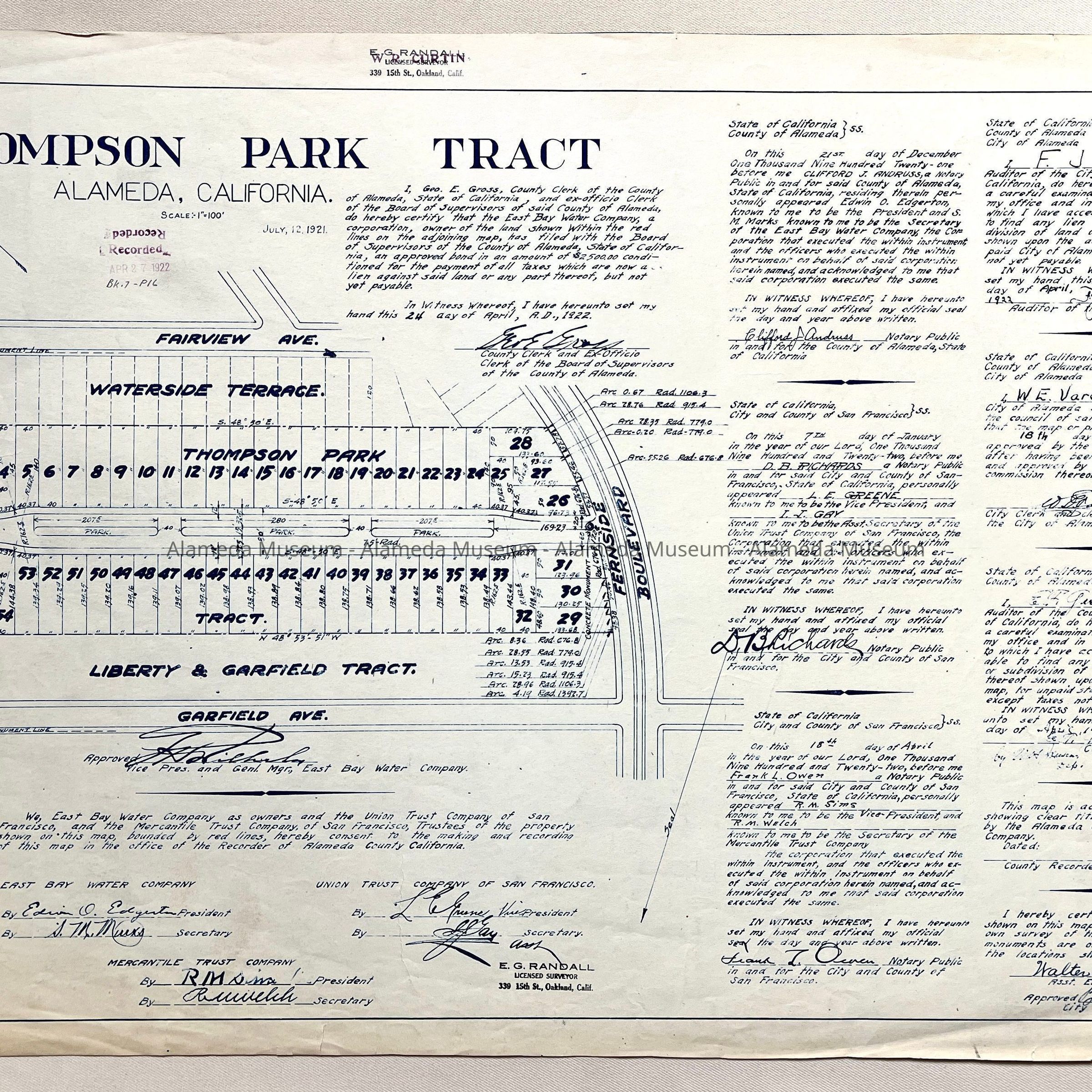
#17: Copy of Map of Thompson Park, 1921 (between Fairview Ave and Garfield Ave).
#18: Tracing Survey No. 748, For Alaska Packers Association, 1935 (showing corner Sherman and Eagle)
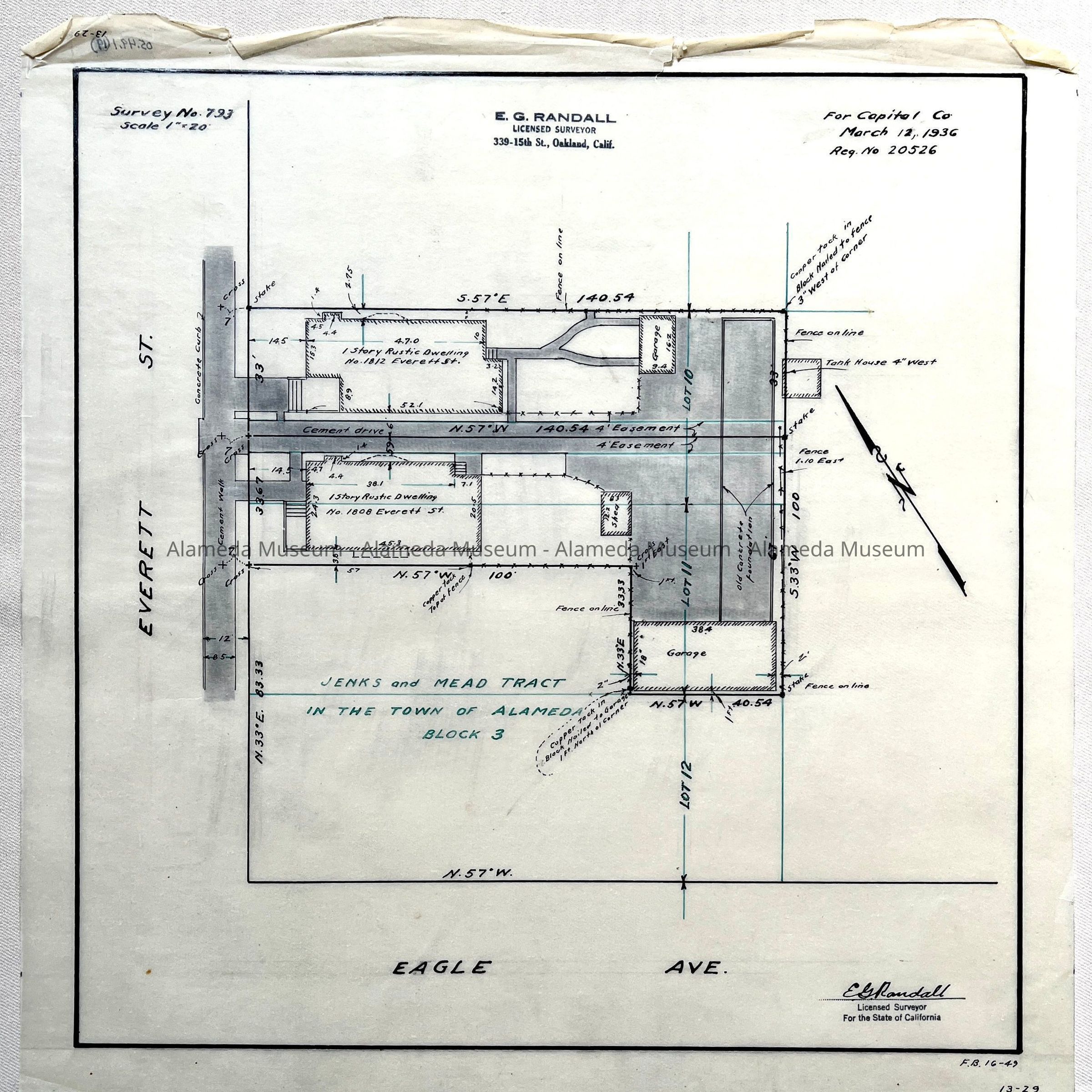
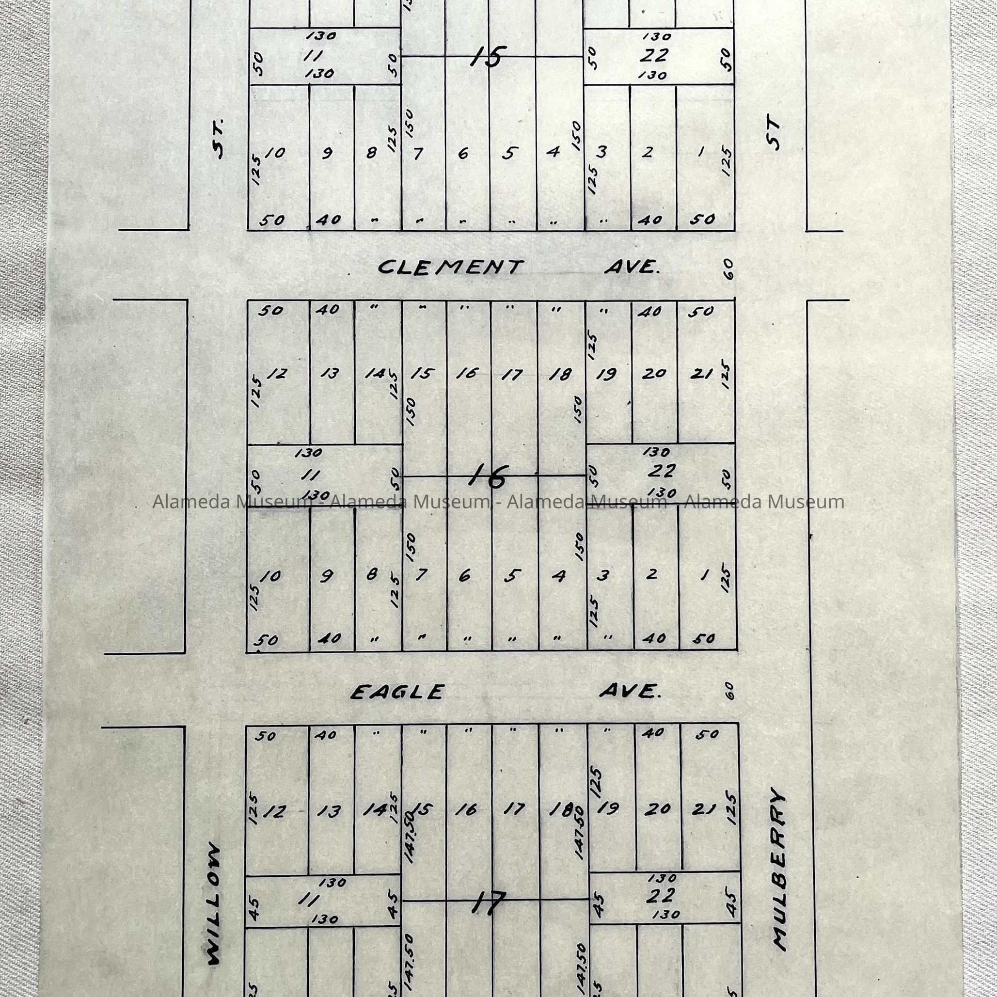
#19: Tracing Survey No. 793, For Capital Co, 1936 (showing corner Eagle and Everett)
#20: Tracing Plan of Subdivision of Blocks adjacent to Encinal Filed 1889 (showing blocks between Atlantic and Buena Vista, and Chestnut and Willow)
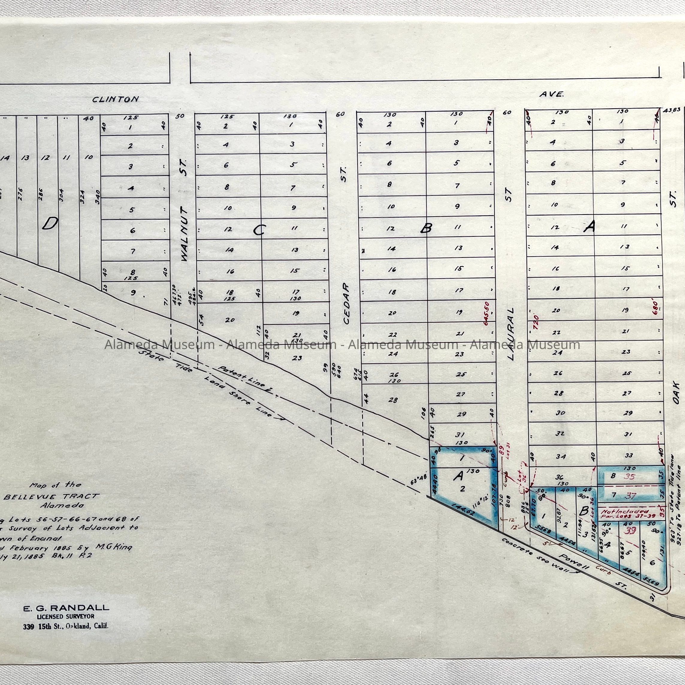
#21: Tracing Map of the Bellevue Tract, subdivided by M.G. King, 1885 / Map of Powell Tract, owned by Powell Brothers Construction Co. (showing triangular section between Oak and north of Walnut, and Clinton to shore).
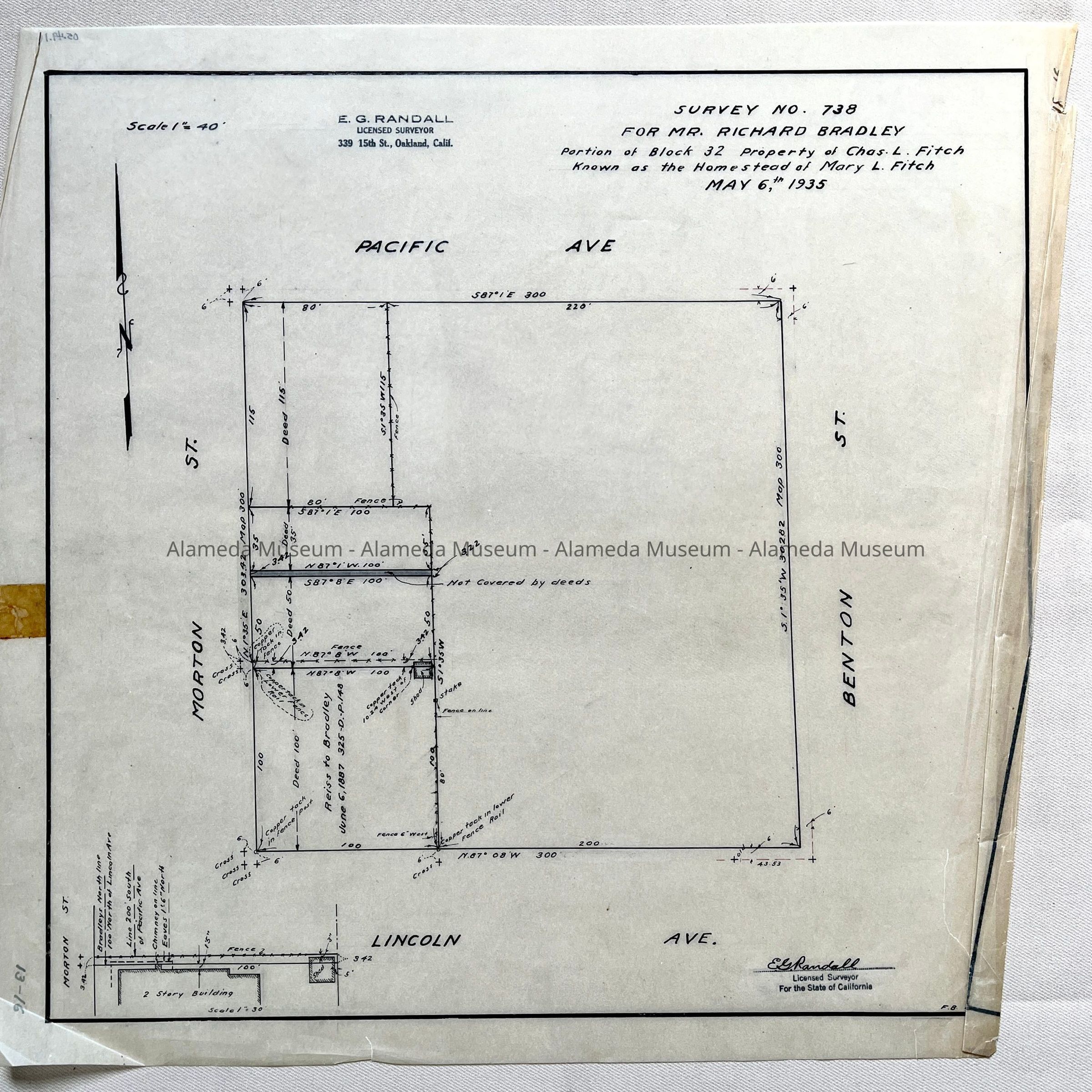
#22: Tracing Survey No. 738 for Mr. Richard Bradley, Homestead of Mary L. Fitch, Property Chas. L. Fitch, 1935 (Benton-Lincoln-Morton-Pacific)
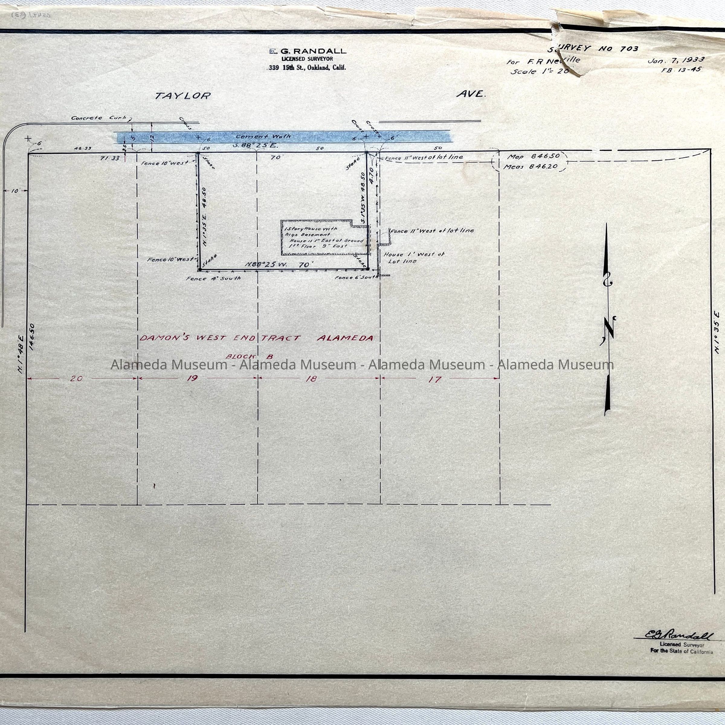
#23: Tracing Survey No. 703, for F.R. Neville, 1933 (corner Taylor and 4th)
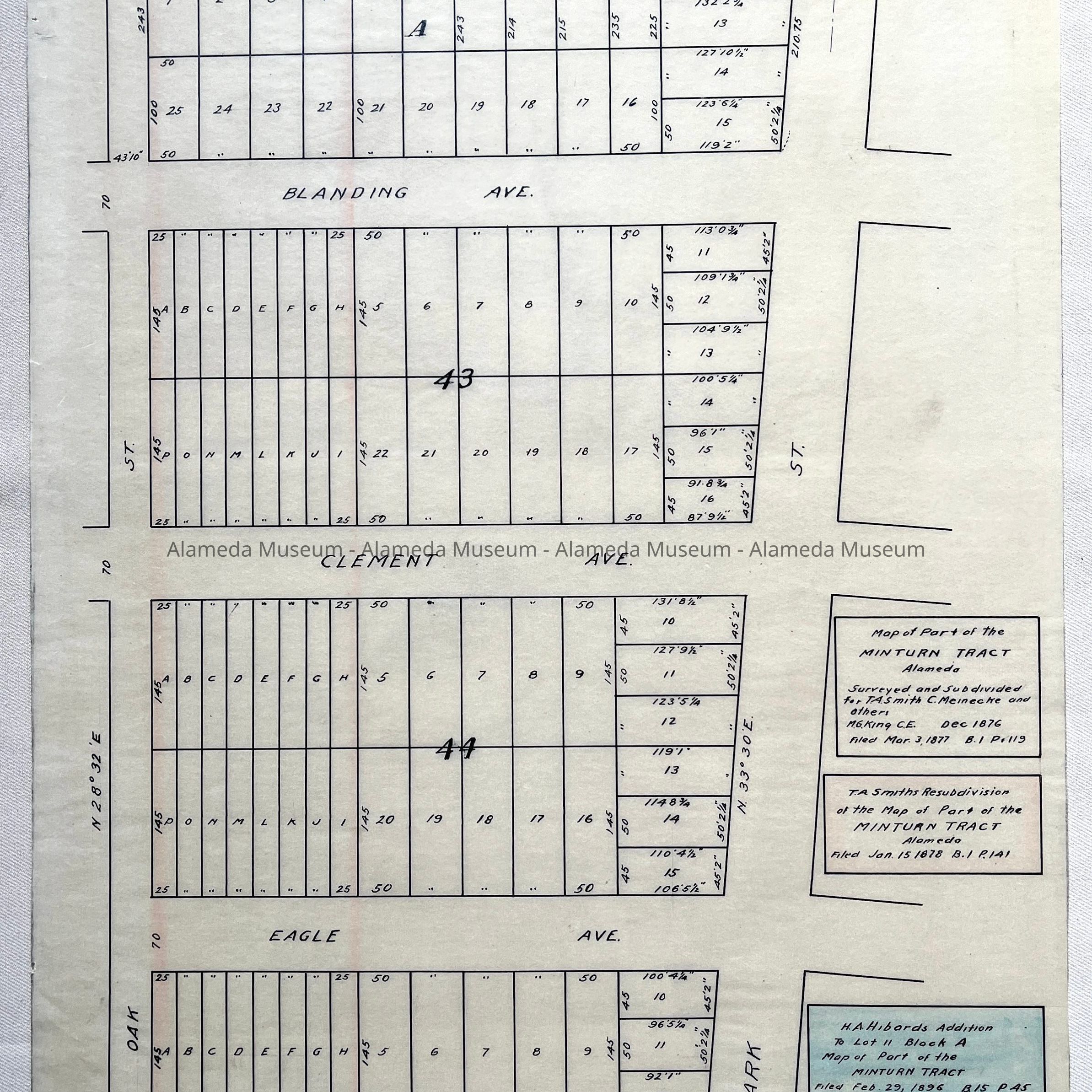
#24: Tracing Map of part of Minturn Tract, 1877 and 1878, and H.A. Hibards Addition, 1896 (between Oak and Park, Buena Vista to Blanding 'Slough')
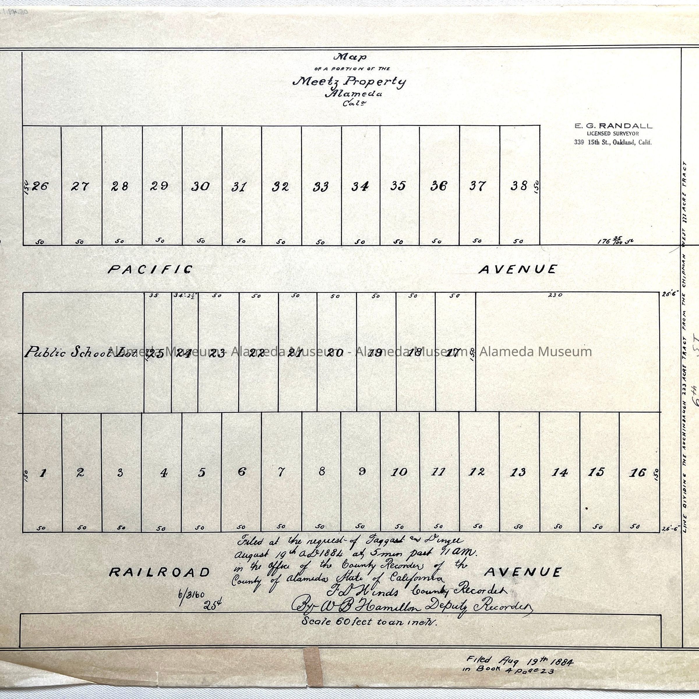
#25: Tracing Map of portion of Meetz Property (Pacific to Railroad (now Lincoln), 1884)
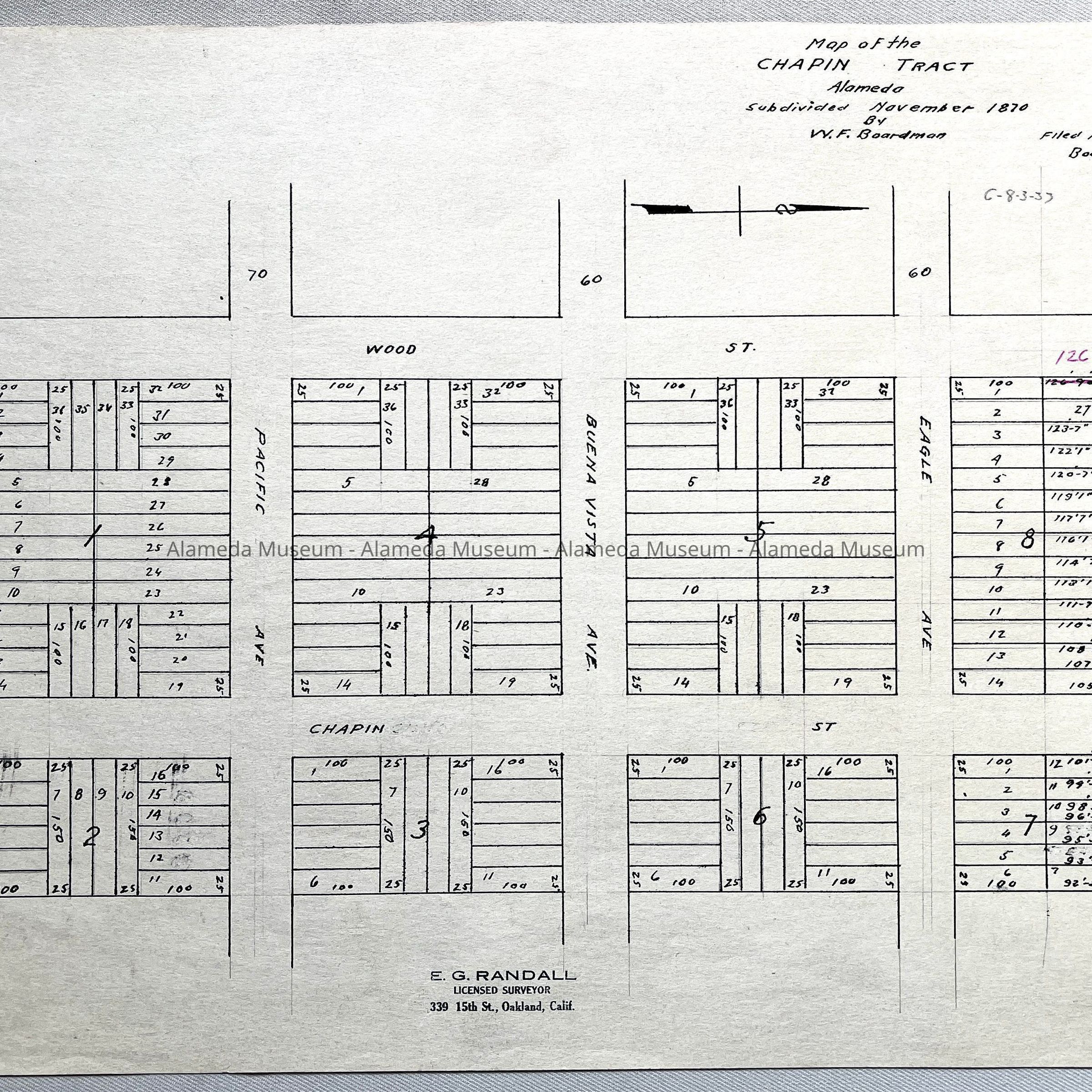
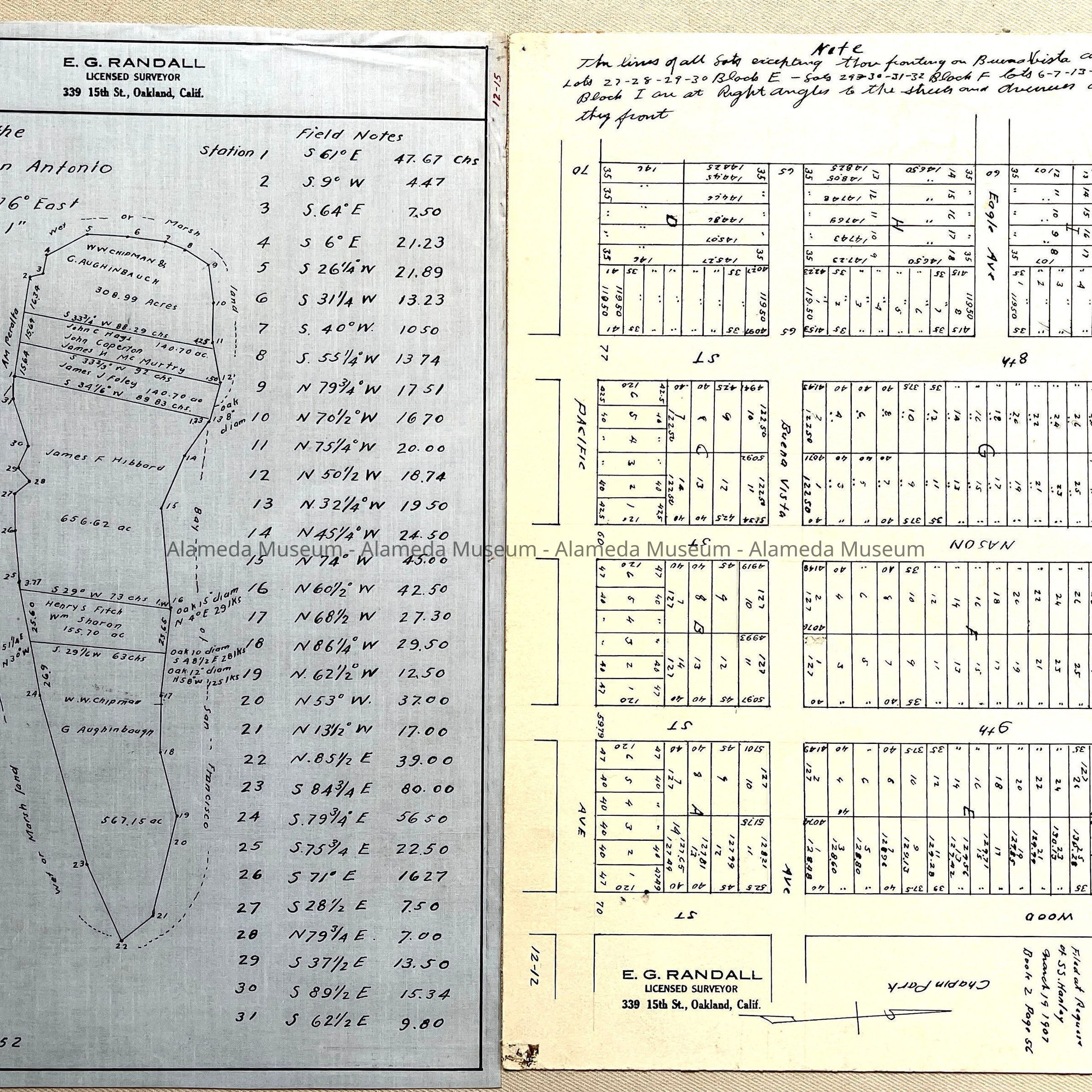
#26: Copy of 1877 Map of the Chapin Tract, subdivided 1870 by W.F. Boardman
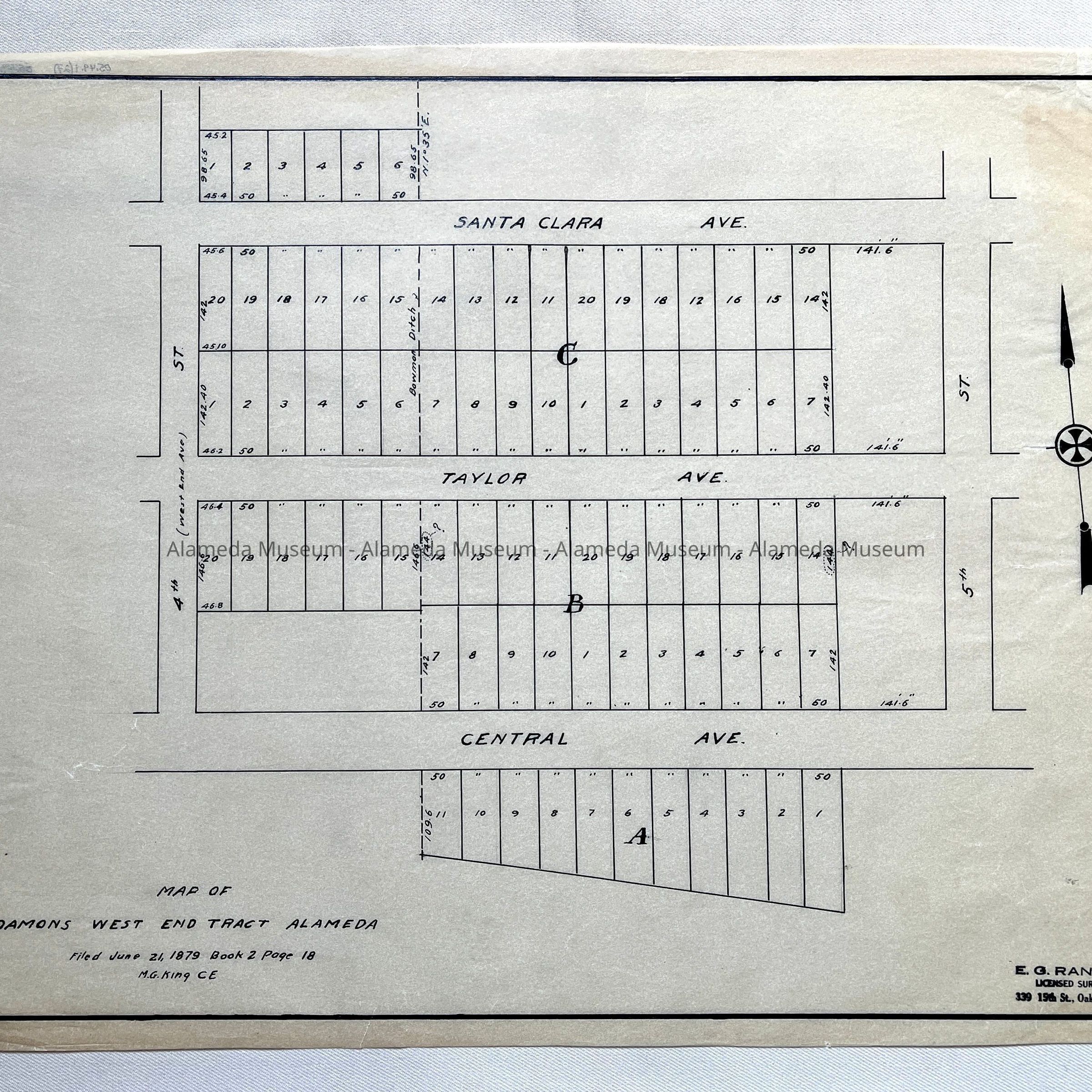
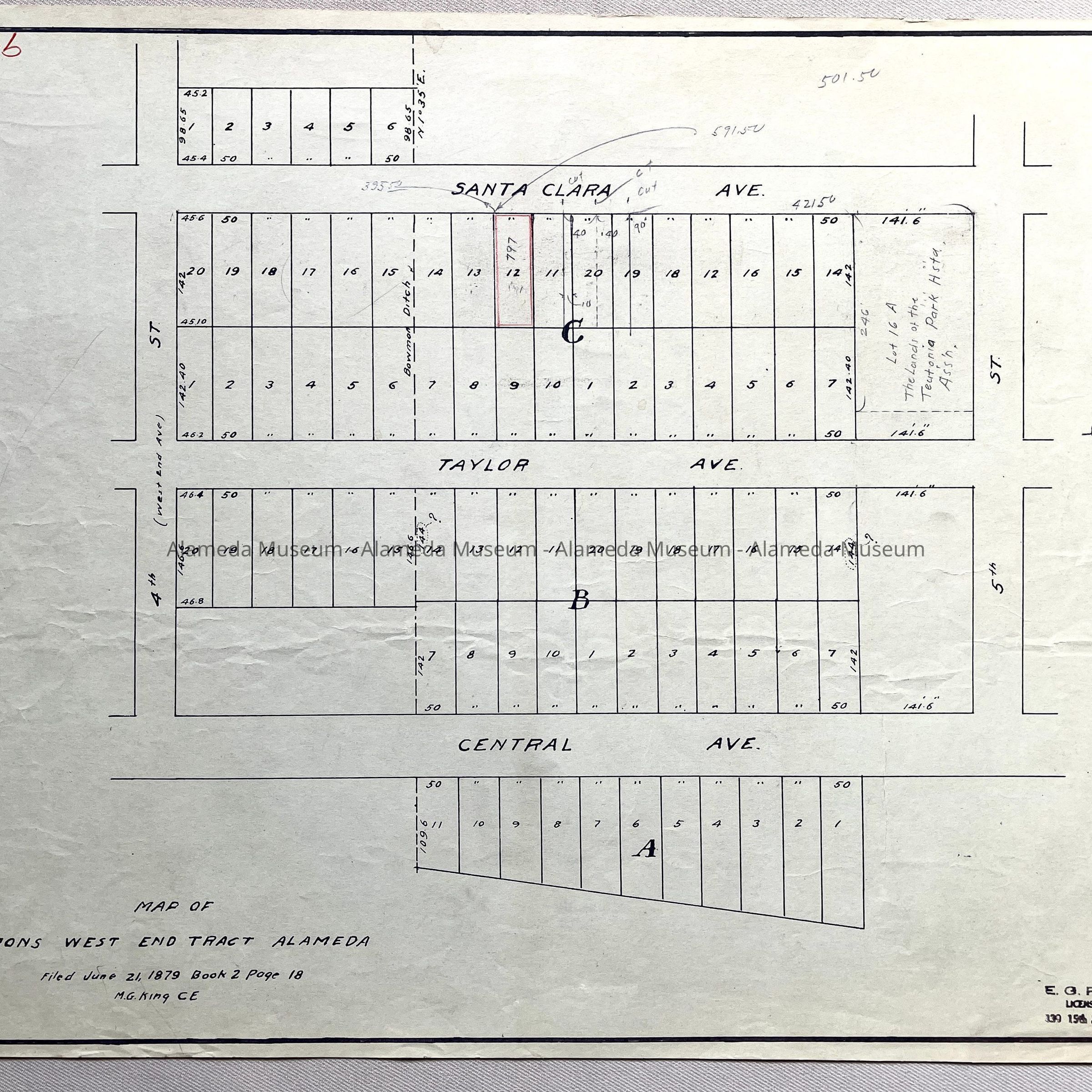
#27: Tracing of 1879 Map of Damons West End Tract
#28: Copy of map of #27
#29: Tracing of Map of the Chapin Tract, as #26
#30: Blueprint copy of Map of the Bartlett Tract, 1878
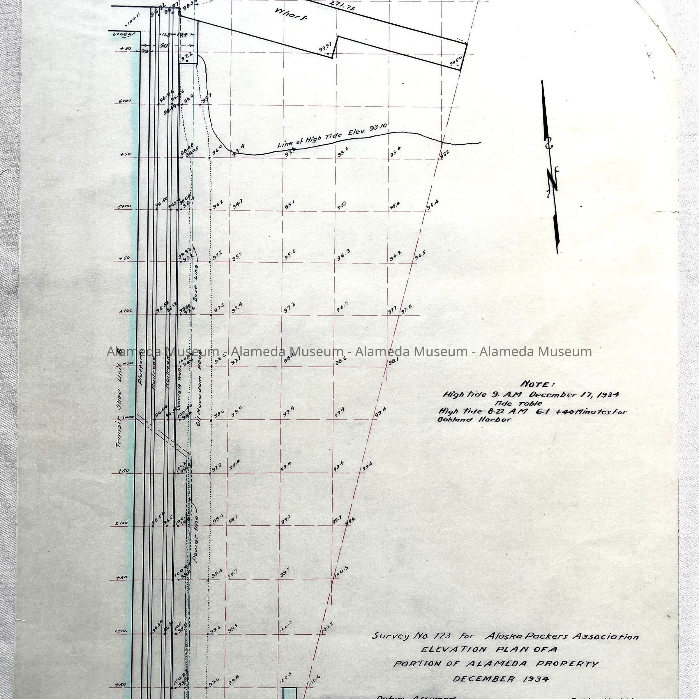
#31: Tracing Survey No. 723 for Alaska Packers, 1934
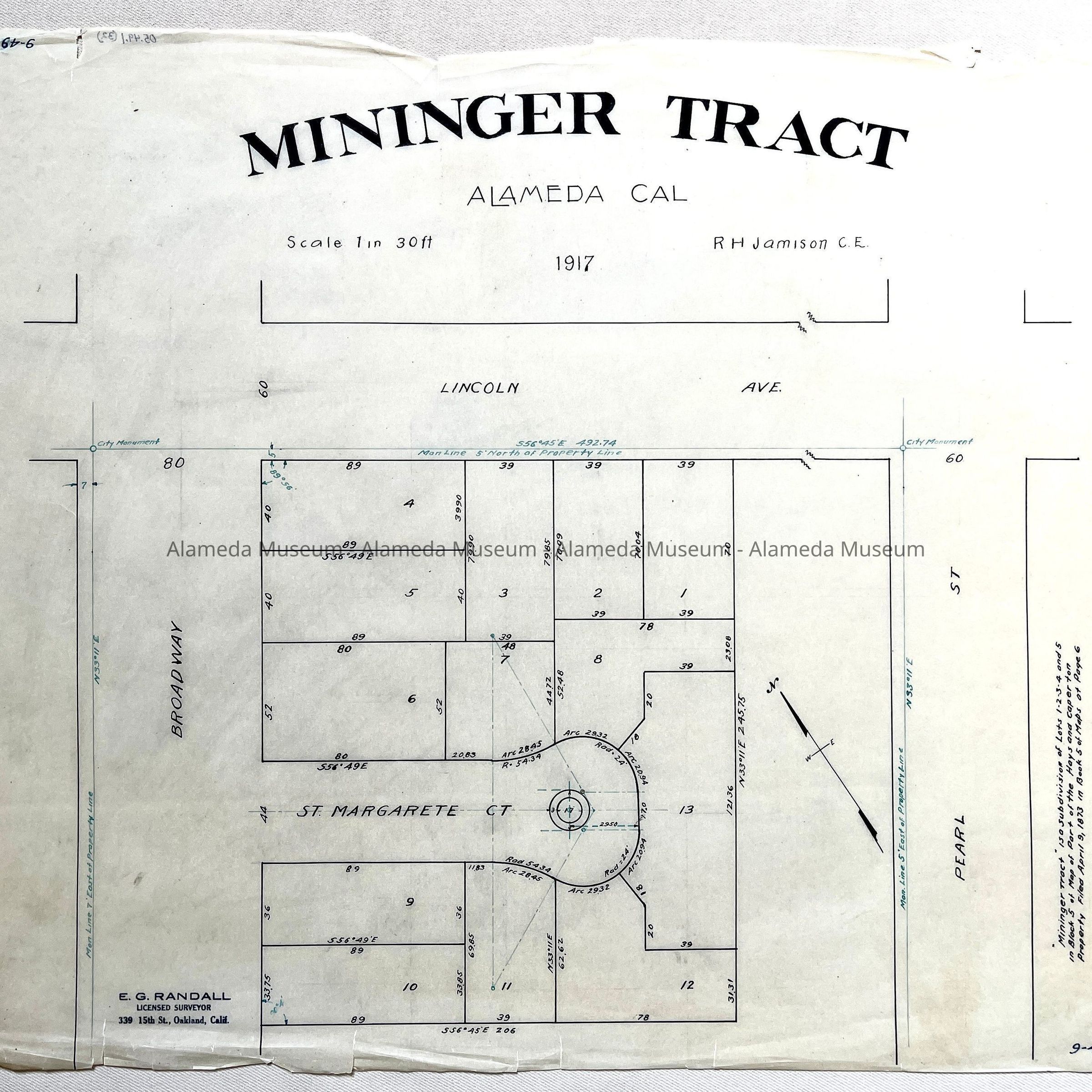
#32: Tracing of Mininger Tract (St. Margarete Ct, Broadway / Lincoln / Pearl), 1917
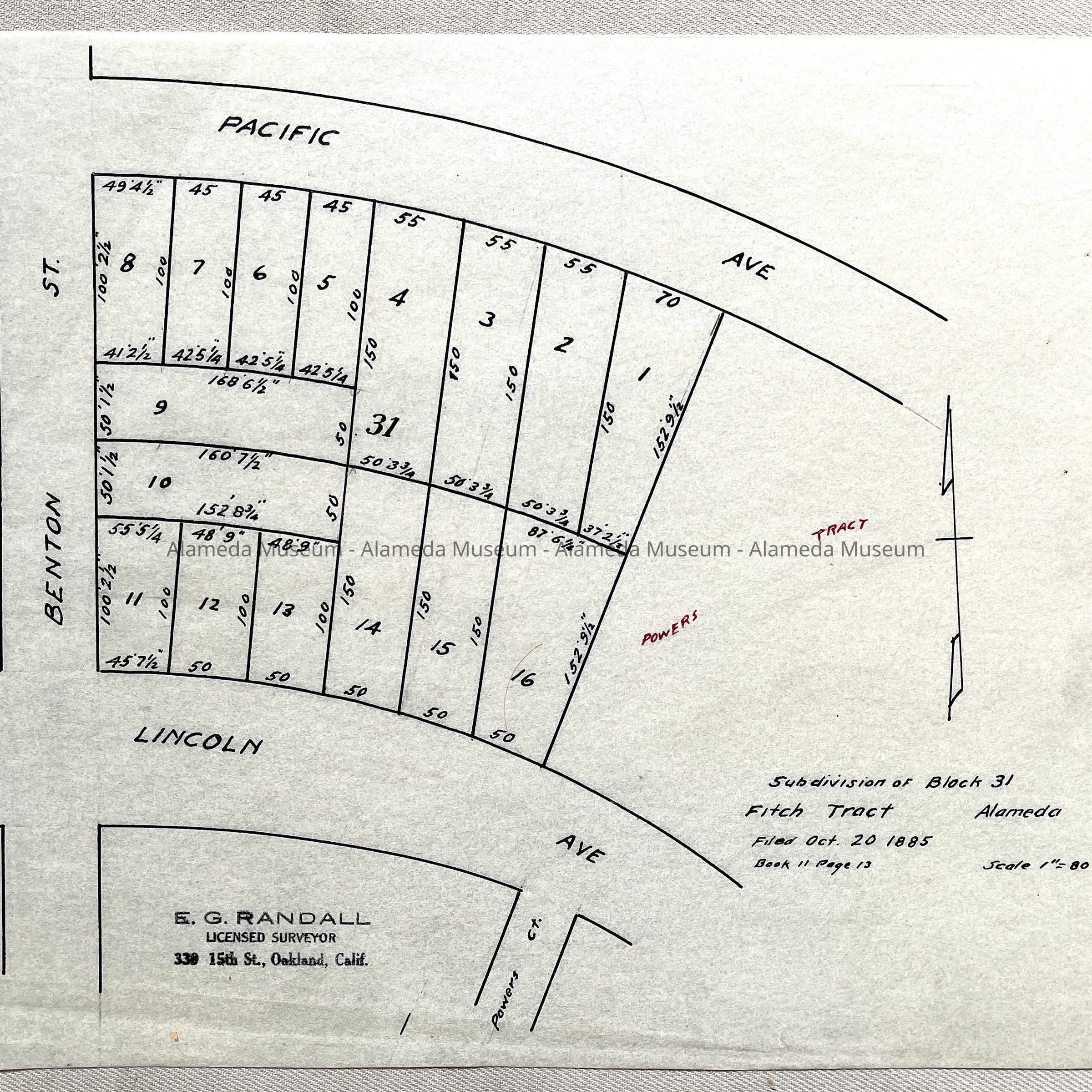
#33: Tracing of Subdivision map of Clock 31 Fitch Tract, 1885 (Lincoln and Pacific at Benton)
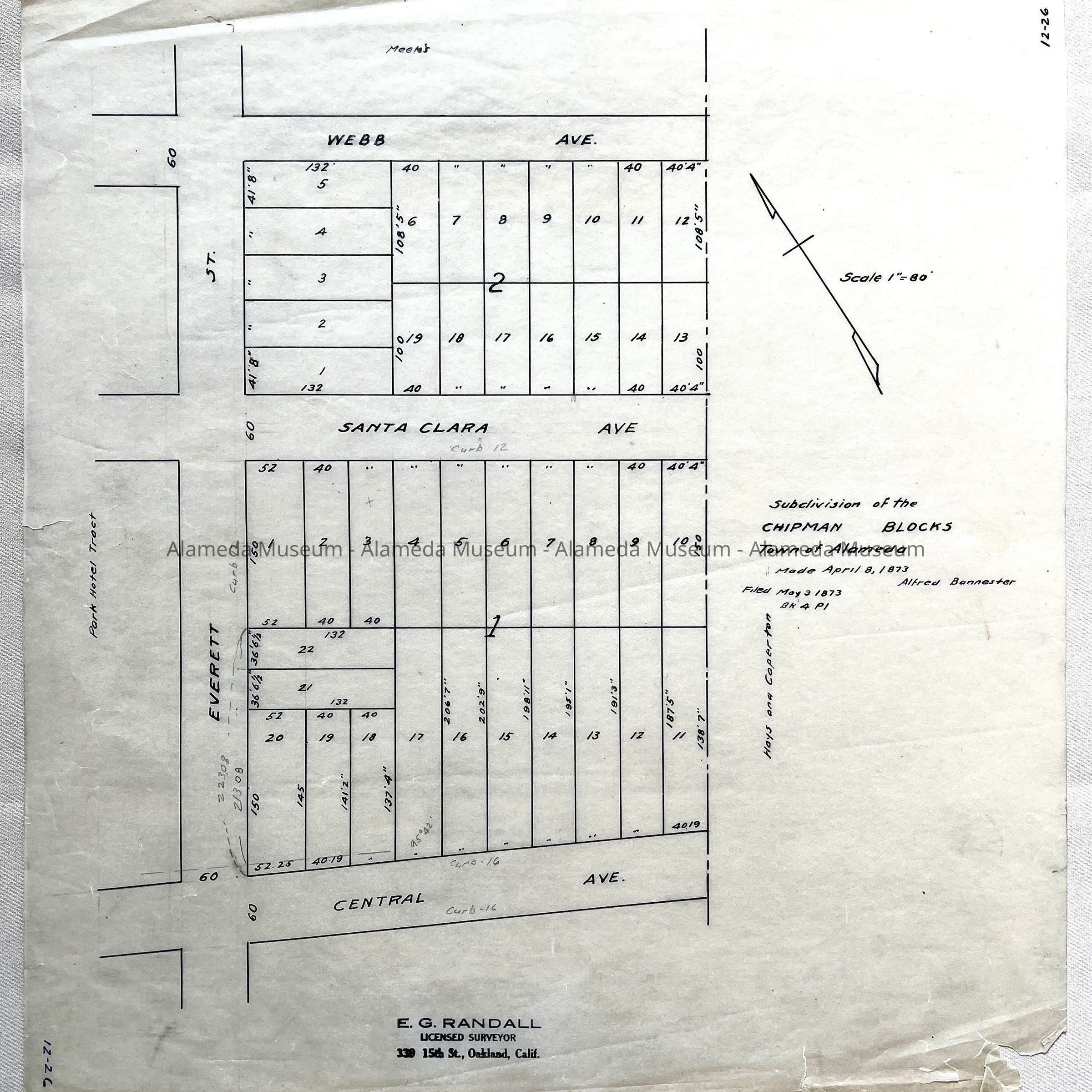
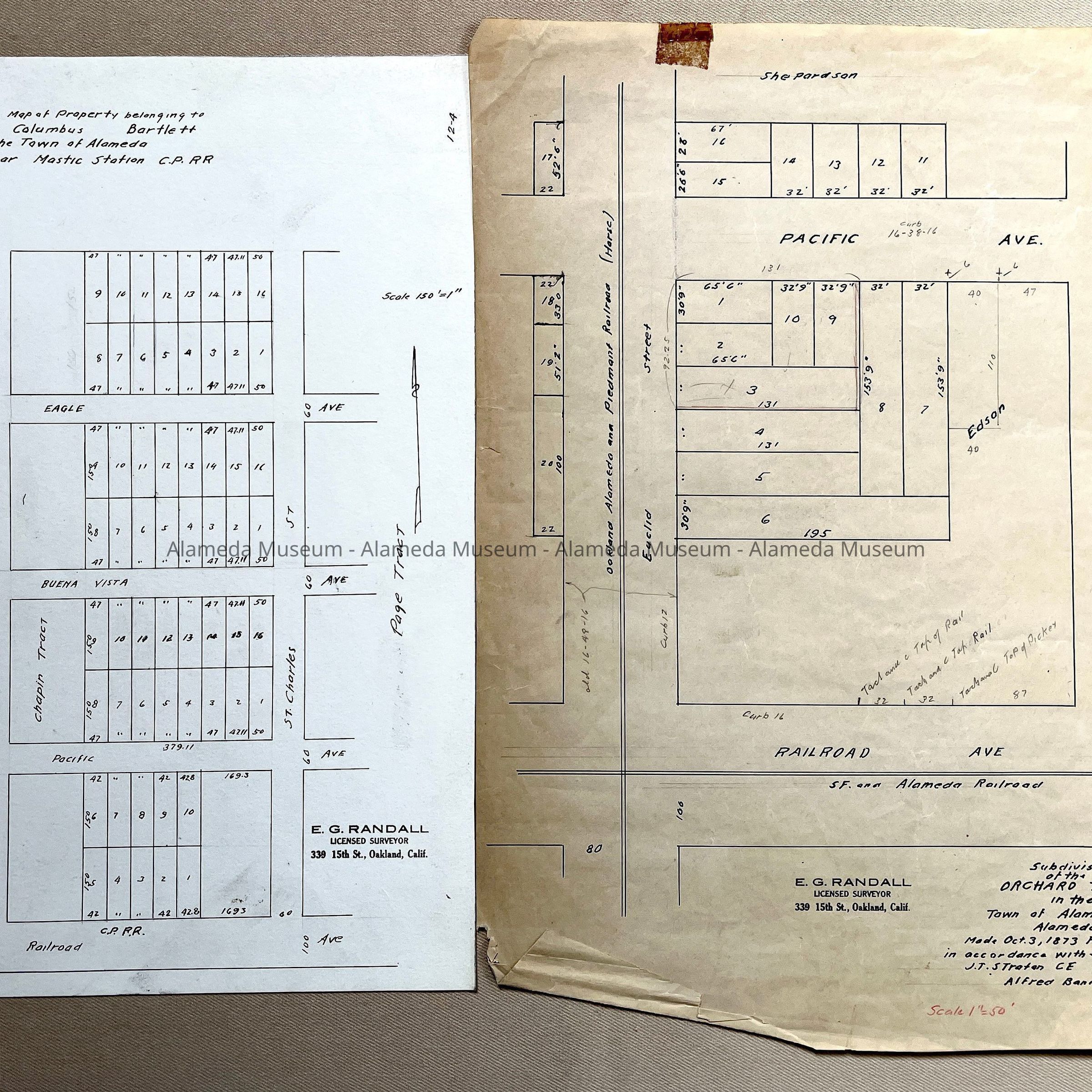
#34: Tracing of Subdivision map of Chipman Blocks (Webb - Santa Clara - Central, and Everett), 1873, by Alfred Bannester
#35: Copy on linnen paper of Survey No. 650, for F.W. Woolworth Co, 1930.
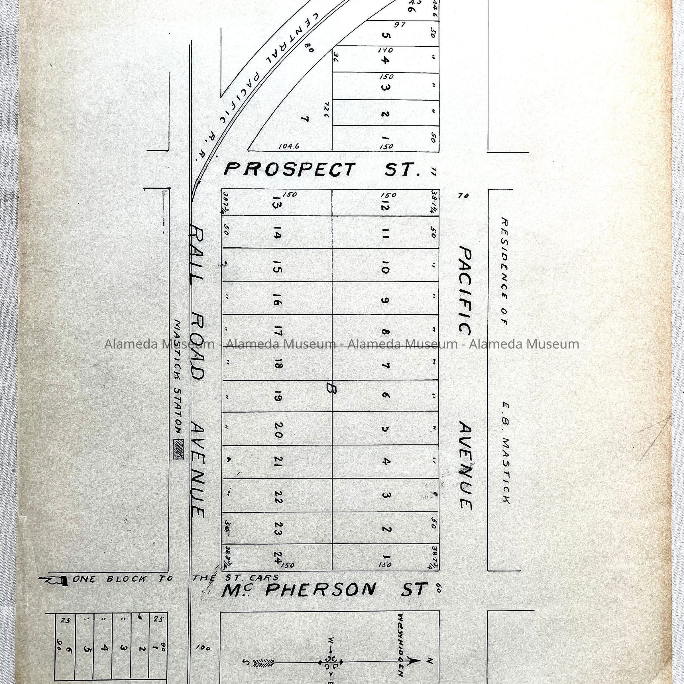
#36: Copy of Map of Property of E.B. Mastic, undated
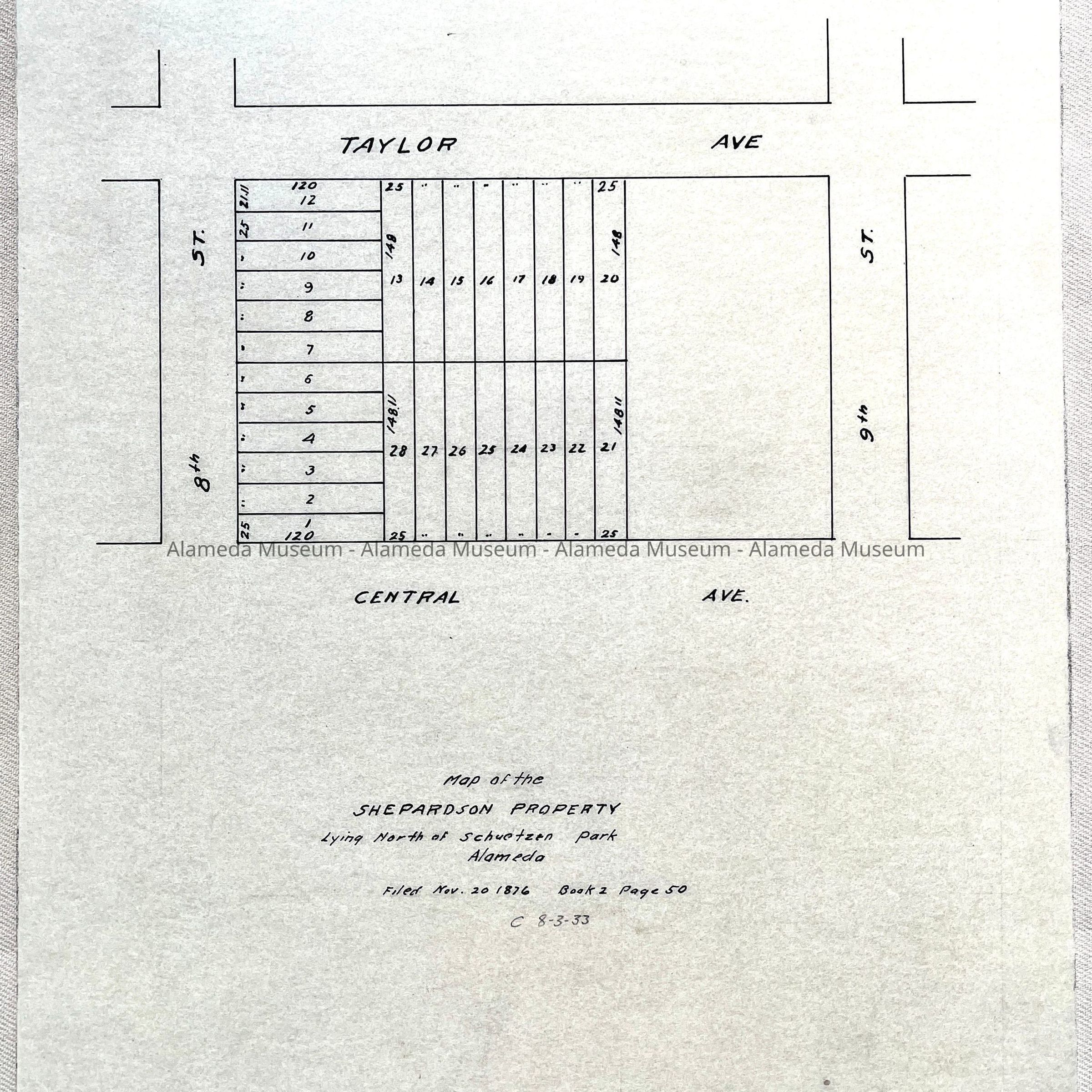
#37: Tracing of Map of the Shepardson Property, lying north at Schutzen Park, 1876
#38: Tracing of revised Map of Encinal Home Lots, 1876
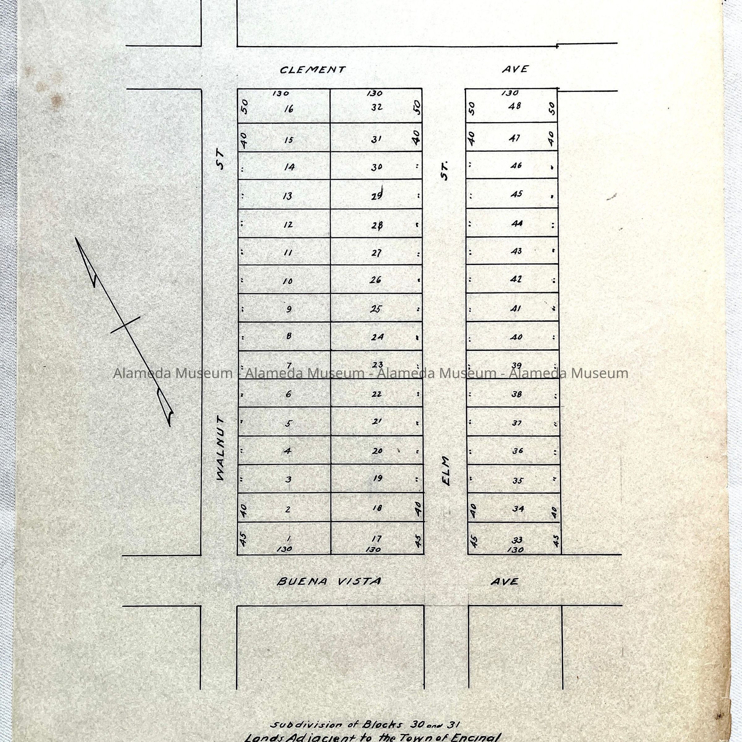
#39: Tracing subdivision map filed 1905 (showing Buena Vista - Clement, and Elm and Walnut)
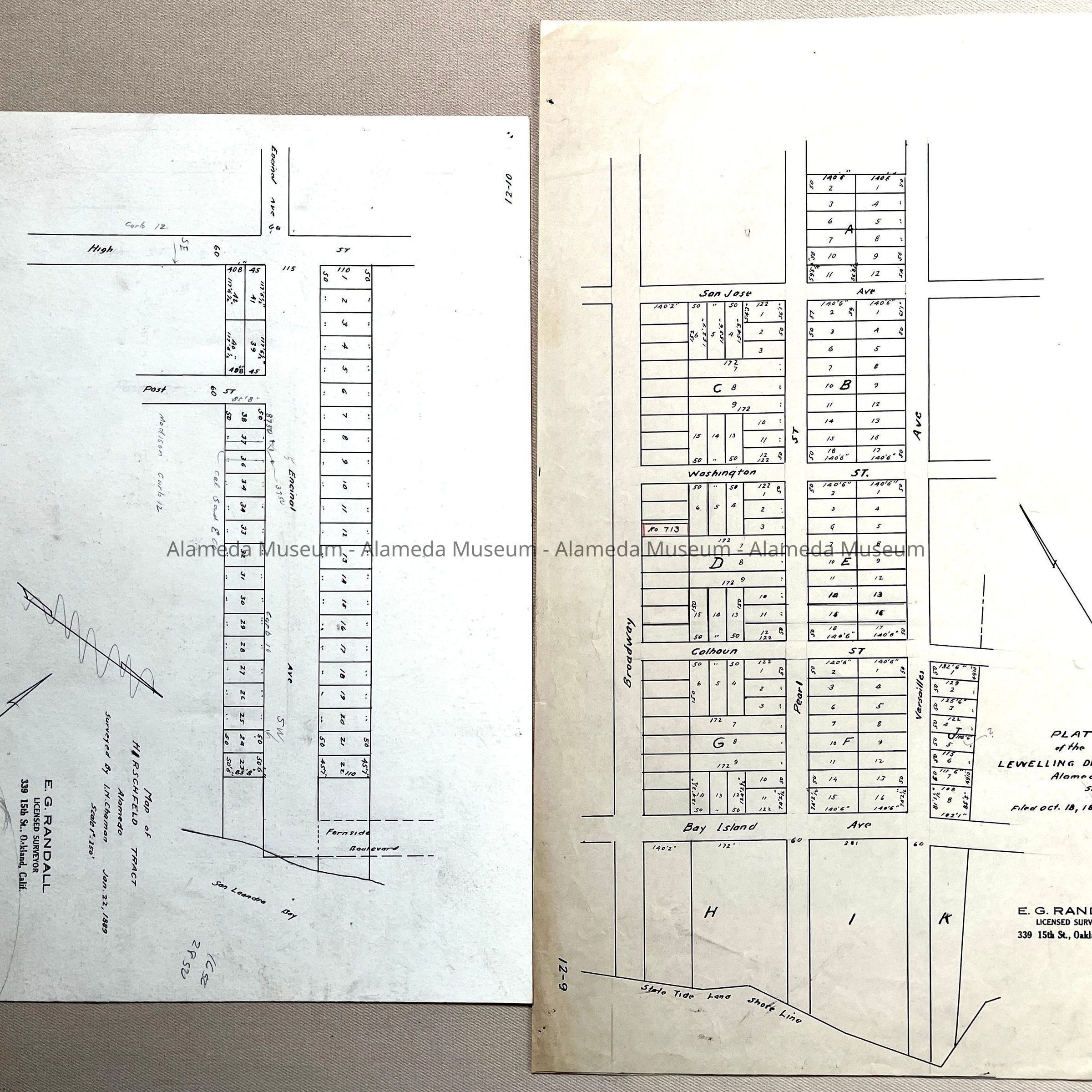
#40: Tracing of resubdivision map of blocks north of Buena Vista and East at Willo, 1888.
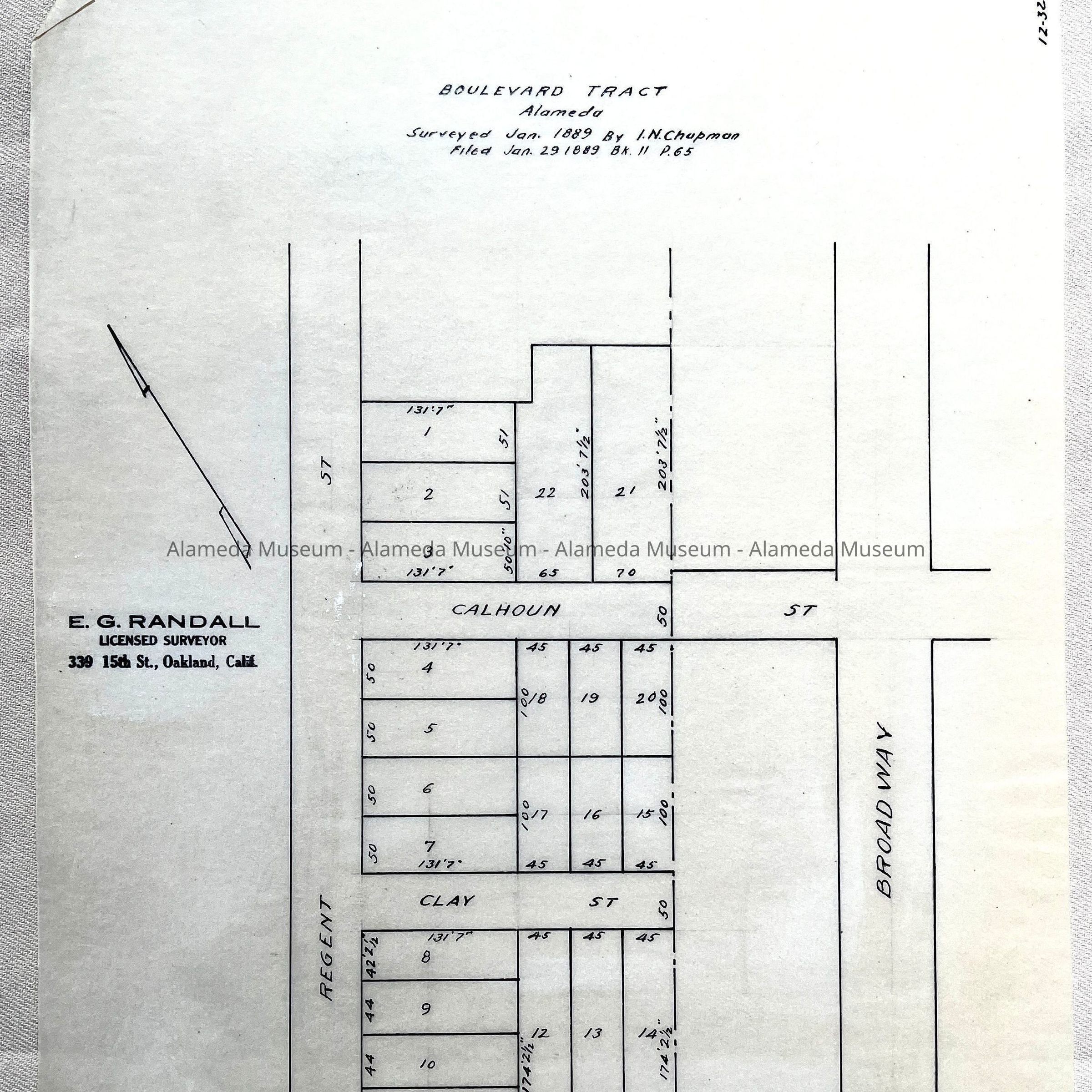
#41: Tracing of map of Boulevard Tract, surveyed 1889 by Chapman (Regent - Broadway, and Bay Island Ave (Otis) - Clay - Calhoun)
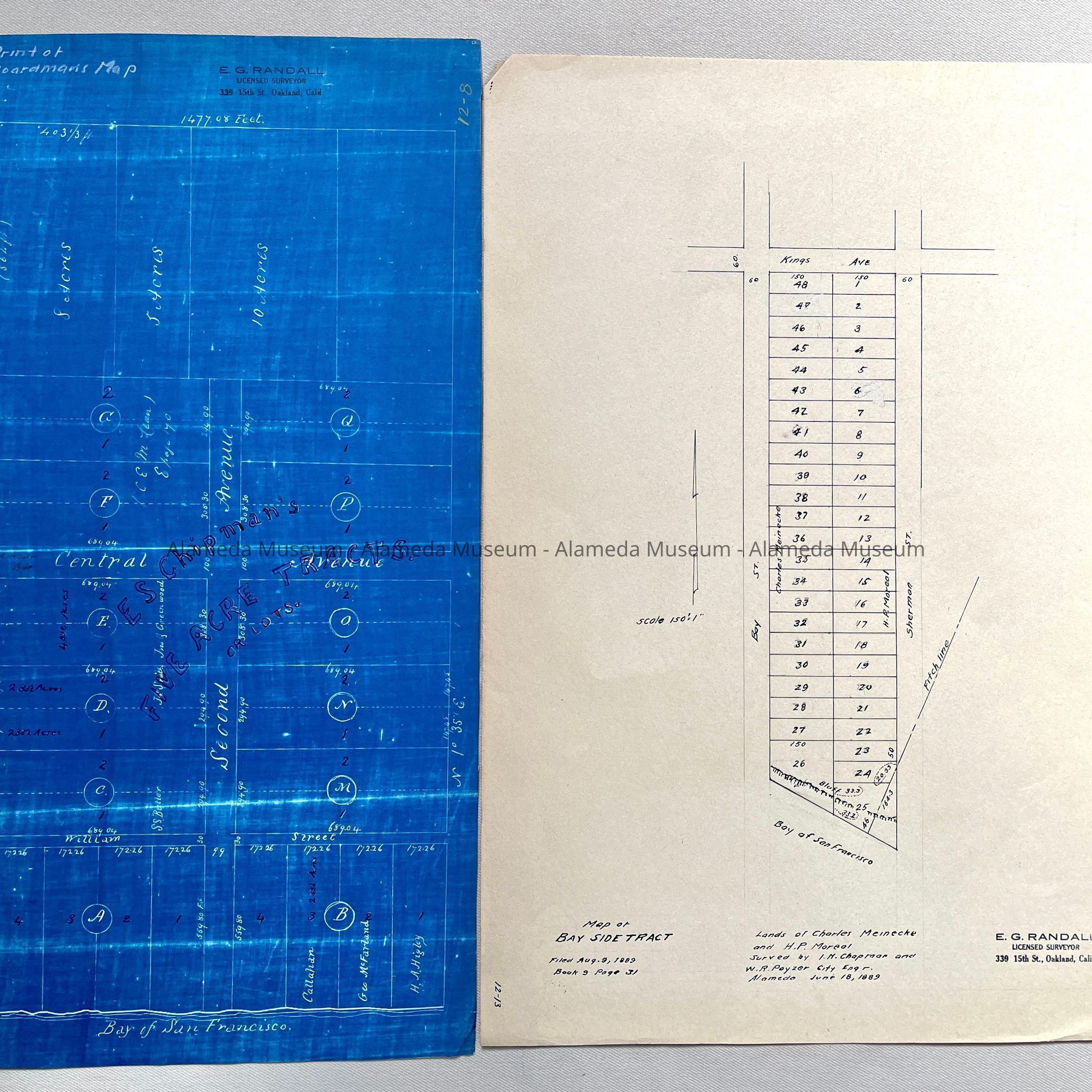
#42: Tracing Survey No. 671 (Pearl - Encinal - Pease )
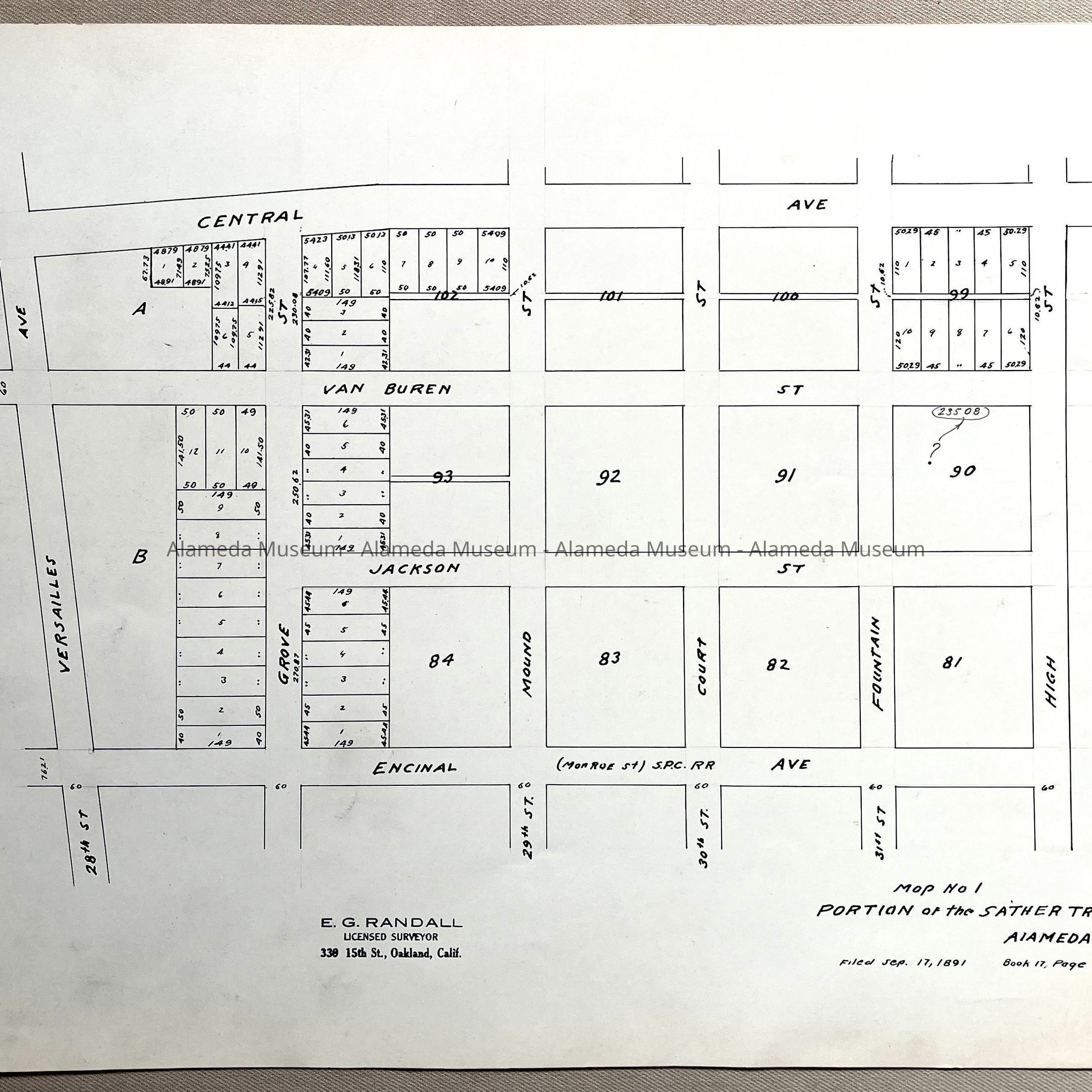
#43: copy of Map No. 1 of Portion of the Sather Trust, 1891
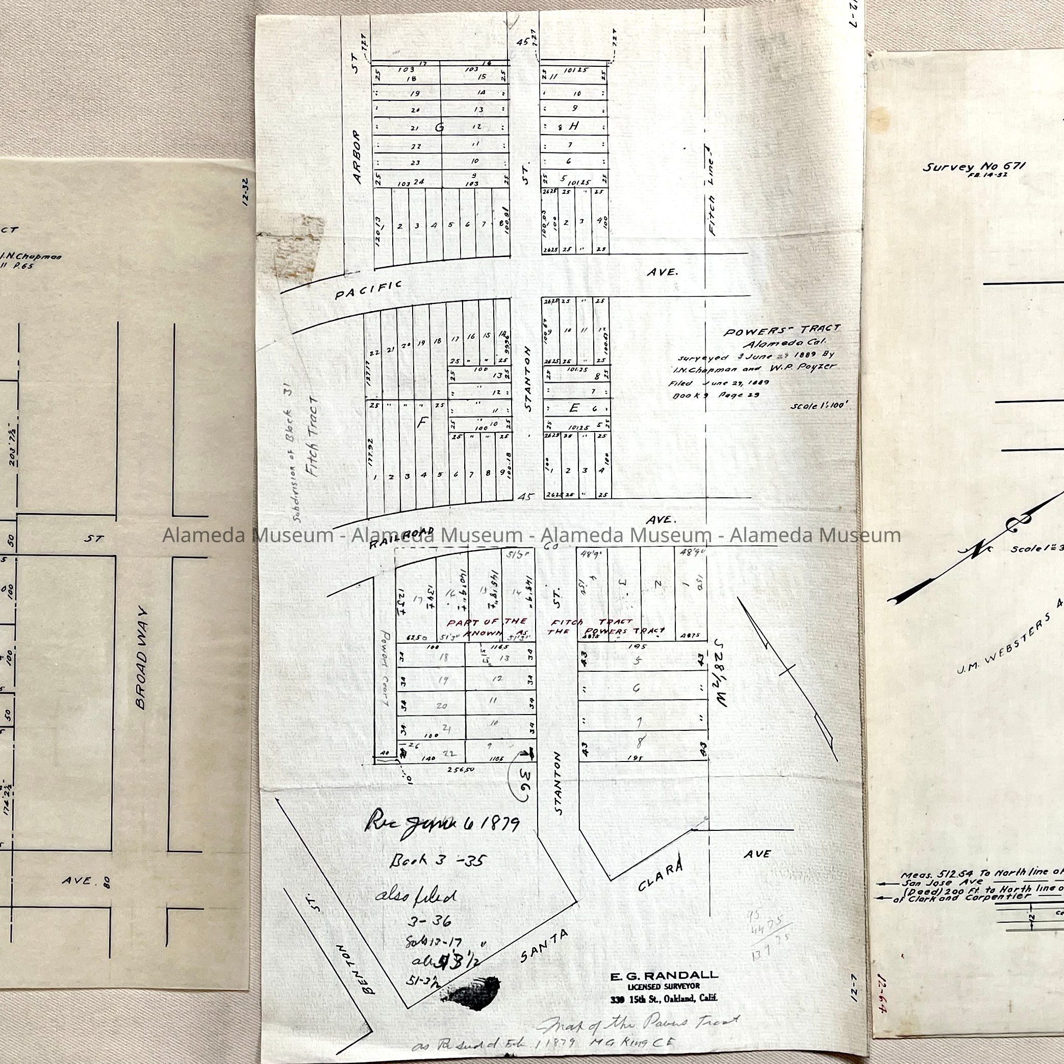
#44: copy of Map of Powers tract, Surveyed 1889 by Chapman and Poyzer
#45: copy of Map of property belonging to Columbus Bartlett near Mastic Station C.P.R.R., undated (but before 1911, mentioning Railroad Ave).
#46: Tracing of Subdivision map of the Orchard Tract, 1873 for W.W. Chipman (showing Euclid, Pacific, Concordia)
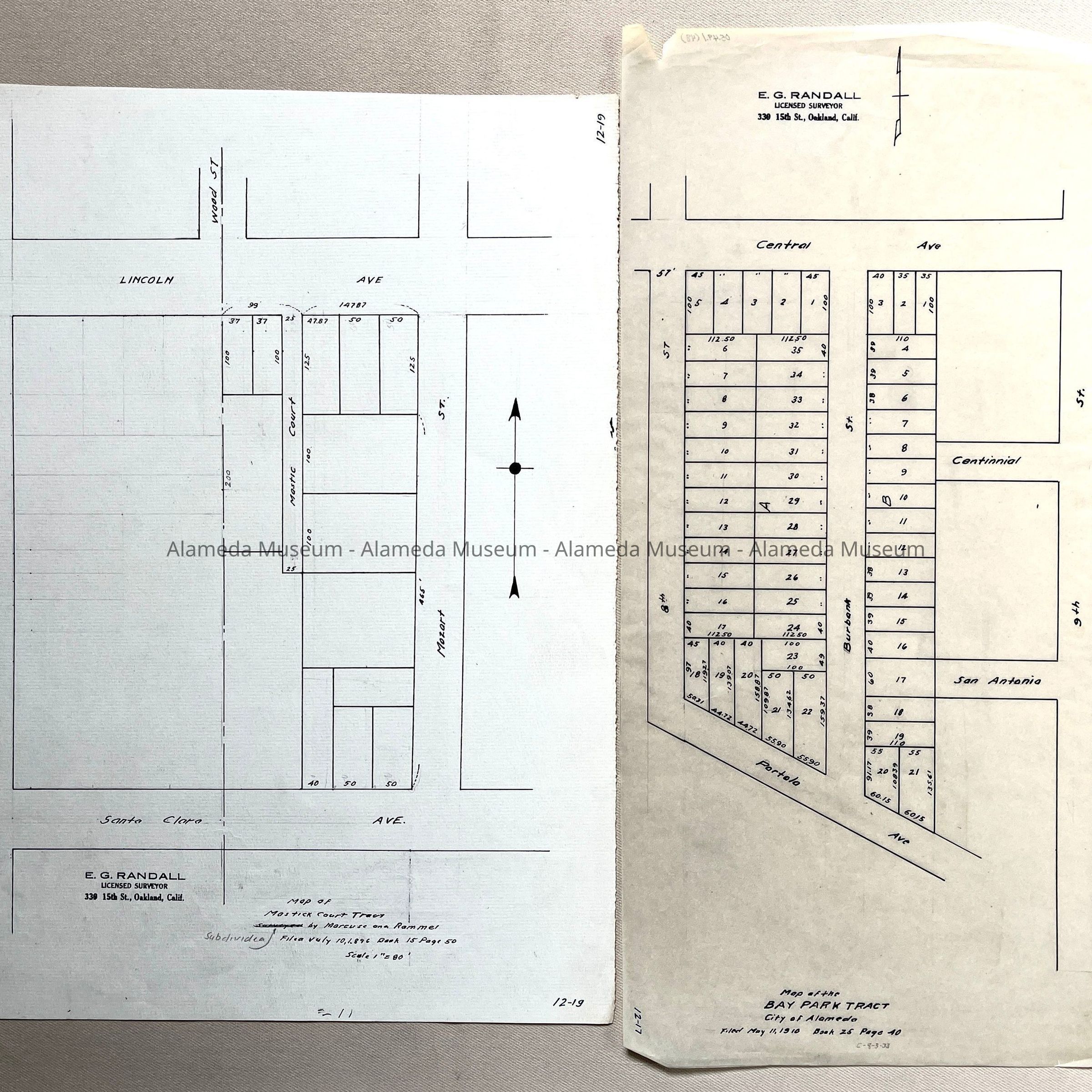
#47: Copy map of Mastic Court Tract, by Marcuse and Remmel, divided ca, 1986
#48: Tracing map of Bay Park Tract, 1910 (Portola / Burbank)
#49: copy on linnen paper of Plat of the Encinal San Antonio, undated (but early, c. 1960s. mentioning Chipman, Aughinbaugh, Fitch, Sharon, Hibbard, Foley, Hags, Caperton, McMurtry, and S.W. Larnes House & Lovegroves Hotel)
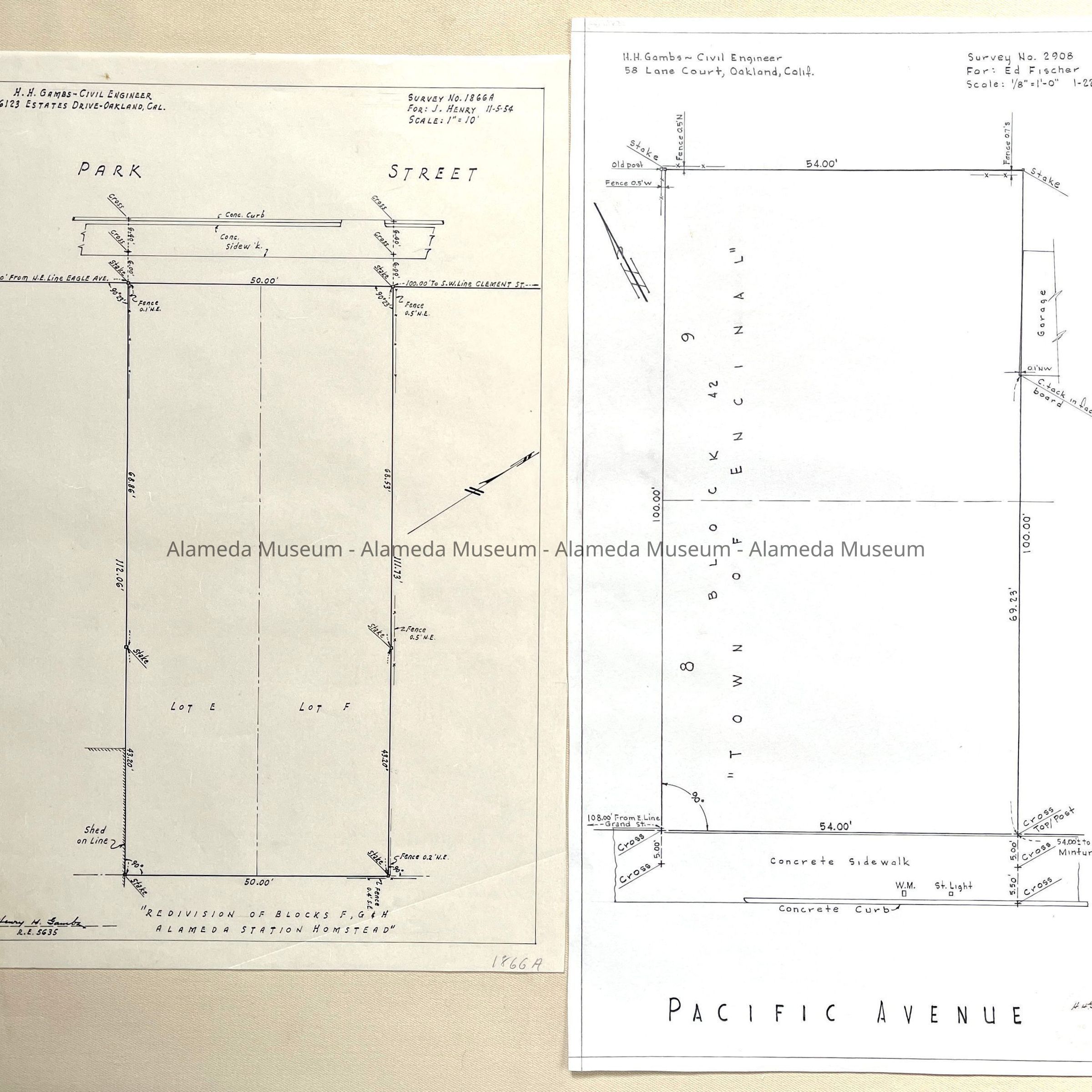
#50: Copy of Map of Mastic Park, 1906/1907
#51: Copy of Map of Hirschfeld Tract, 1889
#52: Tracing of Plat of the Lewelling Division, 1887 (Broadway-Versailles; Bai Island - San Jose)
#53: Blueprint copy of W.F. Boardmans Map, filed 1861
#54: Copy of Map of Bay Side Tract, 1889, lands of Charles Meinecke and H.P. Moreal (Sherman-Bay to Kings Ave (now San Antonio))
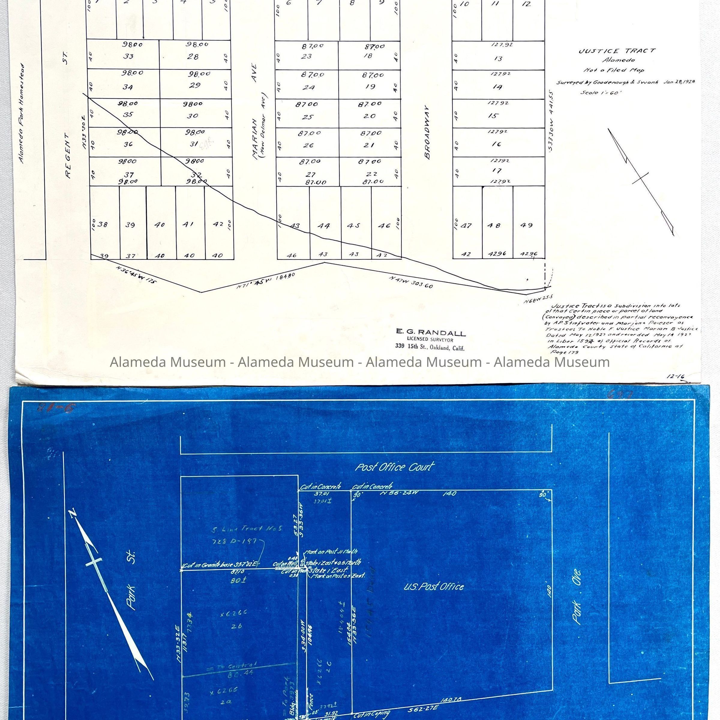
#55: copy of map of Justice Tract, 1928 (Broadway - Marian/Delmar - Regent)
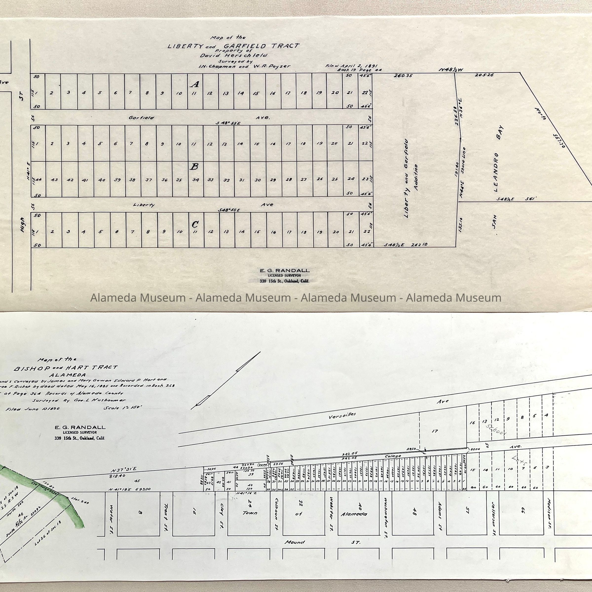
#56: Blueprint map of Post Office Court, 1920 for Alameda National Bank
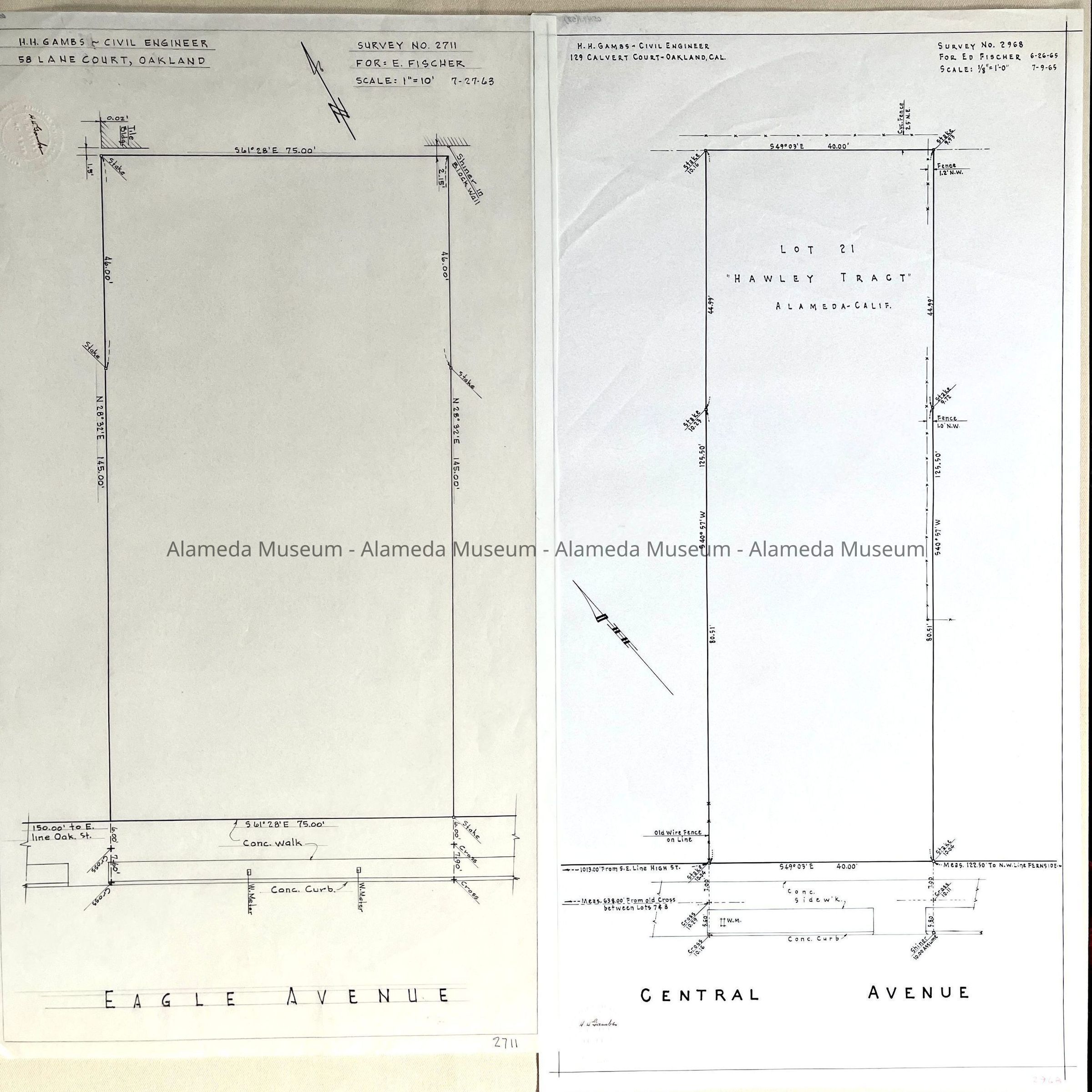
#57: Tracing of Survey No. 2711 for E. Fischer (Eagle Ave), undated
#58: copy of Survey No. 2968 for AnFiscp Inc., R. Faria, 1961
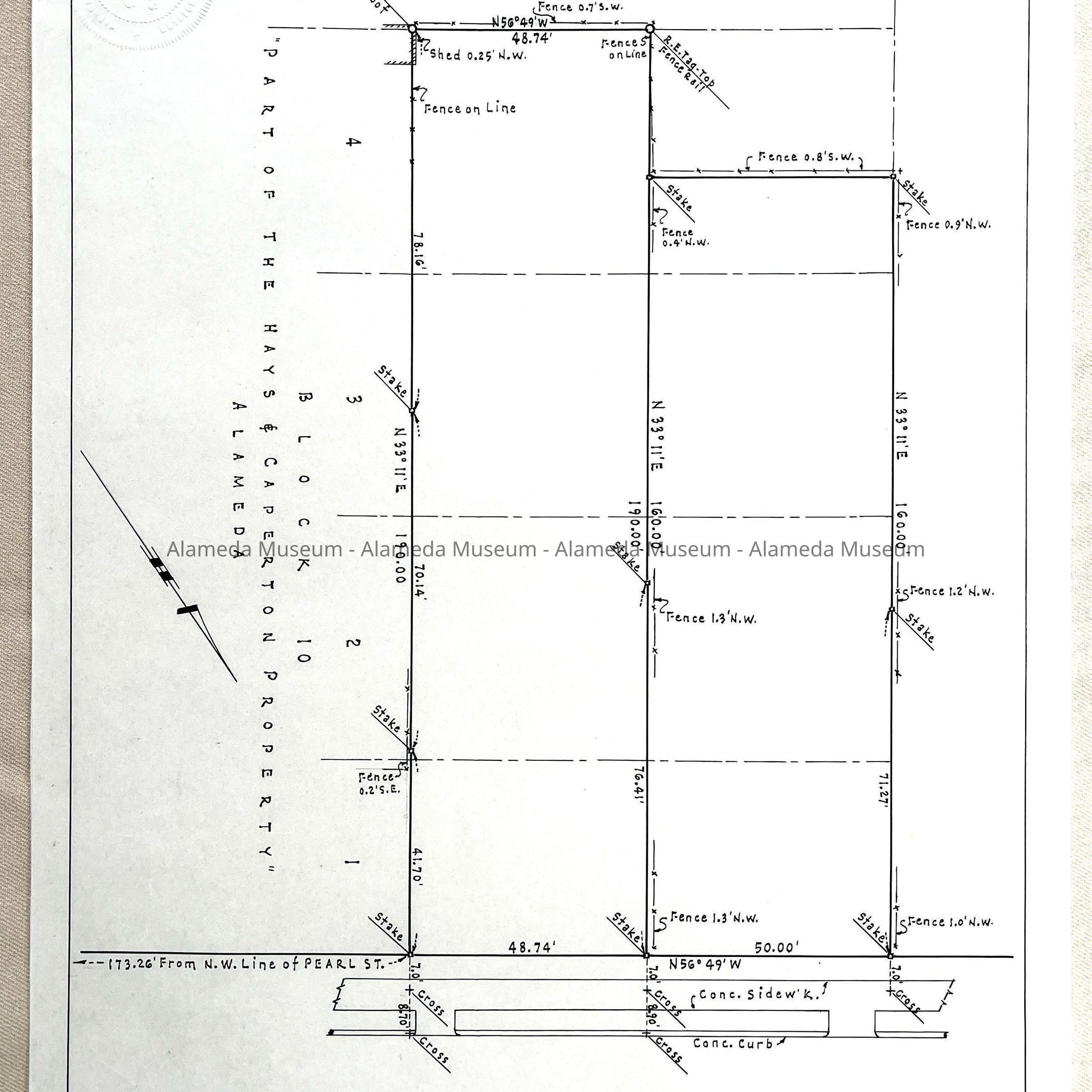
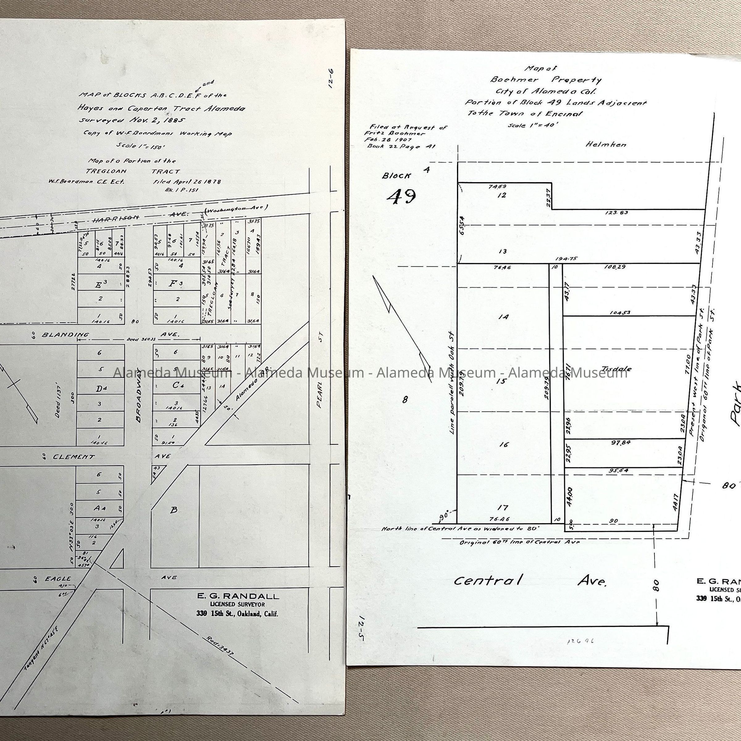
#59: copy of Survey No. 2383 A for AnFiscp Inc., R. Faria, 1961 (Block 10 of the Hays and Caperton Property).
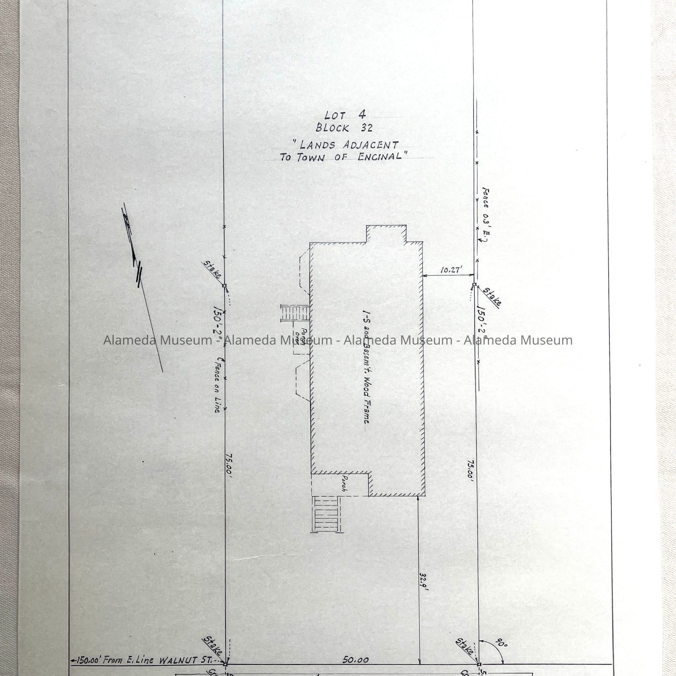
#60: Tracing of Survey No. 1332A, for Dave Rosling, Lot 4, Block 32, Lands adjacent Encinal (footprint of a home on Pacific)
#61: Tracing of Survey No. 1866A for J. Henry, 1954, redivision of blocks F, G & H Alameda Station Homstead [Homestead] (showing 2 lots on Park Street)
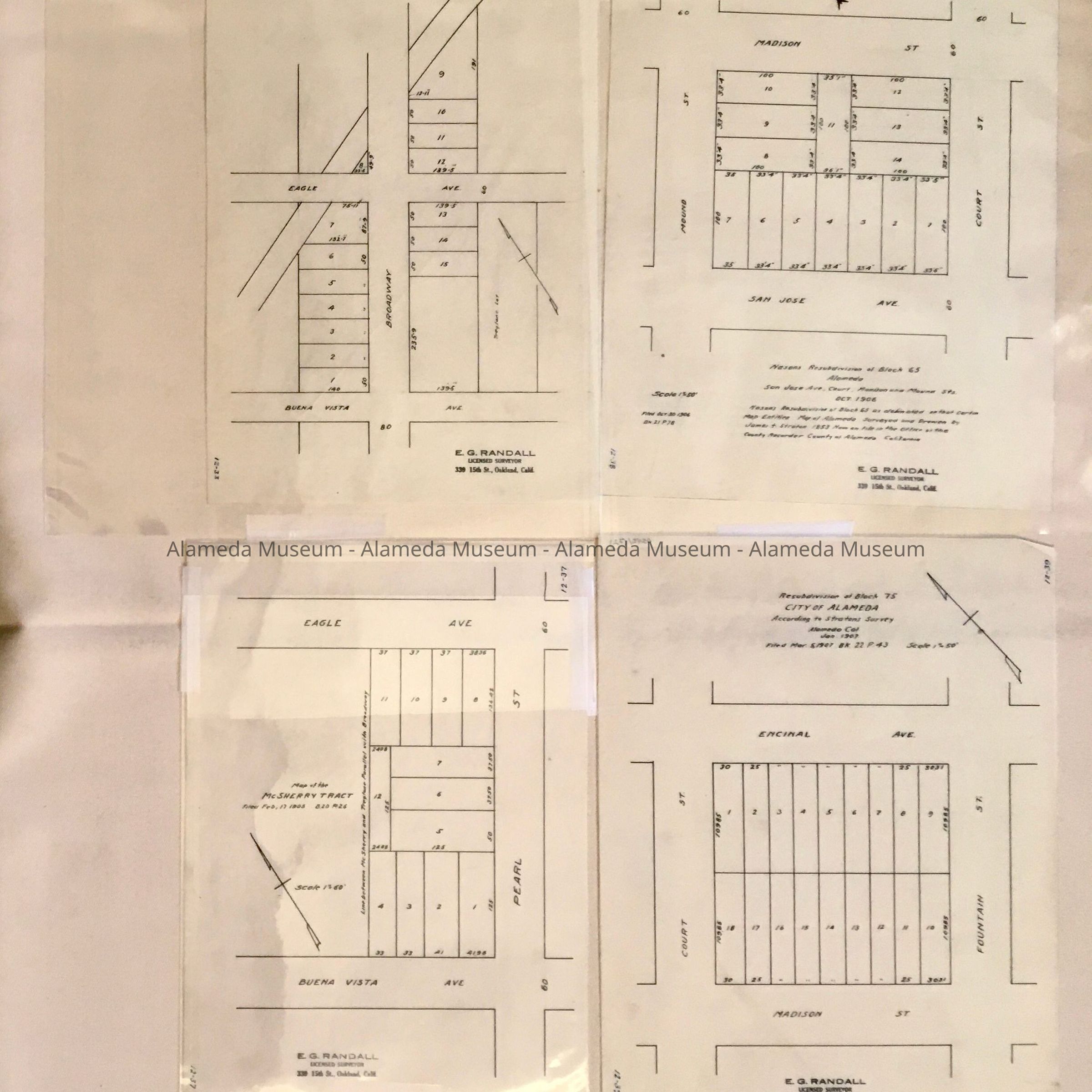
#62: Copy of Survey No. 2908 for Ed. Fisher, 1965 (showing a lot on Pacific Ave.)
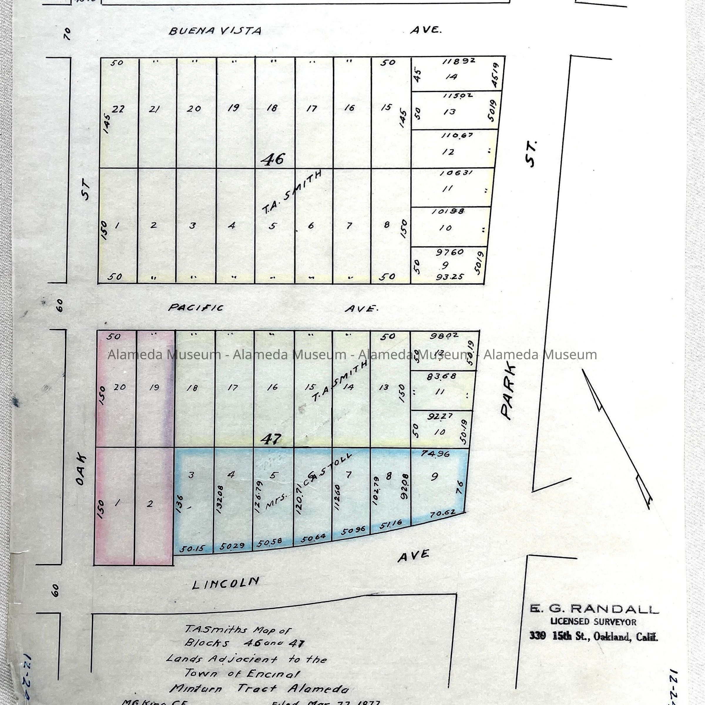
#63: Tracing of T.A. Smith's Map of blocks 46 and 47, lands adjacent Encinal, Minturn Tract, filed 1877 (Park - Oak, Lincoln - Pacific - Buena Vista)
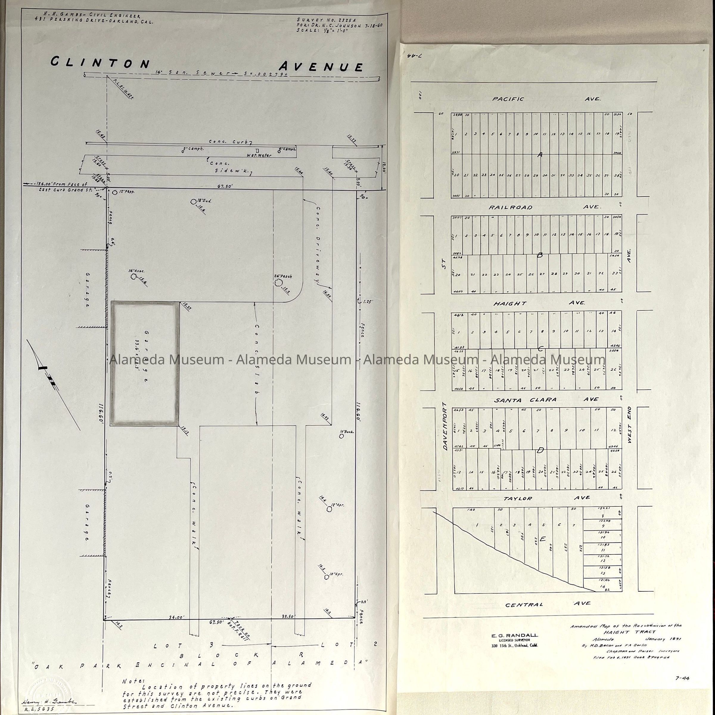
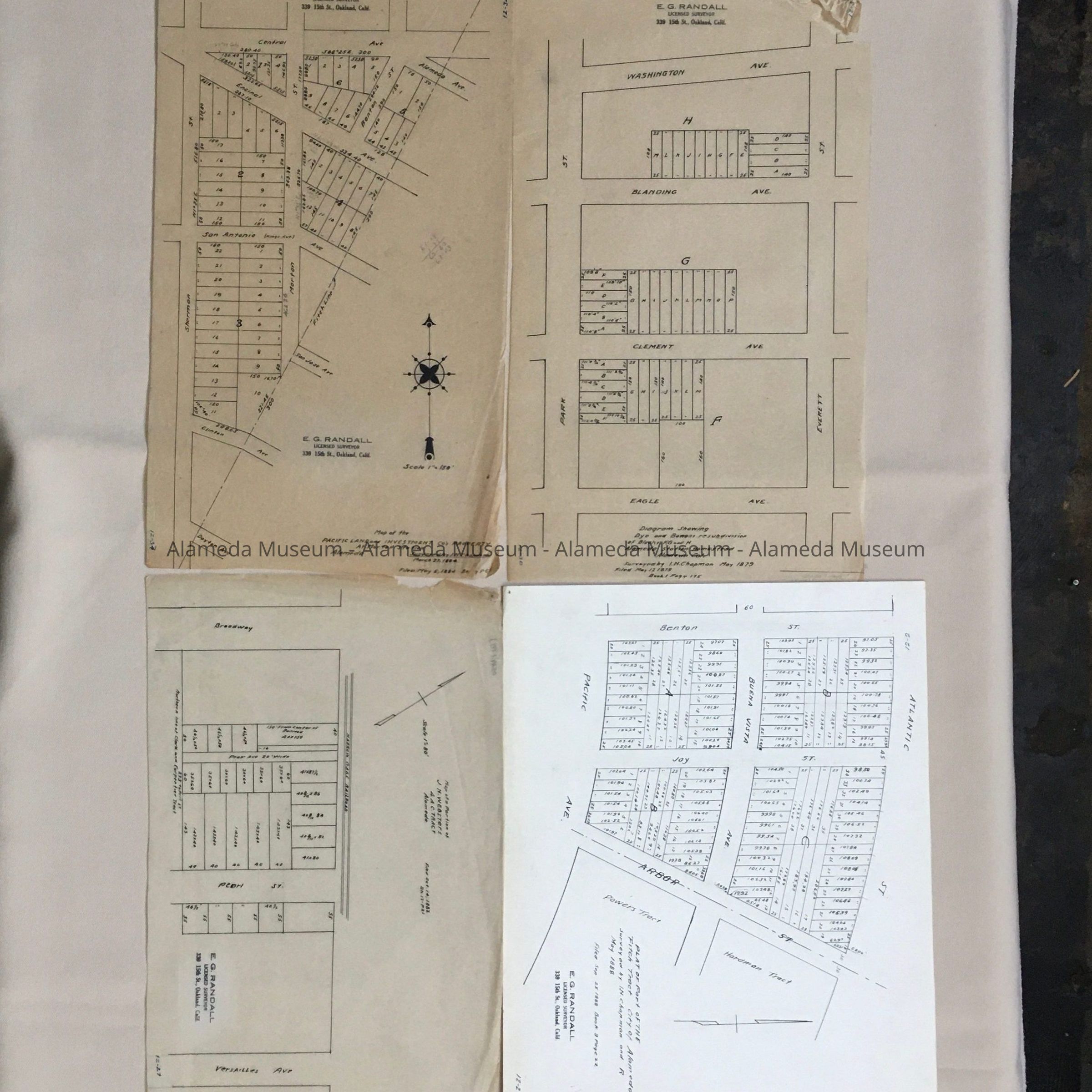
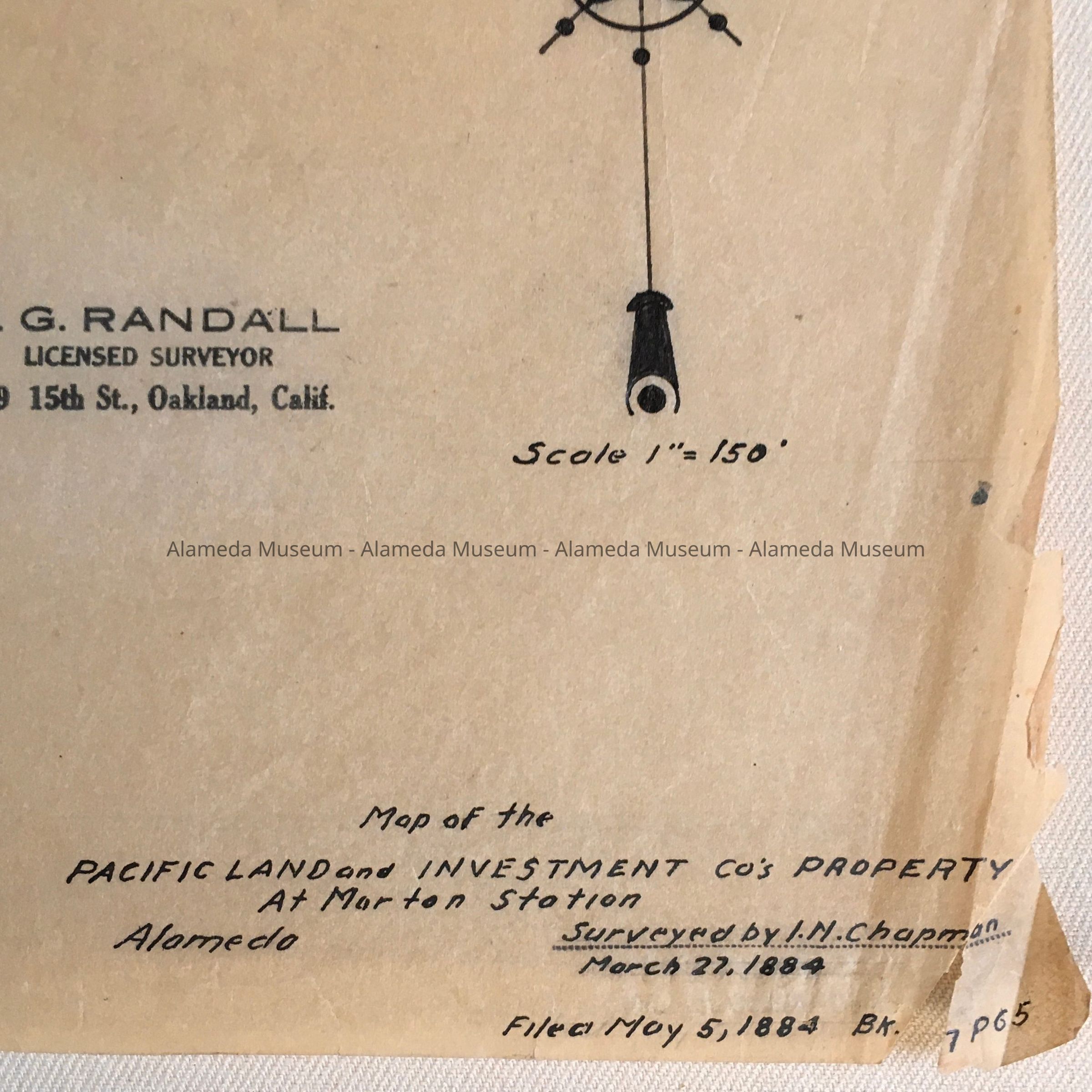
#64: Tracing of Survey No. 2325A for: Dr. N.C. Johnson, 1960, Lot 3, Block R, Oak Park Encinal (lot bordering Clinton Ave)
#65: Copy Amended Map of the Resubdivision of the Haight Tract, 1891 (West End
- Davenport, Central - Taylor - Santa Clara - Haight - Railroad - Pacific)
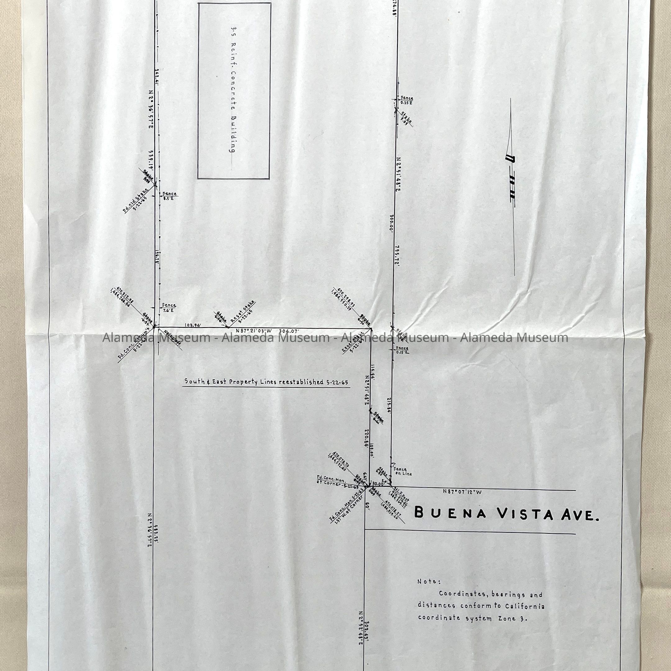
#66: Tracing of Survey No. 2677 for Hanson & Hanson, 1963 (Buena Vista)
#67: Tracing of map of the Liberty and Garfield Tract, property of David Herschield, filed 1891
#68: Copy of Map of the Bishop and Hart Tract, 1885/1890 (Versailles - College - Mound, Monroe - Madison - Jefferson - Adams - Washington - Webster - Calhoun - Clay - Front - Water Streets)
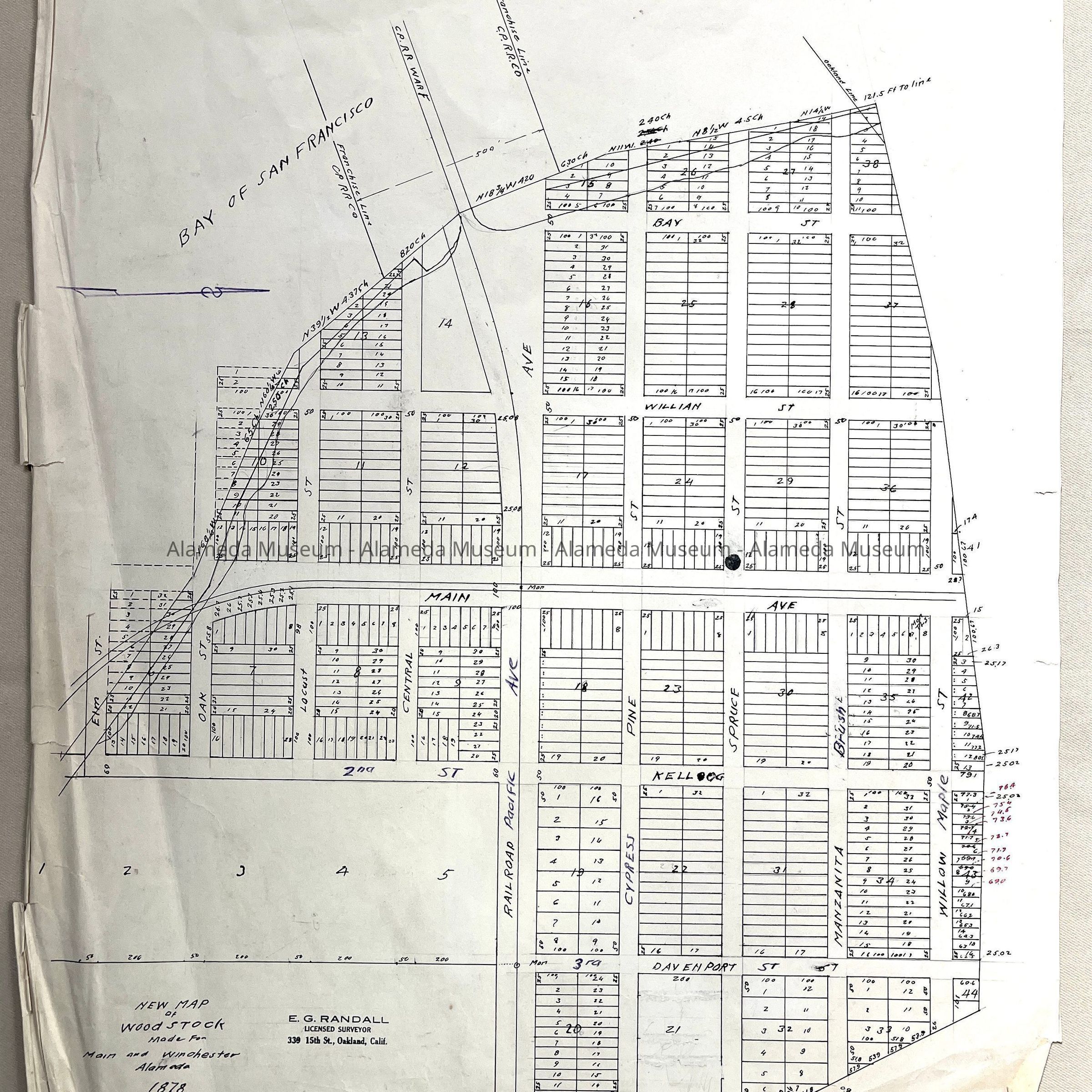
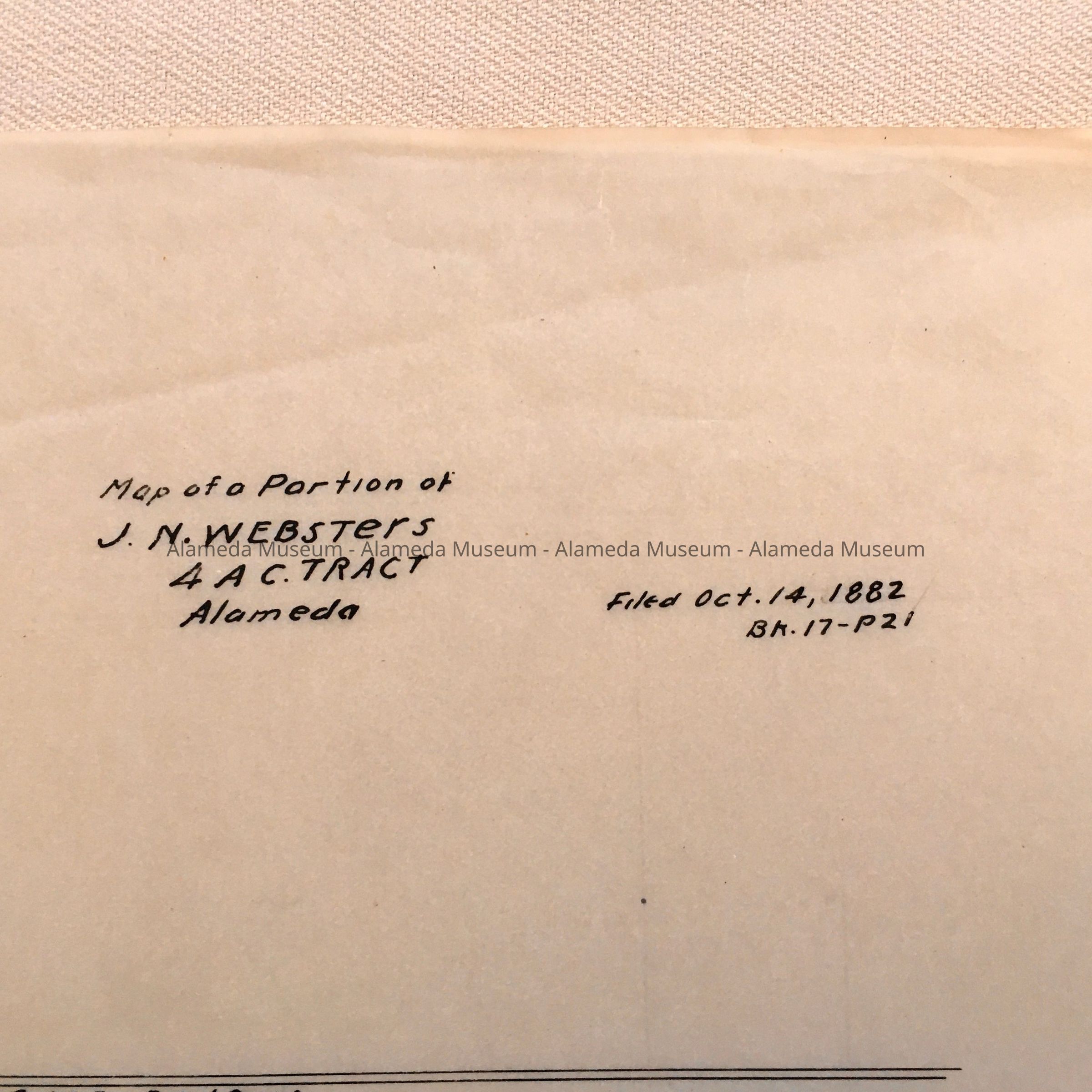
#69: copy of New Map of Woodstock made for Main and Winchester, 1878 (showing Bay - Willian - Main - 2nd / Kellog - 3rd / Davenport, Elm - Oak - Locust - Central - Railroad / Pacific [?] - Cypress / Pine - Spruce - Manzanita / Brush - Willow / Maple streets)
#70: Copy of Maps of Blocks A, B, c, D, E, and F of the Hayes and Caperton Tract, surveyed 1885; copy of W.F. Boardman walking map; Map of portion of the Tregloan Tract, 1878 (with Eagle, Clement, Blanding, Harrison, and Broadway and Park);
#71: Copy of Map of Boehmer Property, filed for Fritz Boehmer, 1907 (showing Central corner Park)
#72: Resubdivision of Block 75 According to Stratens Survey, 1907.
#73: Nesons Resubdivision of Block 65, San Jose Ave, Court, Madison and Mound, 1906 (based on survey James T. Straton 1853).
#74: Map of the McSherry Tract, 1903
#75: Map of the Pacific Land and Investment co's property at Morton Station, 1884
#76: Map of Pancost Tract, 1876
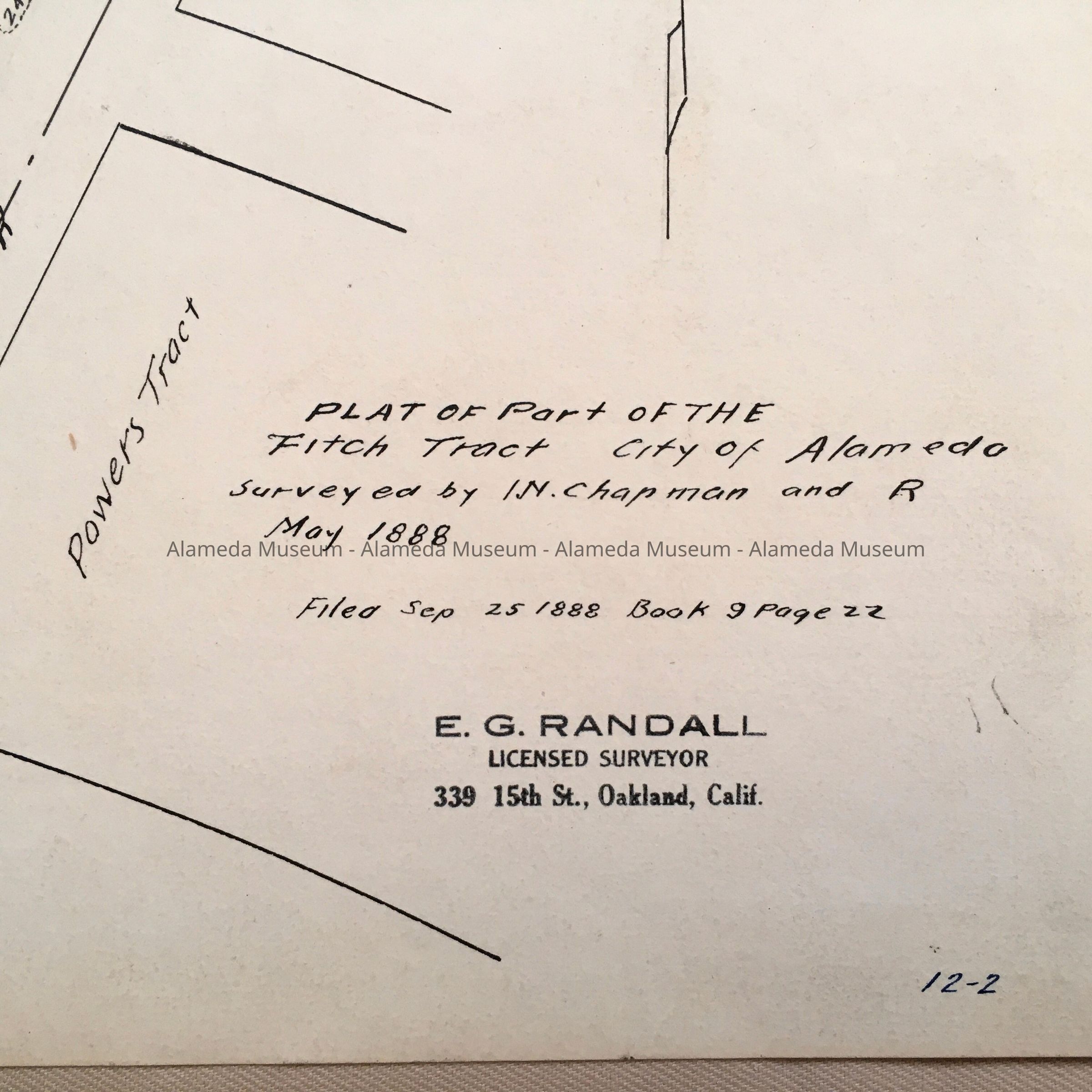
#77: Plat of Part of the Fitch Tract, 1888
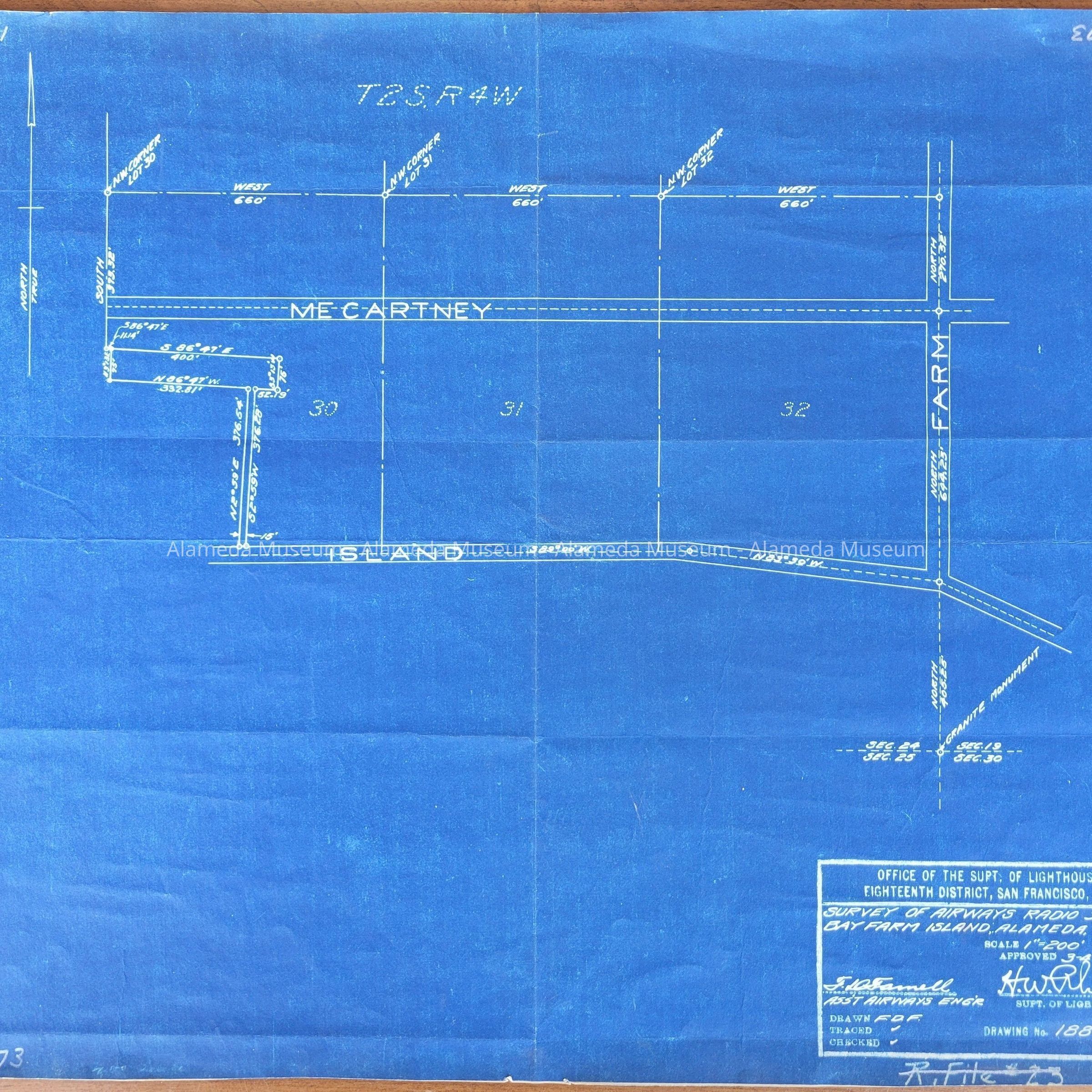
#78: Survey of Airways Radio Station, Bayfarm Island, dwg #1886, 3-4-29
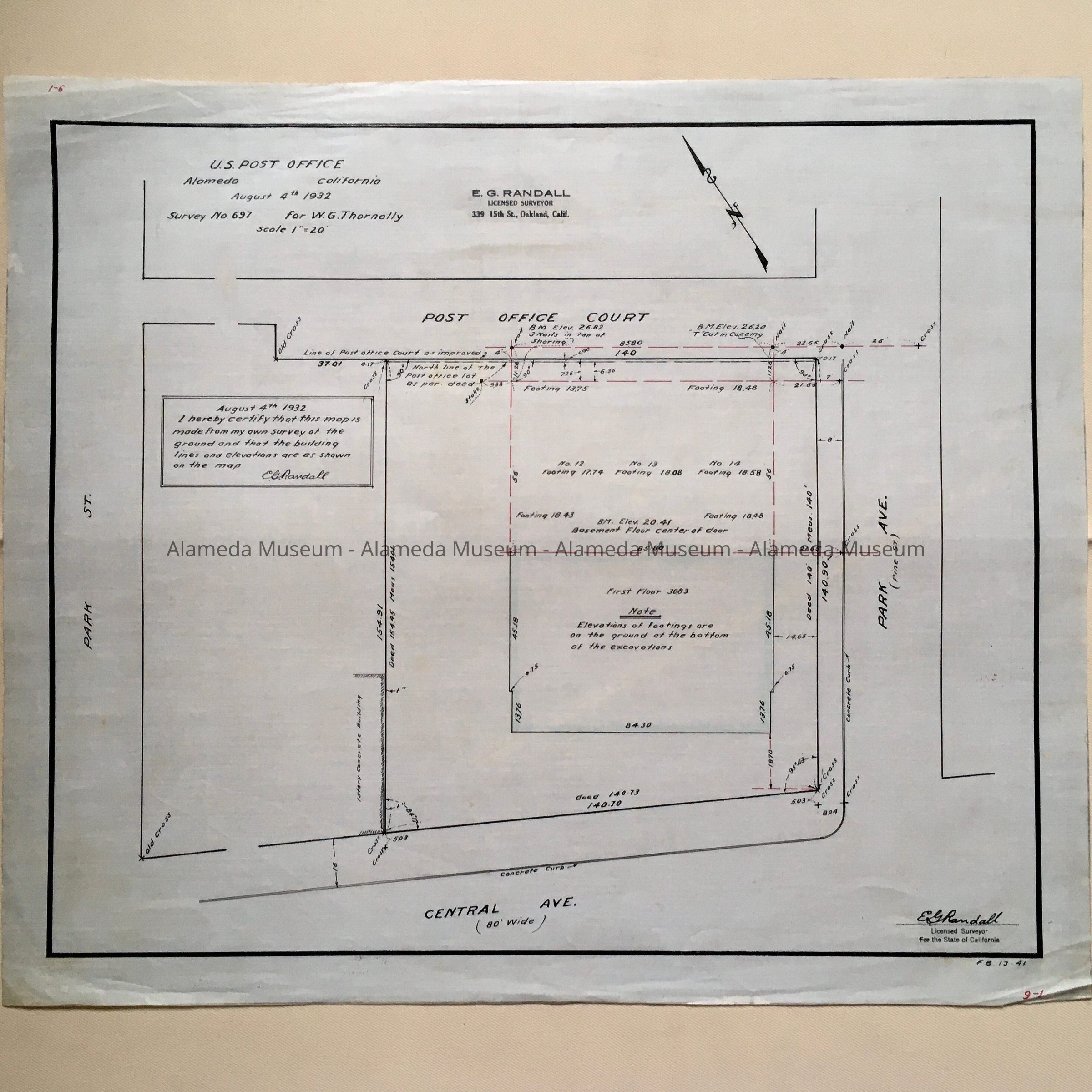
#79: Map (not tracing) of U.S. Post Office, Survey No. 697 For W.G. Thornolly. Made from own survey by E.G. Randall, August 4, 1932.
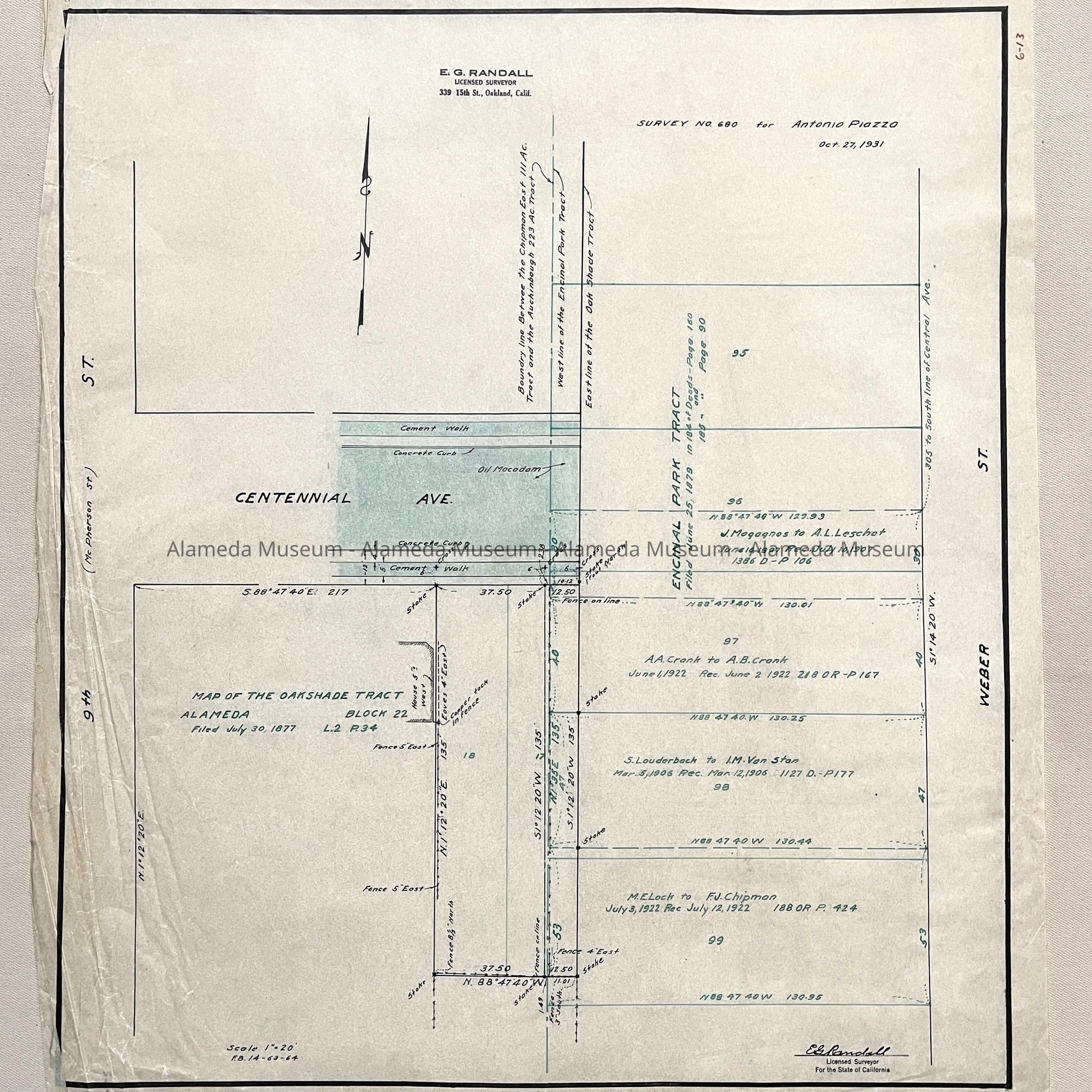
#80: Survey No 680 for Antonio Paiozza (Centennial, Weber, 9th Street), 1931
#81: Map of a Portion of N.N. Websters 4 Ac. Tract, 1882
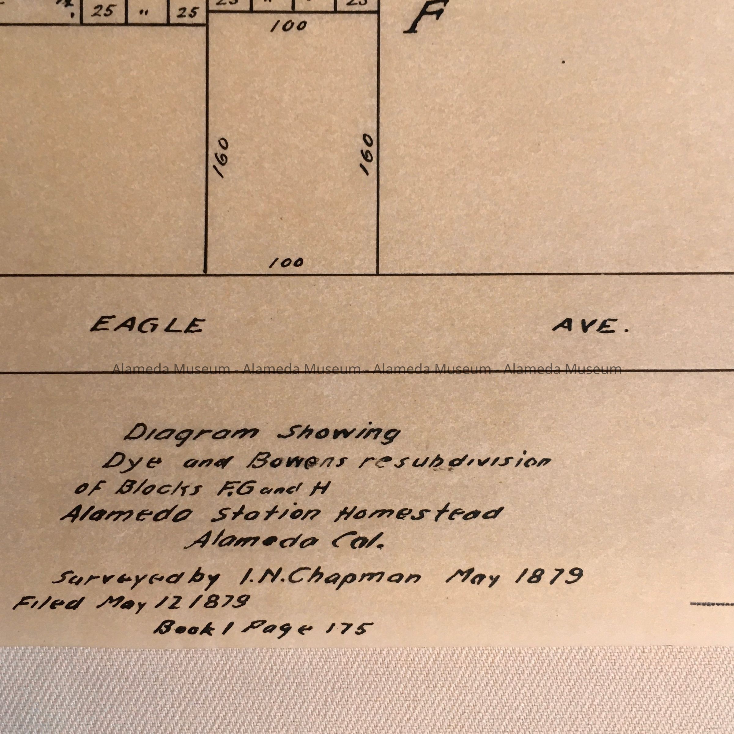
#82: Diagram Dye and Bowens subdivision, Alameda Station Homestead, 1879
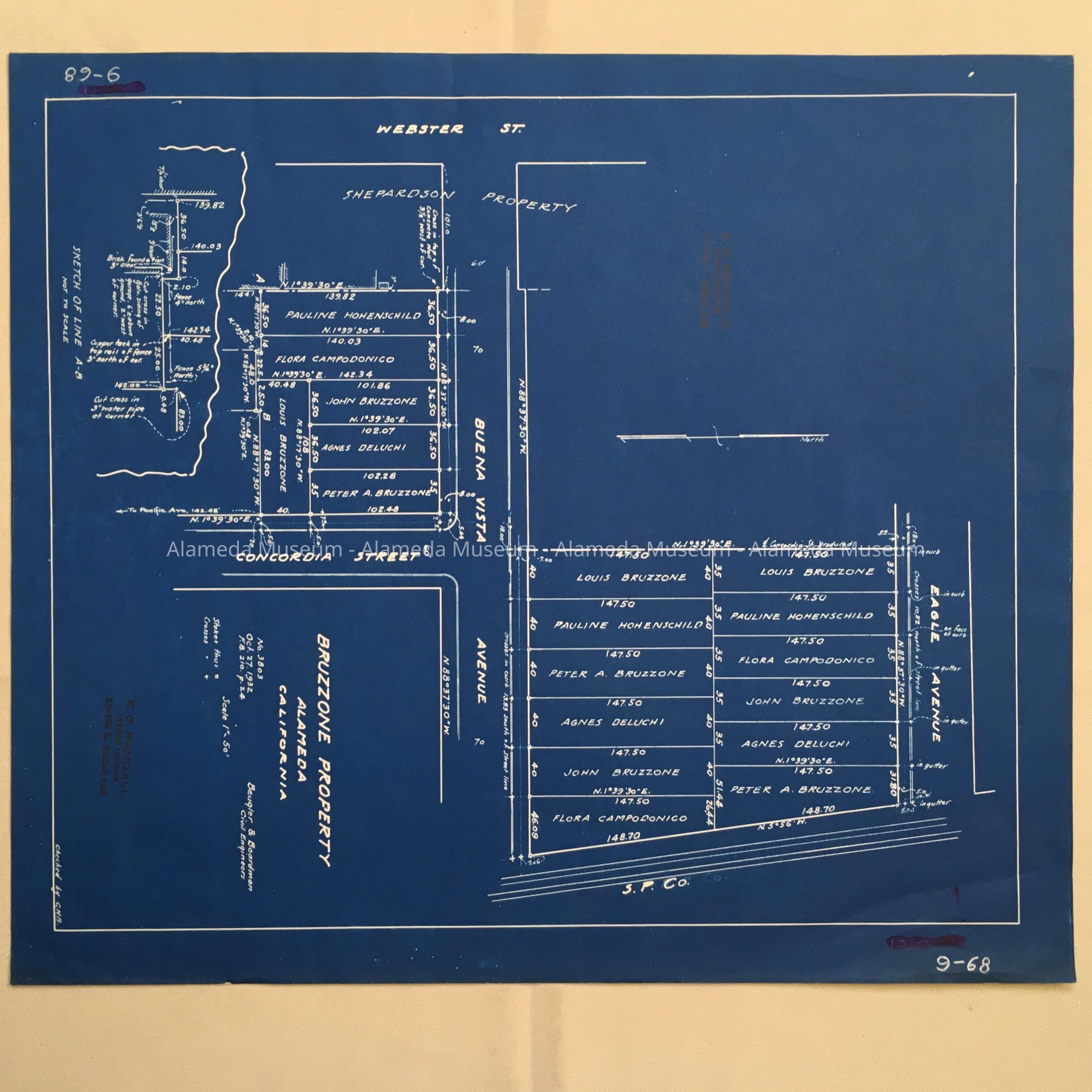
#83: Blueprint map of Bruzzone Property, 1932, blueprint paper.
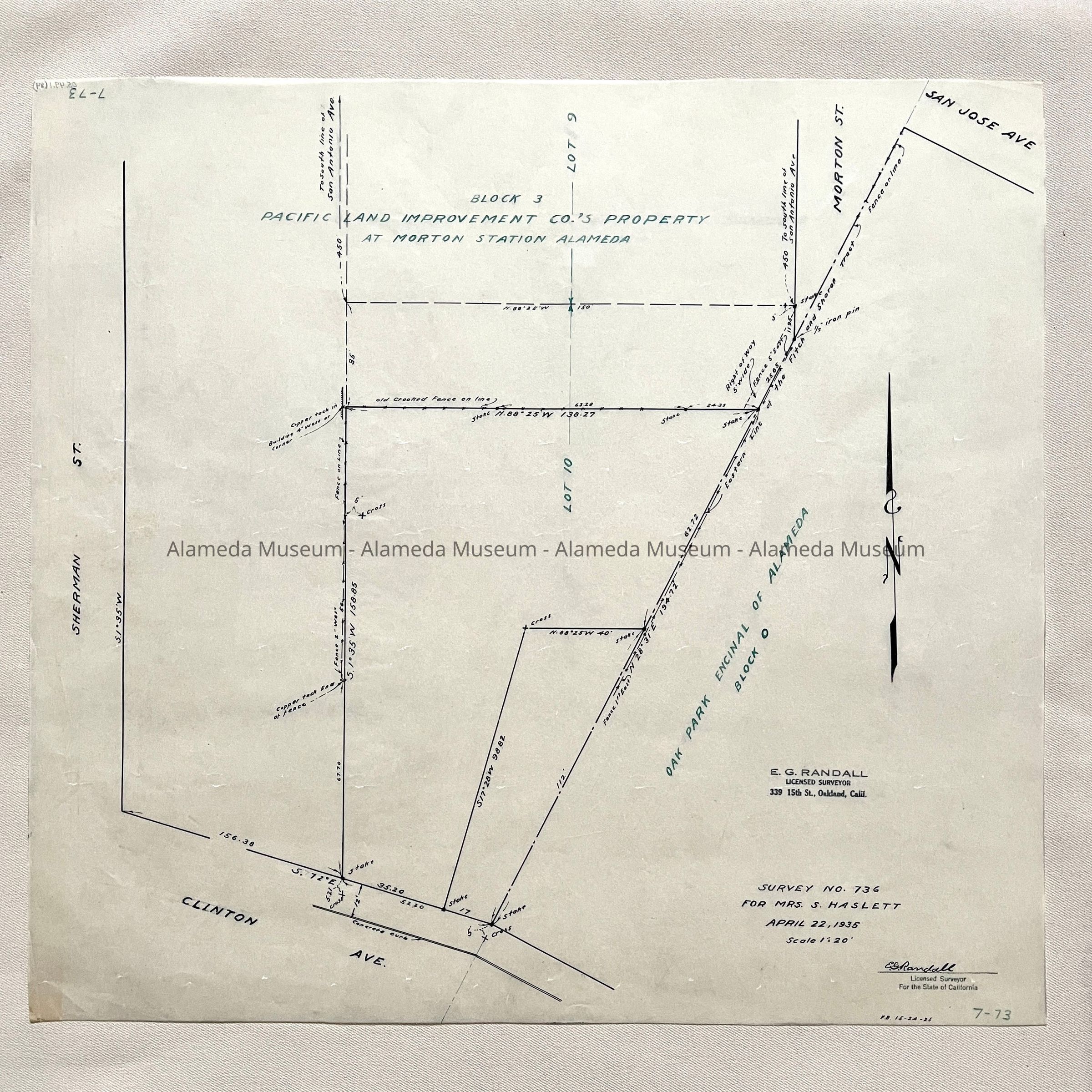
#84: Survey No. 736 for Mrs. S. Hasslett, 1935 (Sherman, Clinton, Morton)
Donor: Diane Lichtenstein
Cataloged: July 16, 2005; adjusted entry description: 5/21/2024