Name/Title
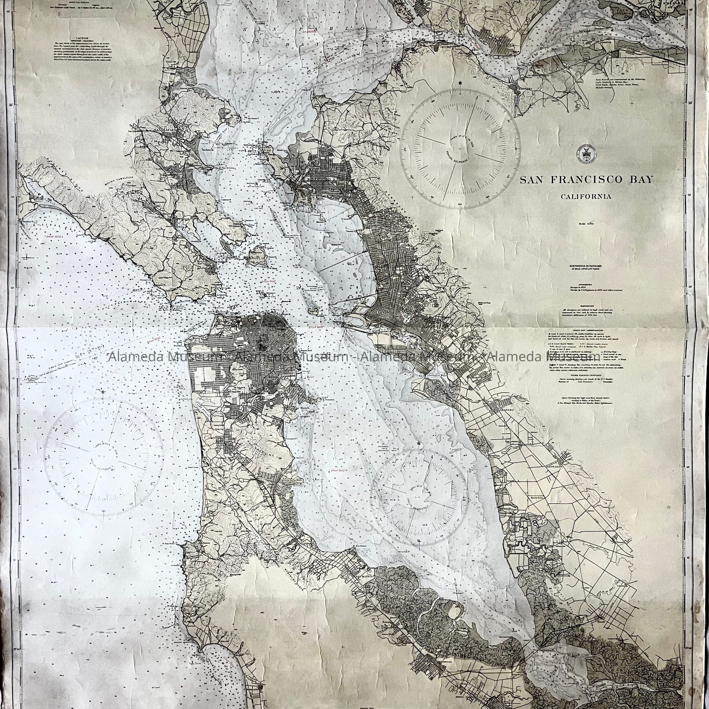
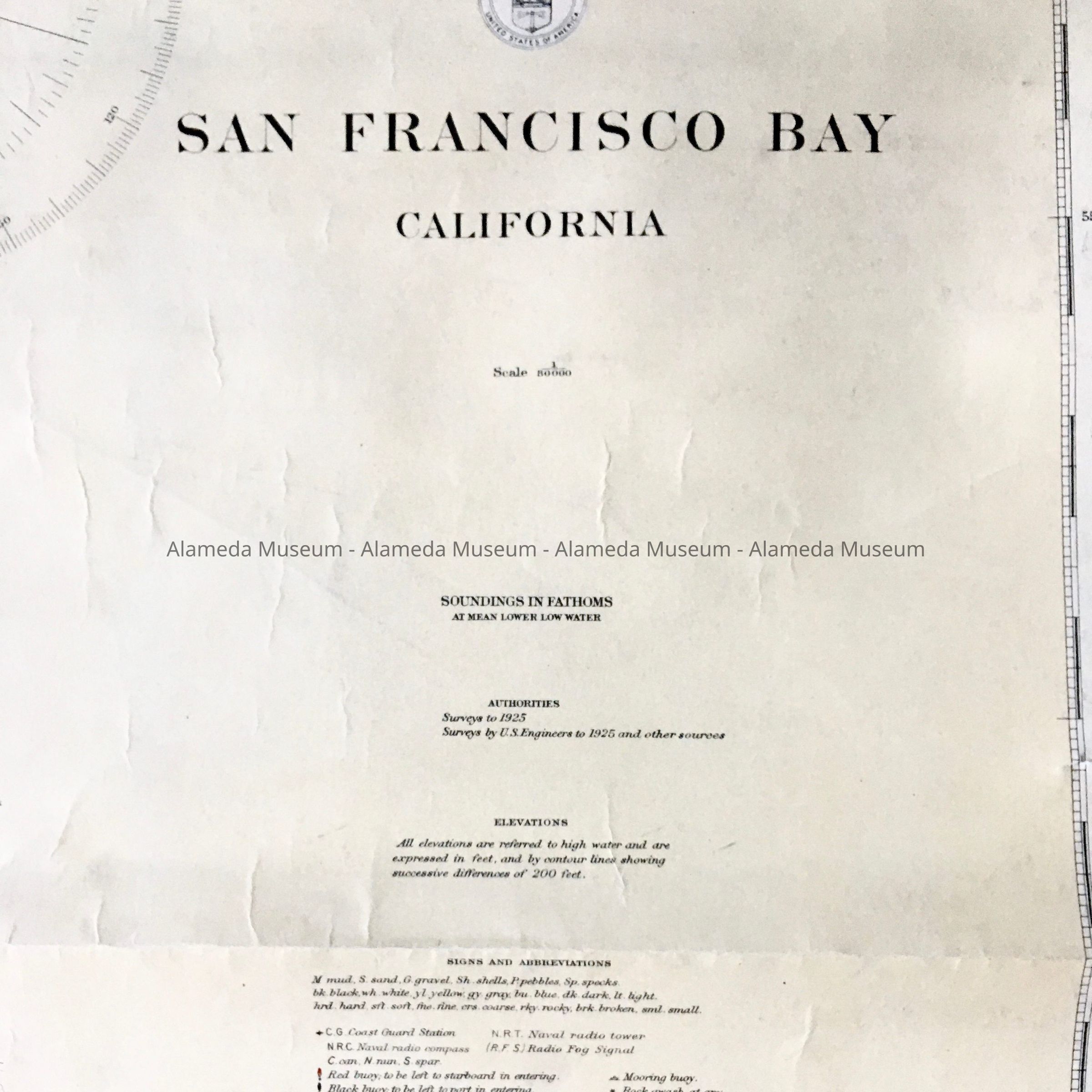
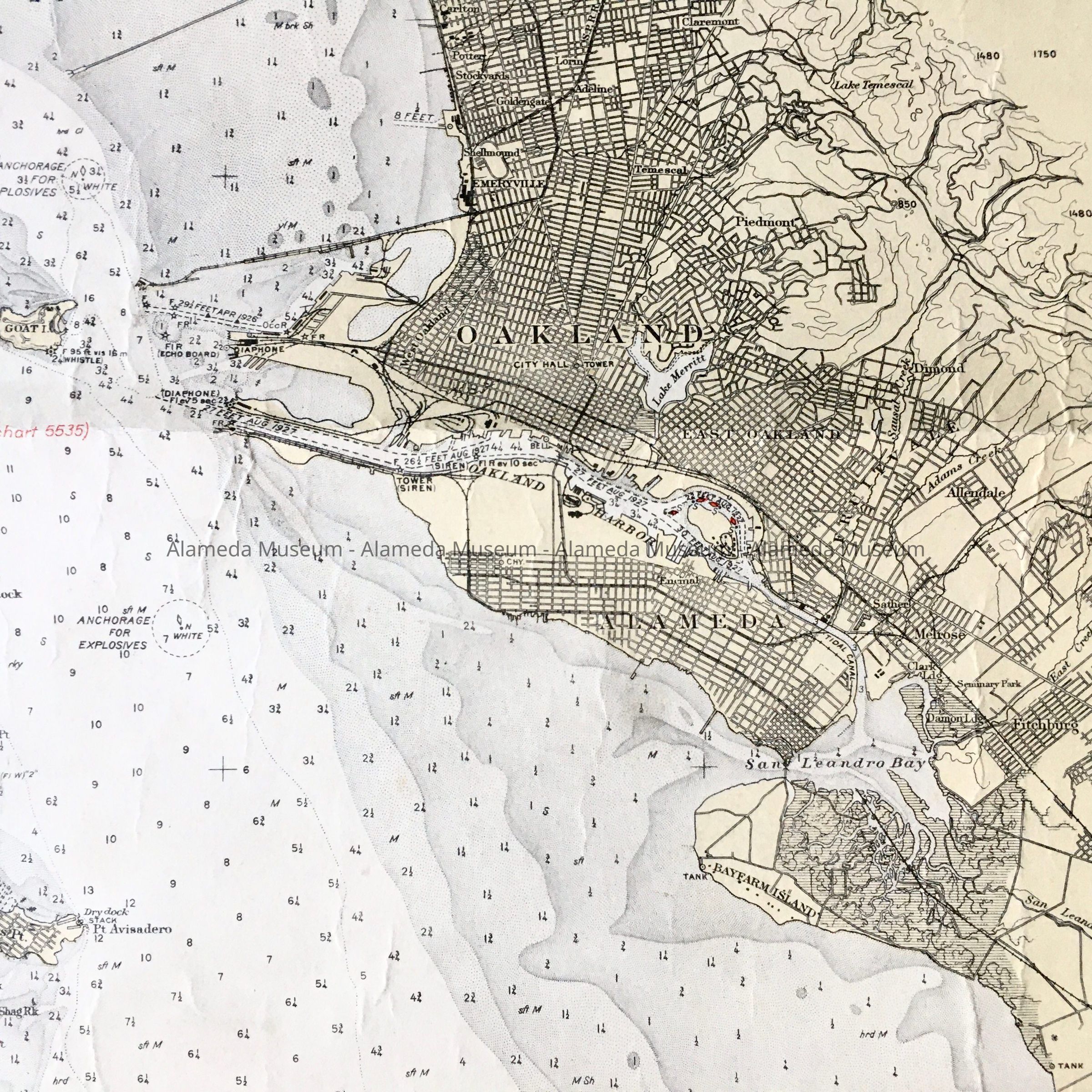
Map depth and footage of Estuary, 1925, 1928Entry/Object ID
1984.23.3Description
ACC. NO. 84.23.3
SUBJECT CATEGORY: Map -
San Francisco Bay including the City of Alameda -
depth and footage of Estuary.
DATE OR PERIOD: Map is dated February 18, 1928
OBJECT: Map
DESCRIPTION OF OBJECT: Map was published in Washington, D. C. October 1925 by the U. S. Coast and Geodetic Survey. It is a geodetic map of the San Francisco Bay, California, and it includes the City of Alameda. It gives the depth and footage of the estuary.
SIZE: 44" long by 35 1/4" wide
HISTORY OF OBJECT:
See above.
ACQUIRED FROM: Chris K. Freeman,
Originally from the collection of Helen Freeman and donated by her son (Chris K. Freeman).
DATE: August 18, 1984