Name/Title
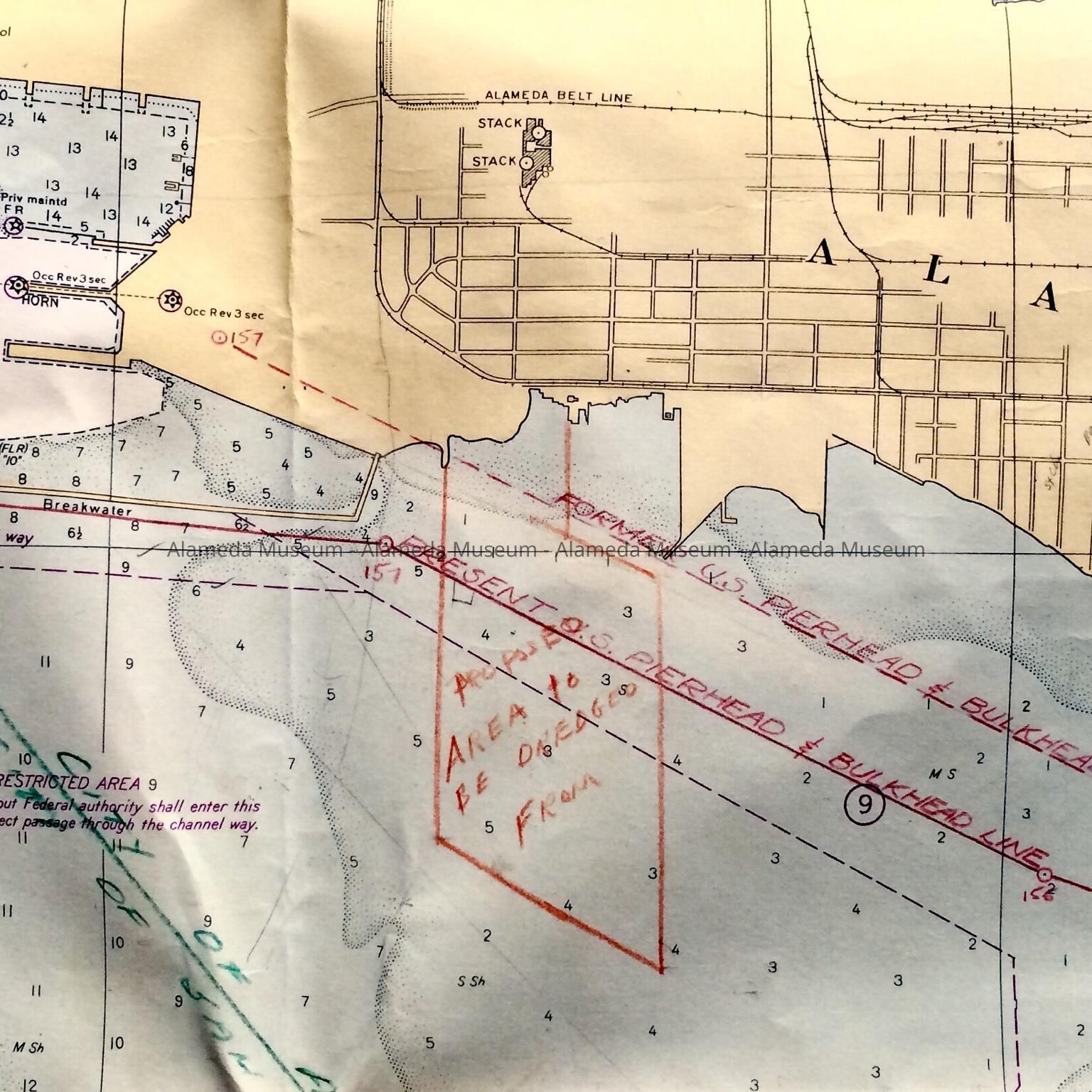
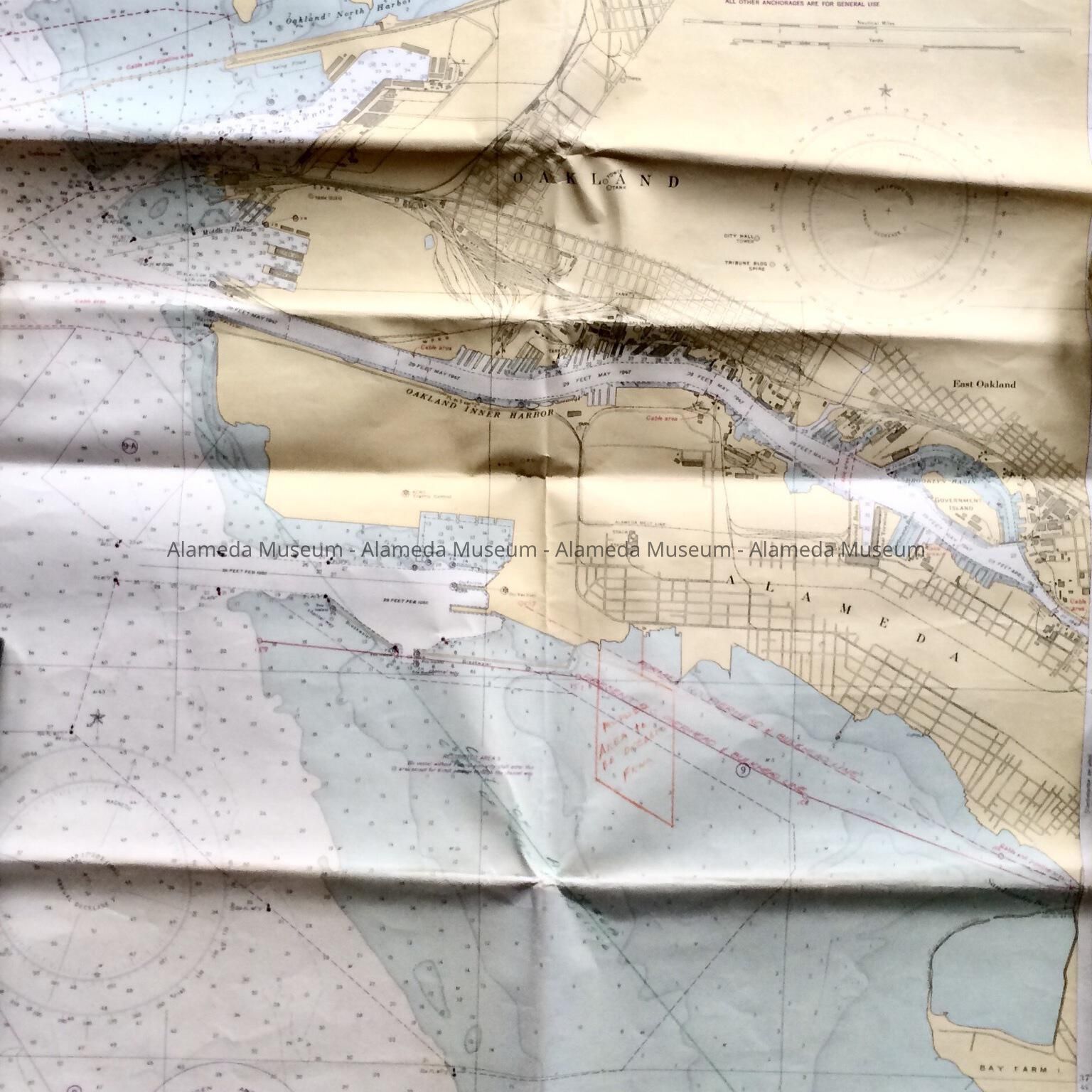
Map of a proposed dredging area, c. 1950sEntry/Object ID
2011.85.29Description
Accession No. 11.85.29
Subject Category: City of Alameda
Date or Period: 1950, over 1943
Object: Map
Description: Full size U.S. Coast and Geodetic Survey Map #5535, of San Francisco Bay - Candlestick Point to Angel Island, 17th edition, 1943, with lights, beacons and buoys updated to August 1950, with hand-drawn lines and writing in red, green, and graphite pencil.
Size: L 35" X W 45"
History of Object: Map found in the attic of City Hall in the 1990s. This map has been used to mark off an area of the Bay for proposed dredging, off of what is now Crab Cove. This was likely in anticipation of the South Shore development plans.
Acquired from: City of Alameda
Cataloged: December 21, 2011