Name/Title
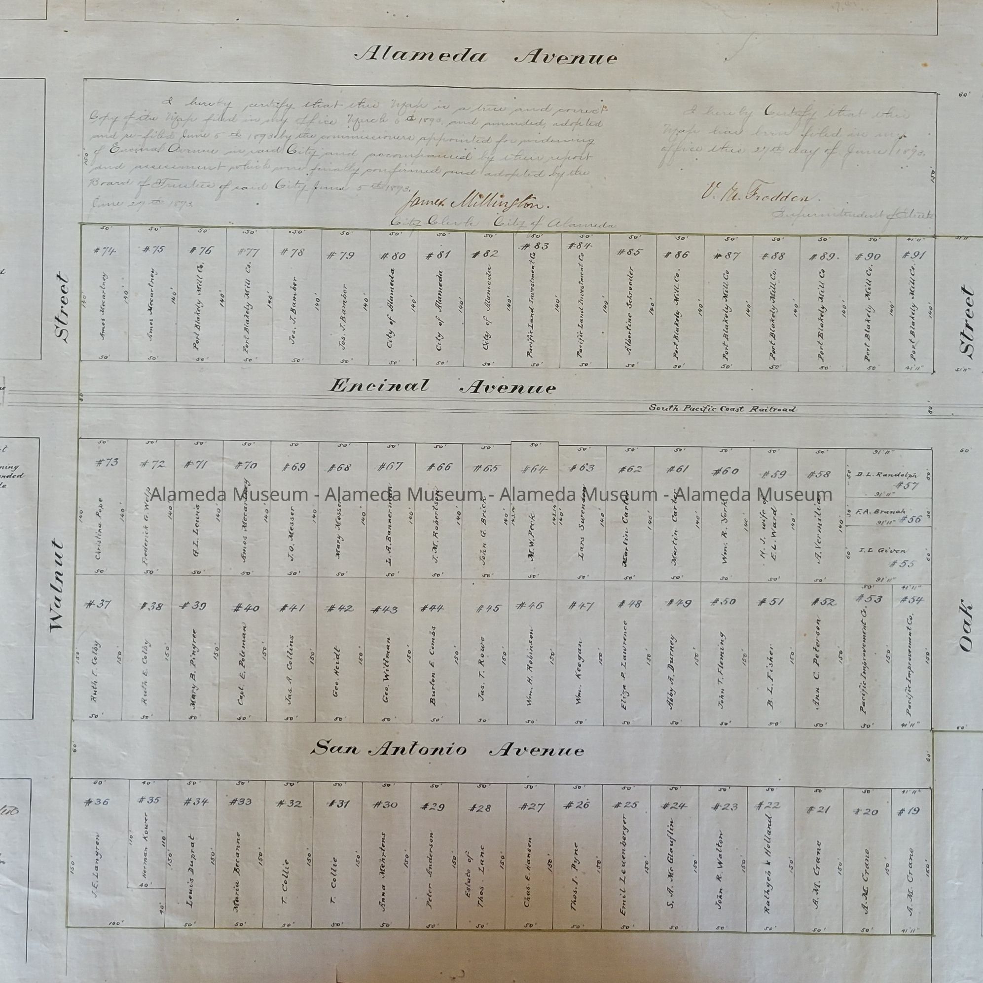
1893 Map for Widening of Encinal AveEntry/Object ID
2025.78.1Description
Acc. No. 25.78.1
Subject Category: City of Alameda; Streets of Alameda; Road Work
Date or Period: 1893
Object: map
Description: A Map, hand-drawn on linen paper, blocks, properties and property owners in black ink. Title: ‘Map of the Assessment District for widening Encinal Ave between Park Street and Oak Street, Alameda’ is written in the upper lefthand corner. Scale is 1 inch equals 60 feet.
Size: L 18 " x W 34”
History of Object: In addition to the area to be widened, this map shows the individual property owners on both sides of Encinal Ave. and San Antonio Ave., between Walnut St. and Park St. "Filed March 6th 1893" is written on the map.
Donor: unknown
Donation Date: unknown, found in museum storage, awaiting processing.
Catalog Date: 6/6/2025