Name/Title
1918 Maps of Tidal Marshlands along the Northern WaterfrontEntry/Object ID
2025.91.1Description
Acc. No. 25.91.1 A-C
Subject Category: City of Alameda; Marshlands of Alameda
Date or Period: Jan 1918
Object: Three maps
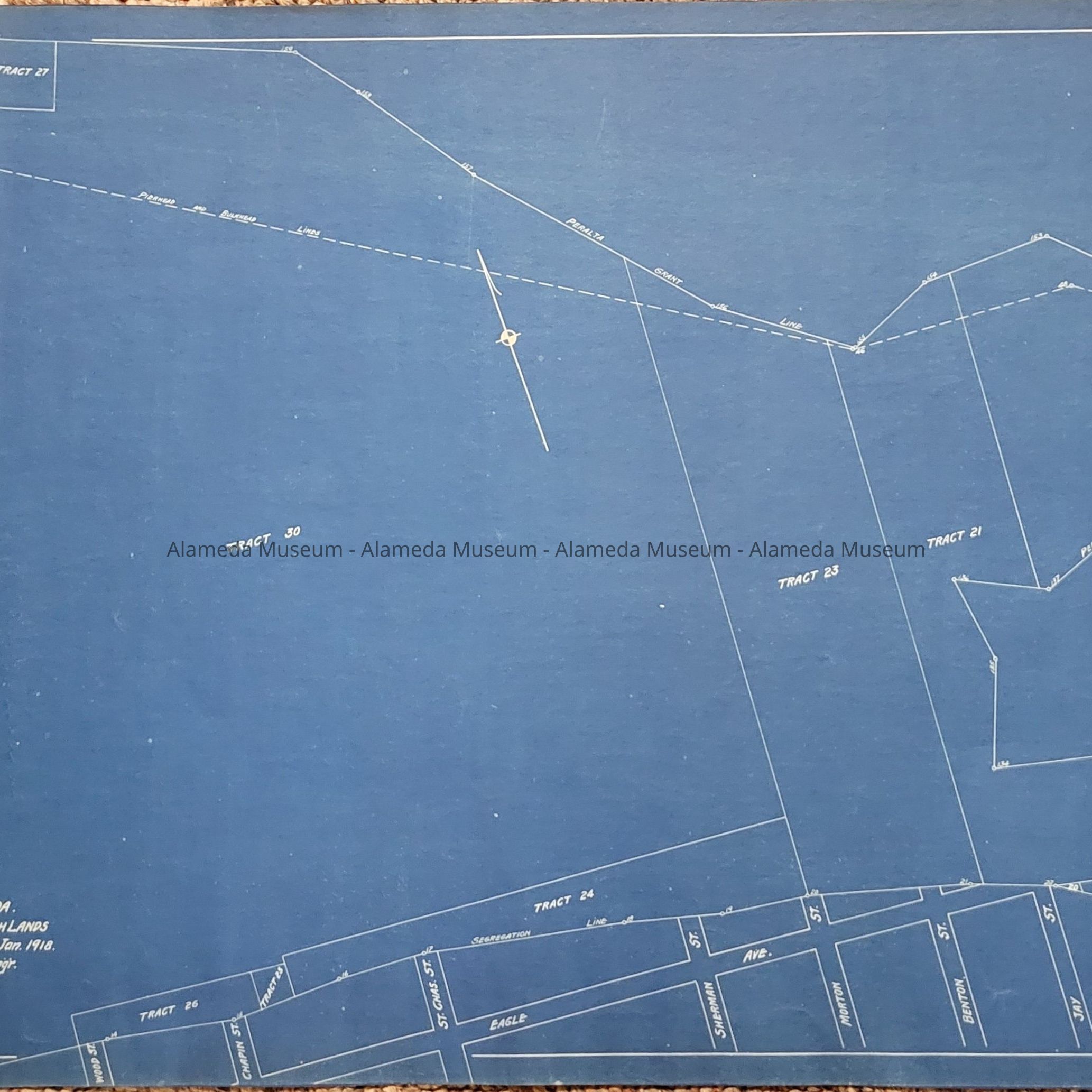
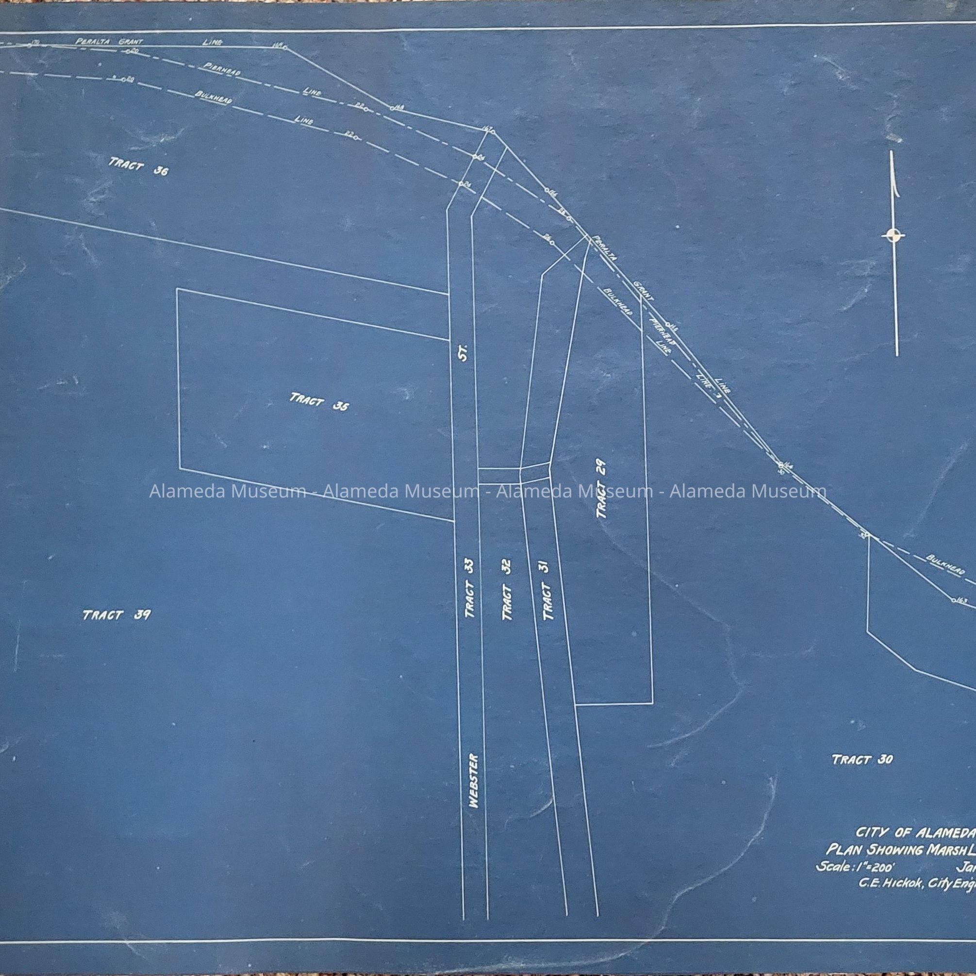
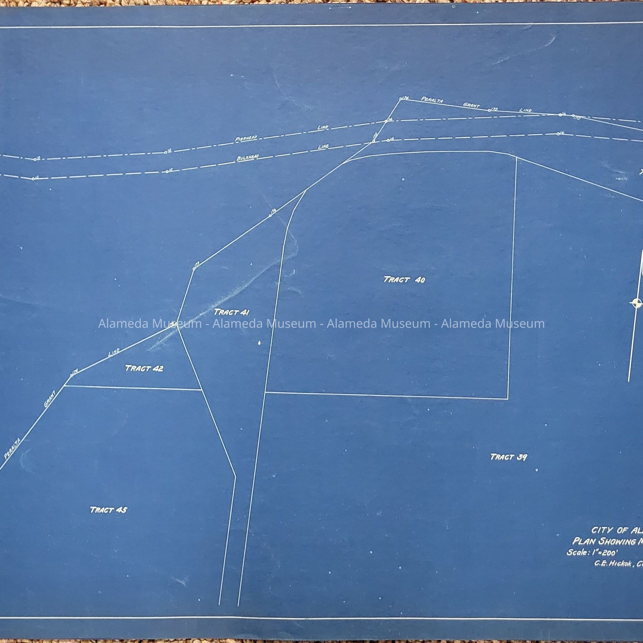
Description: Three blueprint style maps, showing tidal marshlands west of Fortmann Basin. They are divided into tracts 17-45. All maps are labelled "CITY OF ALAMEDA."/"PLAN SHOWING MARSHLANDS"/"Scale: 1"=200' Jan. 1918."/"C.E. Hickok, City Engr."
25.91.1A is labelled "SHEET NO. 4." in the upper righthand corner. Fortmann Basin is shown on the eastern edge, with Tract 17 just below it. Tract 30 takes up a little more than half of the western half of the map. Several streets are shown on this map, between Wood St and Arbor St.
25.91.1B is labelled "SHEET NO. 5." in the upper righthand corner and is a continuation to the west of Sheet No. 4. The continuation of Tract 30 is shown on the eastern edge. Webster St. bisects this map in the north/south direction and makes up Tract 33. Tract 39 takes up a most of the western half of the map.
25.91.1C is labelled "SHEET NO. 6." in the upper righthand corner and is a continuation to the west of Sheet No. 5. The continuations of Tract 36 and Tract 39 are shown on the eastern edge. Tracts 40 through 45 make up the rest of this map.
Size: L 16 " x W 24” all three
History of Object: Unknown.
Donor: unknown
Donation Date: unknown, found in museum storage, awaiting processing.
Catalog Date: 8/29/2025