Name/Title
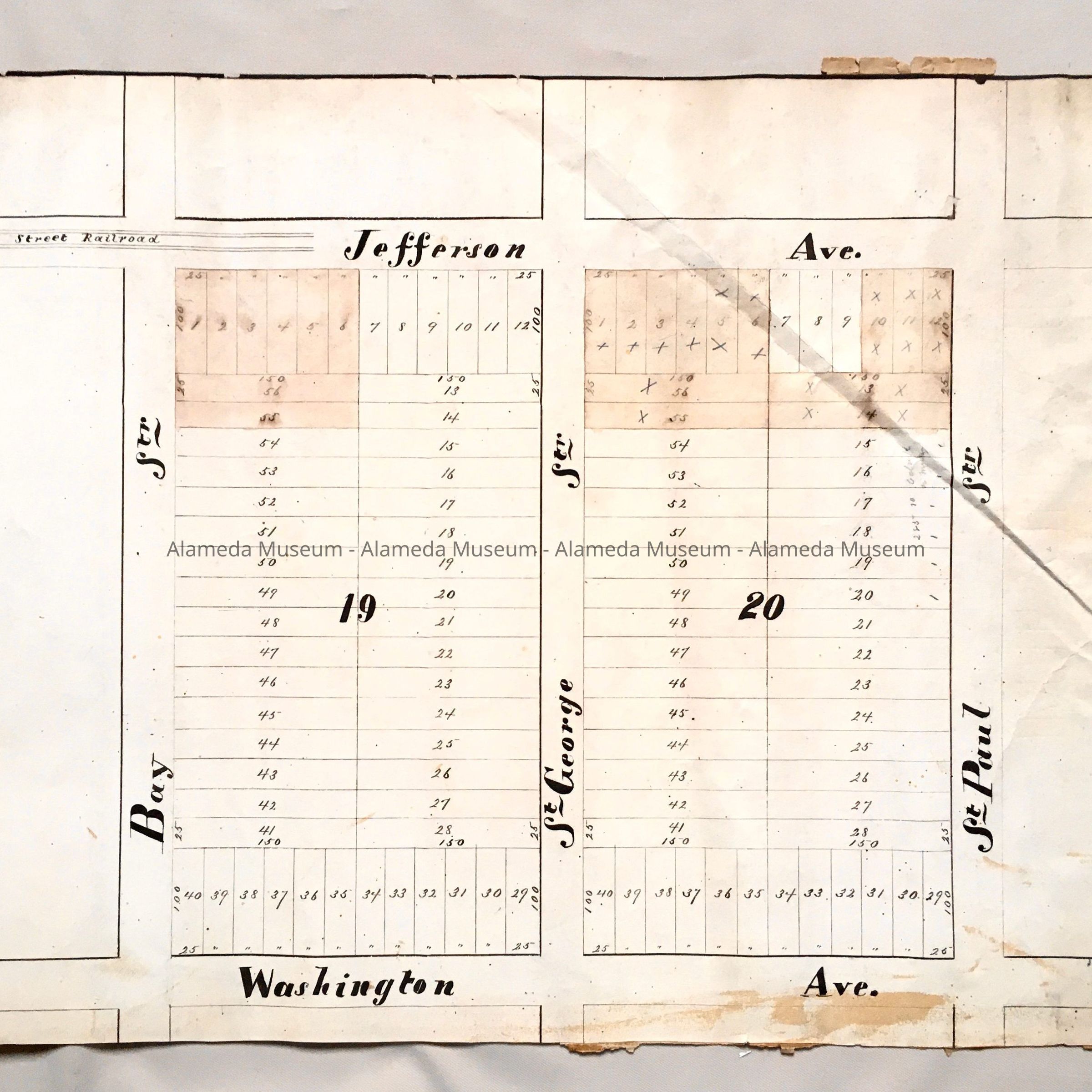
Subdivision map Block 19 and 20, St. Paul / Jefferson / Washington, c. 1870sEntry/Object ID
2002.80.10Description
Acc. No. 02.80.10
Subject: Maps
Date or Period: circa 1870's
Object: Maps, Subdivision
Description:
Hand-drawn map in black-colored ink on off-white colored paper. Some individual lots have been shaded in brown watercolor.
Size: L17 x W22 inches.
History:
Subdivision map showing Block 19 and 20, bounded by Bay and St. Paul Streets, Jefferson and Washington Avenues. This collection of maps, etc., found in the attic of City Hall prior to the rehabilitation and seismic upgrades in the late 1990's.
Acquired From: City of Alameda
Date: 7/28/02