Name/Title
Prototype Map for 'Map Alameda Station Homestead Tract', 1870sEntry/Object ID
2002.80.17Description
Acc. No. 02.80.17
Subject: Maps
Date or Period: 1870's
Object: Maps, Subdivision
Description:
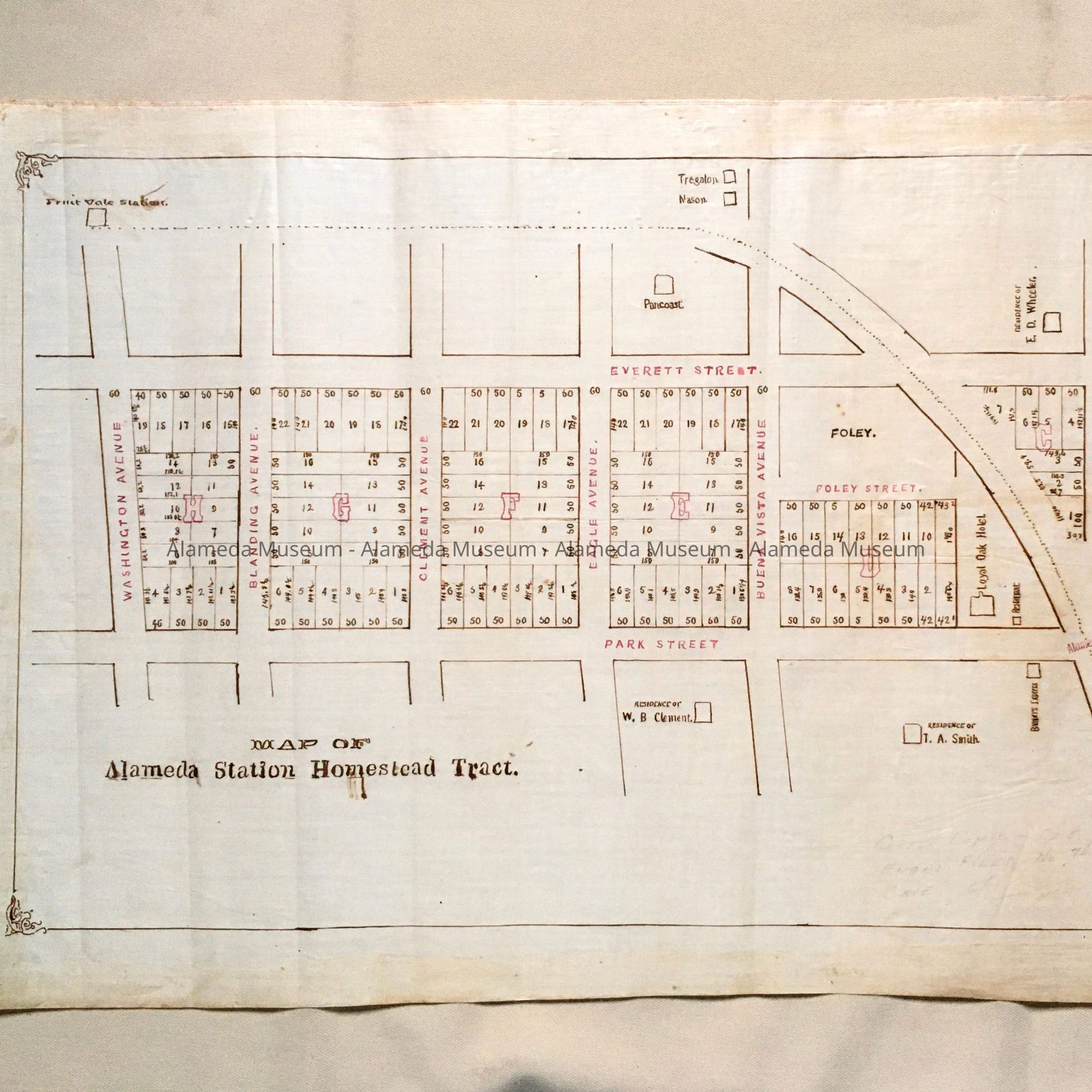
Hand-drawn map in sepia-colored ink on off-white polished linen paper.
Size: L24-1/2 x W15 inches.
History:
Map which appears to be a prototype for a printed map with bold-printed caption, "Map of Alameda Station Homestead Tract”, showing property located between Park and Everett Streets, Webb and Blanding Avenues. Map also depicts pioneer homes and businesses in the locality, including the Loyal Oak and Park Hotels. This collection of maps, etc., found in the attic of City Hall prior to the rehabilitation and seismic upgrades in the late 1990's.
Acquired From: City of Alameda
Date: 7/28/02