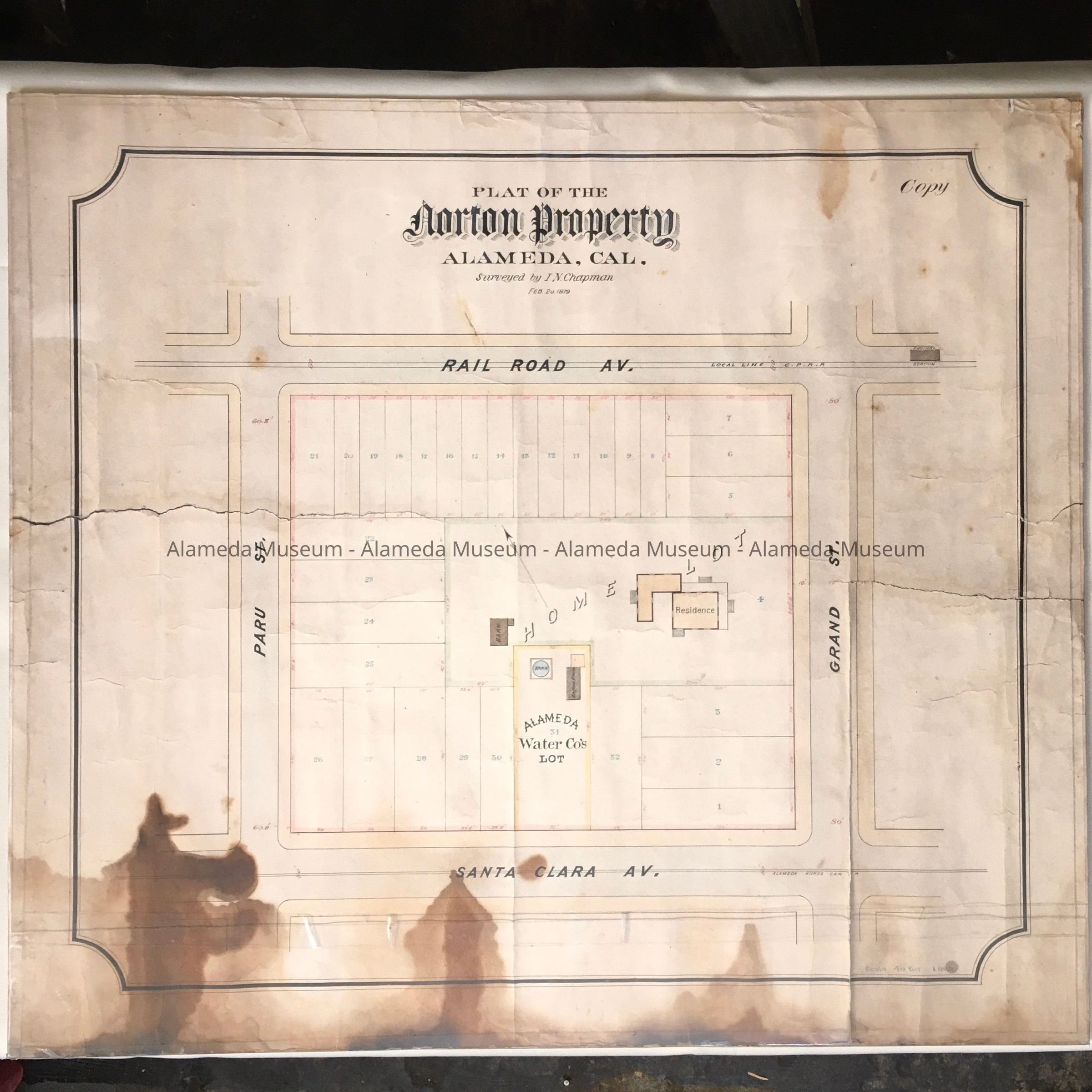
Name/Title
Map of Norton property, surveyed by I.N. Chapman, c. 1879Entry/Object ID
1984.19.2Description
Acc. No. 84.19.2
Subject Category: Water
Date or period: Circa-1879
Object: Map
Description: Hand drawn map with bold heading "Plat of the Norton Property, Alameda, Cal." The map has been accentuated with water colors.
Size: W-26 X L-23 inches.
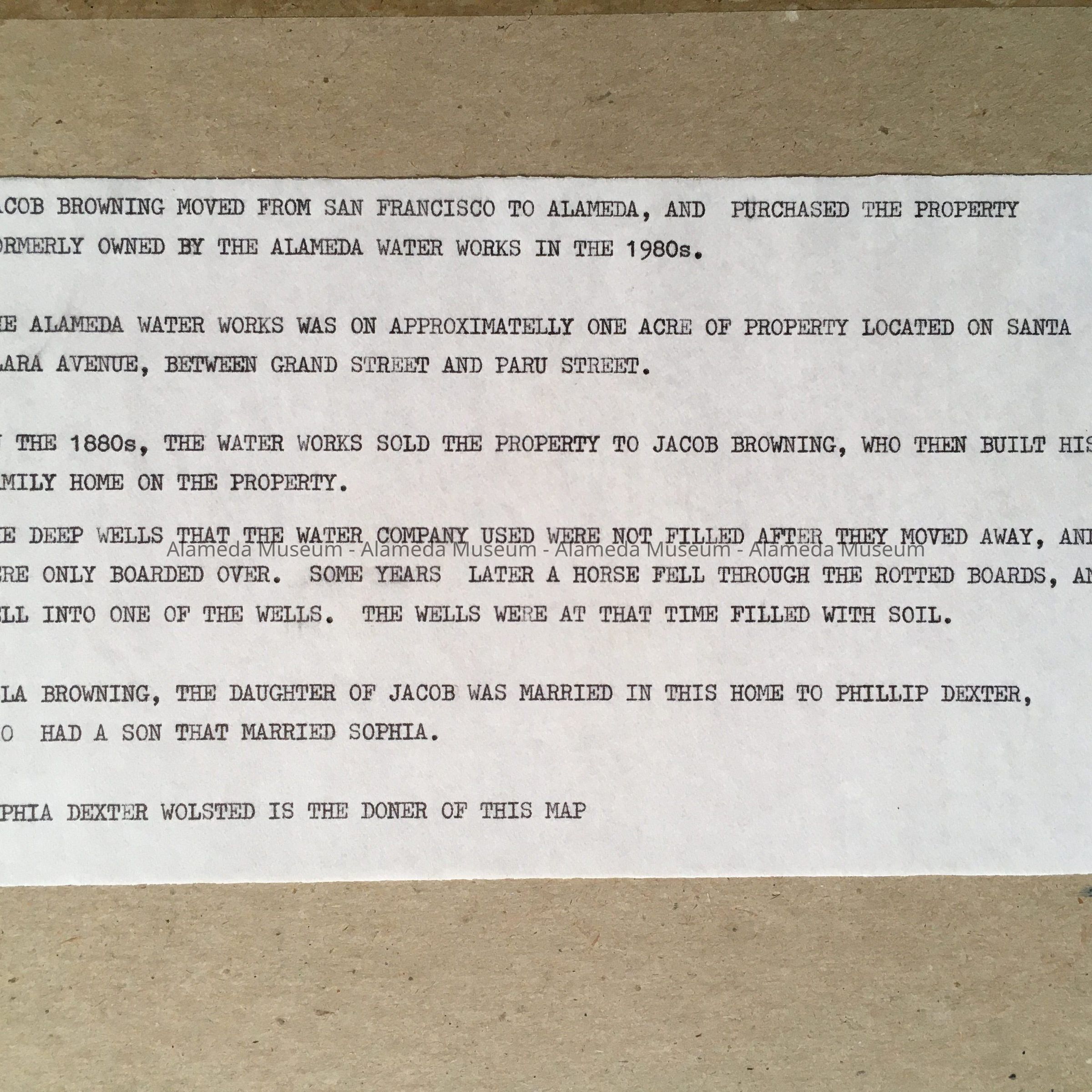
History of Object: Map depicting the Norton property, bounded by Santa Clara and Railroad (Lincoln) Avenues, Paru and Grand Streets. This was the site of Norton's Alameda Water Company, where the first attempt to provide water for public consumption in Alameda took place. It was later purchased by R. R. Thompson, and used to expand his operation. The map states that the property was surveyed by I. N. Chapman (City Surveyor), Feb 20, 1879.
Acquired from: Sophia L. Walsted (widow of Philip L. Dexter)
Date: July 28, 1984