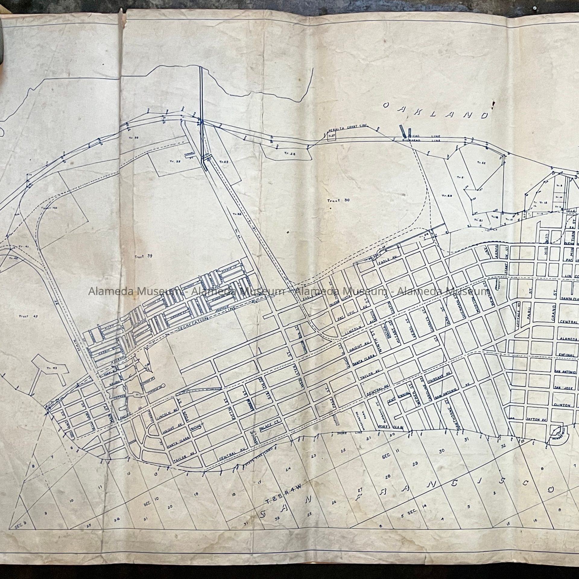
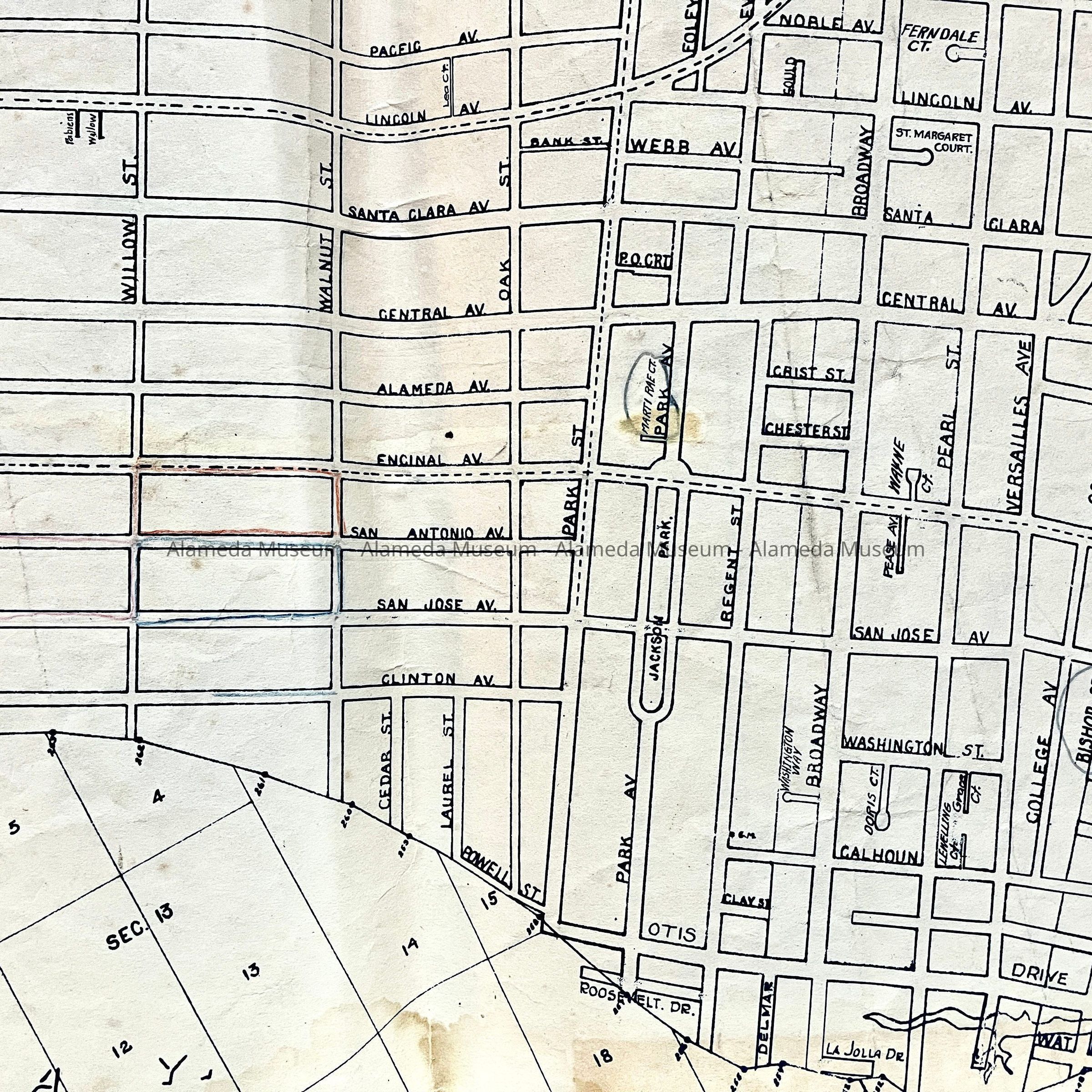
Name/Title
Blueline / Whiteprint map of Alameda, circa 1960.Entry/Object ID
2023.33.2Description
Acc. No. 23.33.2
Subject Category: Maps, Alameda
Date or Period: 1940s
Object: Map
Description:
Blueline or whiteprint (blue on white background) style Map of Alameda, scale 1:500, on sturdy paper. Showing streets, railroad lines, marshland divisions on the south shore, and 3 bridges and a tunnel crossing the estuary, and a ‘segregation line’ along the west end of Atlantic Avenue.
Size: L 23 1/2 x W 51 inches
History of Object: Map of Alameda drawn by City Engineer Geo Sperbeck. There are streets and housing blocks on the other side of the segregation line along Atlantic Avenue, so after 1939, but before the South Shore Landfill. Purpose or use of the map is unknown, but there are faint blue and red lines around blocks between Willow, Walnut, Encinal and Clinton, and Marti Rae Court and Bishop Street have been circled in black pencil.
Acquired from: unknown (City of Alameda?)
Catalog Date: 11/11/2023