Name/Title
Subdivision map of East End, c. 1860s-1870sEntry/Object ID
2002.80.8Description
Acc. No. 02.80.8
Subject: Maps
Date or Period: 1860's-1870's
Object: Maps, Subdivision
Description:
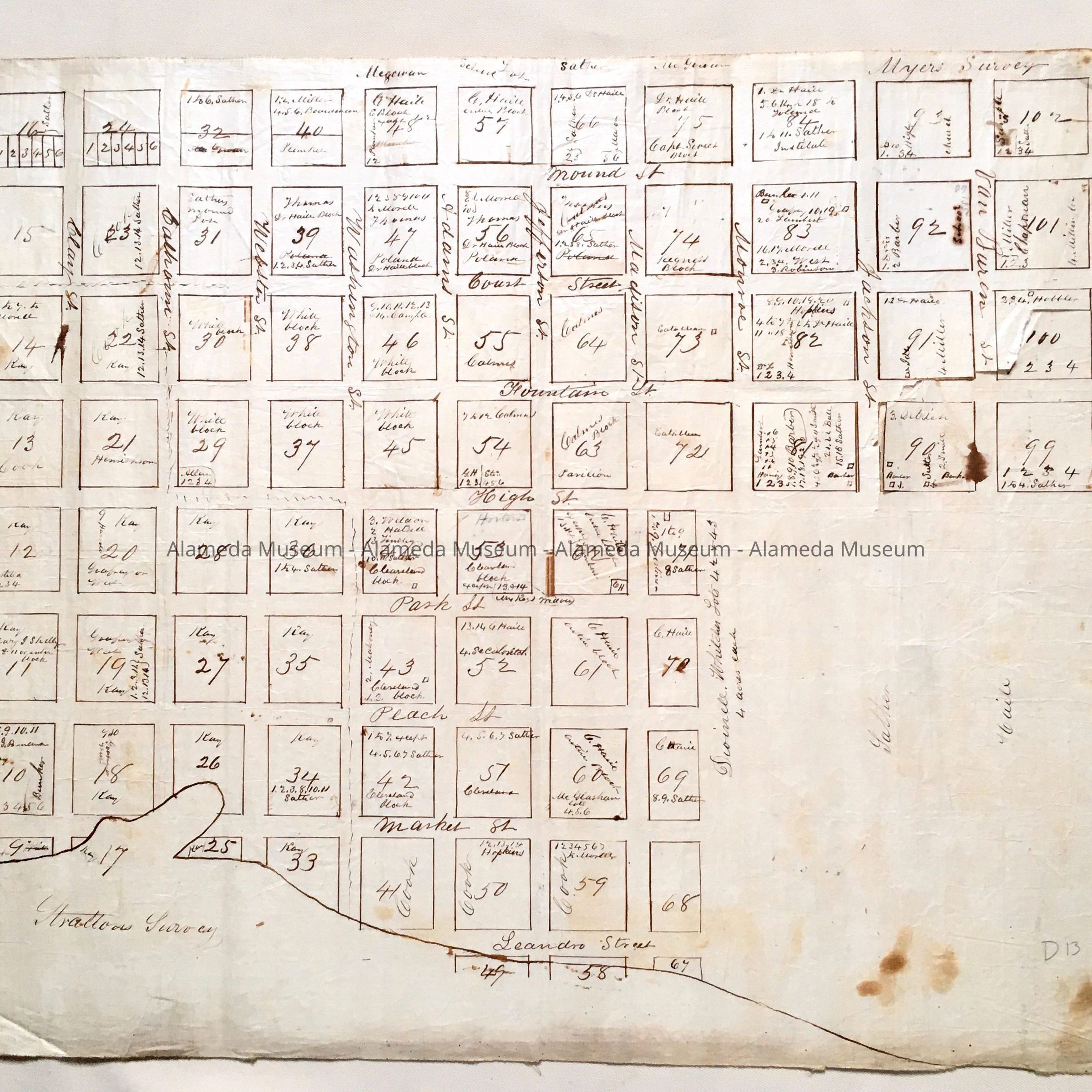
Crudely hand-drawn map in sepia-colored ink on white-colored polished linen paper.
Size: L18 x W24 inches.
History:
Subdivision map showing ownership of blocks of land in the East End in the Old Town of Alameda. During this period, San Jose is known as Jefferson Street. Early map shows blocks in the vicinity of High Street, mostly named after Presidents of the U.S.
This collection of maps, etc., found in the attic of City Hall prior to the rehabilitation and seismic upgrades in the late 1990's.
Acquired From: City of Alameda
Date: 7/28/02