Name/Title
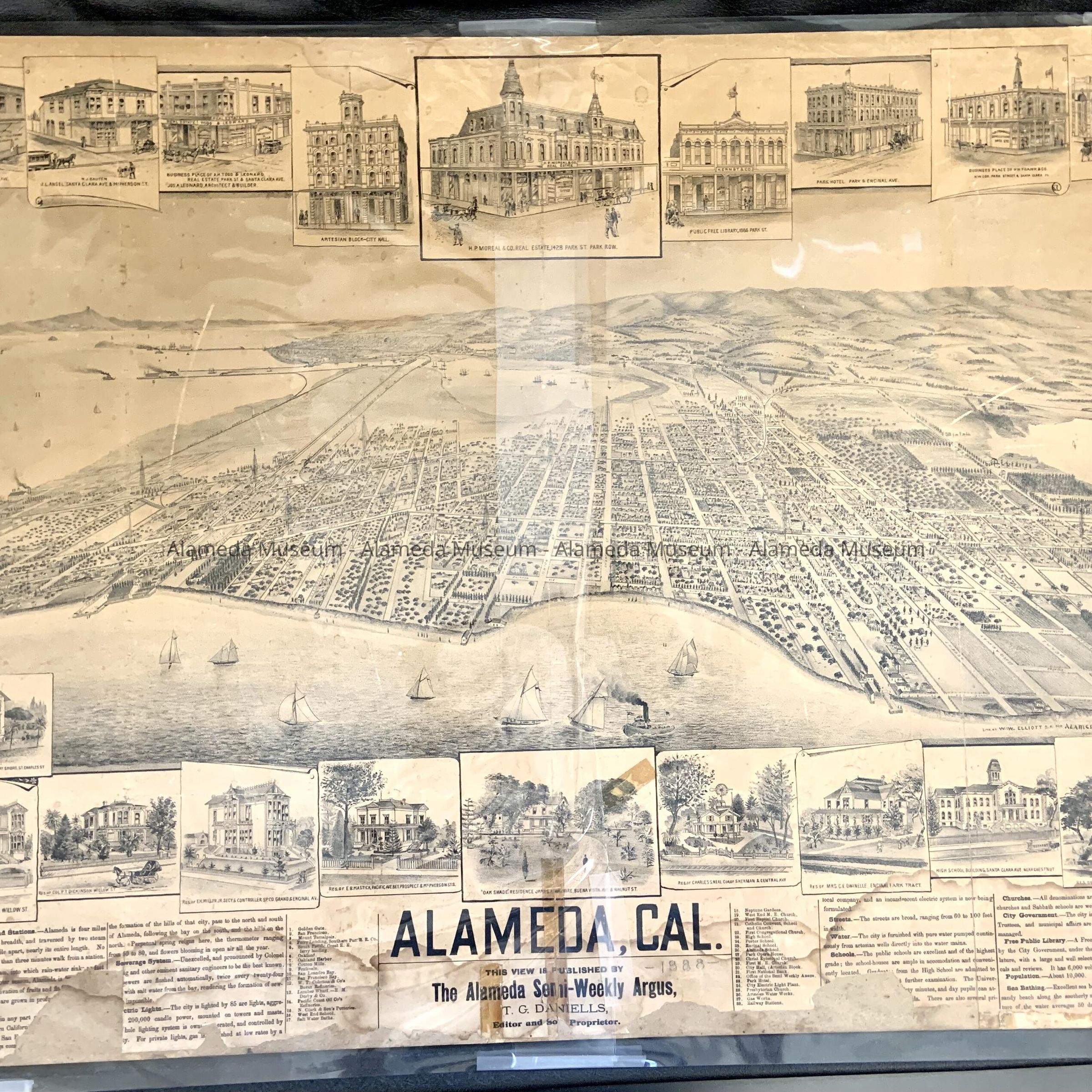
Bird's-eye view map of Alameda, c. 1887Entry/Object ID
2007.14.1Description
Acc. No. 07.14.1
Subject Category: Map
Date or Period: circa 1887
Object: Map
Description: Illustrated map with bold printed caption, "Alameda, Cal". Printed on newsprint and mounted to cardboard. Map segments are missing and water staining exists along the bottom margin, and cellophane tape was used on tears.
Size: L-23” x W-36 1/2”
History of Object: Birds-eye view map of Alameda published by the Alameda Semi-weekly Argus, T.D. Daniels, Editor and Proprietor. The map of the then peninsula of Alameda joined to Oakland has two bridges at Webster St., and shows the route of the two railroads and the location of the arc-light towers. The map is numbered and has a corresponding inventory with references to various sites in the city including churches, schools, industries, etc. Bordering the map are some 31 important structures of the time.
This map was part of the original Alameda Museum collection prior to 1971 but was never cataloged.
Acquired from: Unknown
Date: 03/03/07