Name/Title
Folder and report re. Bay Farm Island sewer assessment, 1948-1957Entry/Object ID
2011.57.7Description
Accession No. 11.57.7 A, B
Subject Category: City of Alameda
Date or Period: 1948-1957
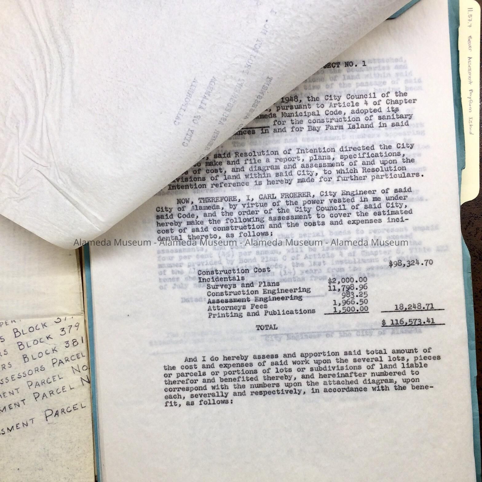
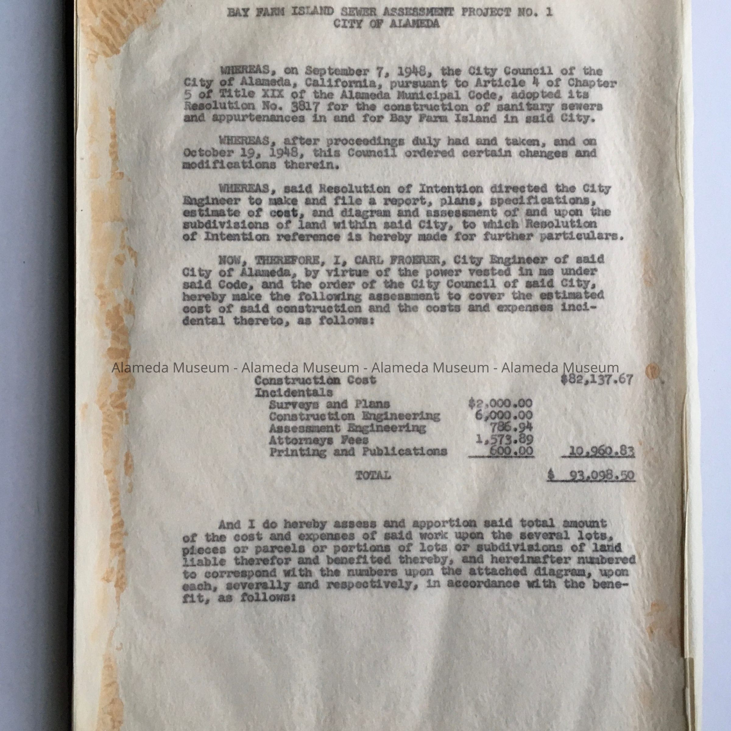
Object: Folder, file (A); Report
Description:
A: Acid free legal size manila file folder with documents.
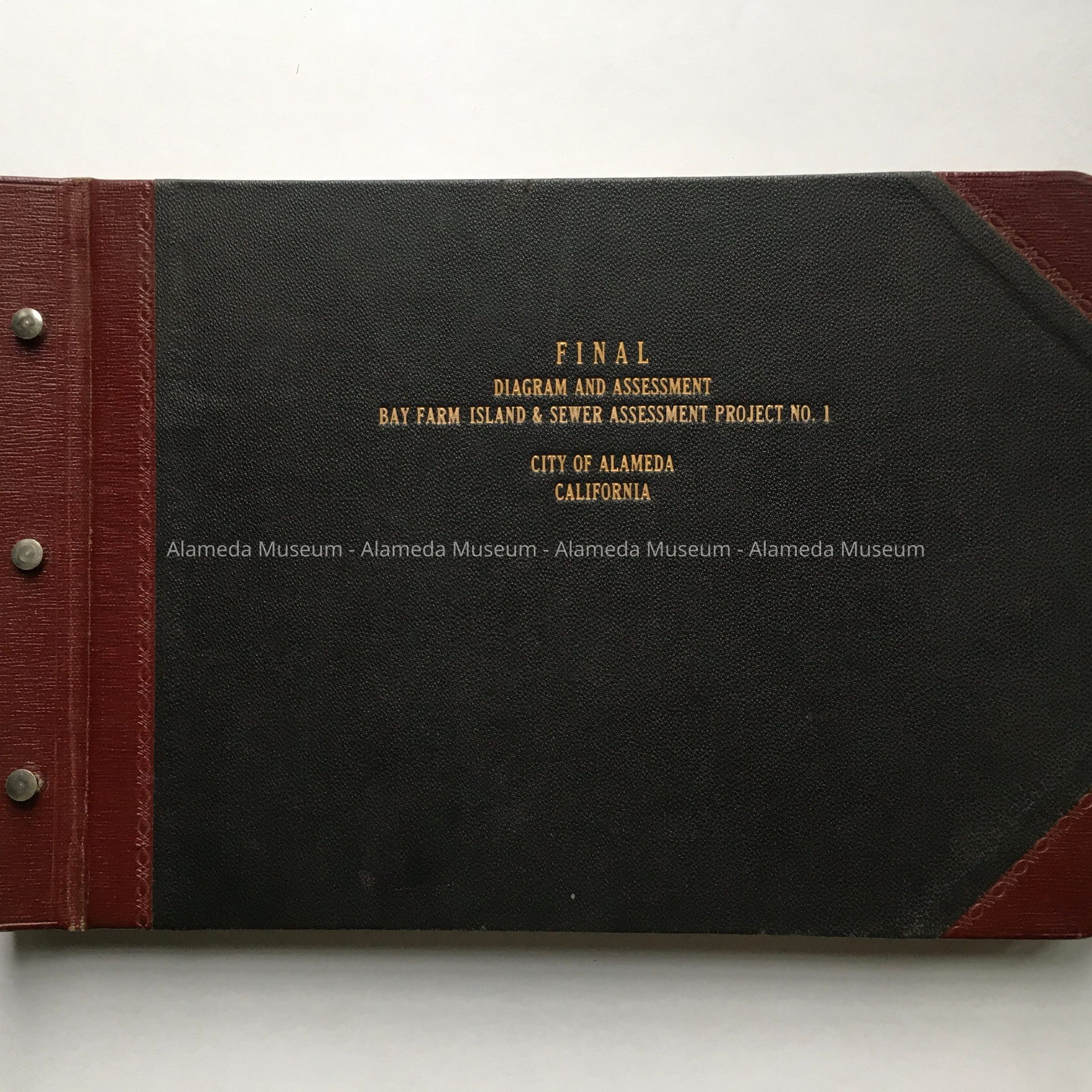
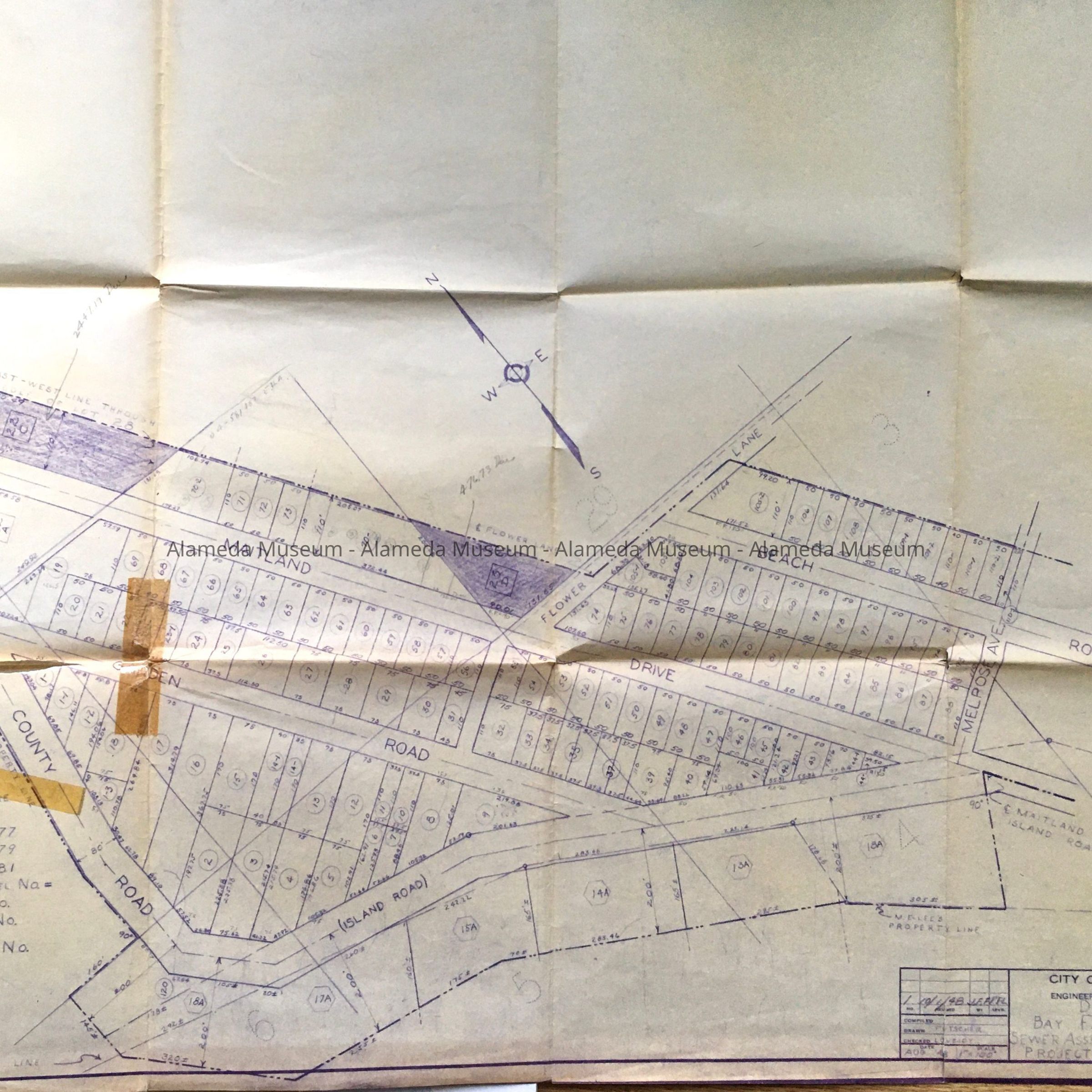
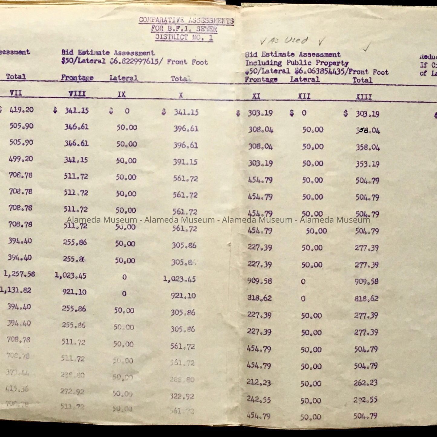
B: loose-leaf report bound with 3 metal screws and pins, with black buckram trimmed along collating edge and opposite corners with red leather-look plastic, titled ‘Final / Diagram and Assessment / Bay Farm Island & Sewer Assessment Project No. 1’
Size: A: L 14 3/4" x W 9"; B: L 13 1/2” x W 9”
History of Object:
A: Documents found in City Hall attic during remodel in the 1990s, placed in a new folder after donation to the museum in 2011. Tab of original folder (now discarded) stated: Bay Farm Island - Assessment District sewers". Folder contains correspondence and reports on sewers for Bay Farm Island. Includes assessments and plot map (including a map featuring street labelled ‘St. Charles Street’).
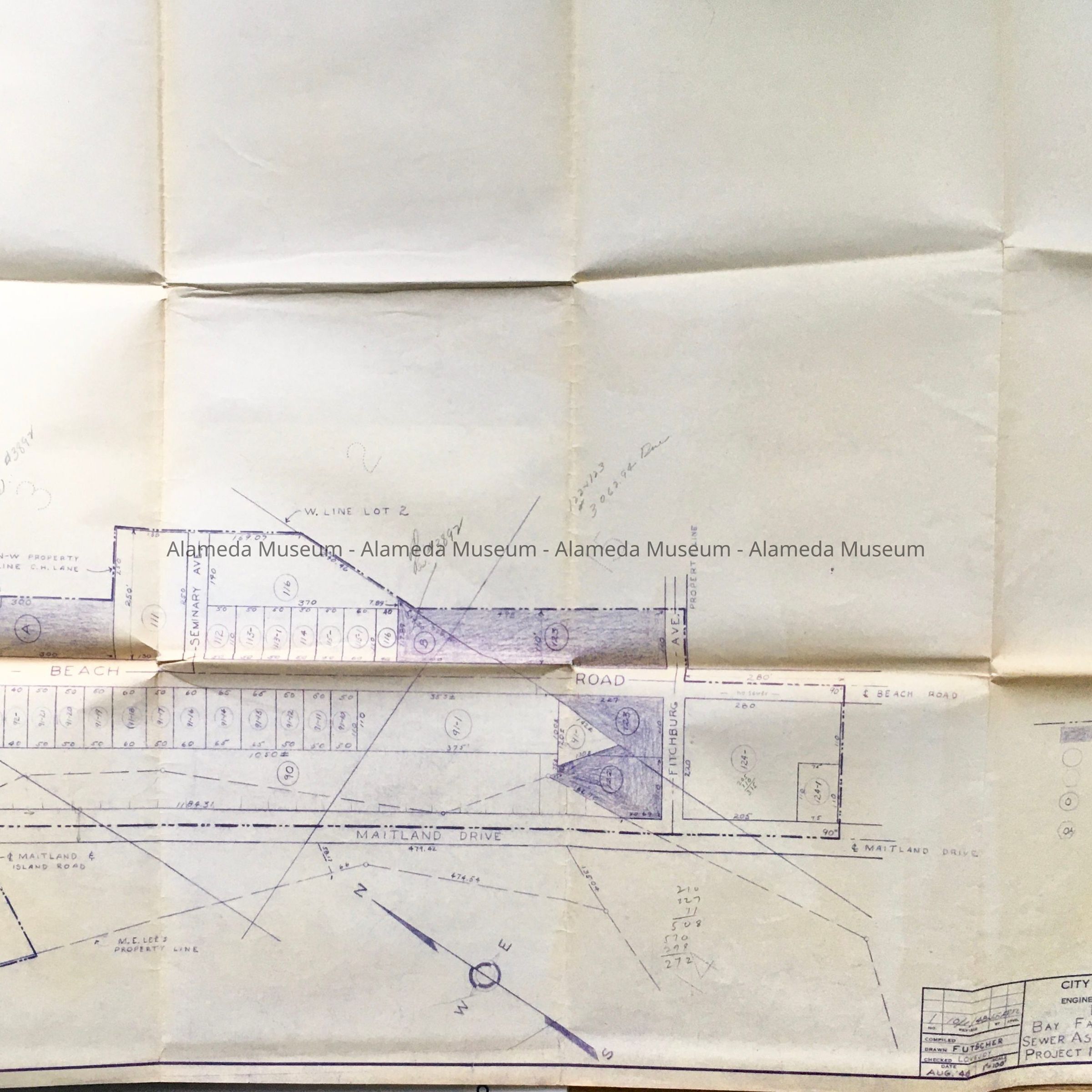
B: report about same, including attached maps of the area, (Maitland Drive, Garden Road, County / Island Road, Beach Road; Melrose Ave; Maitland Dirve, Island Road, Melrose Ave, Seminary Ave, Fitchburg Ave). Also included is a stapled mimeographed list of owners and expected taxes to pay for the sewer.
Acquired from: City of Alameda
Date Cataloged: October 1, 2011