Name/Title
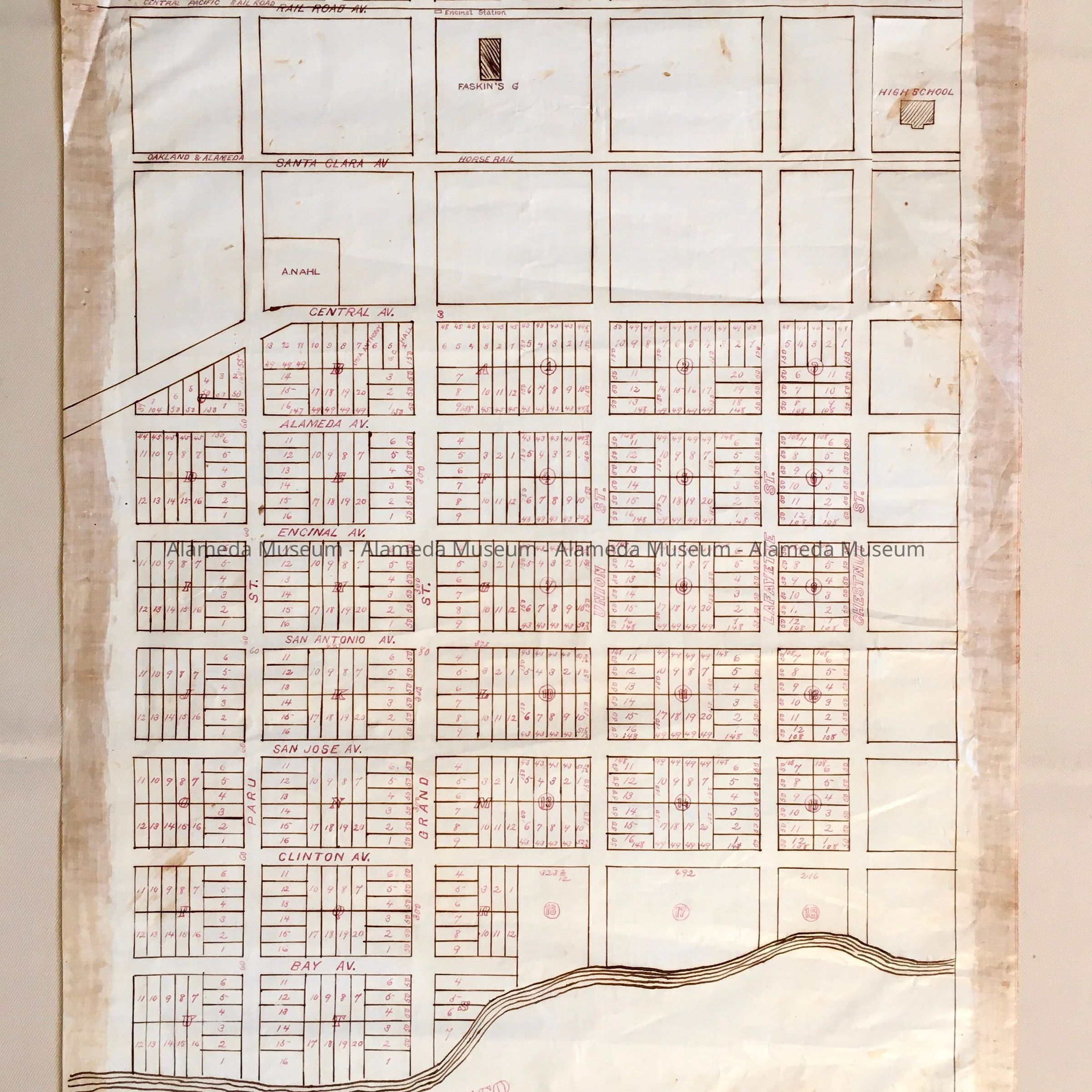
Subdivision map of the area between Paru / Chestnut/Bay/ Central, c. 1880s.Entry/Object ID
2002.80.23Description
Acc. No. 02.80.23
Subject Category: Maps
Date/Period: circa 1880's
Object: Maps, Subdivision
Description:
Hand-drawn map in sepia-colored ink on linen paper, with lot numbers and sizes added in red, with arced outline for High School (later Haight) and Faskin's G (Garden), and Encinal Station and a line for property owned by A. Nahl. Labeled 'C6' in pencil at the bottom right. A line indicates the Oakland & Alameda Horse Rail road on Santa Clara, and another line indicates the Central Pacific Rail Road on Railroad (Lincoln) Ave.
Size: L 22 1/2 x 15 1/2 inches.
History:
Subdivision map of area bounded by Central Av and the Bay, a street (now not existing) to the northwest of Paru and Chestnut.
Some blocks appear to have both a letter and a number some only a letter or number. Other streets are Lafayette, Union, Grand streets, and Bay, Clinton, San Jose, San Antonio, Encinal, and Alameda Avenues.
This collection of maps, etc., found in the attic of City Hall prior to the rehabilitation and seismic upgrades in the late 1990's.
Acquired From: City of Alameda
Date: 7/28/02