Name/Title
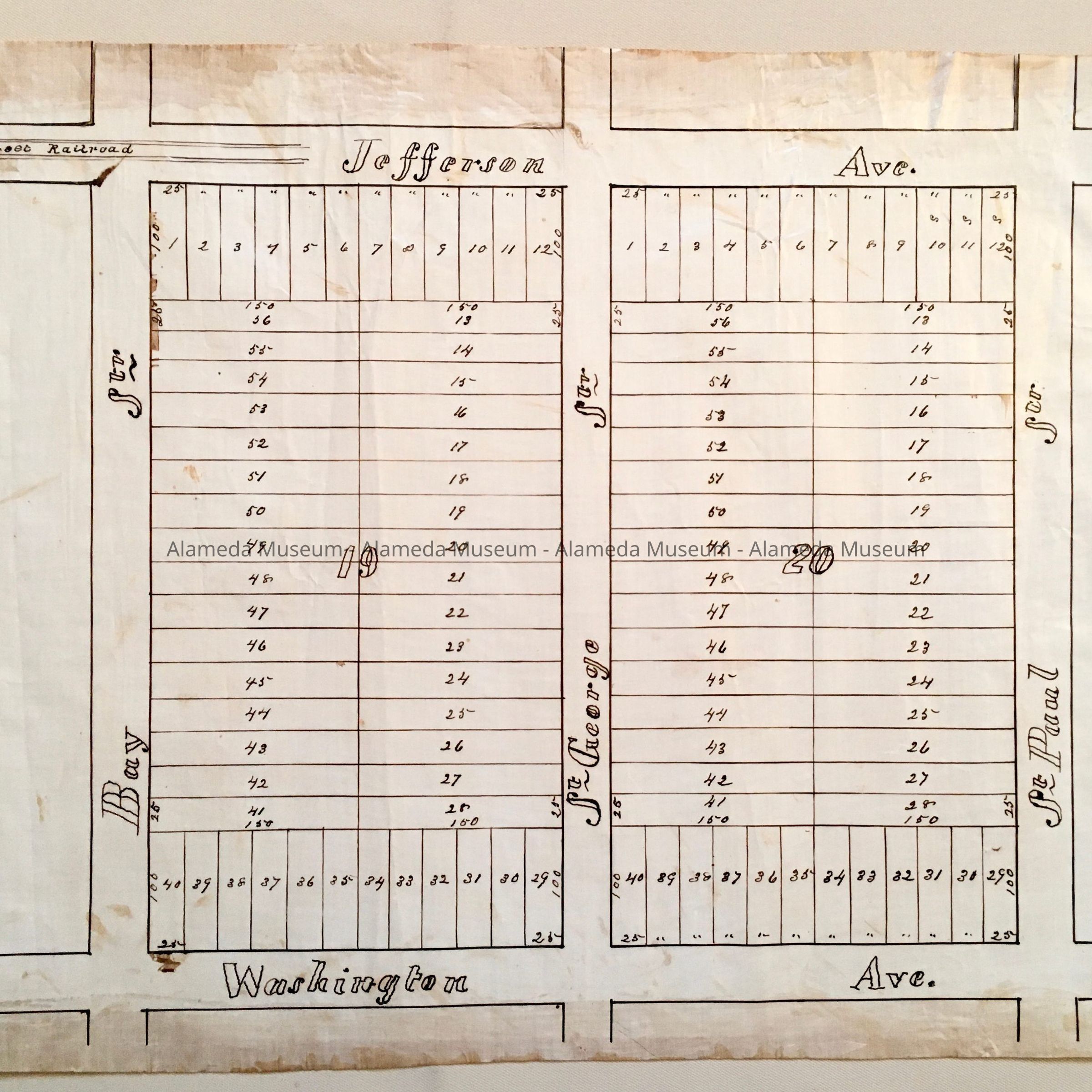
Subdivision Map Block 19 and 20, Jefferson/Washington/St. Paul/Bay, c. 1870sEntry/Object ID
2002.80.21Description
Acc. No. 02.80.21
Subject Category: Maps
Date/Period: circa 1870's
Object: Maps, Subdivision
Description:
Hand-drawn map in black-colored ink on linen paper. With handwritten annotation 'B6' in pencil.
Size: L16 x W22 inches.
History:
Subdivision map showing Block 19 and 20, bounded by Bay and St. Paul Streets (now Benton), Jefferson and Washington Avenues, with St. George (now Sherman) Street between. Also shows two lines with 'Street Railroad' in the top left corner (on Jefferson Ave), representing a horse railroad. Jefferson Ave is now part of Santa Clara.
This collection of maps, etc., found in the attic of City Hall prior to the rehabilitation and seismic upgrades in the late 1990's.
Acquired From: City of Alameda
Date: 7/28/02