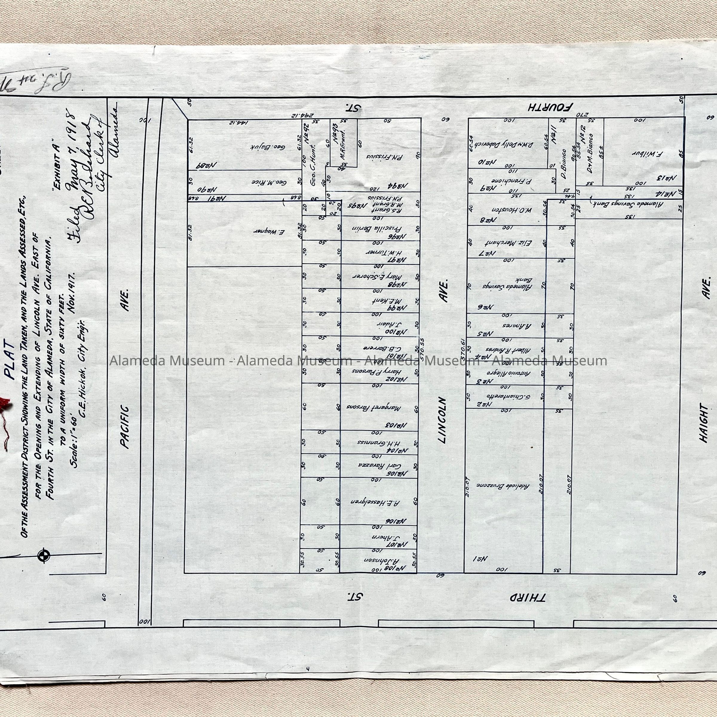
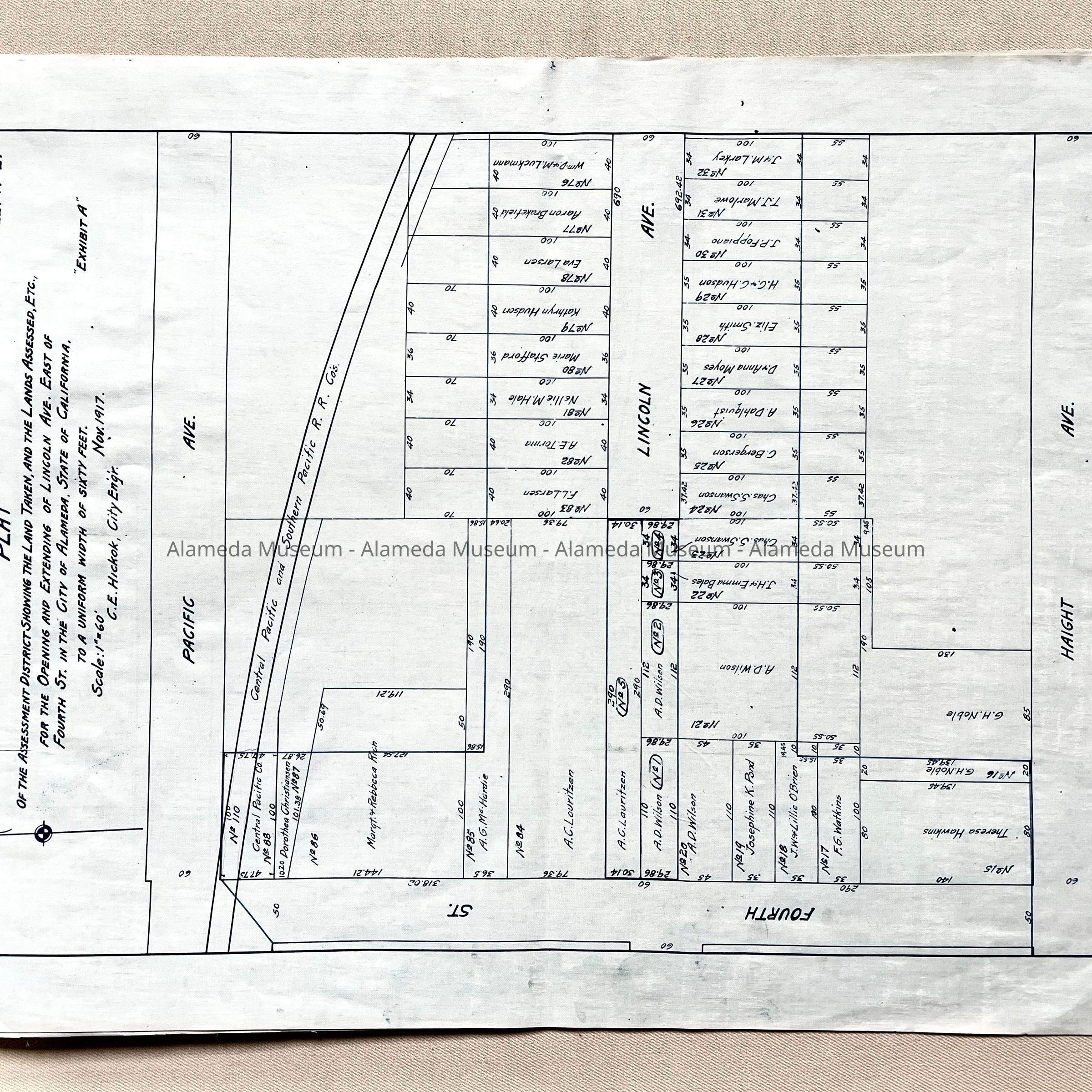
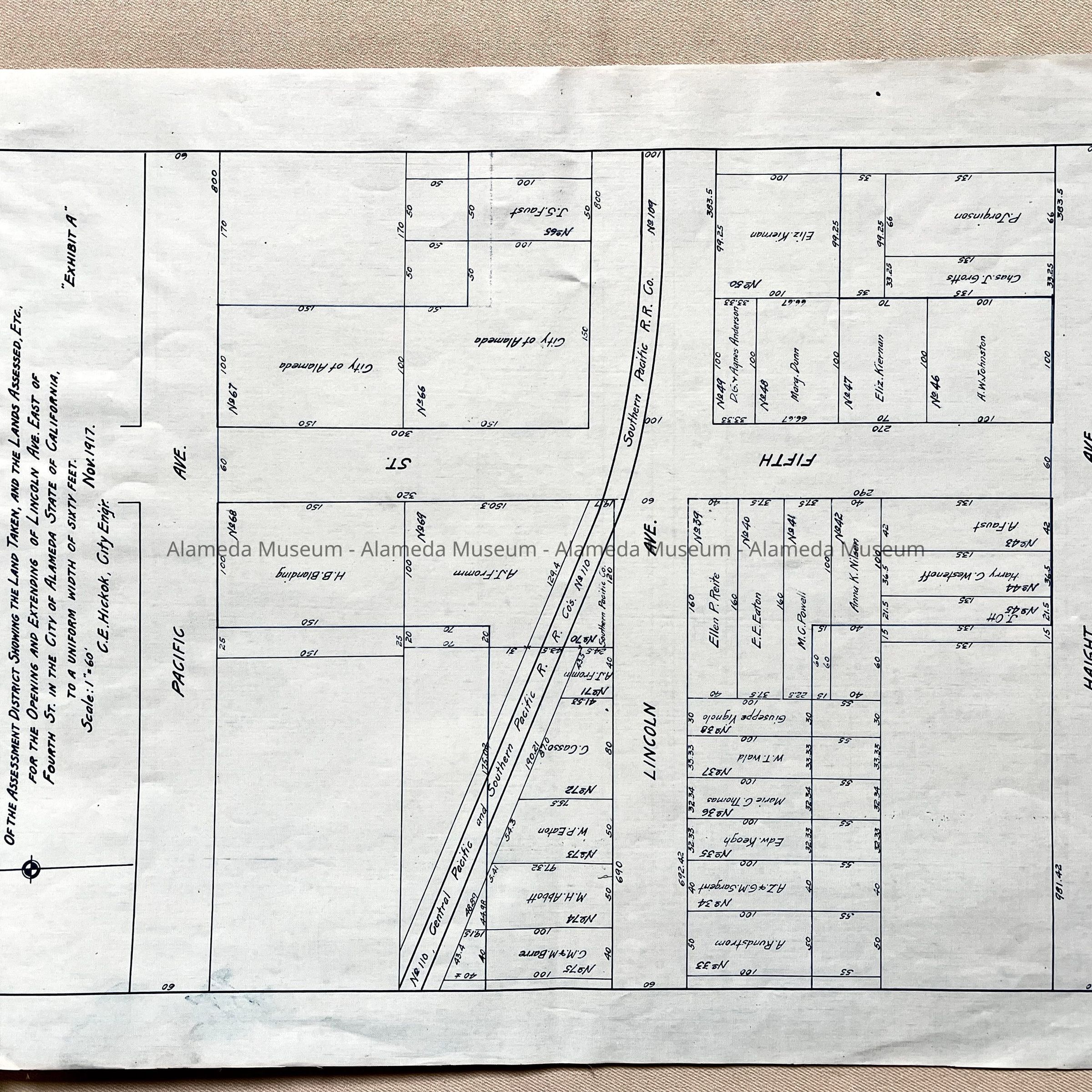
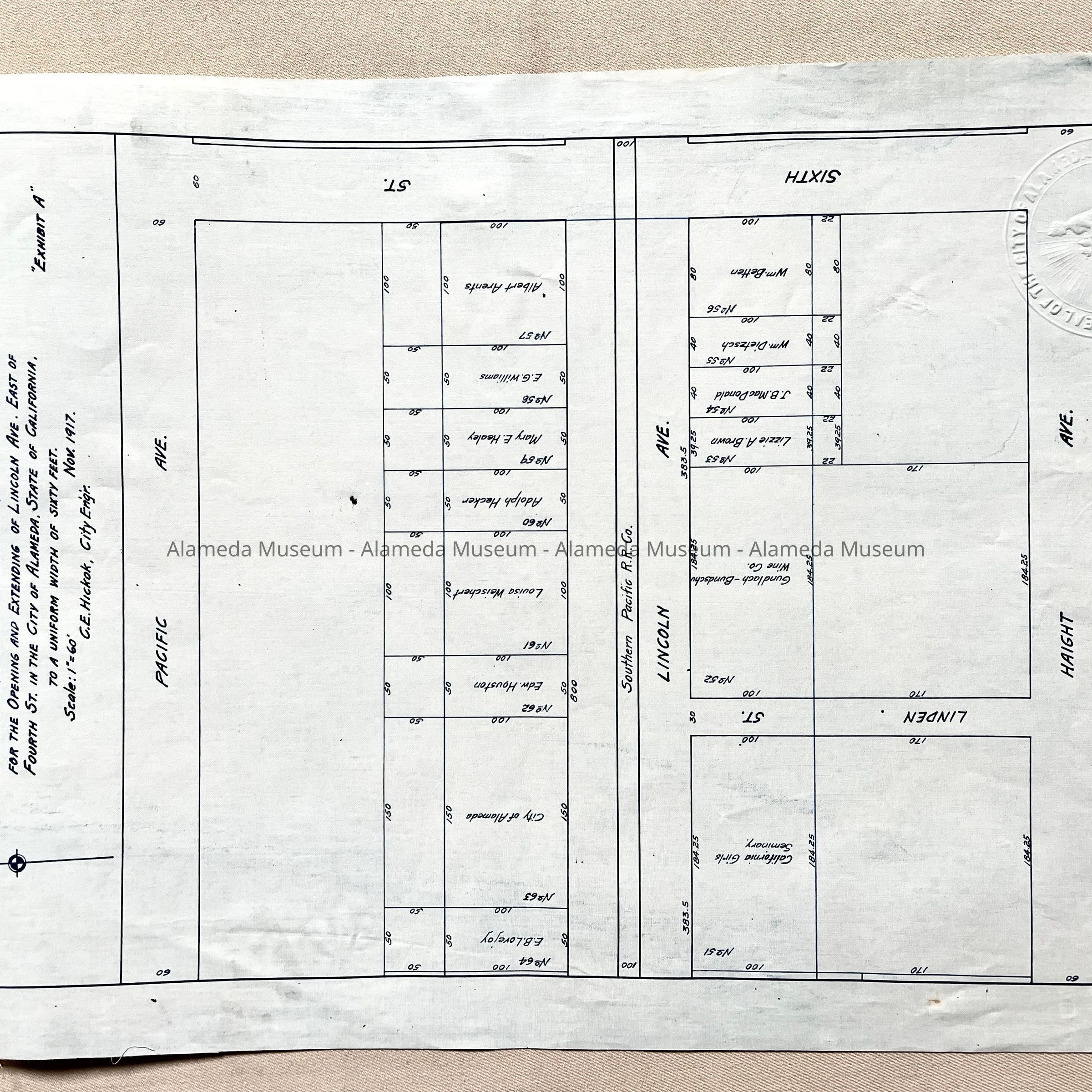
Name/Title
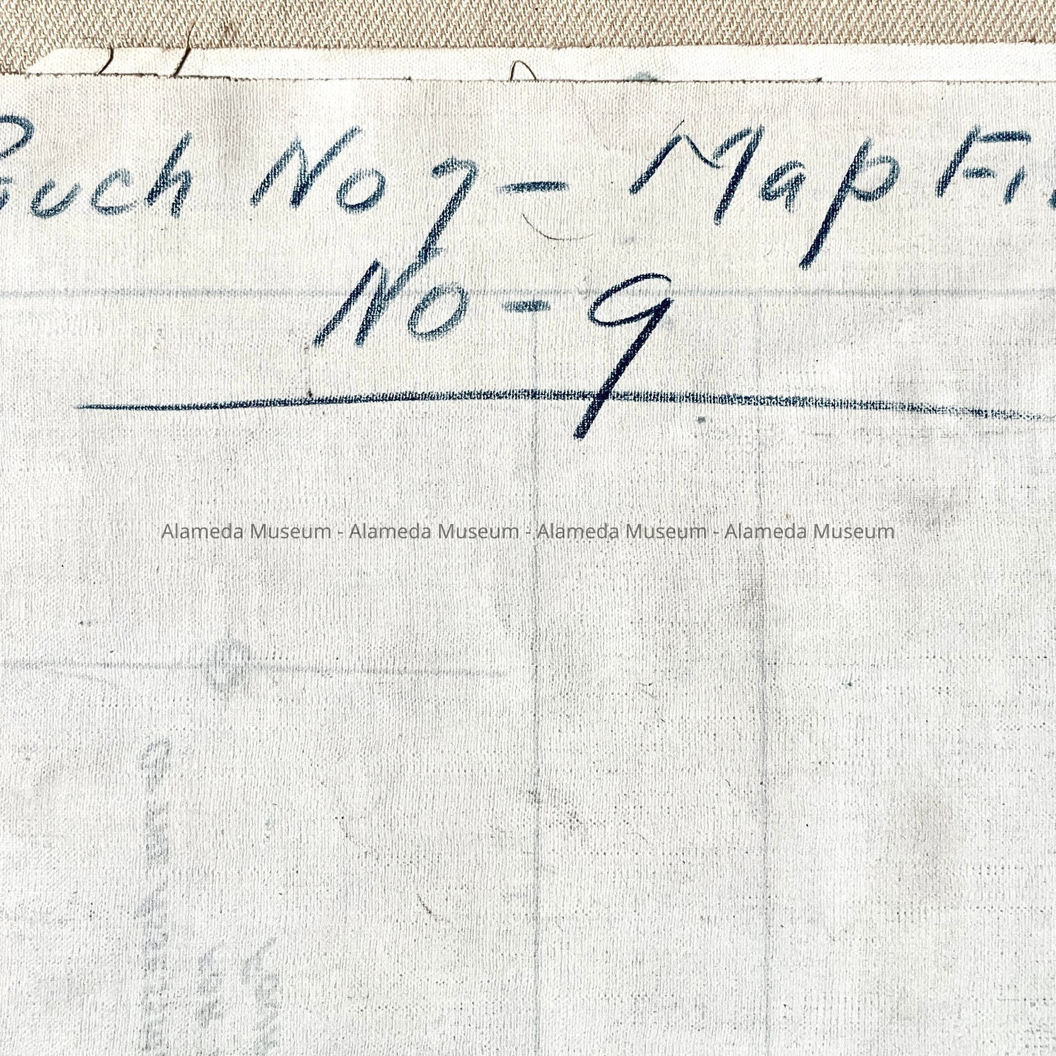
Plat maps for opening and extending Lincoln Ave east of Fourth Street, 1918Entry/Object ID
2000.100.3Description
Acc. No. 00.100.3
Subject: Streets
Date: 1918
Object: Map
Description:
Series of four (4) plat maps printed in blue colored type on a paper with a high rag content. The maps are secured by red colored cotton string.
Size: L 18 W 13 inches
History: Plat maps depicting land taken and lands assessed, etc. for the opening and extending of Lincoln Avenue east of Fourth Street. Filed May 7, 1918. The plat map gives individual owners names and lot size, etc. in the assessed area.
Donor: City of Alameda
Date: April 29, 2000