Name/Title
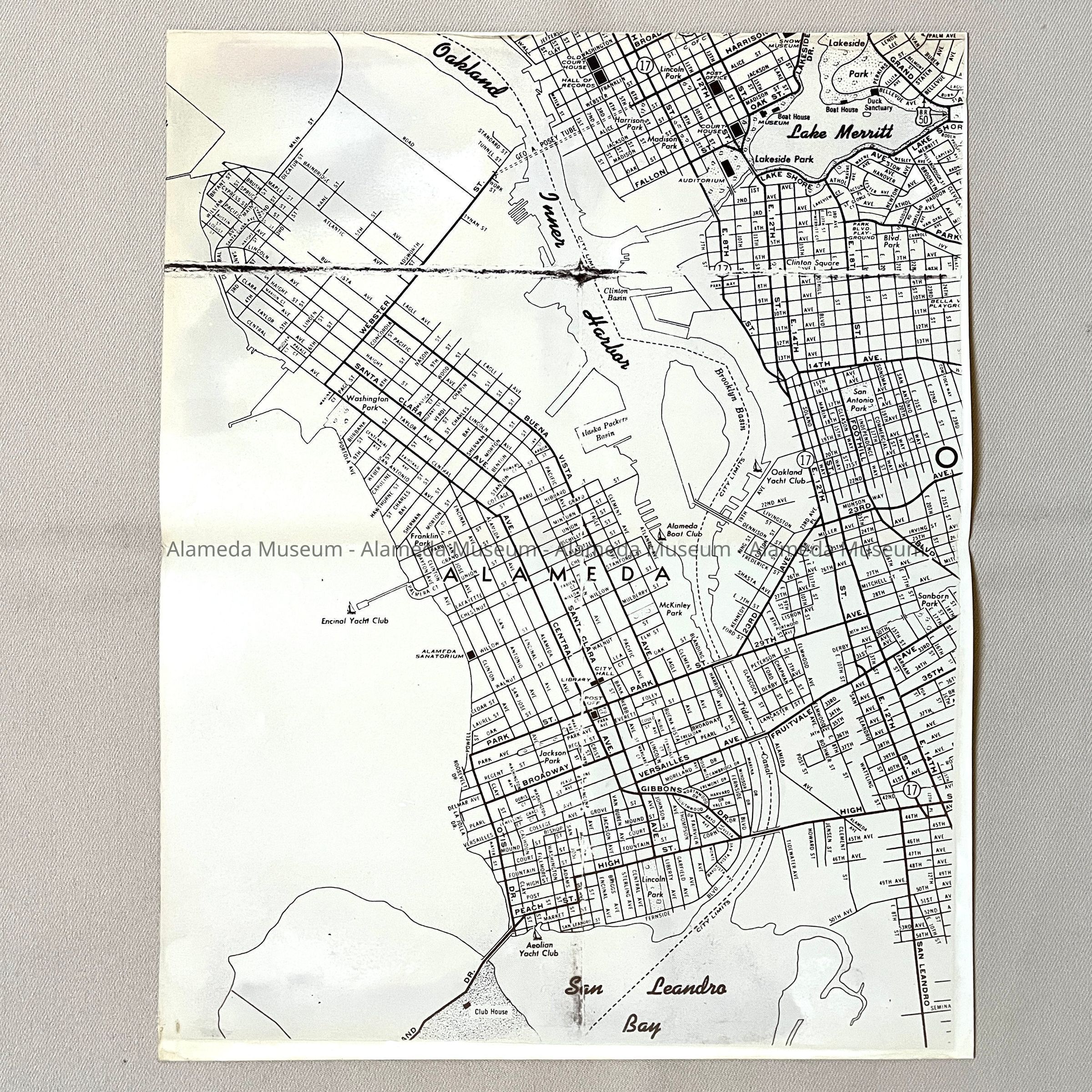
Photocopy of folding map, c. 1939Entry/Object ID
2023.35.1Description
Acc. No. 23.35.1
Subject Category: streets
Date or Period: circa 1939
Object: Map, Photocopy
Description: a glossy off-white photocopy of a monochromatic map of Alameda and parts of Oakland. The original has a large tear, and lines where the image is faded. The waterways (Lake Merritt, Oakland Inner Harbor, San Leandro Bay) are labeled in a distinctive cursive font. Marked are also yachting clubs, landmarks like Parks, City Hall, the Library, and the Alameda Sanatorium, and the Alaska Packers Basin.
Size: L 14 x W 11 inches
History of object: photocopy found, unlabeled, unmarked, without further information, among the maps. The original appears to be a folding map, worn and in one section, ripped at the folds. The possible title on the original has not been copied. Map shows the Posey Tube and Fernside, so after 1927, but also Harrison Avenue (closed by 1939), but no Neptune Beach (closed 1939), yet Alameda Sanatorium (renamed 1939), dating it to around 1939.
Acquired from: unknown
Catalog Date: 11/13/2023