Name/Title
CD with Sanborn Maps Alameda 1897 & Bay Farm Island 1924Entry/Object ID
2024.96.1Description
Acc. No. 24.96.1
Subject Category: Maps (digital)
Date or Period: 1897, 1924
Object: CD
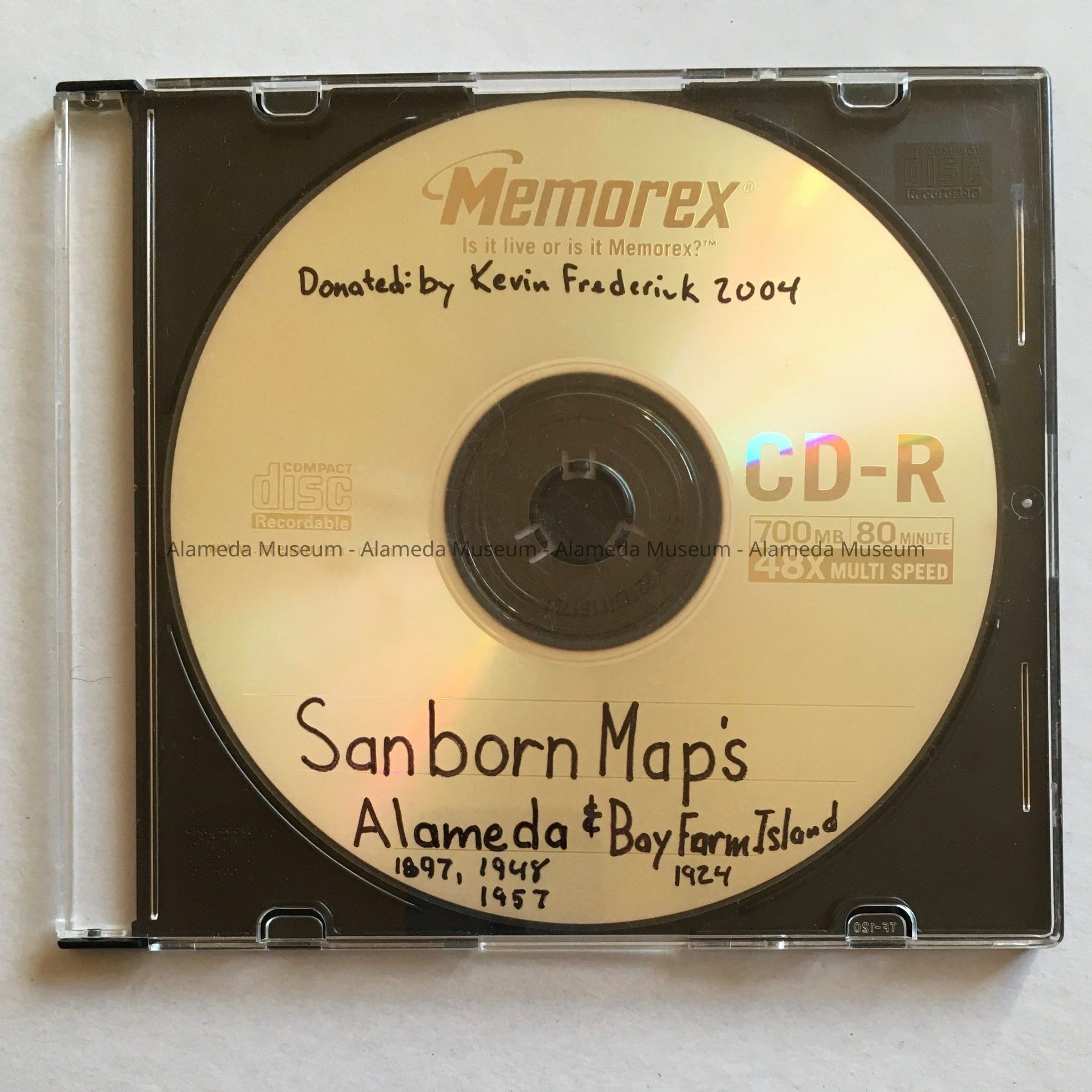
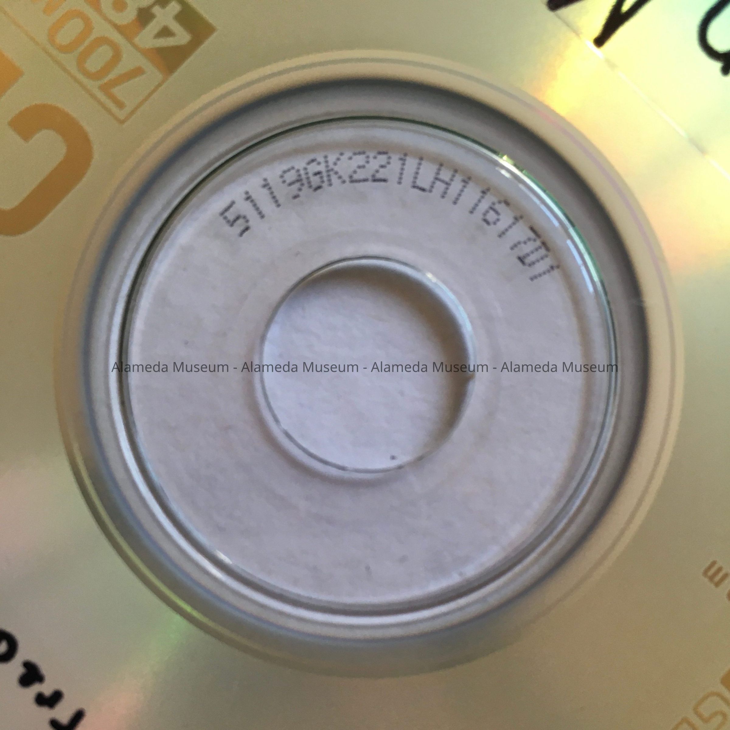
Description: Memorix CD-R, 700 MB, 80 minute, 48 x Multi Speed, no. 5119GK221LH11617D1, in protective black and transparent plastic container. Handwritten in black marker: 'Donated: by Kevin Frederick 2004' and 'Sanborn Map's Alameda 1897, 1948, 1957 & Bay Farm Island 1924'.
Size: (CD-disc:) diameter 4 3/4 inches (approx.)
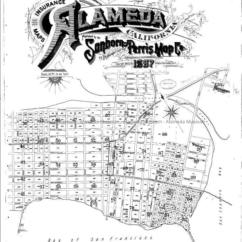
History of Object: CD containing scans in .pdf format of the Insurance Maps published by Sanborn Perris Map Co., for the City of Alameda for 1897 (p. 1-90 + index and key), and for Bay Farm Island of 1924 (p 1-2), donated by Kevin Frederick to George Gunn and the Alameda Museum to help in future research on June 5, 2004.
Note: It is not documented how or why Kevin acquired the scans, but there is no explicit permission from the copyright holder included.
It appears at this time the maps renewed in 1948 and 1957 are under copyright protection, thus, they are excluded from the collection. As time goes on, these maps will eventually become public domain (2043 for the 1948 maps).
Note: the Alameda Museum does not at this time own a publicly available CD-reader. Additionally requires software capable of opening .pdf files (currently Adobe).
Donated by: Kevin Frederick
Donation Date: June 5, 2004
Catalog Date: December 4, 2024