Name/Title
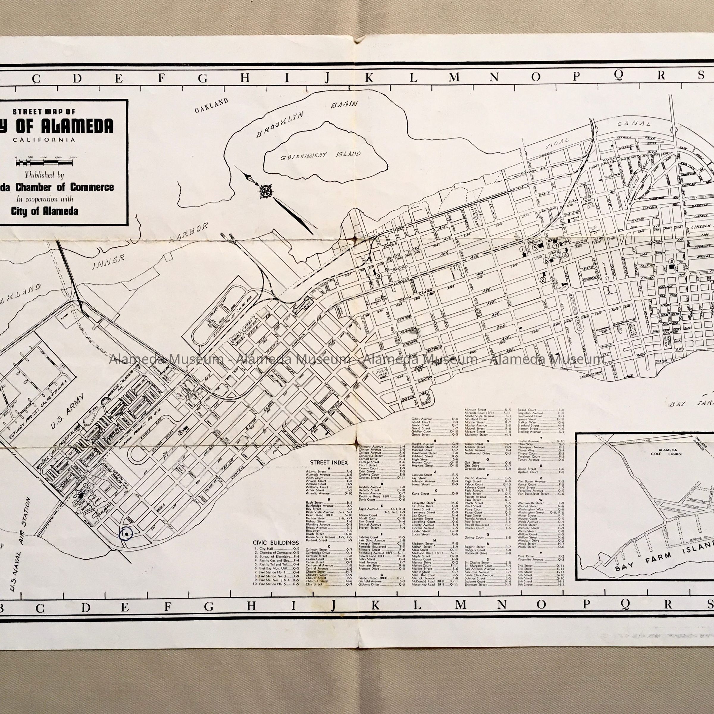
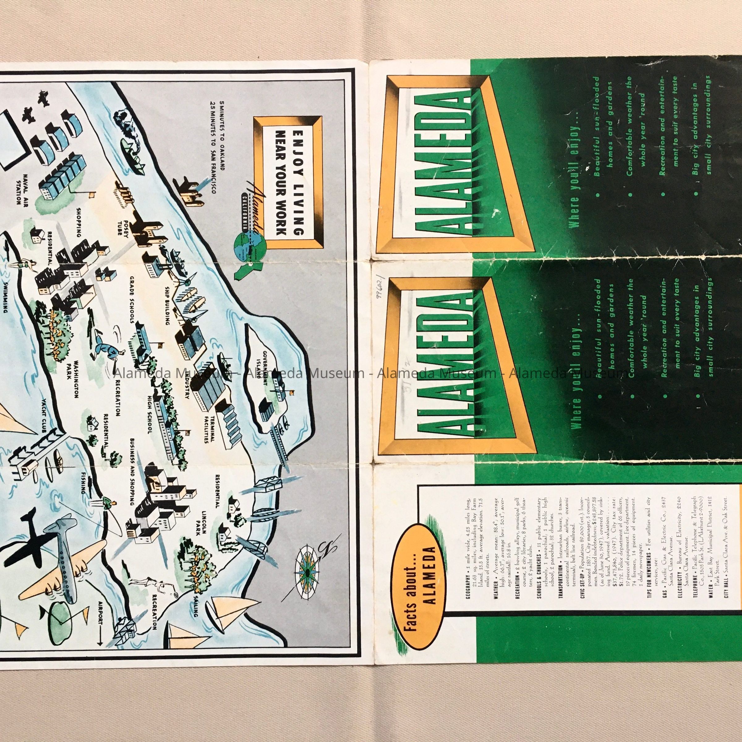
Folding street map of 'Alameda', issued by the Chamber of Commerce, c. 1950sEntry/Object ID
1999.602.1Description
Acc. No. 99.602.1
Category: Maps, Street; Chamber of Commerce
Date: circa 1950's
Object: Map
Description: Lithographic street map folds into three (3) sections. Cover has bold printed caption "Alameda" in green colored type.
Size: closed: L 9 W 4 inches; unfolded: L 18 x W 12 inches
History: Folding street map prior to South Shore construction. The map also includes a drawing of the Island with locations such as High Schools, Naval Air Station, etc. Map issued by the Alameda Chamber of Commerce.
Given prior to 1971 and never catalogued.
Donor: Unknown
Date: November 13, 1999