Name/Title
Map of Oak Park Tract, Paru / Grand / Bay (Dayton) / Central, 1876Entry/Object ID
2002.80.18Description
Acc. No. 02.80.18
Subject: Maps
Date or Period: 1876
Object: Maps, Subdivision
Description:
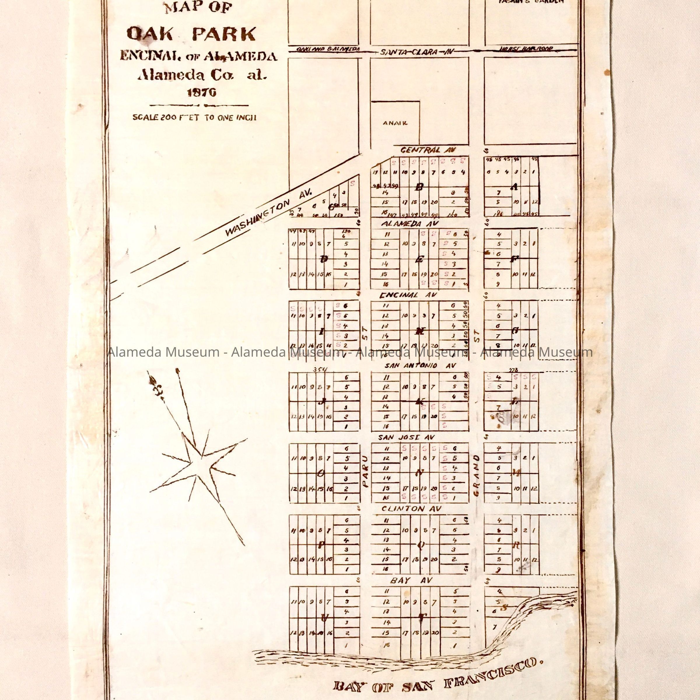
Hand-drawn map in sepia-colored ink on off-white colored polished linen paper with bold-printed caption, “Map of Oak Park, Encinal, of Alameda”.
Size: L21-1/2 x W13-1/2 inches.
History:
Map of Oak Park Tract located in an area bounded by Paru and Grand Streets, Bay Avenue (Dayton Avenue) and Central Avenues. Map also shows the site of Fasskings Gardens at Encinal Station, Grand Street. Map appears to be a prototype for ultimate printing. This collection of maps, etc., found in the attic of City Hall prior to the rehabilitation and seismic upgrades in the late 1990's.
Acquired From: City of Alameda
Date: 7/28/02