Name/Title
Blueprint index map of assessment lighting district, c 1924?Entry/Object ID
2023.33.3Description
Acc. No. 23.33.3
Subject Category: Maps, Alameda
Date or Period: c. 1924?
Object: Map
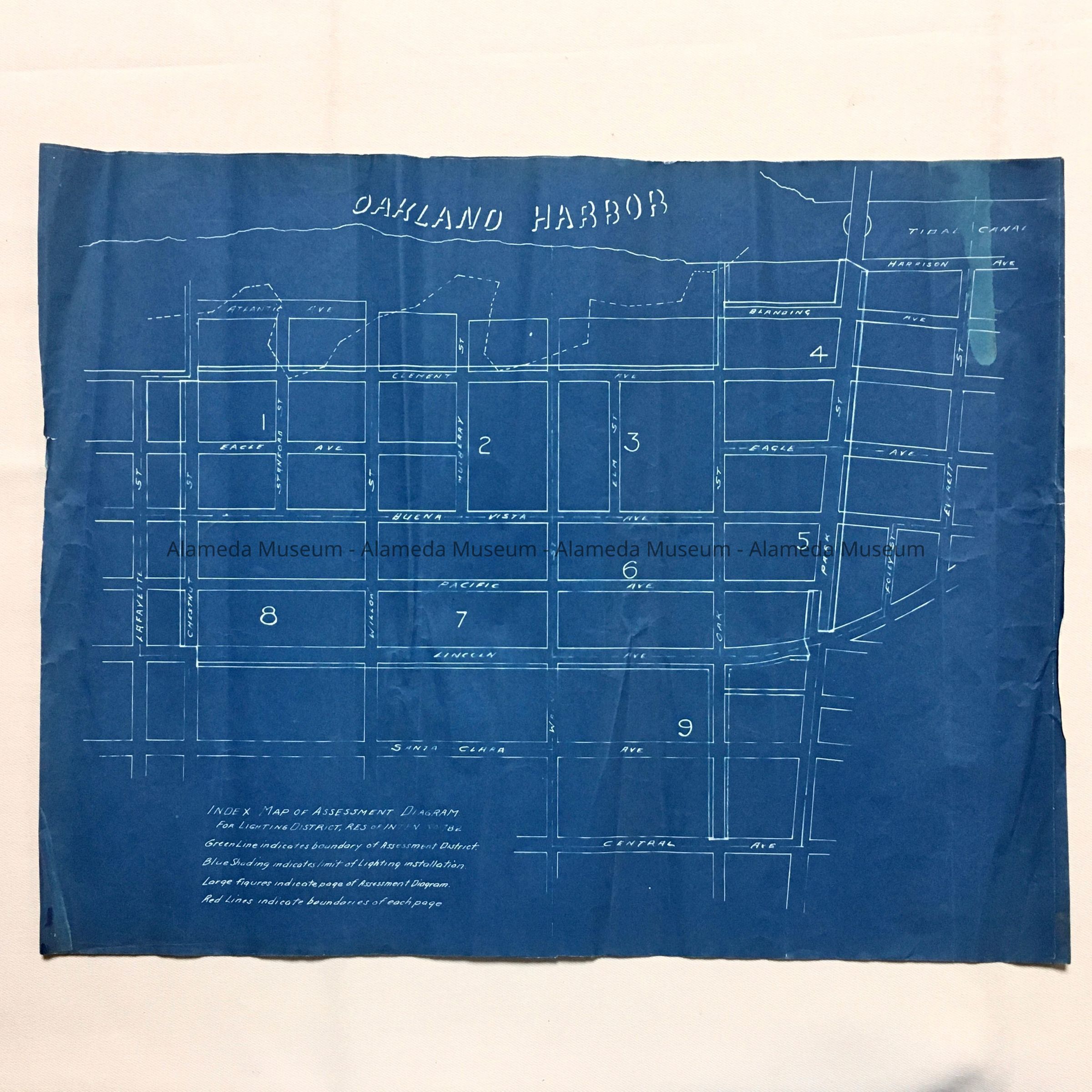
Description: Blueprint map titled 'Index Map of Assessment Diagram for lighting District, Res. of Intent No. 782. Prominent at the top is labeled 'Oakland Harbor'.
Size: L 14 x W 18 inches
History of Object: Index map for the establishment of a lighting district in the area between the Oakland Harbor and Tidal Canal (now commonly called 'the Estuary') or Harrison, and Central, Santa Clara, and Lincoln Avenues, and Lafayette and Everett Streets. Further text on the map refers to colored additions which are not visible on the map; this map may have been the basis of other maps. The numbers indicate pages of an Assessment Diagram, not present. City Council Resolution 782 was from 1924 - unclear if this is the same, but the timing would be reasonable.
Acquired from: unknown (City of Alameda?)
Catalog Date: 11/11/2023