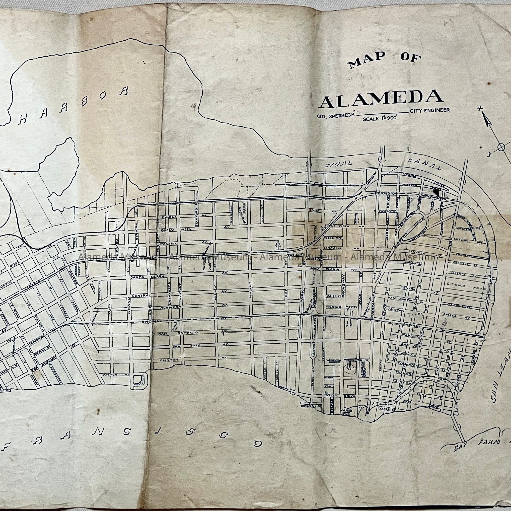
Name/Title
Blueline / Whiteprint map of Alameda, c. 1930sEntry/Object ID
2023.33.1Description
Acc. No. 23.33.1
Subject Category: Maps, Alameda
Date or Period: 1930s
Object: Map
Description:
Blueline / whiteprint (blue on white background) style Map of Alameda, Scale 1:900, on sturdy paper. Showing streets and 3 bridges and one tunnel tube crossing the estuary. Map has discolorations and brown spots.
Size: L 17 x W 33 inches
History of Object: Map of Alameda drawn by City Engineer Geo Sperbeck. There are no Naval Air Station buildings, so this map dates from before 1939, but with the tunnel, so after 1927. Purpose of map is unknown, but train route and stations are apparently added by hand. Also, Doris Court has been circled in pencil.
Acquired from: unknown (City of Alameda?)
Catalog Date: 11/11/2023