Name/Title
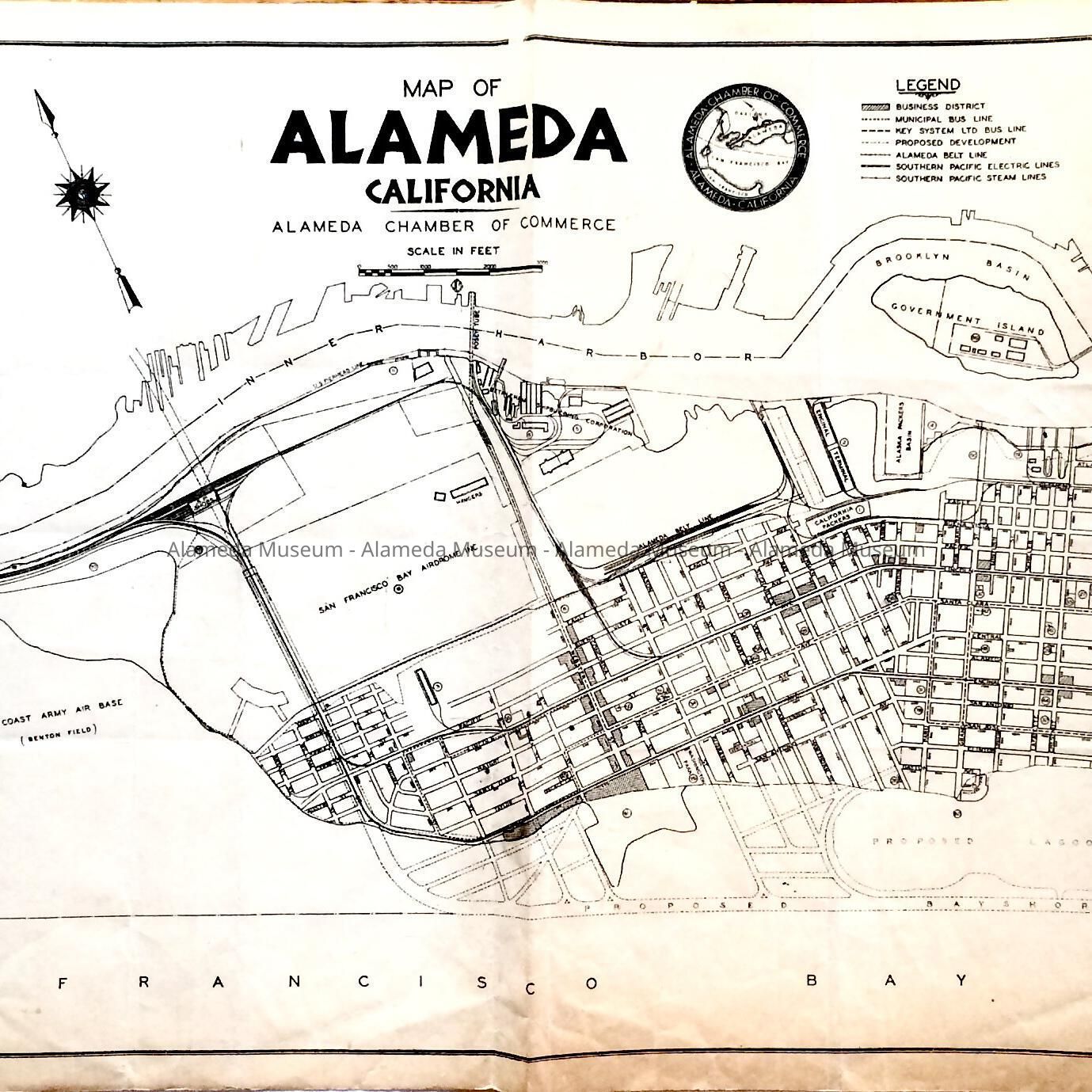
Map of Alameda with proposed shoreline development, c. 1935Entry/Object ID
2021.34.44Description
Acc. No. 21.34.44
Subject Category: Chamber of Commerce, failed developments
Date or Period: c. 1935
Object: map
Description: Map of Alameda, printed one-sided, and folded in four, featuring a proposed lagoon, proposed Bay Shore Highway, Alameda Mole, Alameda Airport, Inc., West Coast Army Air Base (Benton Field), and San Francisco Bay Airdrome, Belt Line yard, and California Packers building. On the bottom right is written: 'Mark Pryor' in pencil.
Size: L-10 3/4 x W-24 1/2 inches.
History of Object: Map issued by the Chamber of Commerce, with proposed Bay shore fill and development. Based on the presence of the features listed in the Description, dating from around 1935. The Alaska Packers building - now 'Del Monte' building - is listed as California Packers. The map appears to have been owned previously by Mark Pryor who may have been the donor.
Acquired from: unknown
Catalog Date: November 8, 2021