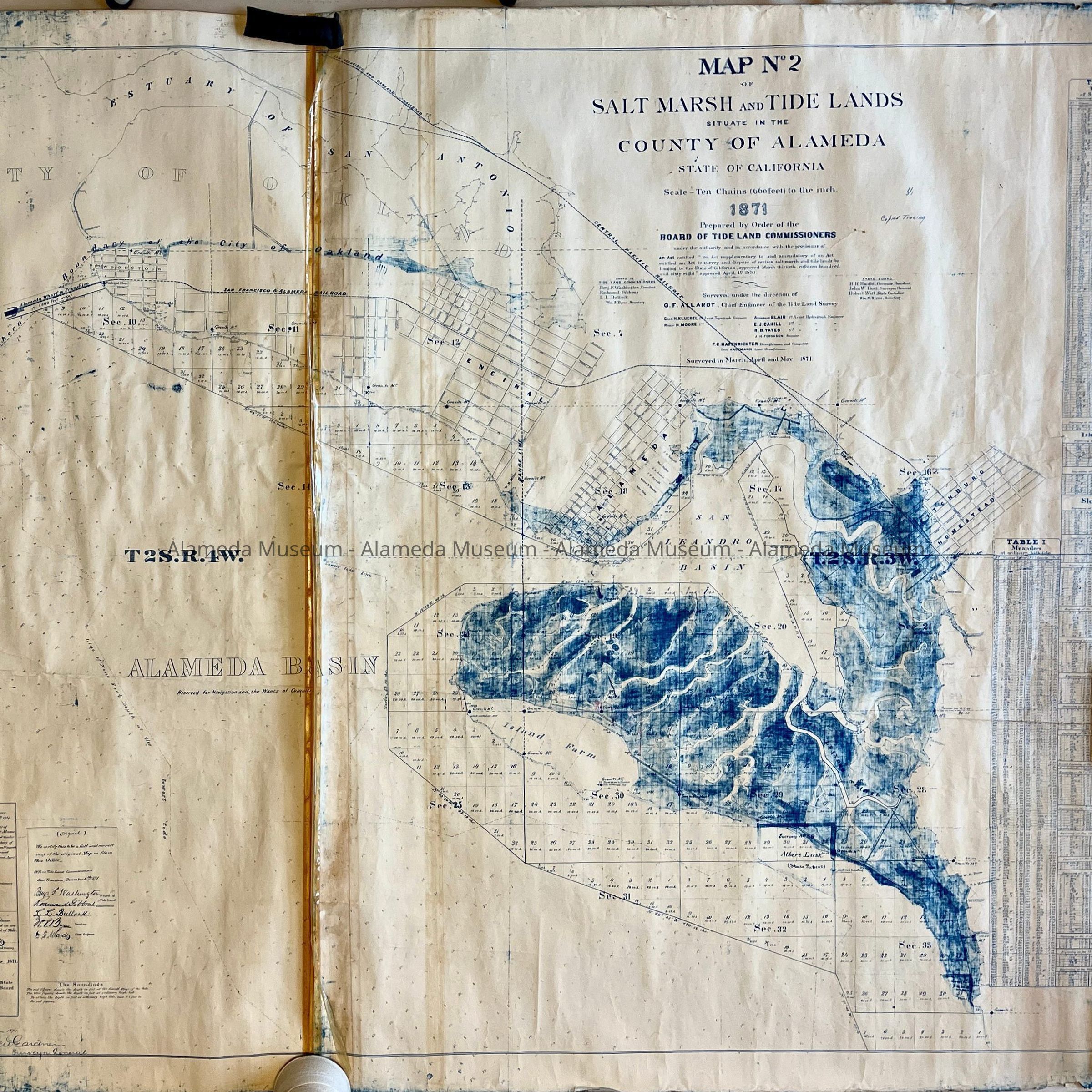
Name/Title
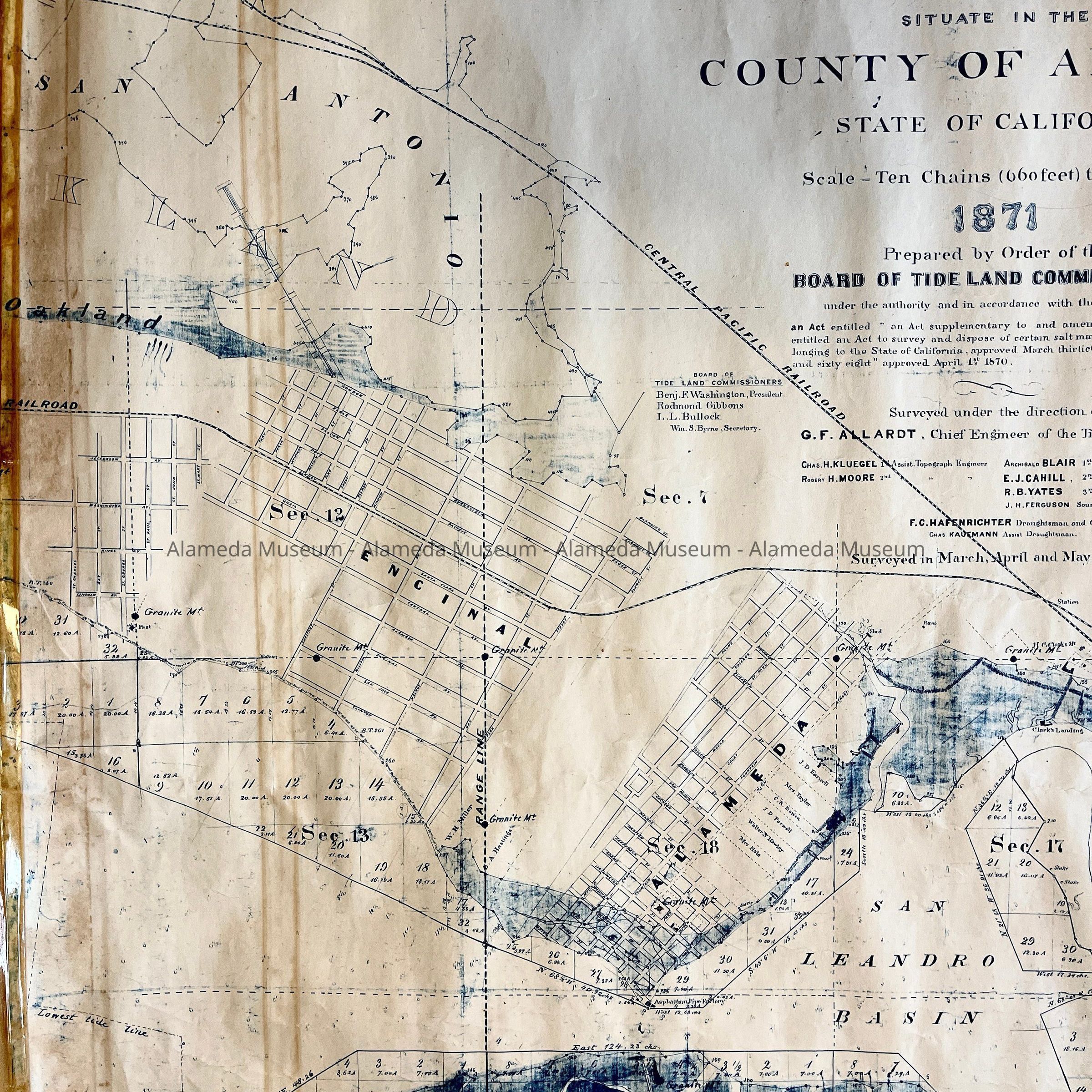
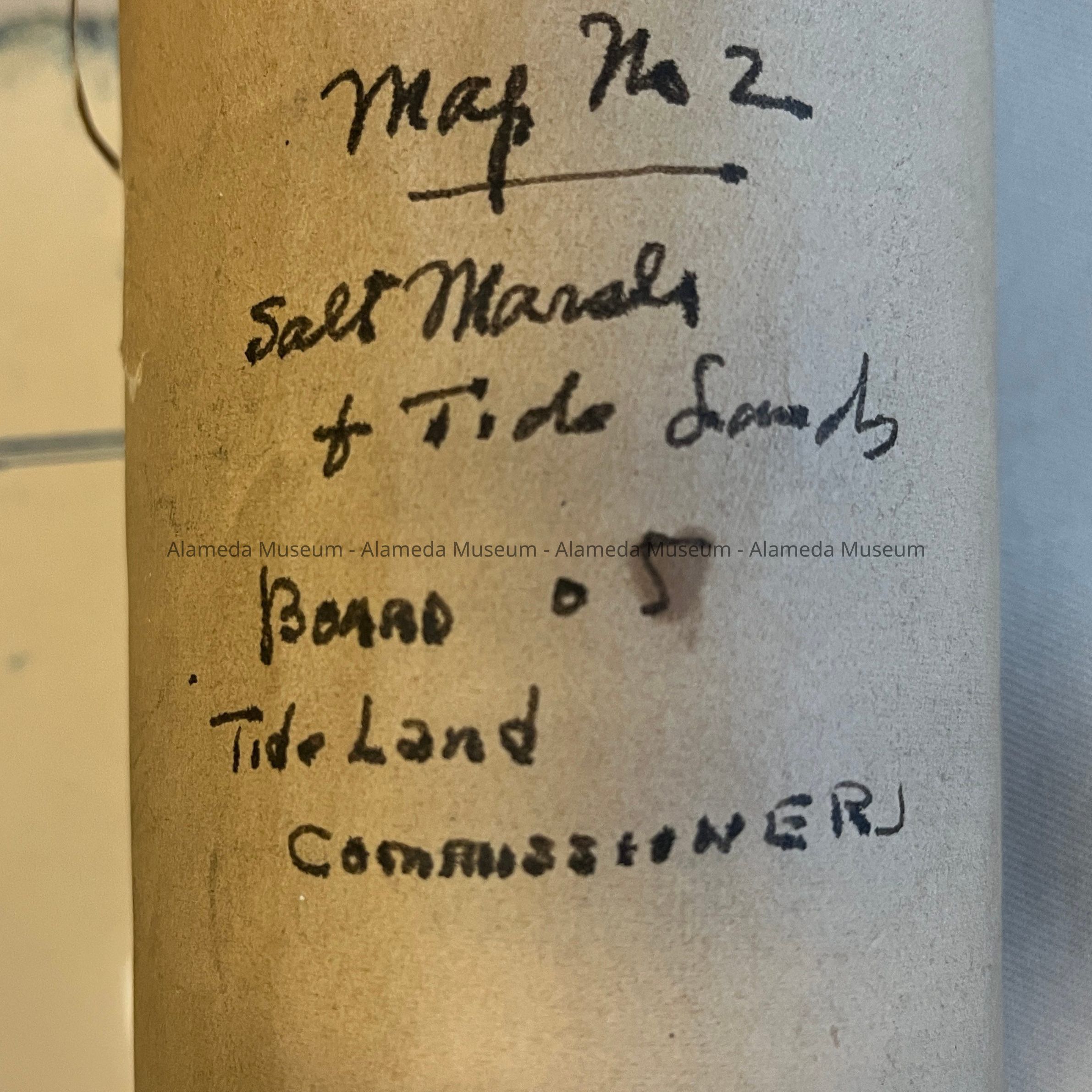
Map No. 2 of the Tidelands, 1871Entry/Object ID
2023.46.2Description
Acc. No. 23.46.2
Subject Category: City of Alameda; Townships
Date or Period: 1871
Object: Map
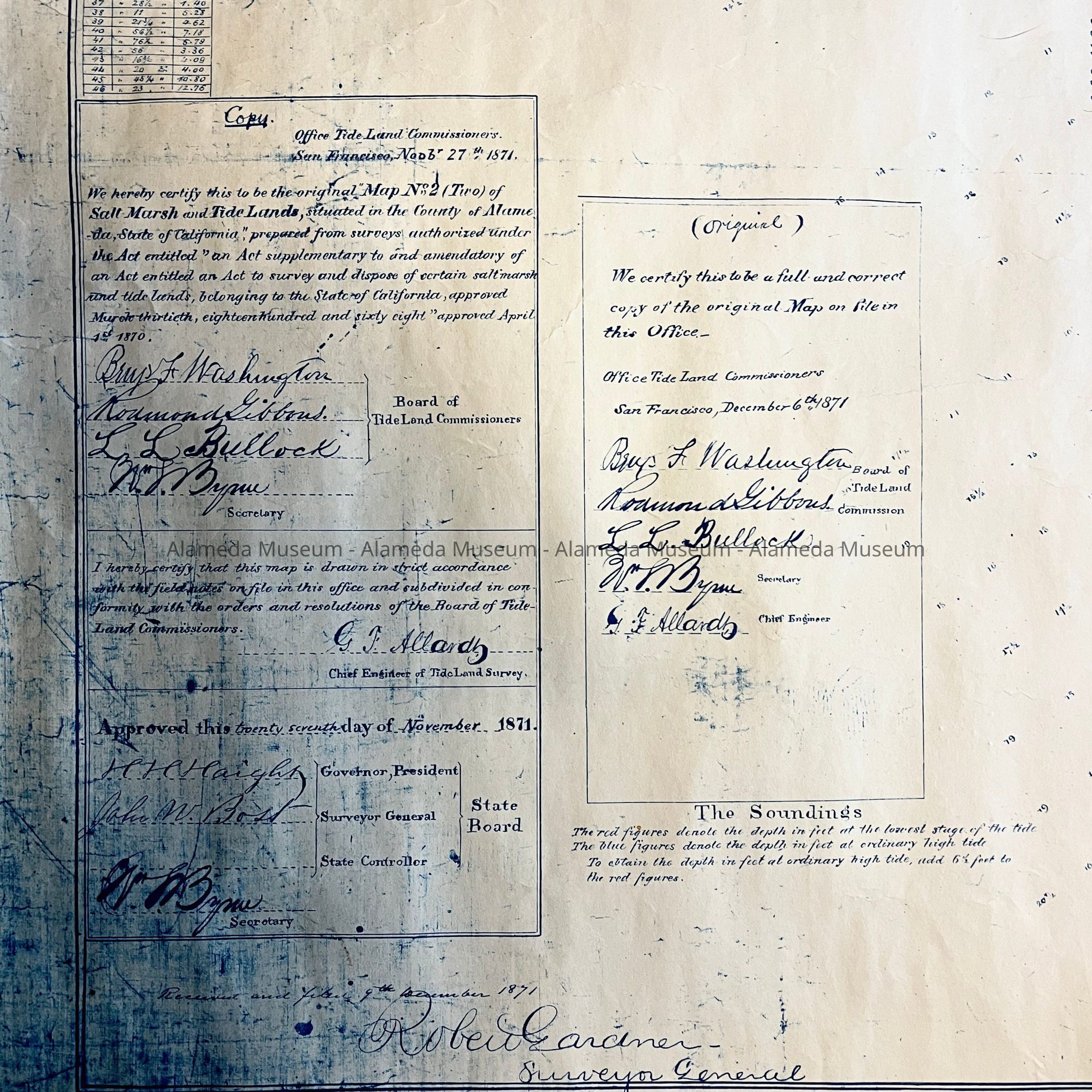
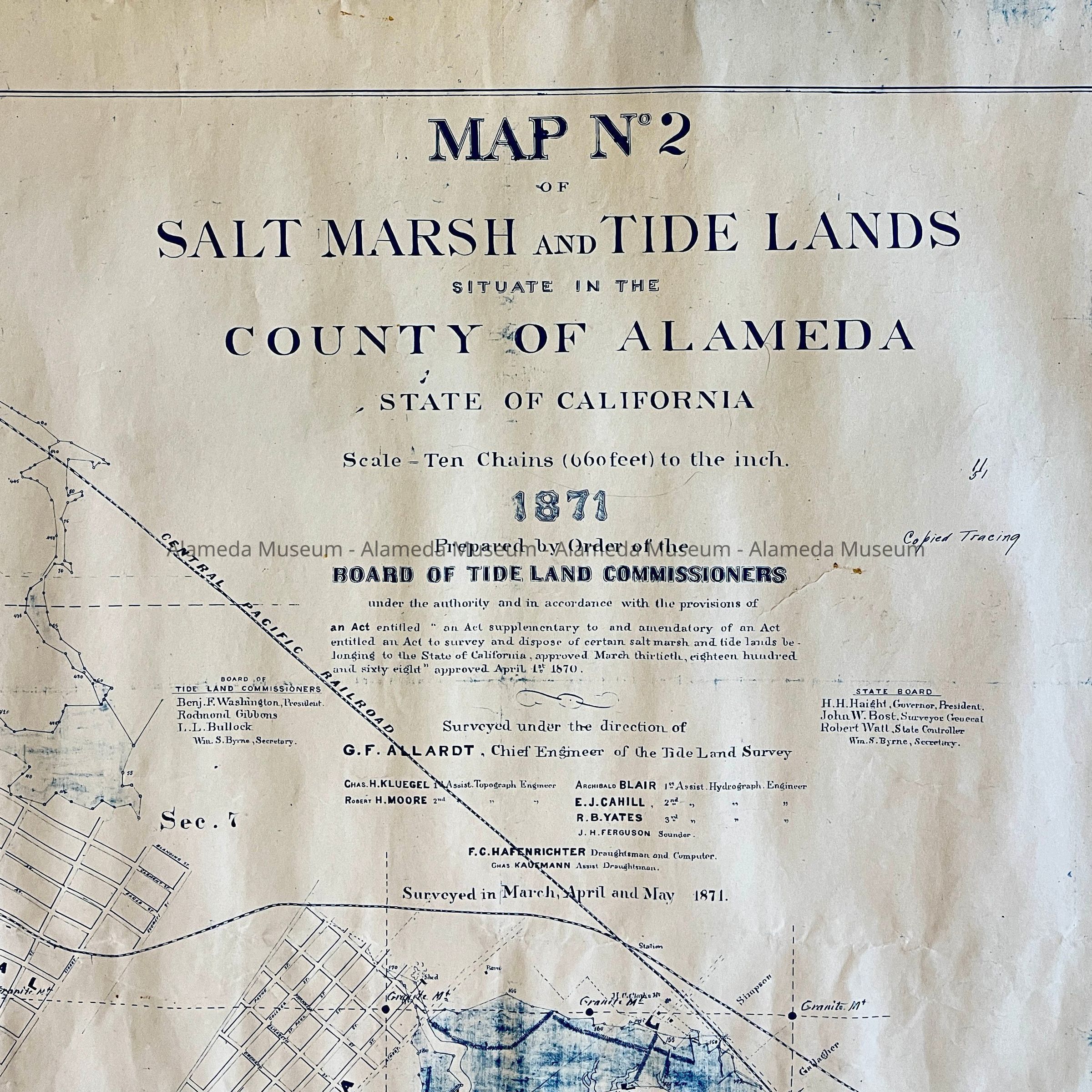
Description: Blueline map in two parts, glued and scotch-taped together (now almost loose), titled ' Map No. 2 of Salt Marsh and Tide Lands'.
Size: L 55 1/4 x W 65 1/2 inches.
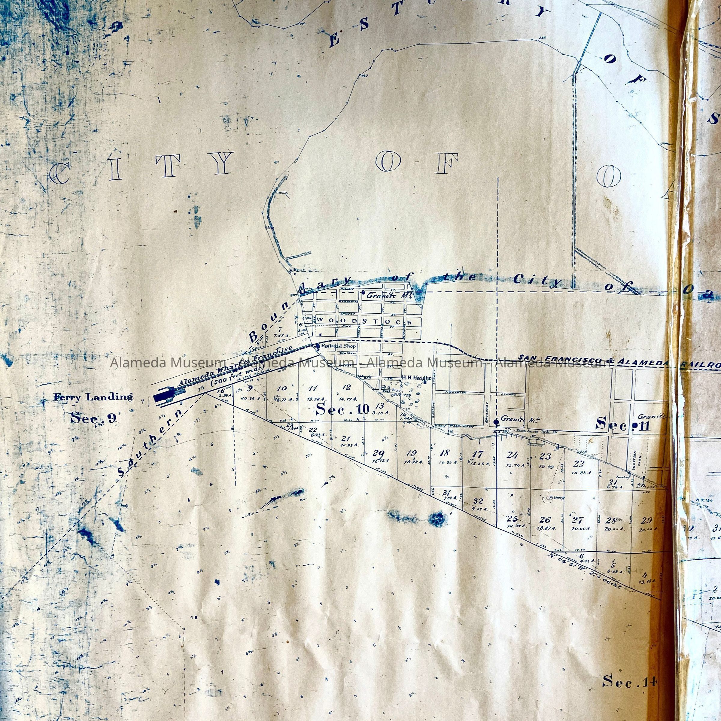
History of Object: Map No 2 of the County of Alameda, 1871, Prepared by Order of the Board of Tideland Commissioners. This Board was presided over by Benjamin F. Washington, other members Rodmond Gibbons, I.L. Bullock.; State Board H.H. Haight, John W. Bost (Surveyor General), Robert Wall, Controller, W.S. Byrne, Secretary. surveyed under direction of G.F. Allardt, Chief Engineer. Map shows the marshlands, as well as early features and parcel ownership, such as early street names, the route of the Alameda and San Francisco Railroad, the wharf, Governor Haight's estate, and the three townships Woodstock, Encinal, and Alameda.
Belongs to report 96.370.1.
Acquired from: Alameda County Historical Society
Via Bernadine Swadley
Donation: 1996; Catalog Date 12/1/2023