Name/Title
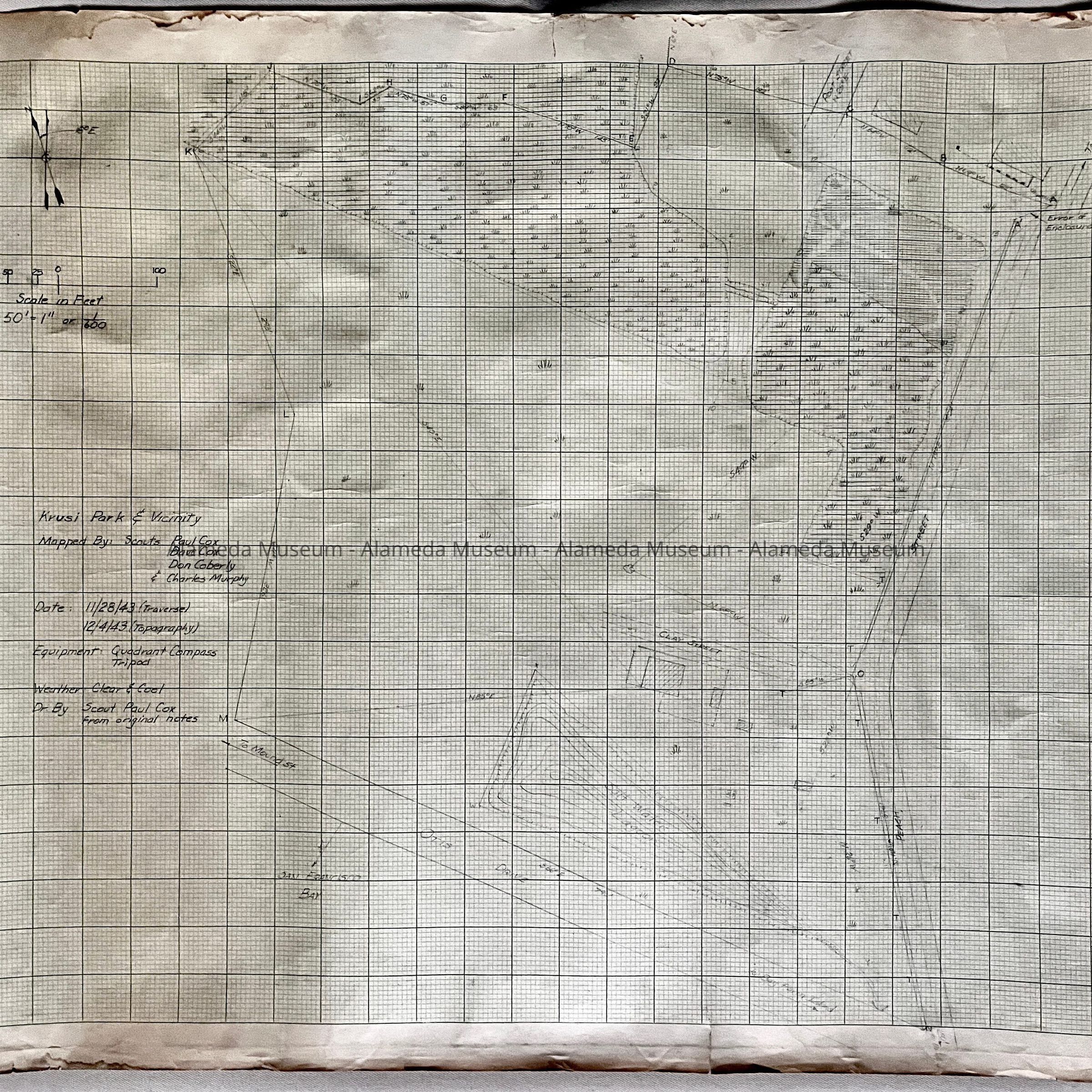
Map of Krusi Park and Vicinity drawn by boy scouts, 1943Entry/Object ID
2023.36.1Description
Acc. No. 23.36.1
Subject Category: Maps, Alameda
Date or Period: 1943
Object: Map
Description: Hand-drawn map on grid paper, titled 'Krusi Park & Vicinity', the legend states 'Mapped By: Scouts Paul Cox, Dave Cox, & Charles Murphy; Date: 11/28/43 (Traverse); 12/4/43 (Topography). Equipment Quadrant Compass, Tripod. Weather Clear & Cool. Dr. By Scout Paul Cox from original notes. Streets named are Post Street, Peach Street, Clay Street, Otis Drive, and San Jose.
Size: L 22 x W 26 inches
History of Object: Map drawn by boy scouts, reason unknown, but possibly to highlight an odd corner, since included near a jump in a street marked with an arrow and the text 'to San Jose', is the label 'Error of Enclosure'. Two of the scouts, Paul and Dave Cox, were sons of William H. Cox and Adeline Toye. The Cox family were longtime residents of Alameda and donated many of their Alameda-related objects to the Alameda Historical Society / Museum.
Acquired from: unknown but likely a Cox family member.
Catalog Date: 11/15/2023