Name/Title
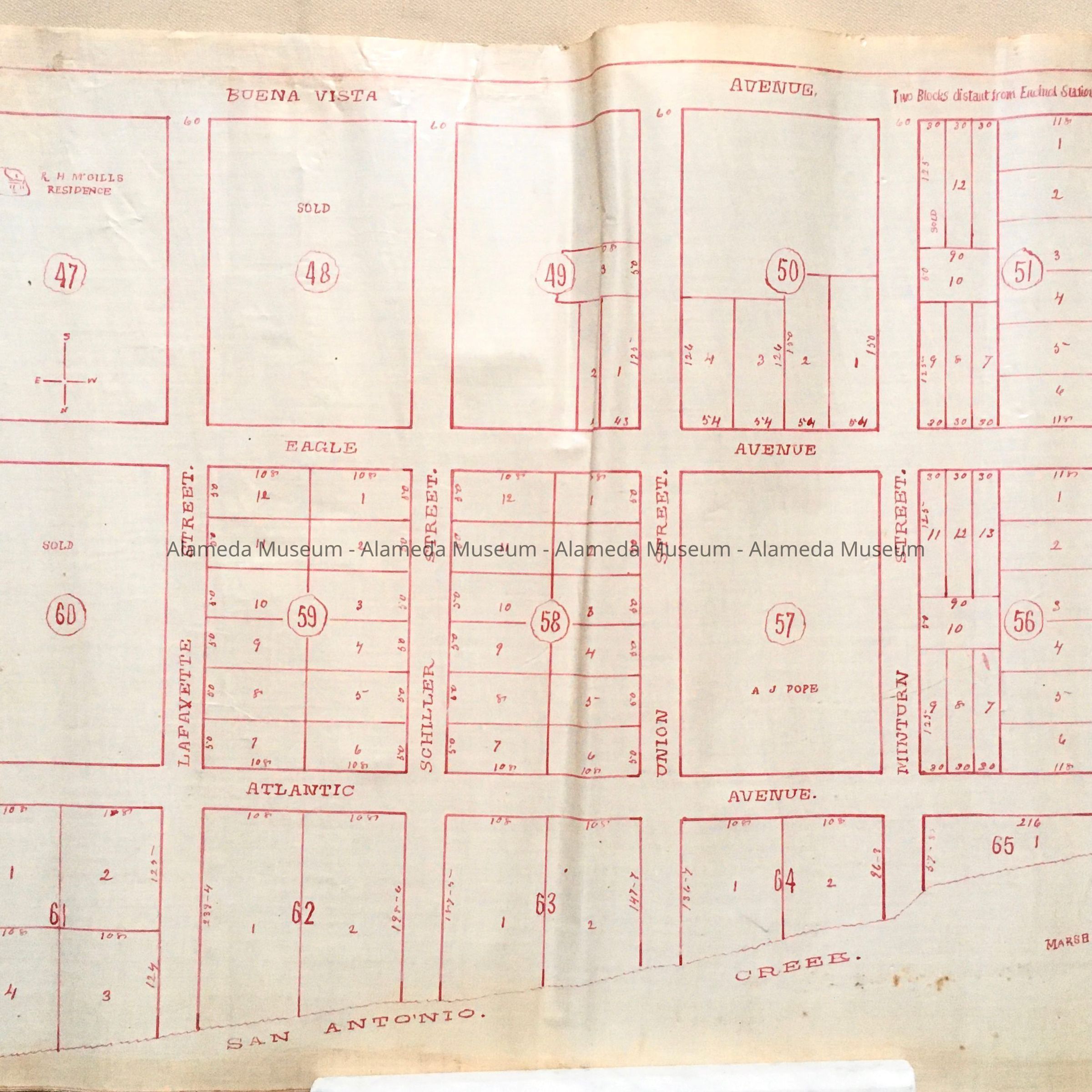
Subdivision map with home of R. H. McGill, Block 47, c. 1870sEntry/Object ID
2002.80.12Description
Acc. No. 02.80.12
Subject: Maps
Date or Period: circa 1870's
Object: Maps, Subdivision
Description:
Hand-drawn map in red-colored ink on white-colored polished linen paper.
Size: L18 x W14 inches.
History:
Subdivision map showing property in an area north of Pacific Avenue and bounded by Chestnut and Grant Streets and San Antonio Creek. The home of R. H. McGill is shown in Block 47.
This collection of maps, etc., found in the attic of City Hall prior to the rehabilitation and seismic upgrades in the late 1990's.
Acquired From: City of Alameda
Date: 7/28/02