Name/Title
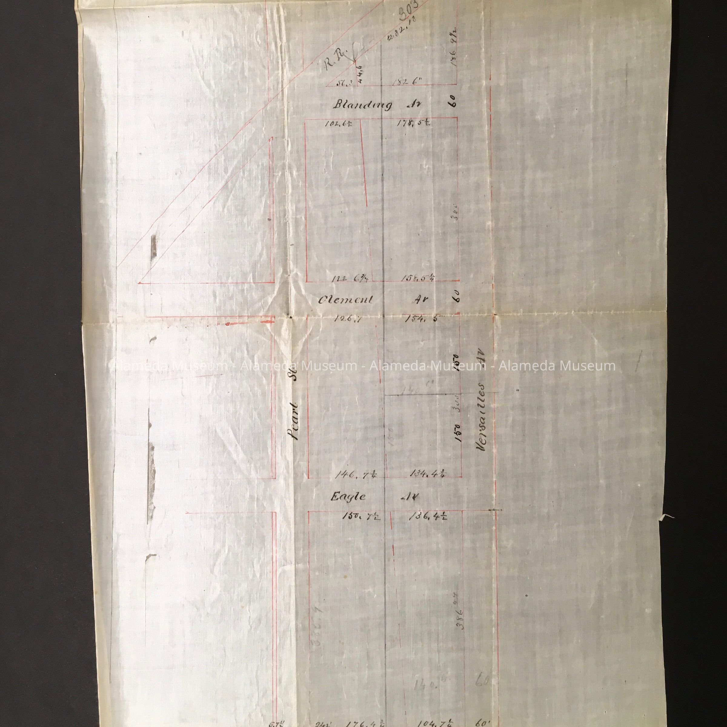
Subdivision Map of the Smith and Palmer propety, c. 1890sEntry/Object ID
1997.402.37Description
Acc. No. 97.402.37
Subject: Land
Date/Period: circa 1890's
Object: Map, Subdivision
Description:
Map hand drawn in sepia and red-colored ink on white-colored paper which appears to have a varnish finish.
Size: L16” x W10-1/2"
History:
Subdivision map of the Smith and Palmer property bordered by Pearl Street, Versailles, Buena Vista, and Blanding Avenues.
Entire collection given to the Alameda Historical Society prior to 1971 and never catalogued. At present, housed in looseleaf binder with hard cover of imitation blackcolored leather in individual plastic sleeves.
Acquired From:
Unknown
Date: 8/16/97