Name/Title
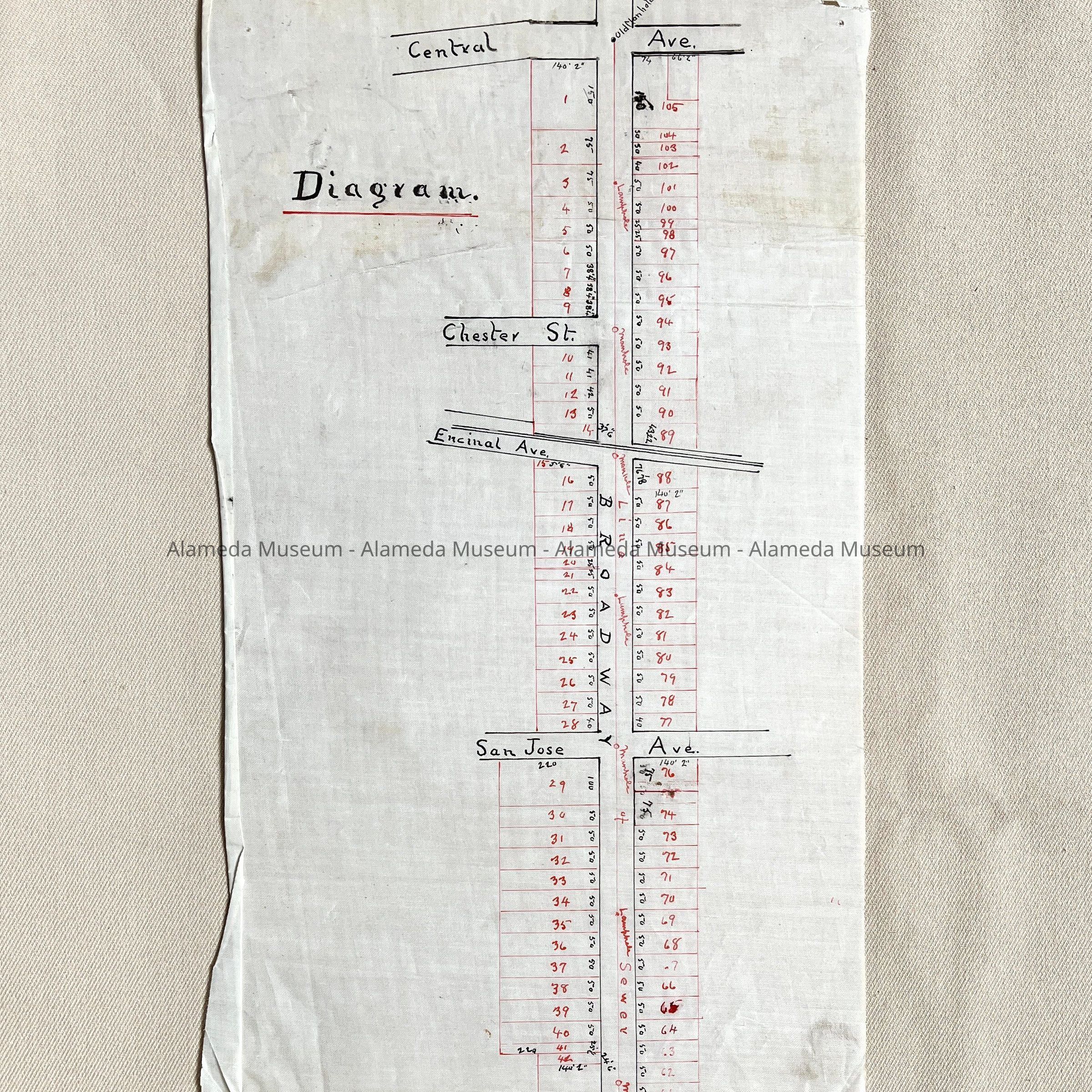
Subdivision Diagram & Sewer lines, Broadway from Central to Otis, c. 1890sEntry/Object ID
2002.80.4Description
Acc. No. 02.80.4
Subject: Maps
Date/Period: circa 1890's
Object: Maps, Subdivision
Description:
Hand-drawn map in red and black colored ink with bold-printed caption, “Diagram”.
Size: L16-1/2 x W7-1/2 inches.
History:
Subdivision and diagram map depicting Broadway from Central Avenue south to what is now known as Otis Drive. Also shows location of sewer and manhole covers. This collection of maps, etc., found in the attic of City Hall prior to the rehabilitation and seismic upgrades in the late 1990's.
Acquired From: City of Alameda
Date: 7/28/02