Name/Title
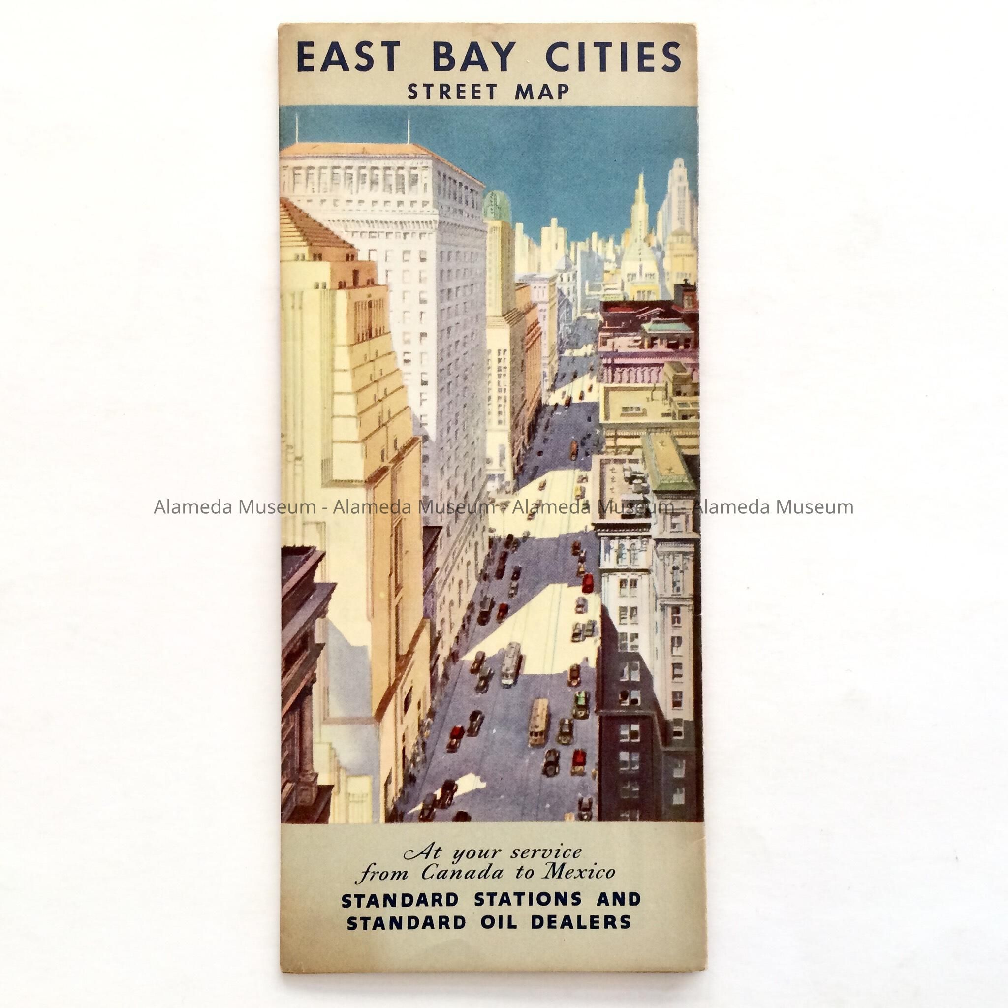
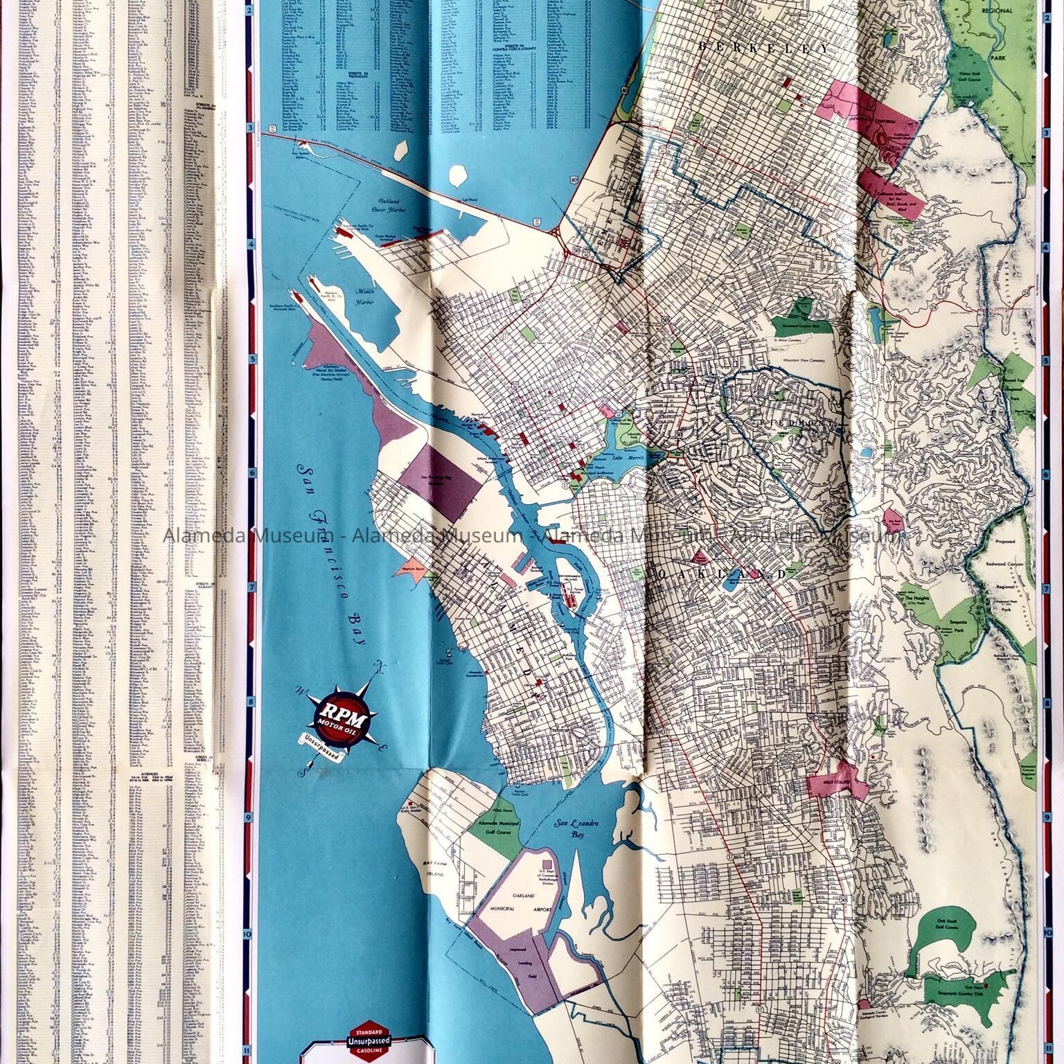
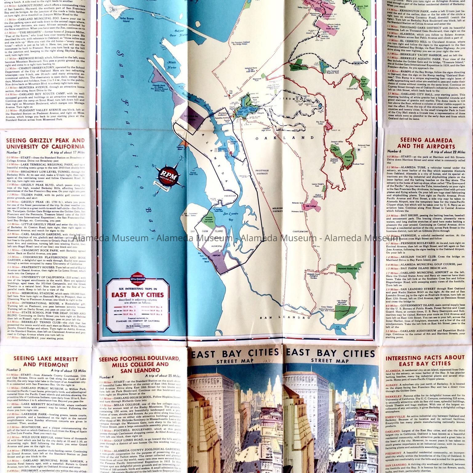
Folding map with aerial view of buildings, 1938Entry/Object ID
2013.7.1Description
Acc. No. 13.7.1
Subject Category: Maps
Date or Period: 1938
Object: Map, street
Description: A folding map with an illustrated cover depicting an aerial view of office buildings, etc.
Size: (folded) L-9” x W-4”
History of Object: A road map issued by Standard Oil of California and used as a promotion in their service stations. The map depicts the East Bay cities including Alameda with its points of interest shown, including the Southern Pacific Mole, the San Francisco Bay Airdrome, Neptune Beach, etc.
Acquired from: Bob Risley, Alameda
Date: 01/19/2013