Name/Title
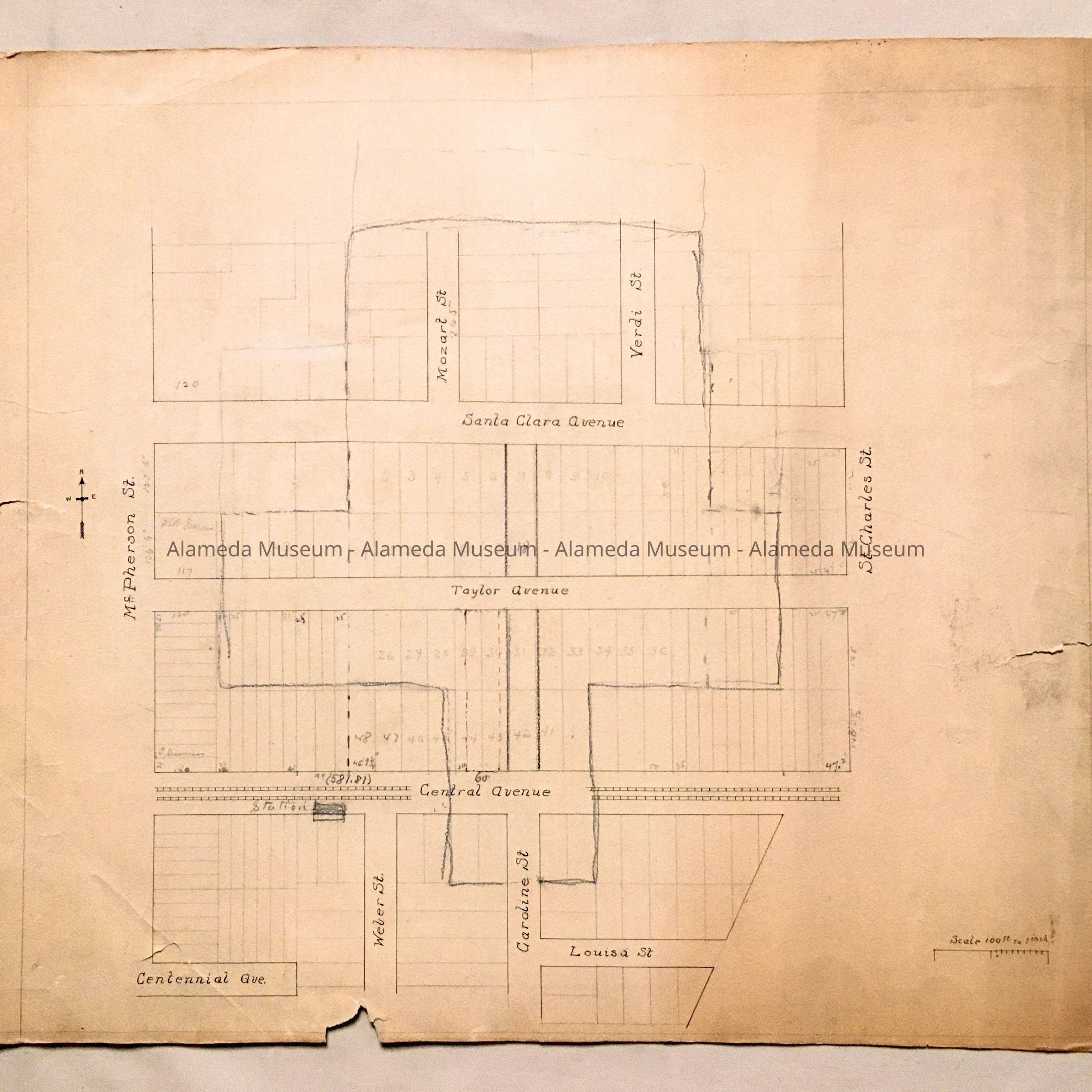
Map of property between Centennial / Santa Clara / Ninth / St. Charles, 1890Entry/Object ID
2001.65.14Description
Acc. No. 01.65.14
Subject: Streets
Date or Period: 1890
Object: Map, Street
Description: Hand-drawn map in ink and pencil. No caption.
Size: L 18” x W 21-1/2”
History: Map of property located between Centennial and Santa Clara Avenue, bordered by Ninth and St. Charles.
Acquired From: City of Alameda
Date: 3/17/01