Name/Title
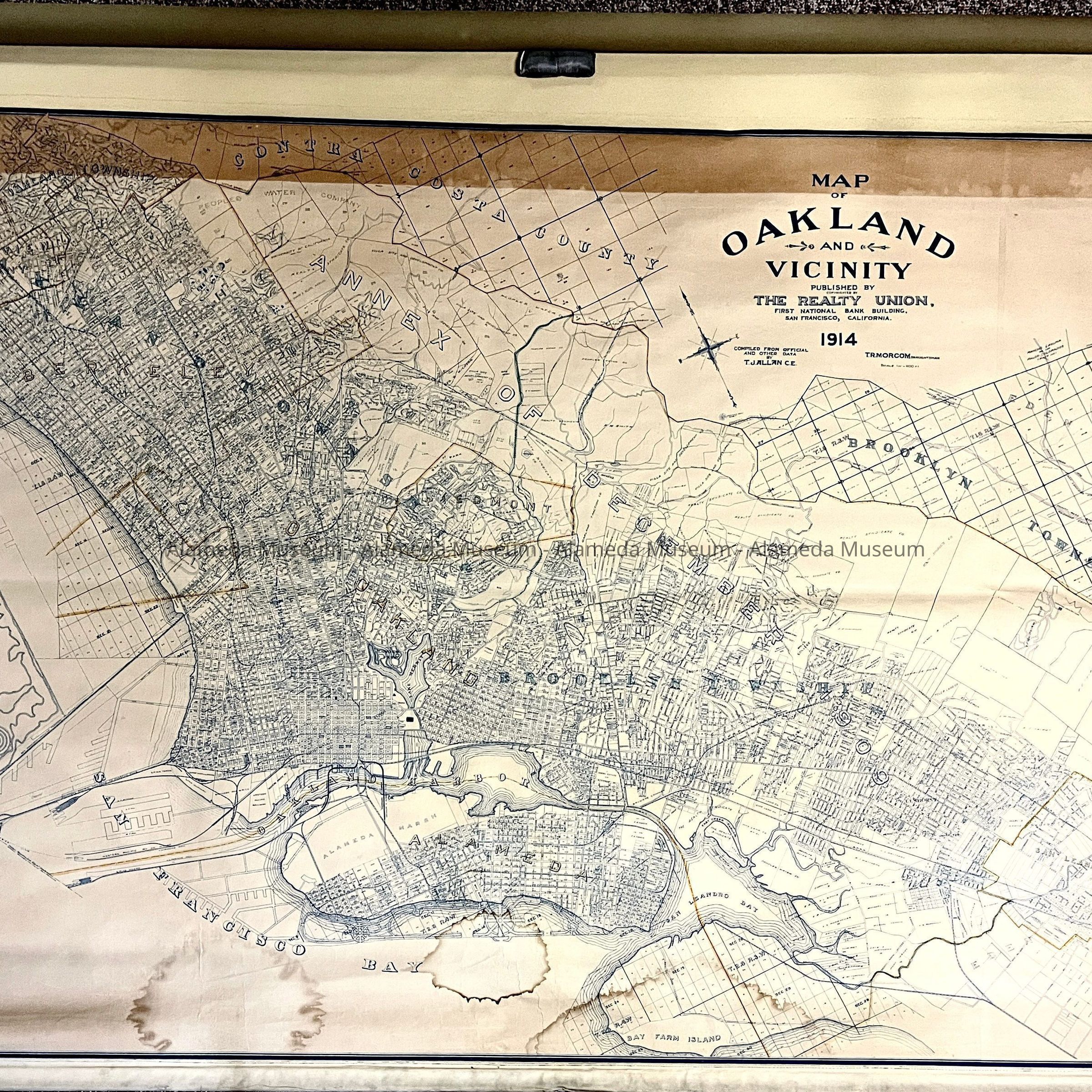
Map of Oakland, Berkeley and Alameda, draughtsman C.E.F.R. Marcom, 1914Entry/Object ID
1981.259.7Description
Acc. No. 81.259.7
Subject Category: Maps, Alameda
Date or Period: 1914
Object: Map
Description:
Wall map mounted on large spring roller. It is a printed paper map that is glued to a shade-like material. It has a cord for pulling it down. It is made with a blue printer’s ink with a cream background. The main heading: "Map of Oakland and Vicinity, Published by and copyrighted by The Realty Union, First National Bank Building, S. F. Calif, 1914. Compiled from official and other data by T.J. Allan, C.E.F.R. Morcom, draughtsman" (in upper right hand corner). "Printed by Oakland Blue Print Co., Commercial Building, Oakland, Calif" (in the lower right hand corner).
Size: 8 feet, 3 inches, by 7 feet, 8½ inches.
History of Object: Map of Oakland, Berkeley and Alameda, showing streets and identifying tracts of land, streets, and also gives the route of the electric and trolley lines.
Acquired from: Barbara Rasmussen
Date: August 19, 1981