Name/Title
Subdivision Map 'Bartlett 50 Acre Tract, Encinal Station', 1877Entry/Object ID
2002.80.13Description
Acc. No. 02.80.13
Subject: Maps
Date or Period: 1877
Object: Maps, Subdivision
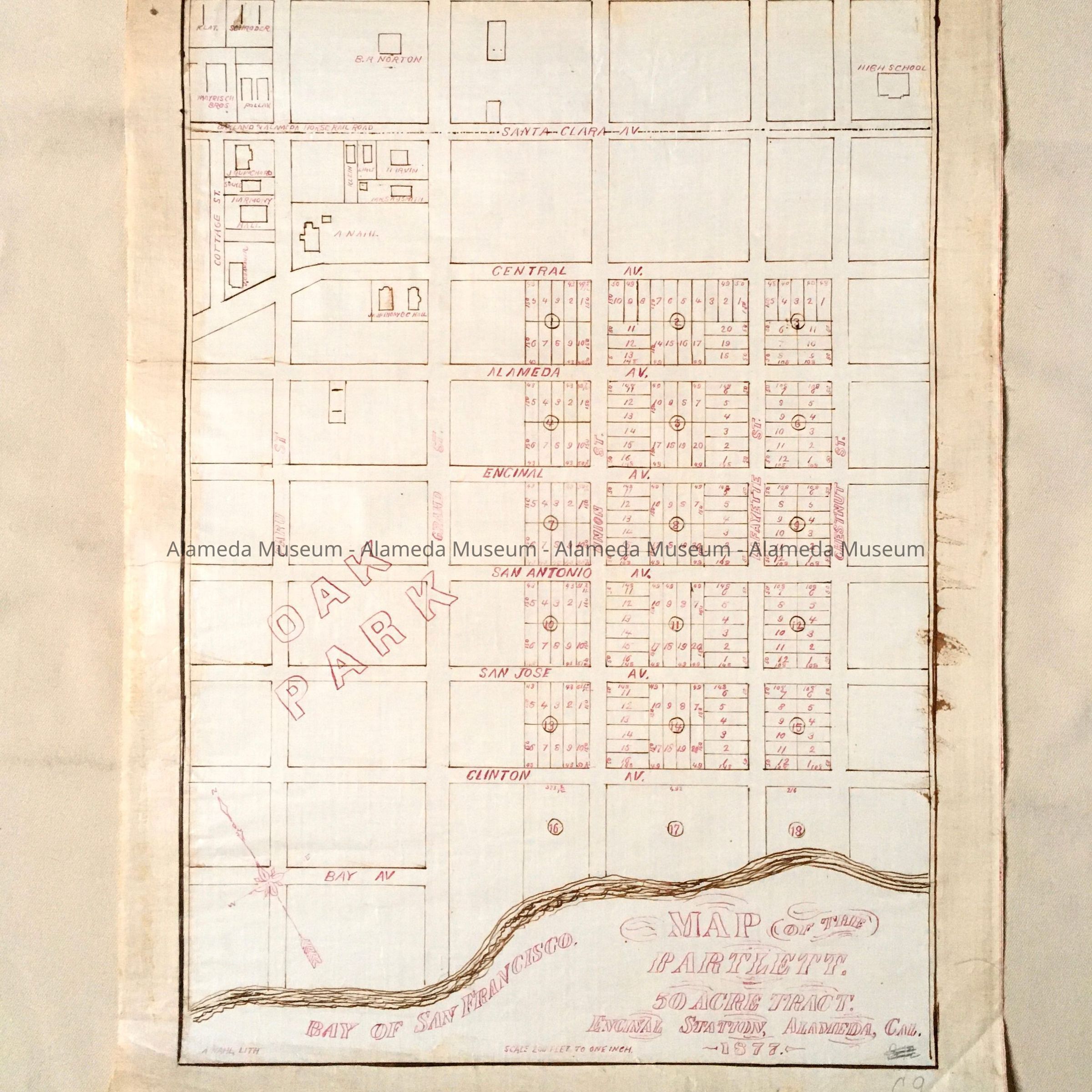
Description:
Hand-drawn map in red-colored ink on white-colored polished linen paper.
Size: L23 x W15-1/2 inches.
History:
Subdivision map entitled, “Bartlett 50 Acre Tract, Encinal Station, Alameda, Ca.”, signed by A. Nahl, lithographer and noted California artists. Map shows undeveloped lots on a parcel of land bounded by Union and Chestnut Streets, Central and Clinton Avenues. Also shows improved property and the names of ownership in the vicinity. Also shows a footprint of A. Nahl's home at Paru and Central Avenue. Map was prototype for eventua! printed map. This collection of maps, etc., found in the attic of City Hall prior to the rehabilitation and seismic upgrades in the late 1990's.
Acquired From: City of Alameda
Date: 7/28/02