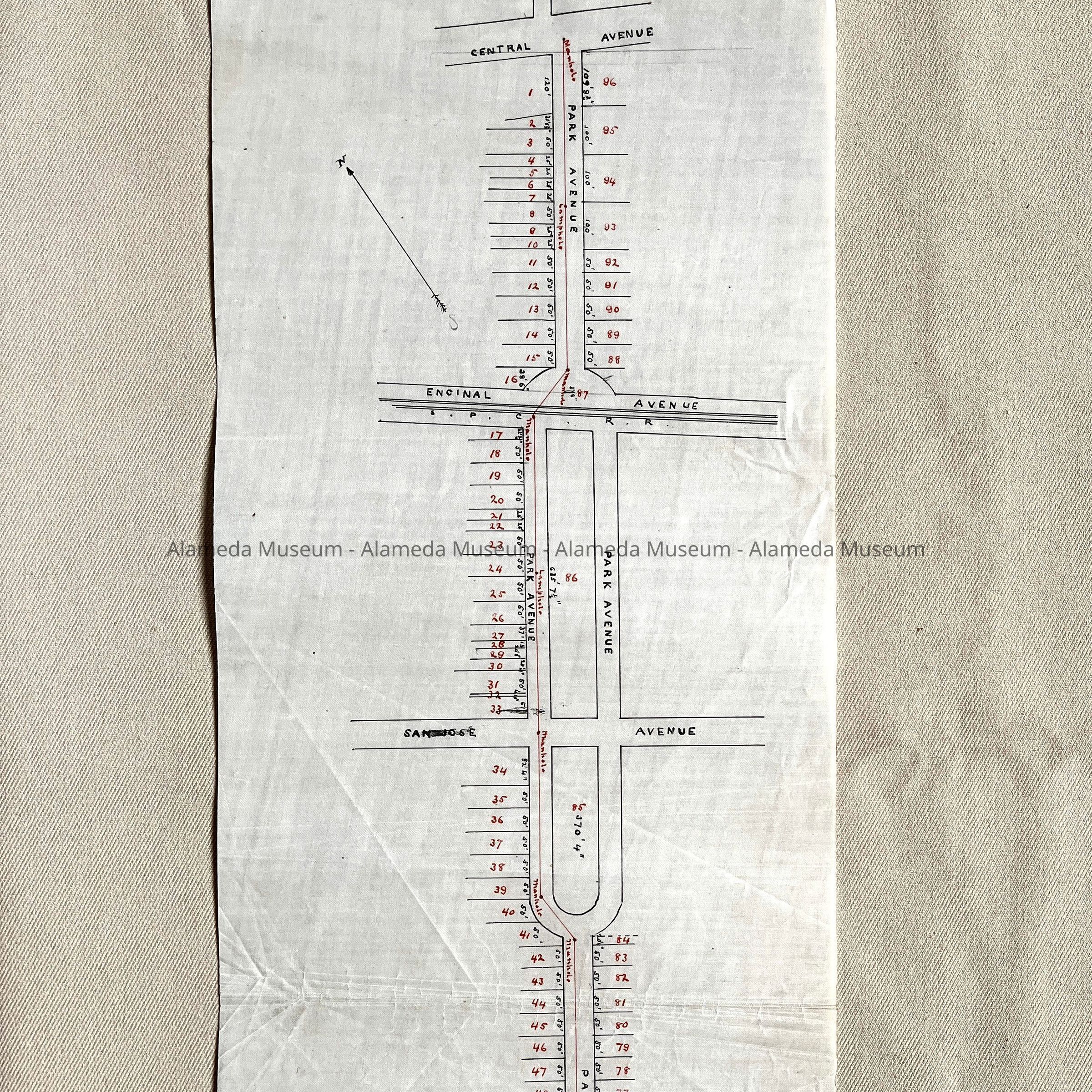
Name/Title
Map of Park Ave between Central Ave and Otis Drive, 1880-1890Entry/Object ID
2002.80.5Description
Acc. No. 02.80.5
Subject: Maps
Date/Period: 1880-1890
Object: Maps, Subdivision
Description:
Hand-drawn map in black and red colored ink on polished linen paper.
Size: L17-1/2 x W6-3/4 inches.
History:
Map of Park Avenue between Central Avenue and Otis Drive. Map gives location of sewer and manhole covers. This collection of maps, etc., found in the attic of City Hall prior to the rehabilitation and seismic upgrades in the late 1990's.
Acquired From: City of Alameda
Date: 7/28/02