Name/Title
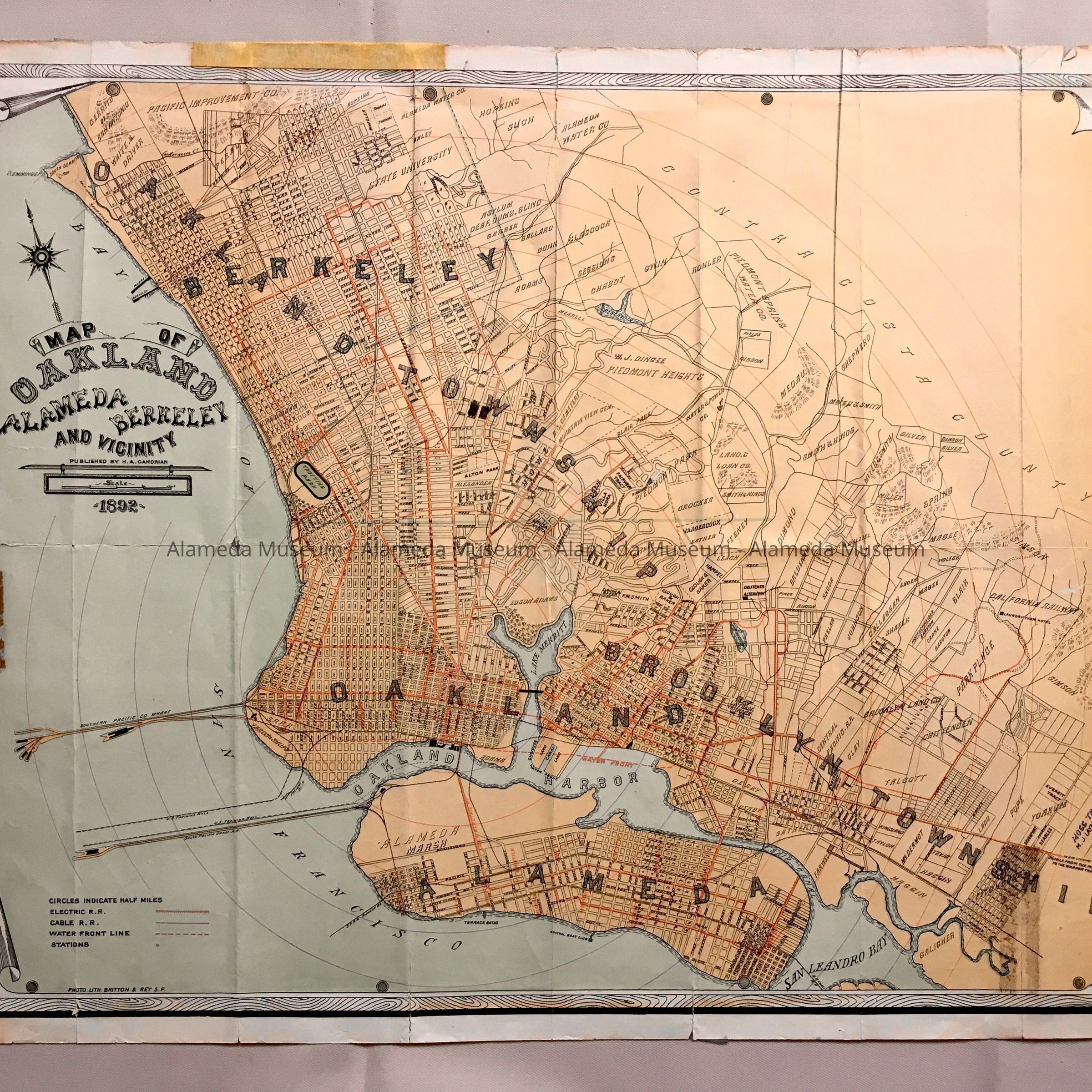
Map of Oakland, Alameda, Berkeley and Vicinity, H.A. Candrian, Britton & Rey, 1892Entry/Object ID
1983.17.1Description
Acc. No. 83.17.1
Subject Category: Maps
Date or period: 1892
Object: Map
Description: Lithographed map (4 colors) with caption in ornate type "Map of Oakland, Alameda, Berkeley and Vicinity", published by H. A. Candrian, 1892, photo lith. Britton & Rey, S.F.
Size: 24x19 inches.
History of Object: Map of Alameda, 1892, which indicates the routes of electric trolleys and steam trains, the location of the South Pacific Coast & S. P. Railroad moles, Terrace Baths, Encinal Boat Club, and the two former bridges at Webster Street (replaced by the tube).
Acquired from:
Loreme Remmel Beatty
City
Date: 5-27-83