Name/Title
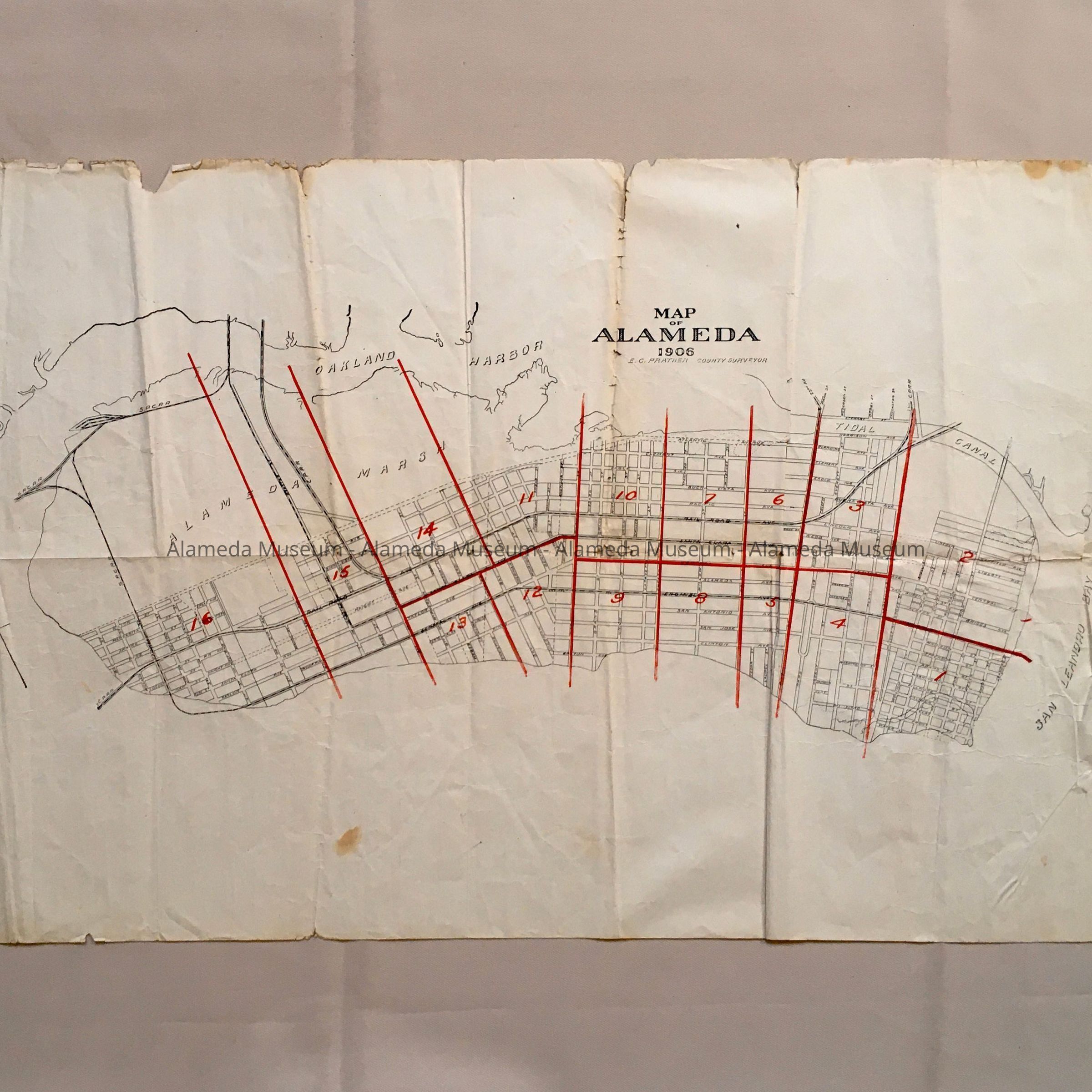
Map of Alameda, 1906Entry/Object ID
1985.20.3Description
Acc. No. 85.20.3
Subject Category: Maps
Date or period: 1906
Object: Map
Description:
Printed map with heading "Map of Alameda, 1906". The map is divided and numbered into 16 different areas or precincts which are defined by red lines.
Size: L-15 3/4 X 28 inches.
History of Object: Map of the City of Alameda, 1906 (does not include Bay Farm Island).
Acquired from: Ms. Roberta McDonell
Date: 4-14-85