Name/Title
Map of lagoons and temporary Channels, South Shore, 1957Entry/Object ID
2024.80.2Description
Acc. No. 24.80.2
Subject Category: City of Alameda, Planning, South Shore; lagoons
Date or Period: 1957
Object: map
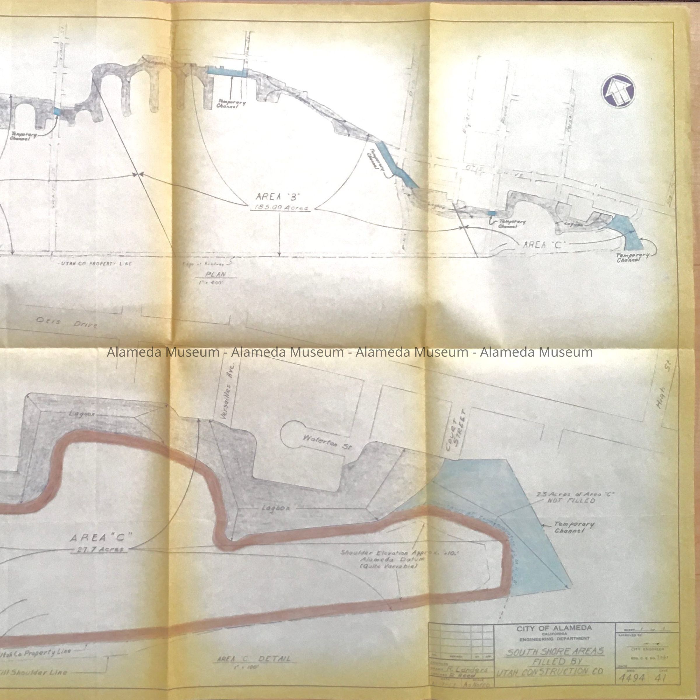
Description: A reproduced map on yellowing paper with dark purple-blue and originally hand-drawn lettering, and colored in areas in blue and brown pencil. Title: South Shore Areas Filled By Utah Construction Co. Date: 1/17/57.
Size: L 32 1/2 by 12 inches.
History of Object: Map of Lagoons from High Street to Nineth Street, in the South Shore Development area, as filled by Utah Construction Co. Highlighted in blue are temporary channels, and the area east of Regent is enlarged.
Possibly used to engineer the initial dredging of the lagoons and filling them with water.
Acquired from: Susan Espinoza
Donation Date: 10/12/2024
Catalog Date: 10/28/2024