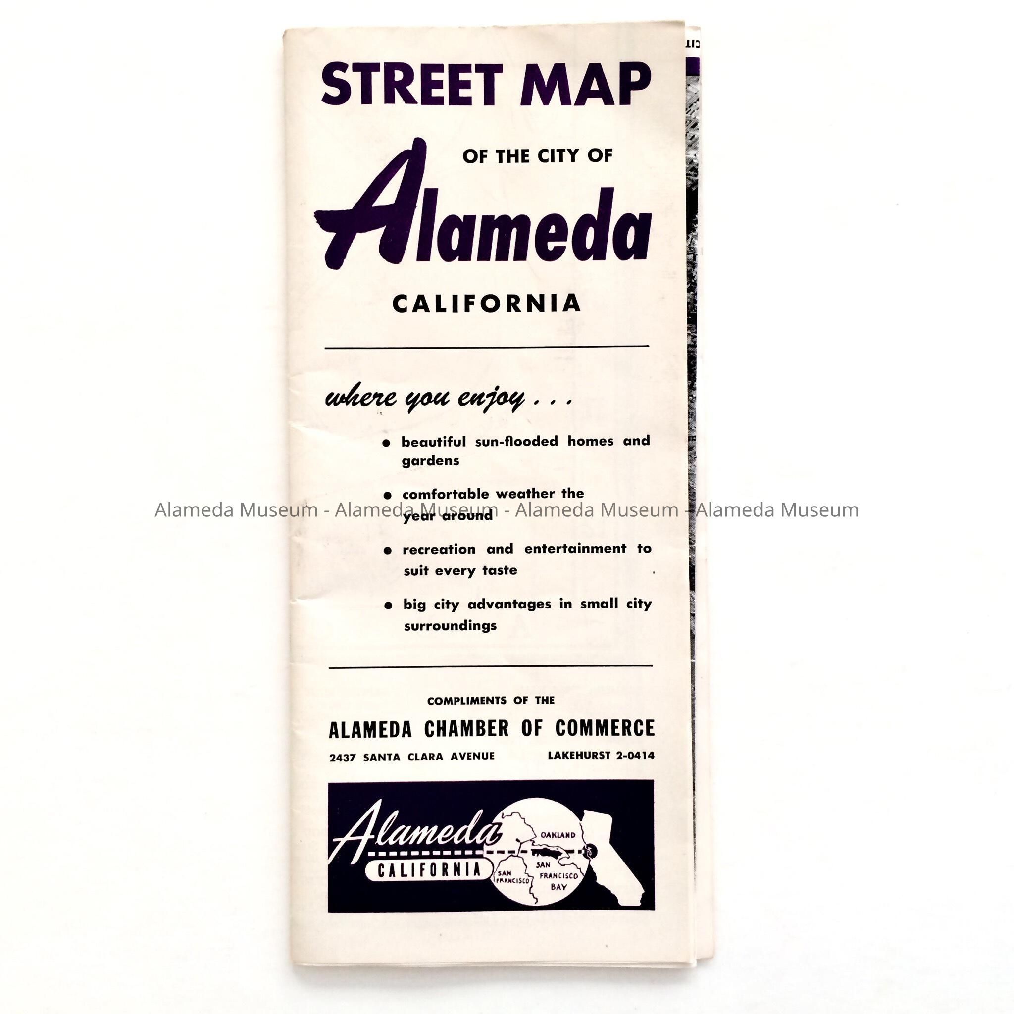
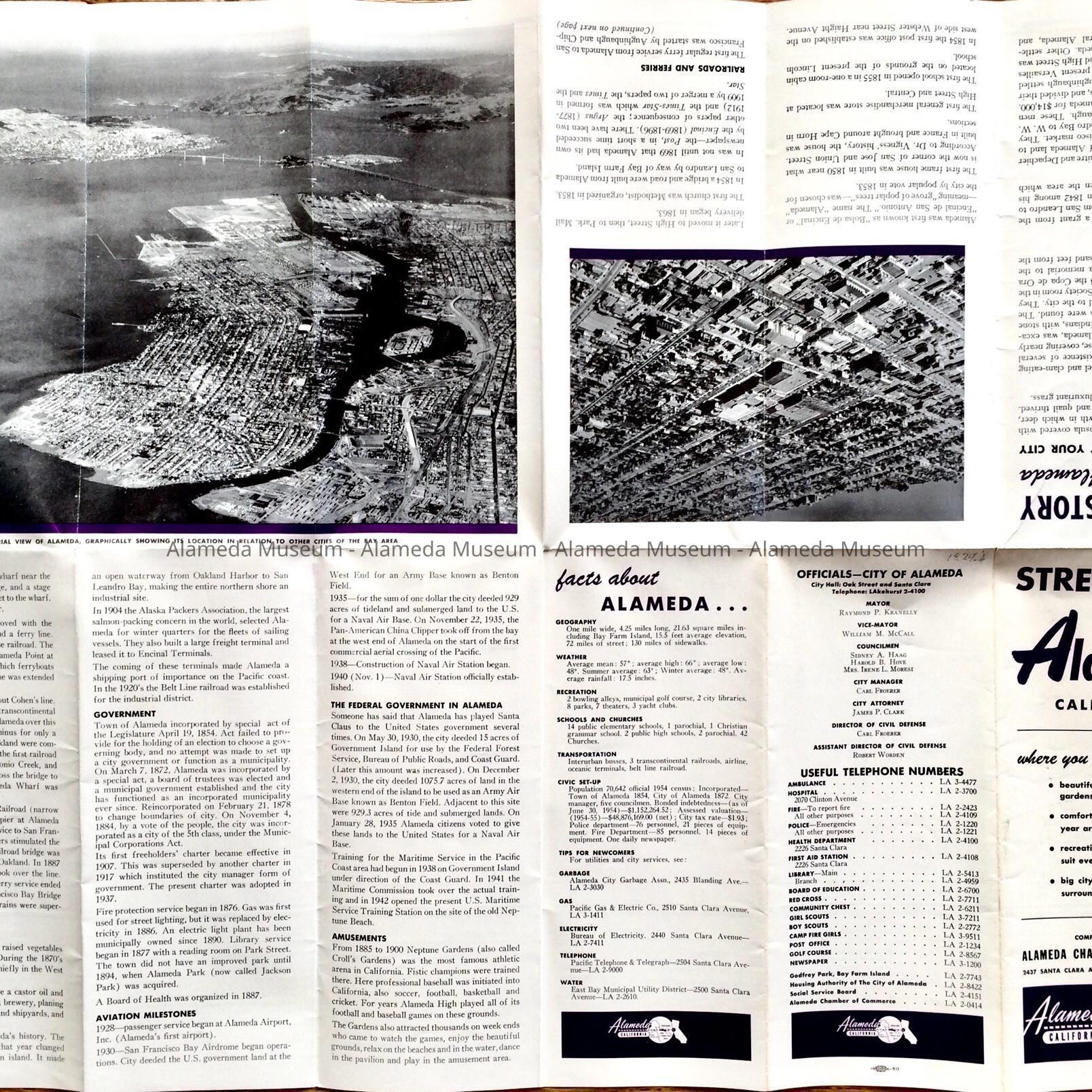
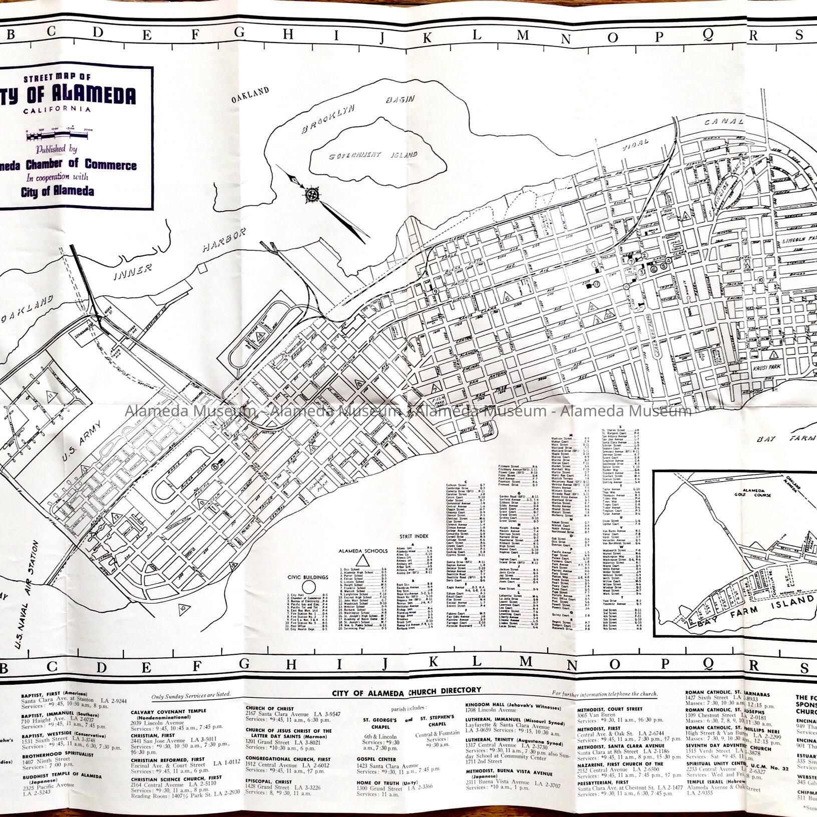
Name/Title
Folding 'Street Map Alameda' issued by the Chamber of Commerce, after 1950sEntry/Object ID
2018.24.4Description
Acc. No. 18.24.4
Subject Category: Chamber of Commerce
Date or Period: circa after 1950's
Object: Alameda city map
Description: A folding map in pamphlet form, the cover states, "Street Map Alameda California" on a white background.
Size: (Folded): L-8 3/4” X 3 3/4”
History of Object: A city street map issued by the Alameda Chamber of Commerce during the administration of Mayor Raymond F. Kranelly; it was undated but the telephone prefix for Alameda, "Lakehurst" was in use at the time.
Acquired from: The George McDonald Collection
Date: 06/02/2018