Name/Title
Maps of Bay Farm Island, 1946-1984Entry/Object ID
2021.41.1Description
Acc. No. 21.41.1 A-E
Subject Category: land; Bay Farm Island
Date or Period: 1946-1984
Object: Maps
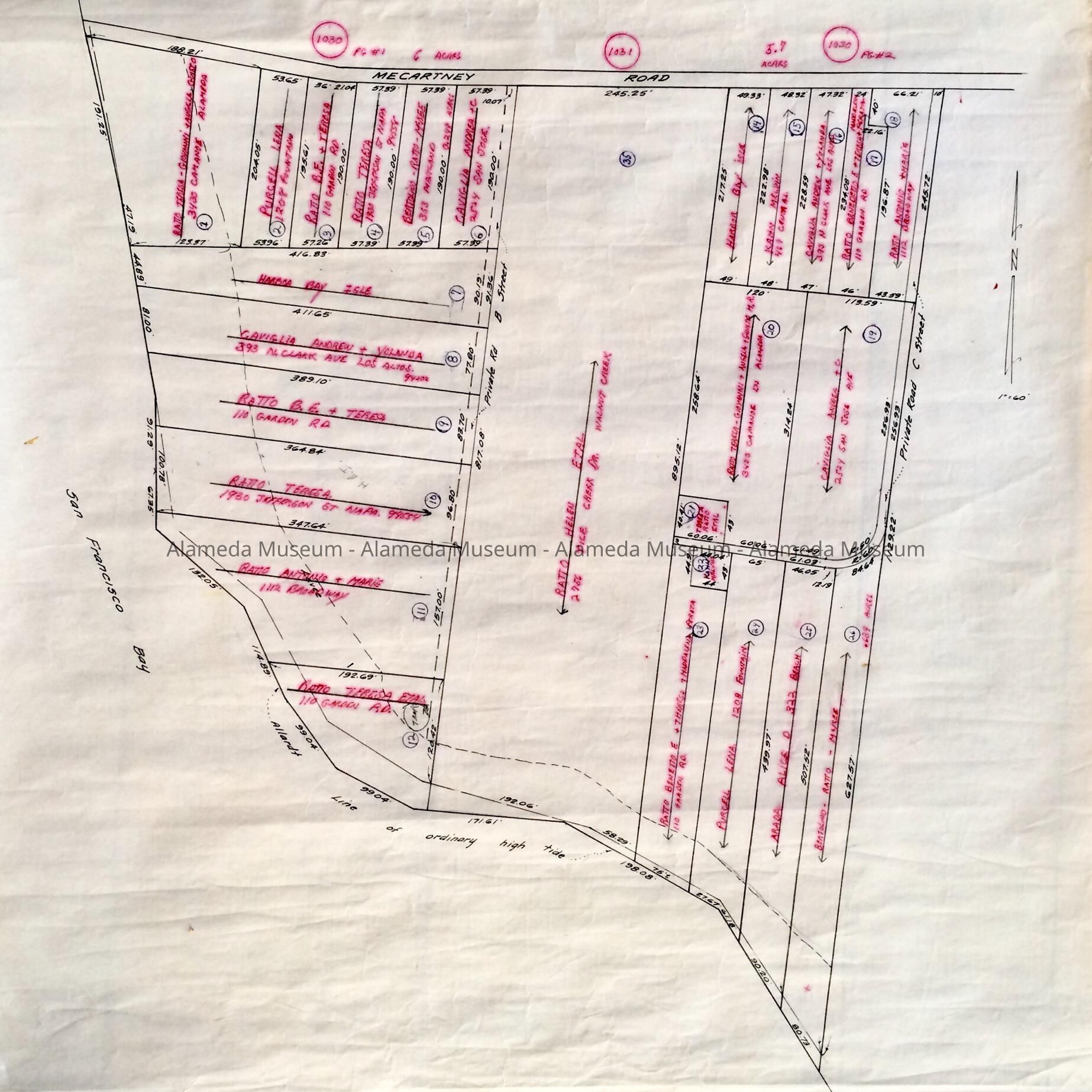
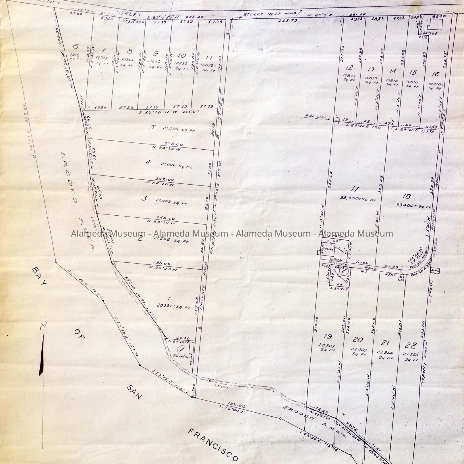
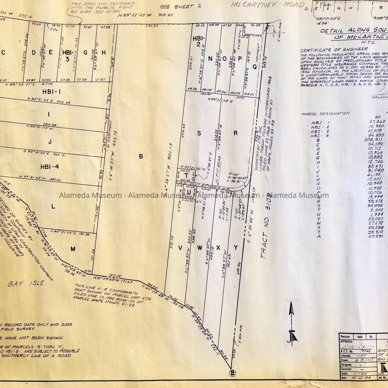
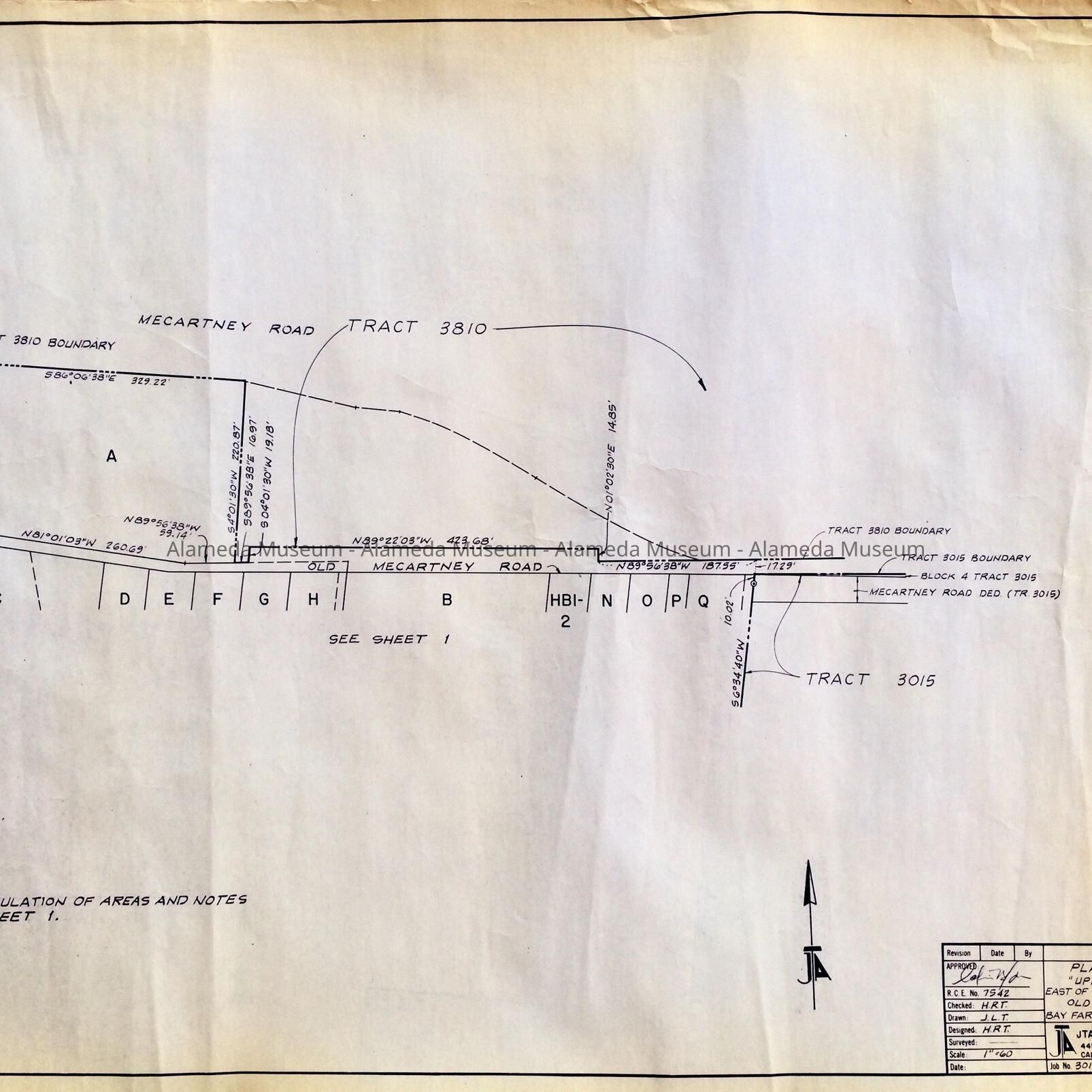
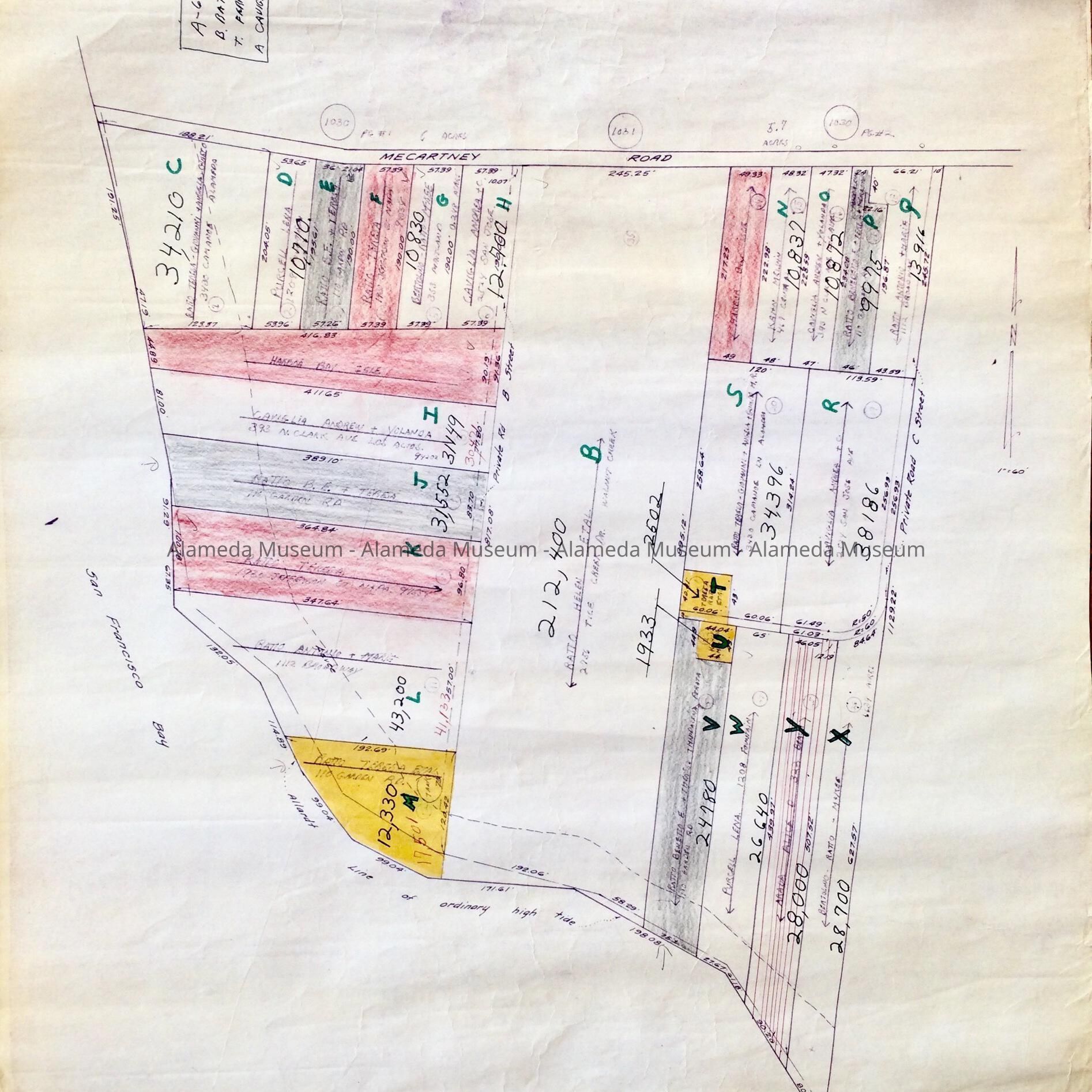
Description: 6 survey maps or copies of same, of different dates, of the same area on Bay Farm Island, to the south of Mecartney Street.
A. photocopy of Survey No. 5368, February 28, 1946, For G. Ratto & Company, West Bay Farm Island, 'Being a portion of the Order of Assignment to Estate of widow dated August 13, 1936', recorded August 20, 1936, by Beugler & Boardman, Civil Engineers, Oakland.
B & C. 2 stapled sheets (2 copies, one much yellowed): Map and detail map, titled 'Plat of Lands; "Upland" Parcels East of Tract 3105 and South of Old Mecartney Road, Bay Farm Island. By JTA Inc. Engineers-Planners, 10/10/1984.
Size: L 22" x W 30 3/4"
D. Undated, hand-drawn map on tracing paper with property ownership, and addresses of the owners, written in pink pen. Size. L 21" x W 24"
E. Undated , hand-drawn and hand-colored with red, grey and yellow areas; appears to be based on D.
Size: L 21 1/2" x W 24"
History of Object: Maps used as the basis for plans for revitalization of Bay Farm Island.
Acquired from: Marion McKee for Arthur McKee
Donation Date: May 10, 2021
Catalog Date: May 15, 2021