Name/Title
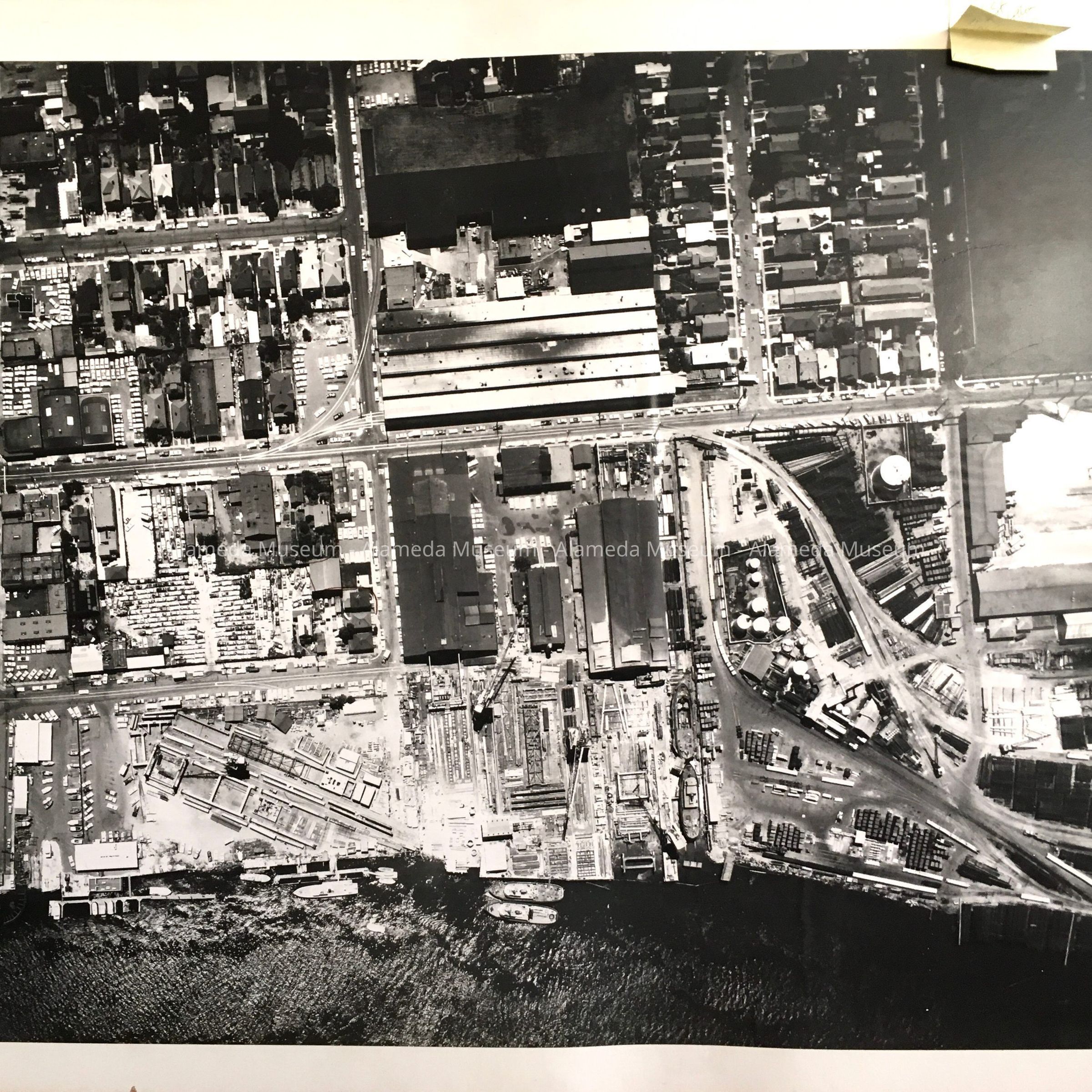
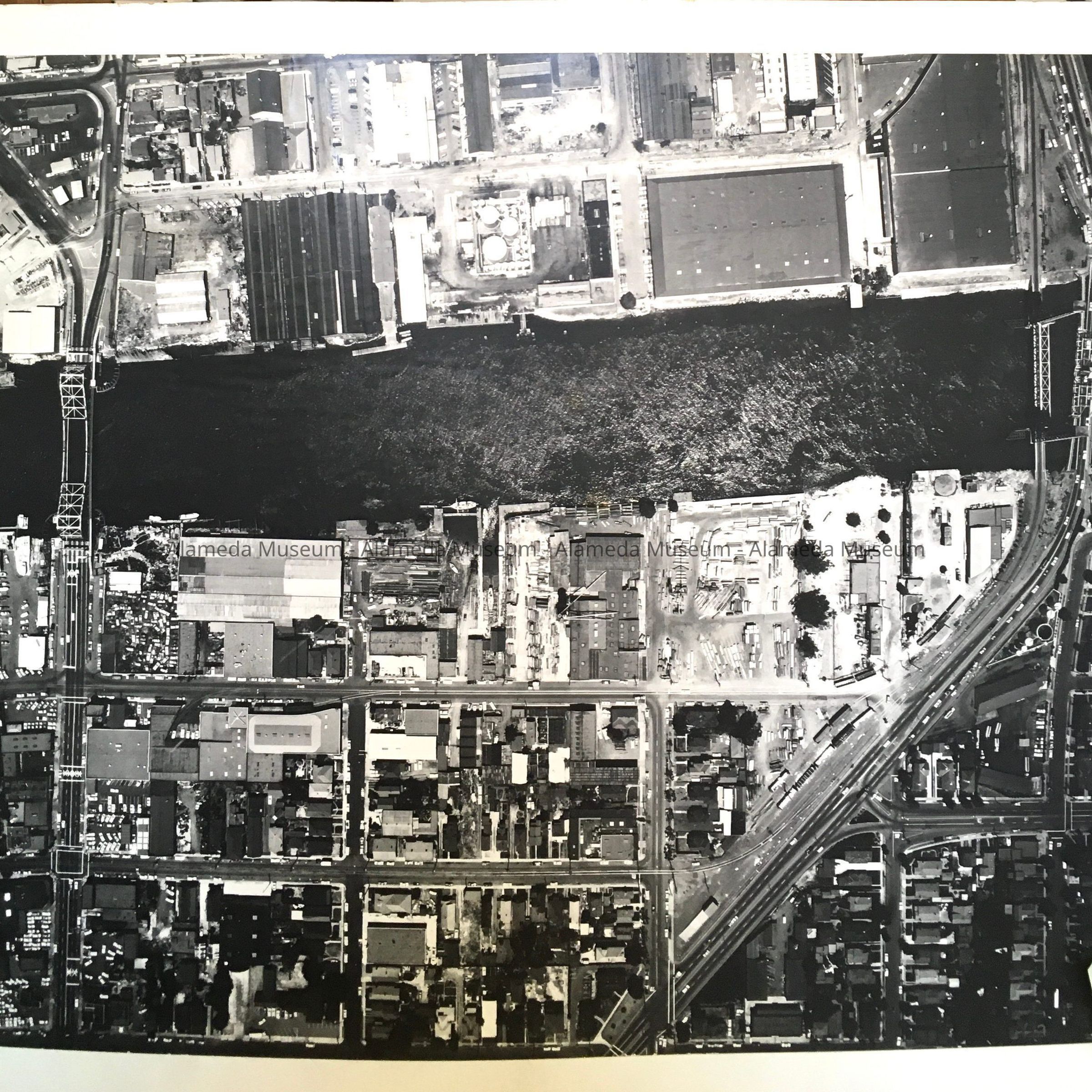
Aerial photos of Estuary Industries, c. 1965Entry/Object ID
2024.26.1Description
Acc. No. 24.26.1 A-J
Subject Category: Industries, shipbuilding
Date or Period: c. 1965
Objects: Aerial photographs
Description: large size black and white photographs mounted on cardboard, white on one side, grey on the reverse. Photographer or source organization unknown.
H has clear water damage.
Size: photos: L 23” x W 19”; boards: L 25” x W 21 1/2”
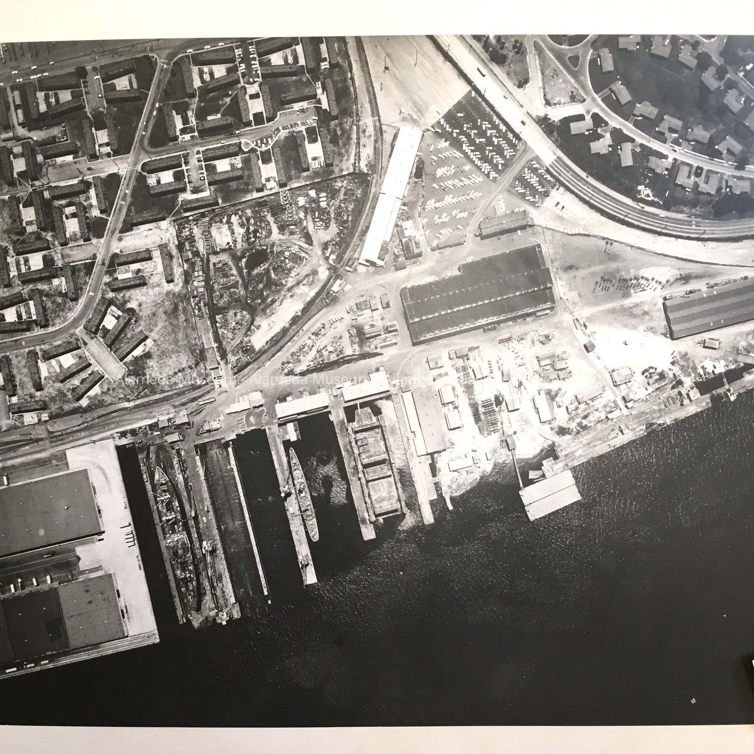
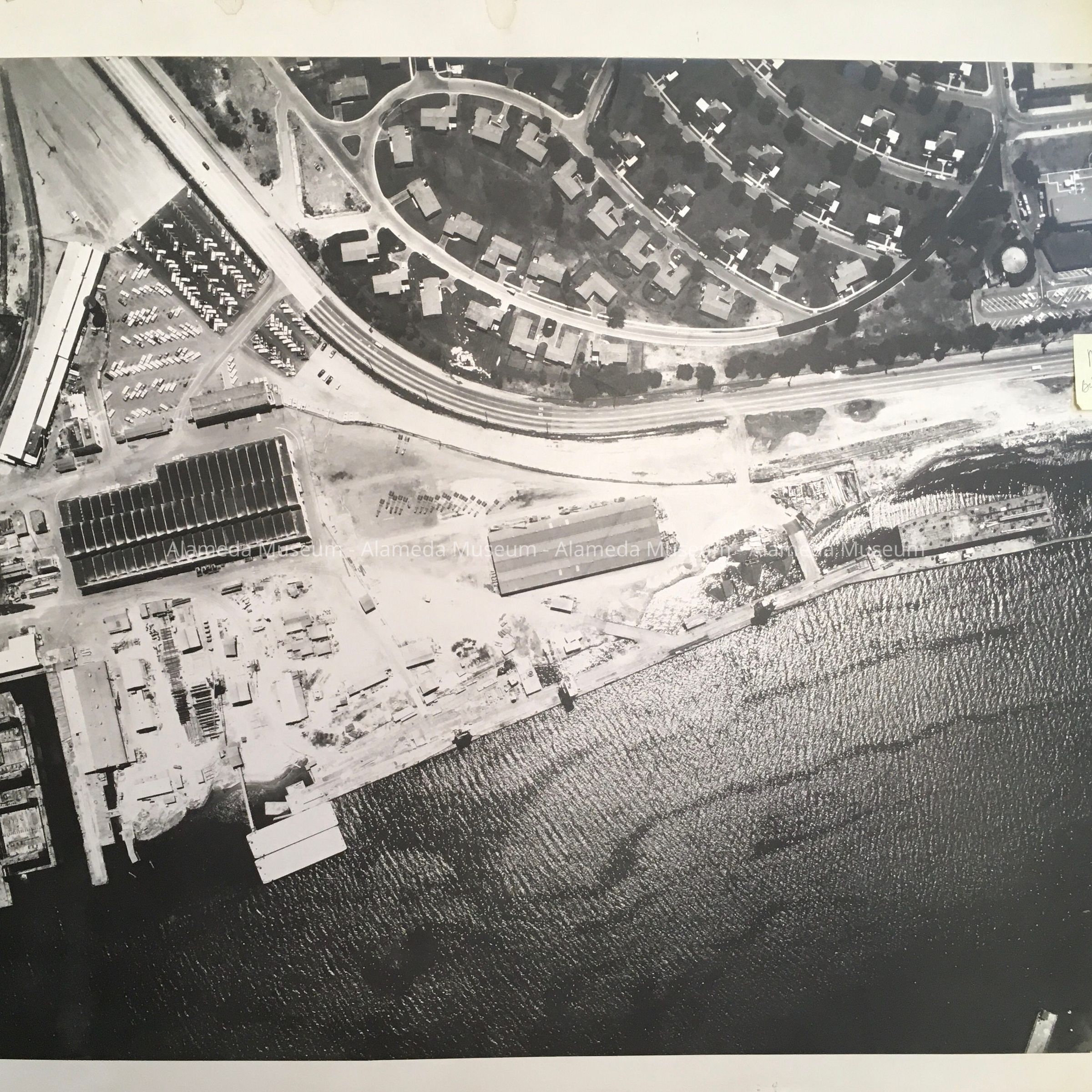
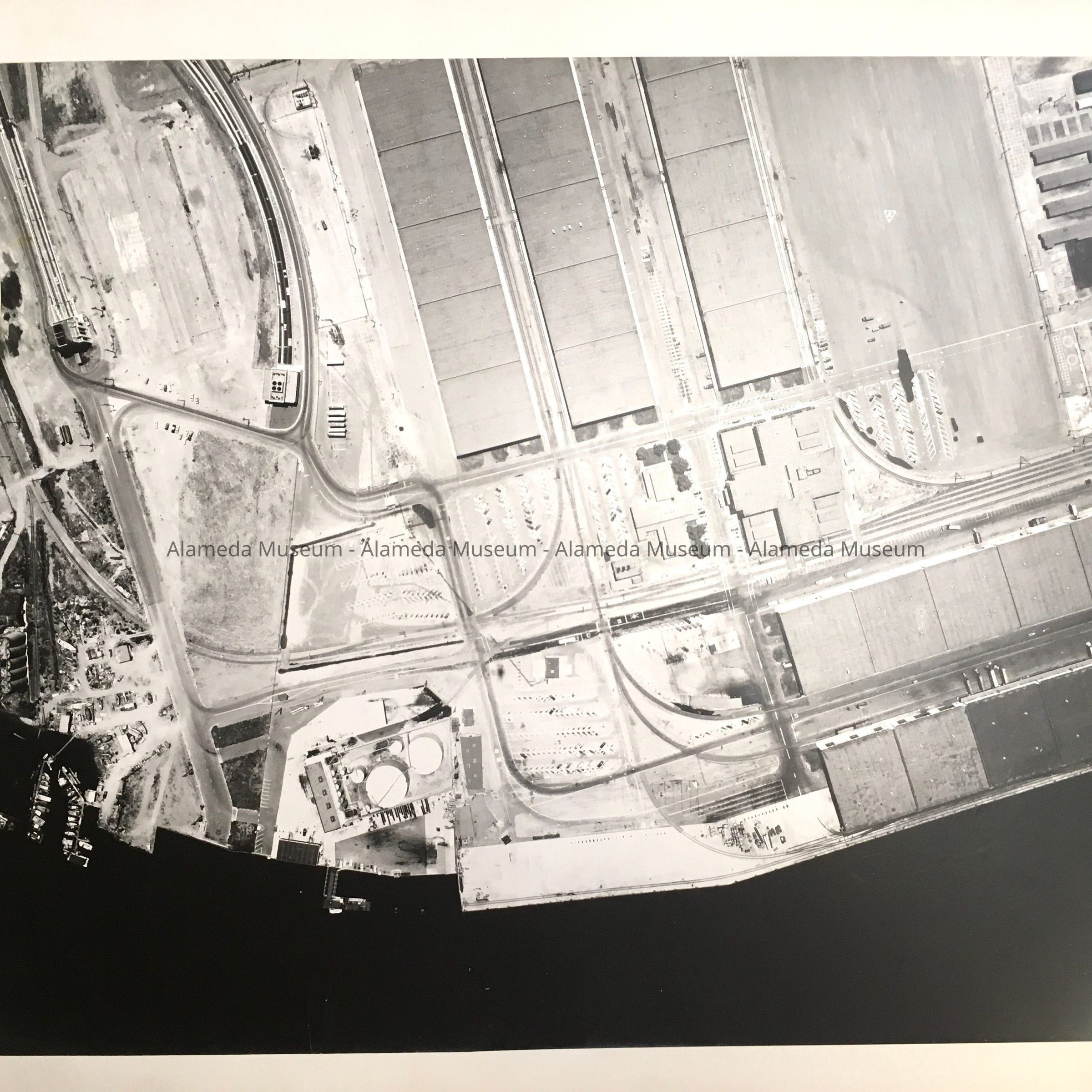
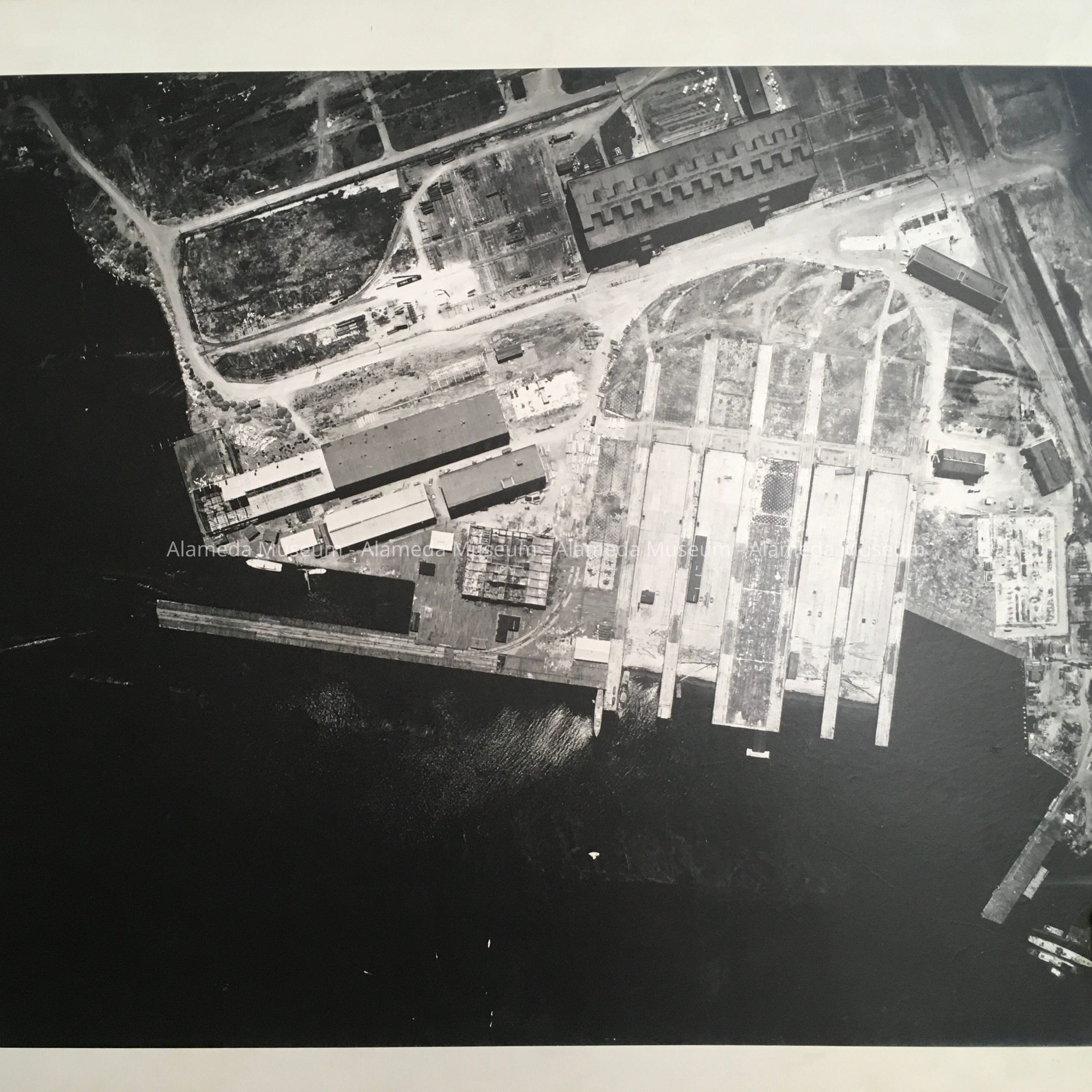
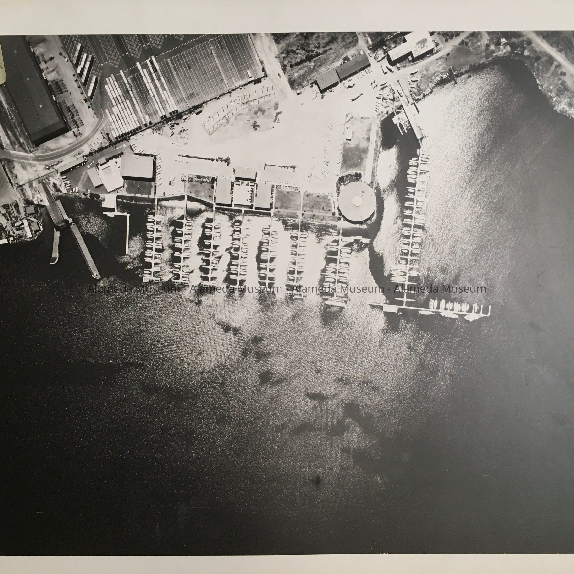
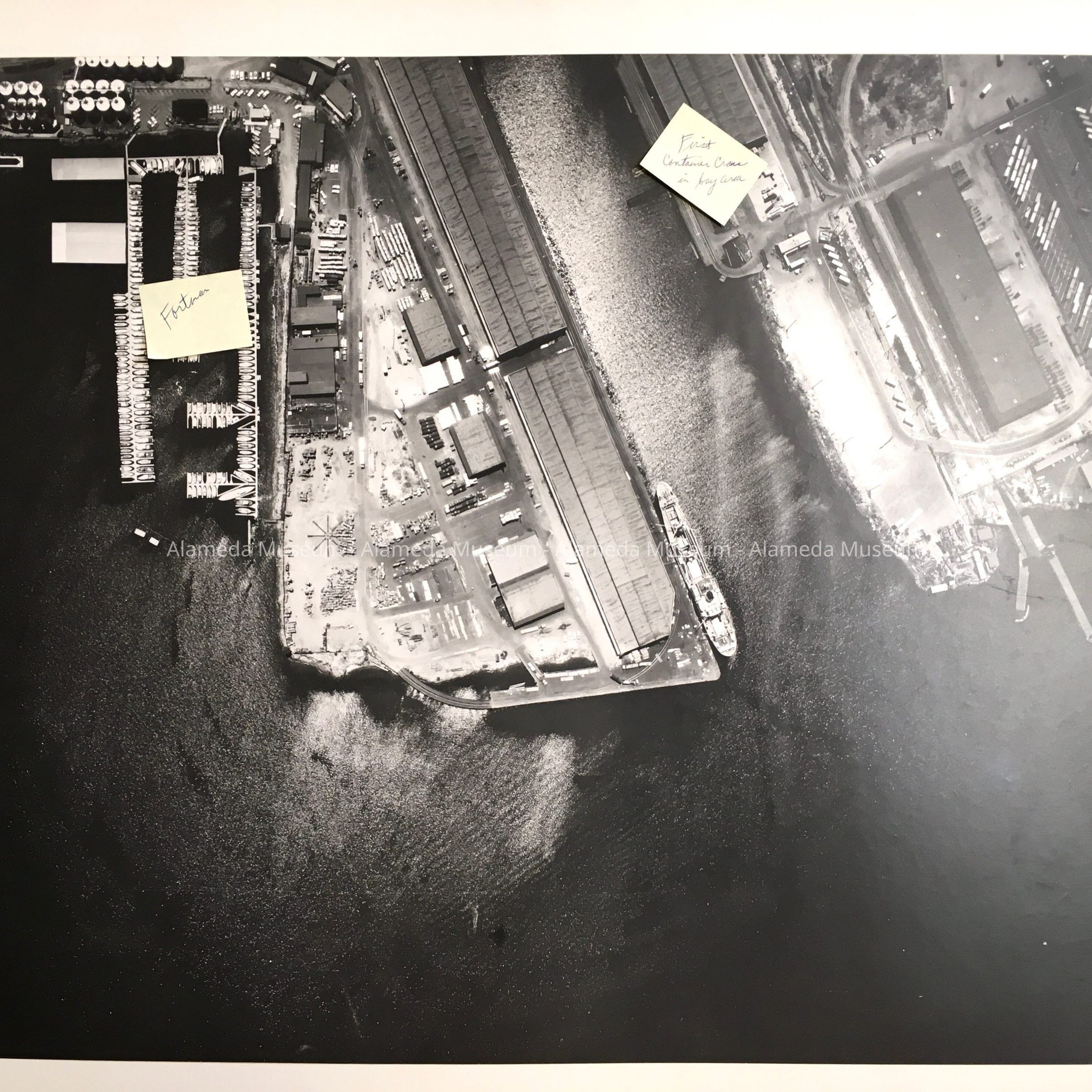
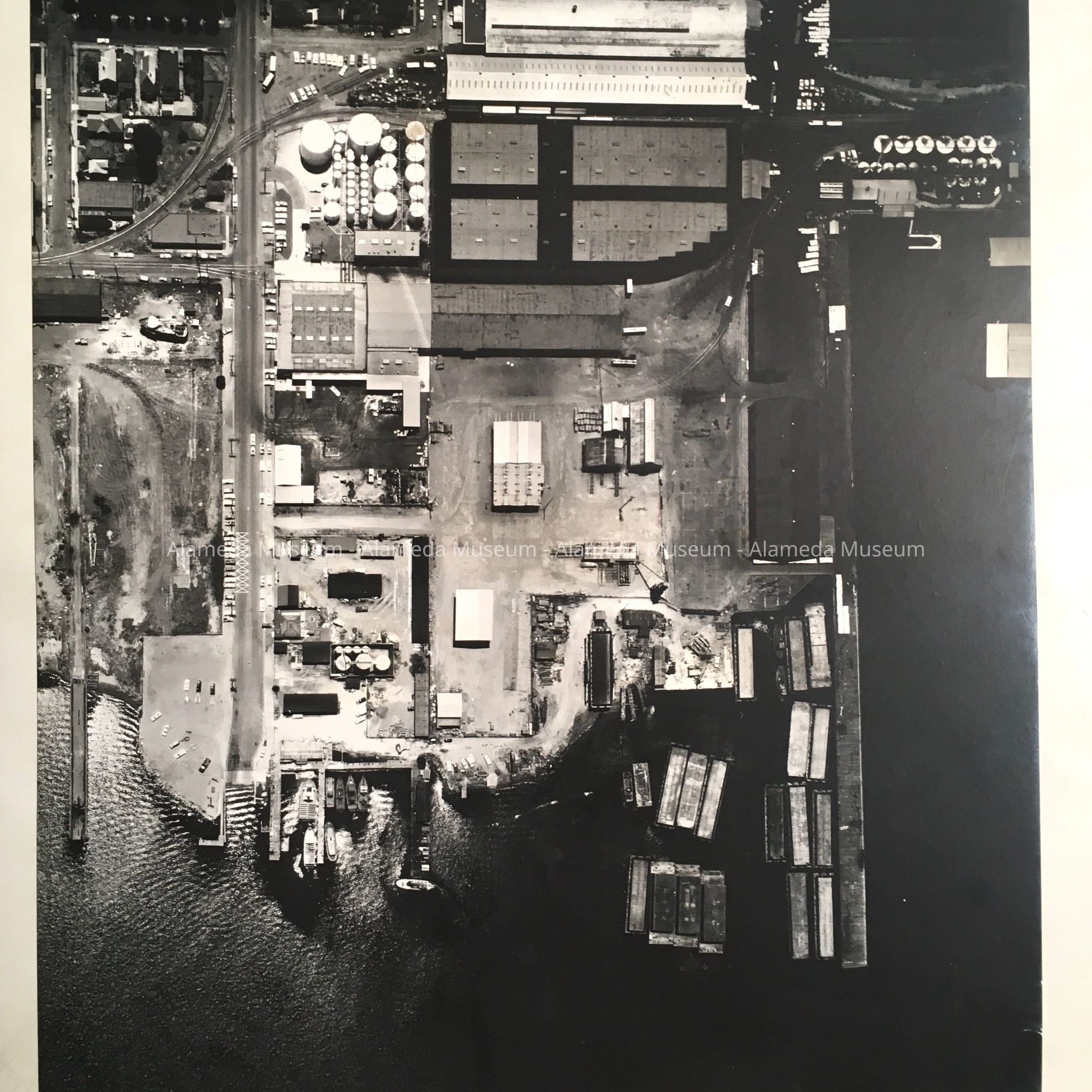
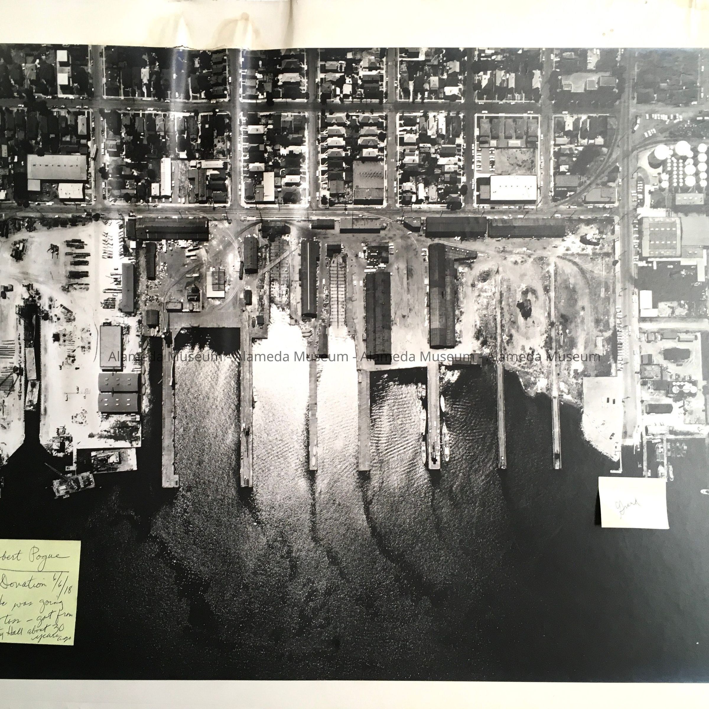
History of Objects: Aerial photographs of industries along the Oakland-Alameda Estuary, c. 1965. Donor obtained them from City Hall, in the 1990s. Visible are (from West End to East): A: Main Street & Big Sawtooth Building; B: just east of same area (Todd Shipyard); C: Webster and Posey tubes (with cars); D: close-up of slipways of Bethlehem Shipyard, with Red Brick Building (power plant building); E: Galleon restaurant at the Pacific Marina; F: Encinal Terminals after installation of the first container crane, & Fortman Basin marina; G: close-up of Pennzoil tanks and foot of Grand; H: piers, from Clement between Grand and Willow; I: Paceco shipbuilding between Willow and Park; J: Park Street Bridge to old Fruitvale car bridge (replaced c. 1970), with Loop Lumber.
Acquired from: Robert Pogue
Donation Date: 6/6/2018; Catalog Date: 3/15/2024