Name/Title
Map of proposed roadway from Webster Street to Unified Engineering Works, 1909Entry/Object ID
2002.53.8Description
Acc. No. 02.53.8
Subject: City of Alameda
Date/Period: 1909
Object: Map
Description:
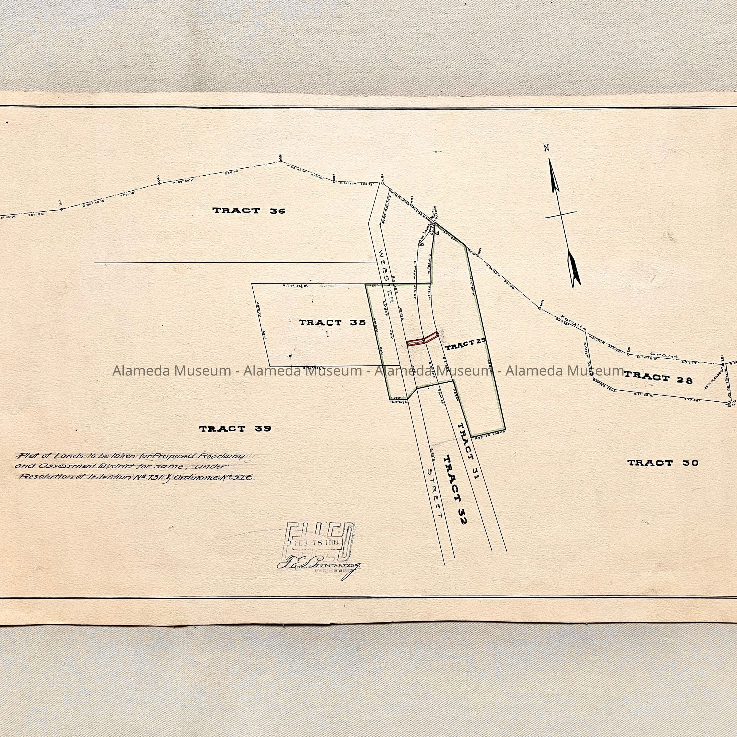
Hand-drawn map accentuated with red and green on an off-white colored background.
Size: L12-1/2” x W22-1/2”.
The following collection of documents found in the attic of the City Hall prior to refurbishment of the building in the 1990's.
History:
Tract map with proposed roadway from Webster Street. This served as evidence in the Resolution of Intention. Proposed roadway from Webster Street to the Unified Engineering Works.
Acquired From: City of Alameda
Date: 2/23/02