Name/Title
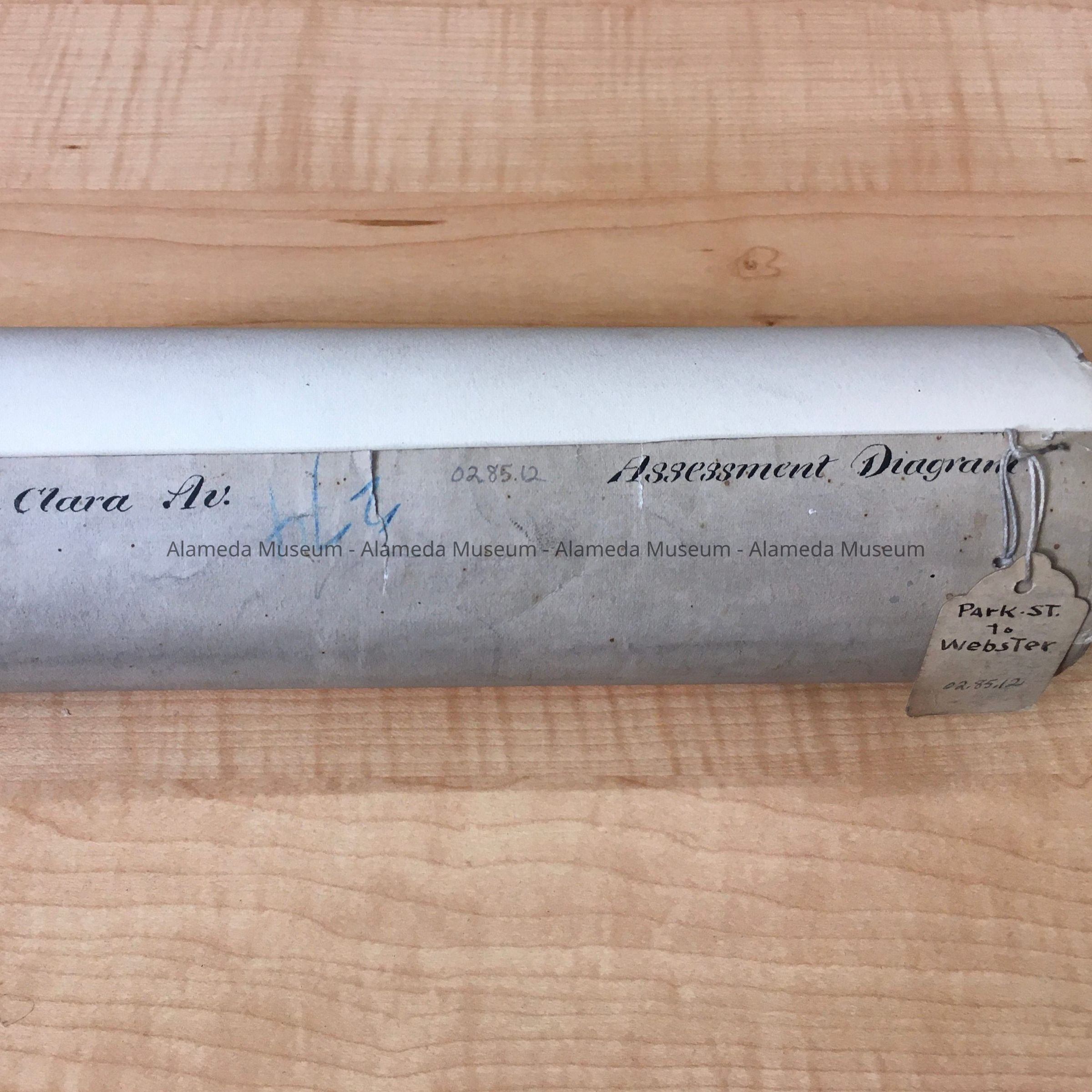
Assessment Diagram of Santa Clara Ave, Park to Webster, 1880Entry/Object ID
2002.85.12Description
Acc. No. 02.85.12
Subject Category: City of Alameda
Date or Period: 1880
Object: maps and plans
Description:
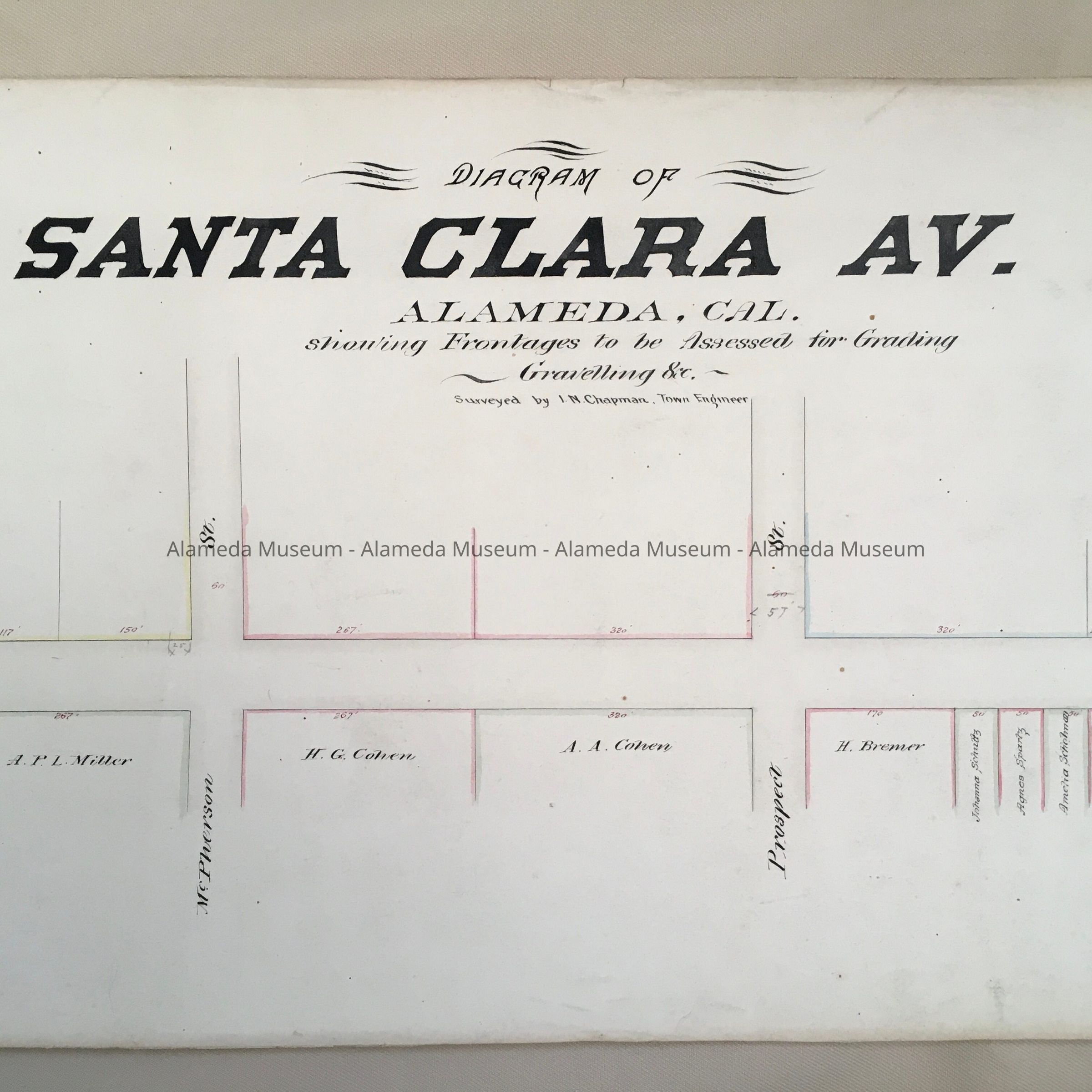
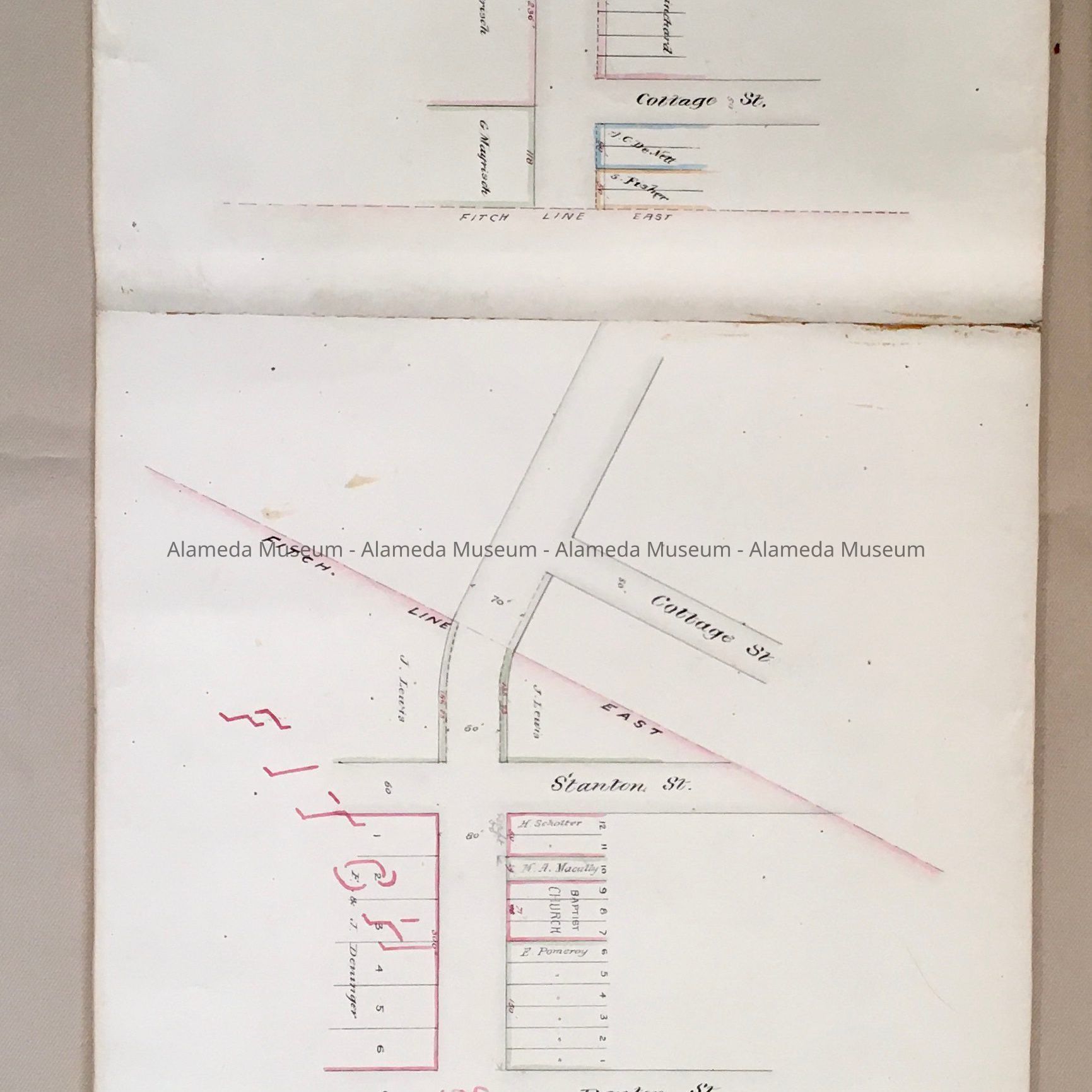
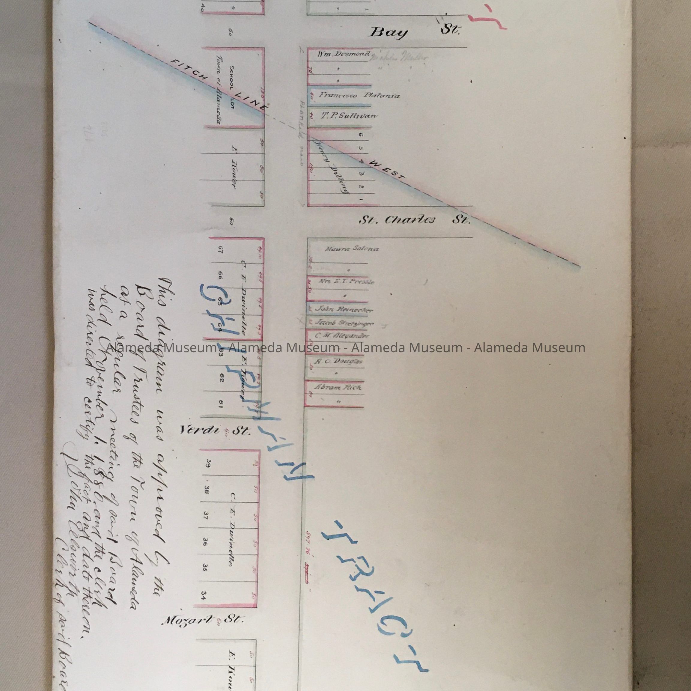
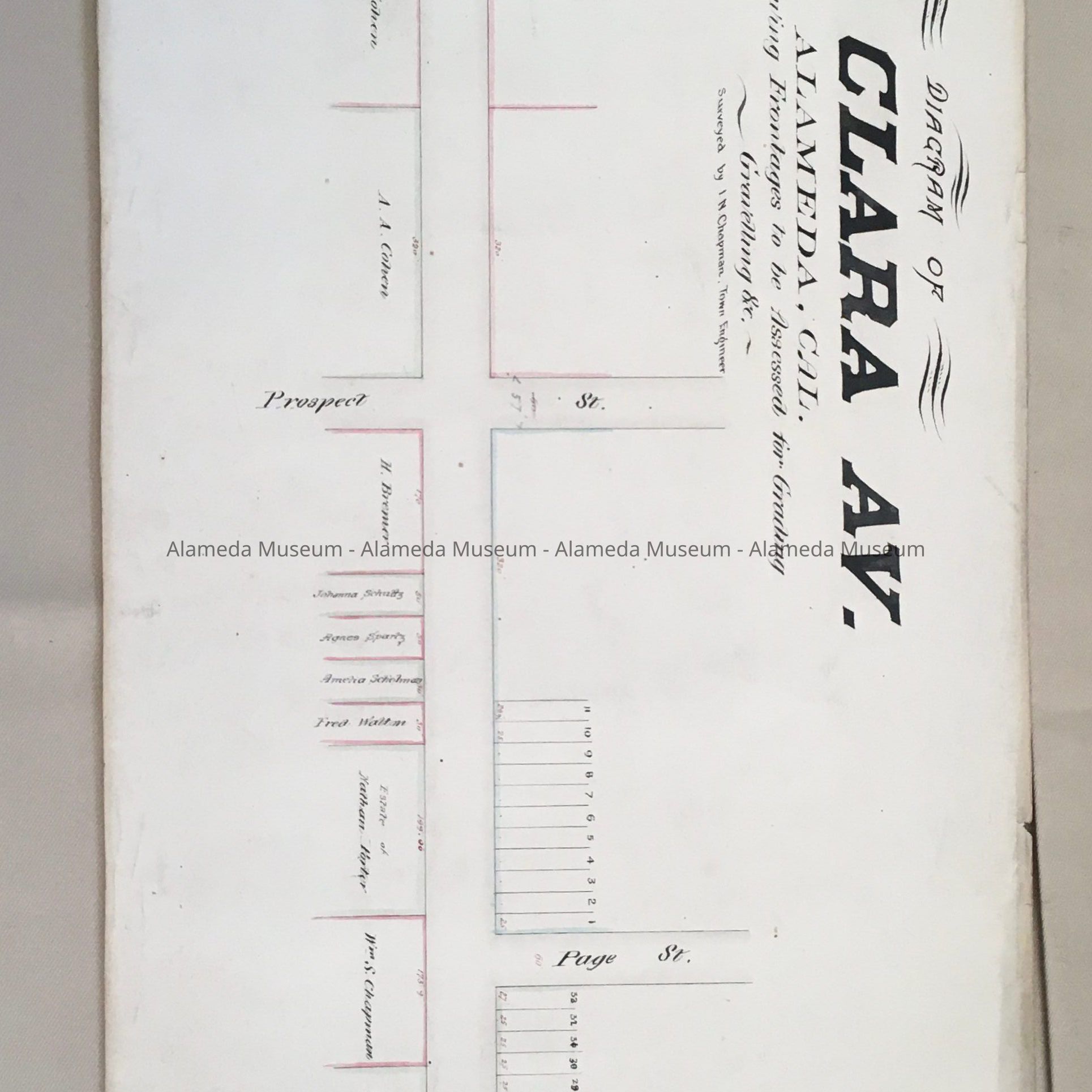
Long, narrow diagram, rolled up into a scroll, with written in ink on the edge of the roll: 'Santa Clara Av.' and 'Assessment Diagram'. An attached tag, which may be original, states 'Park .St. to Webster'. In blue pencil, upside down, is written the number 274. Inside is printed in ink: 'Diagram of/Santa Clara/ALAMEDA, CAL./Showing Frontages to be Assessed for Grading/ Gravelling Etc./Surveyed by I.N. Chapman, Town Engineer'.
Size: L 117" x W 11".
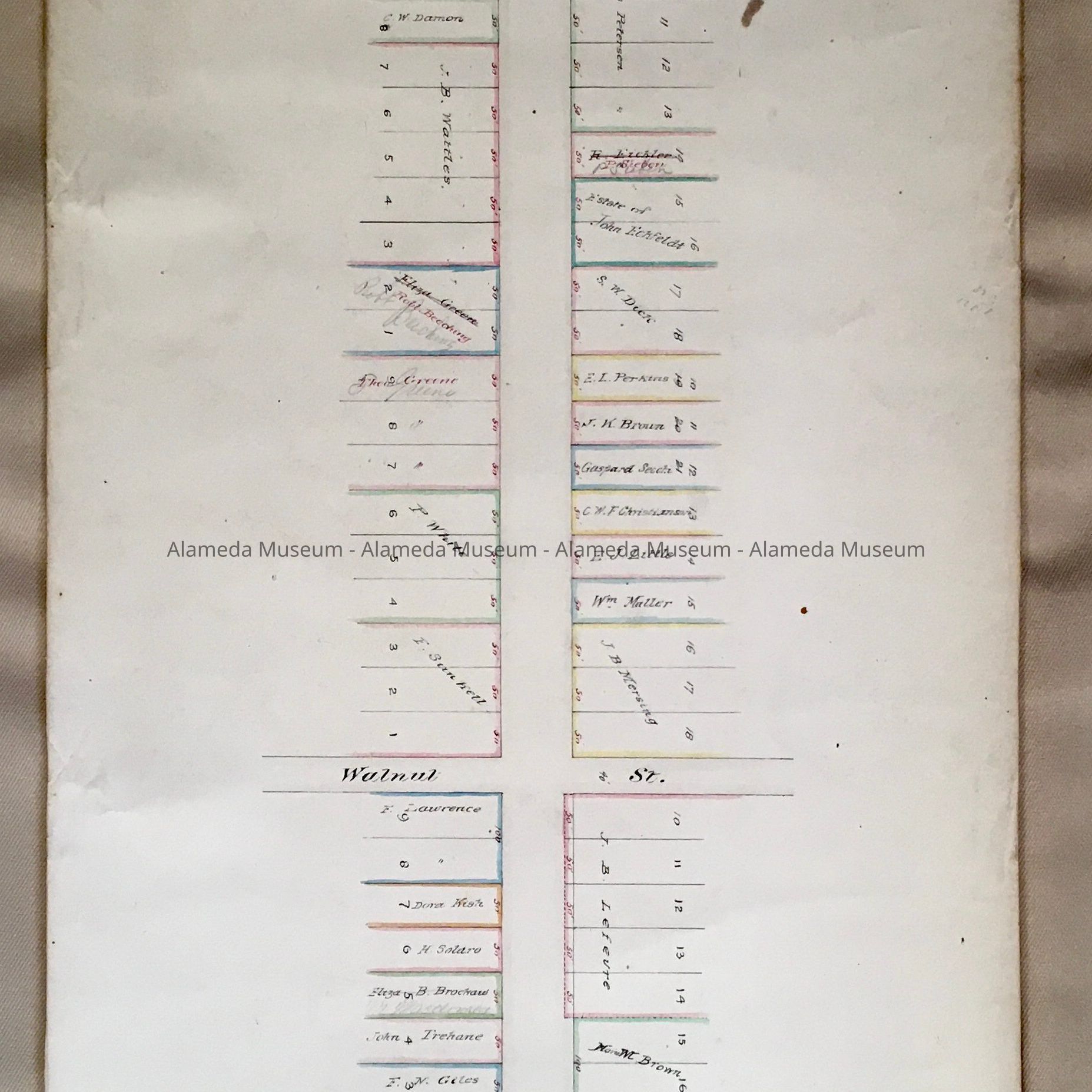
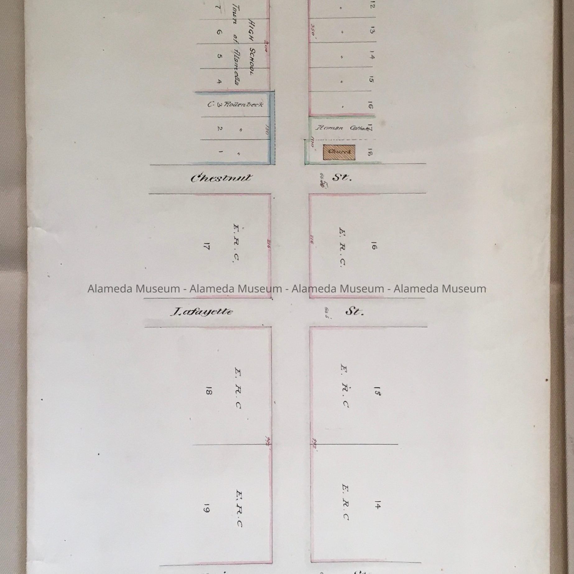
History of Object: Assessment Diagram showing Santa Clara from Park Street to Webster, created by the town engineer, approved by the Board of Trustees on November 1, 1880. The Diagram shows lots with numbers, sizes, and owner's names, some with corrections in red, and pencil, as well as cross streets.
Acquired from: City of Alameda
Cataloged: August 24, 2002