Name/Title
Modified Chamber of Commerce Map and brochure, c. 1945Entry/Object ID
2011.61.1Description
Accession No. 11.61.1
Subject Category: City of Alameda; Naval Air Station
Date or Period: c. 1945
Object: Folding Map and Brochure
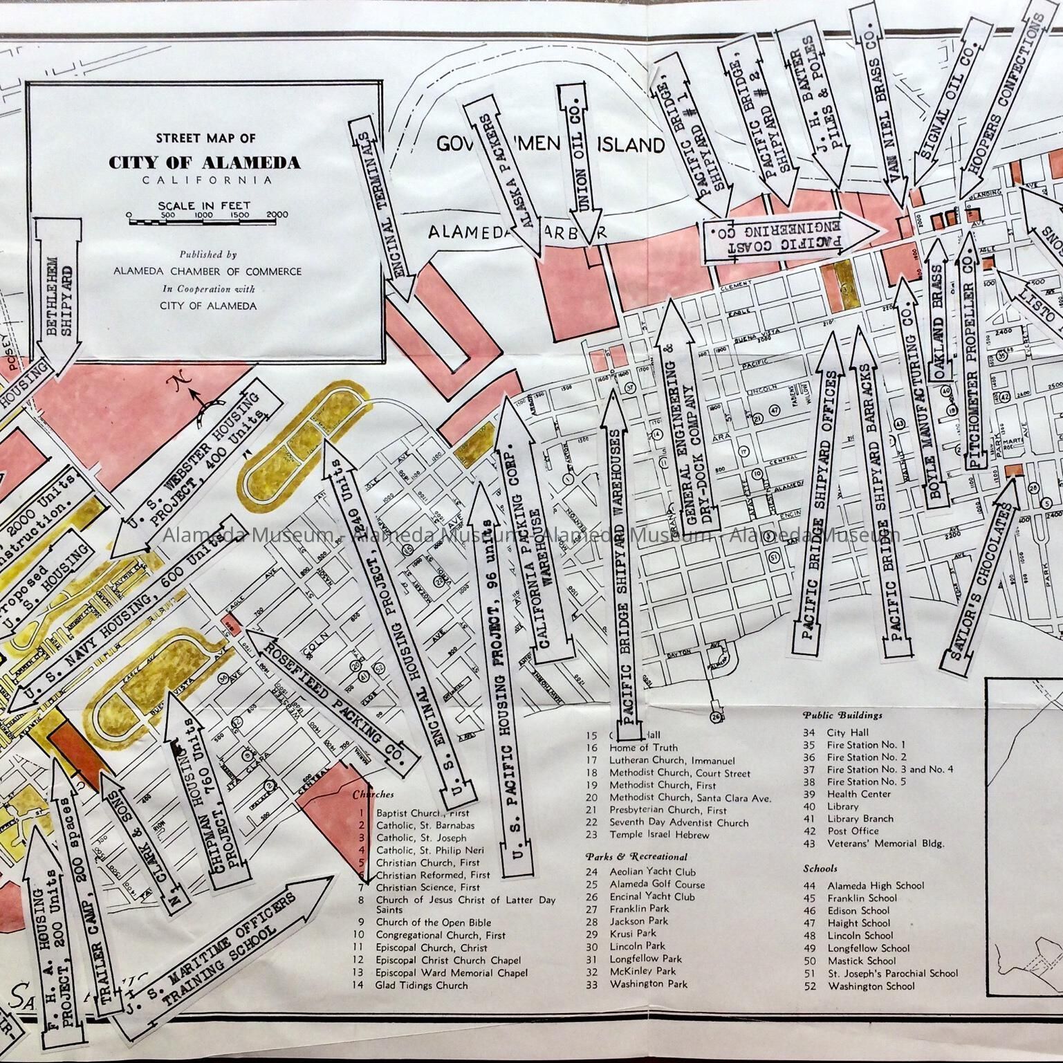
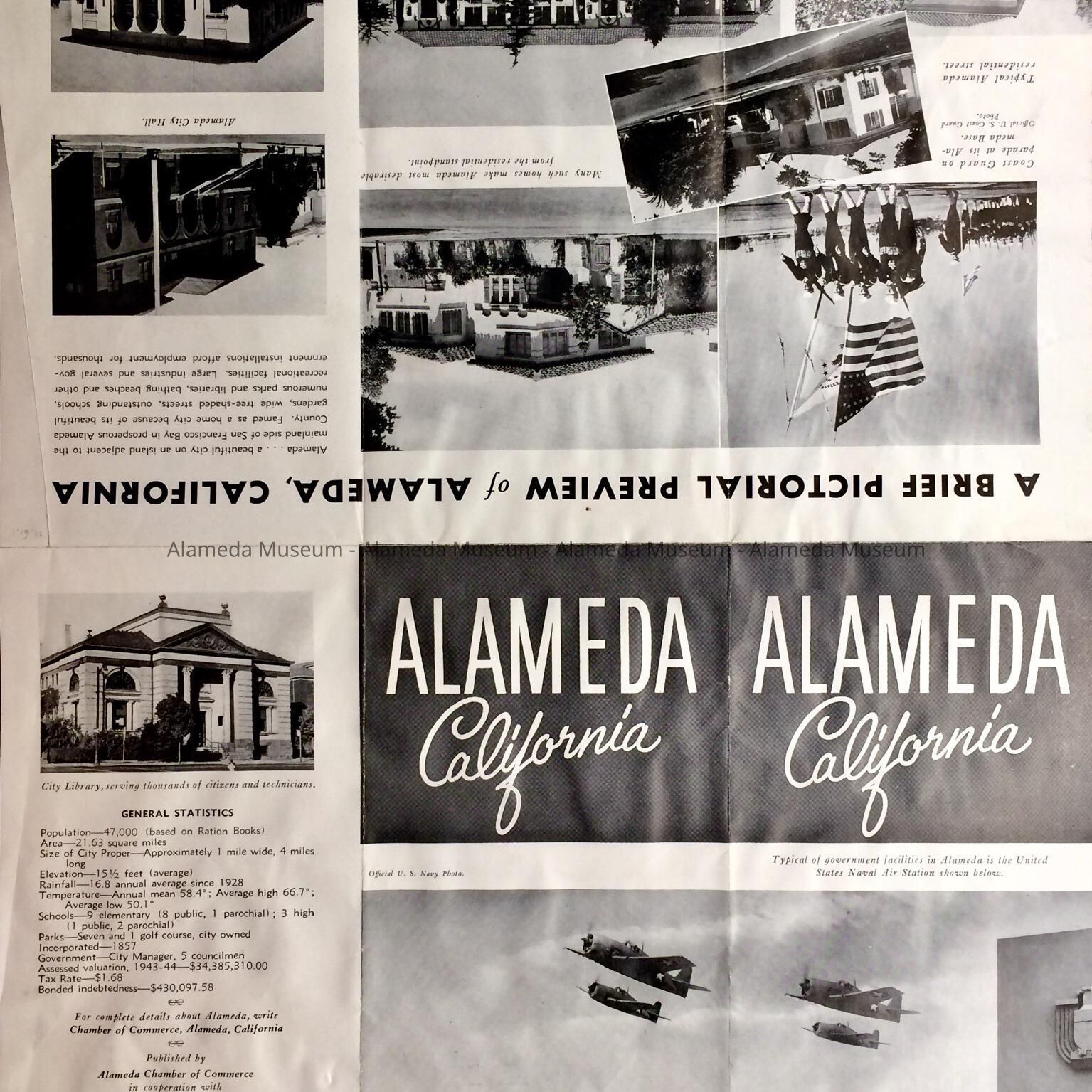
Description: Undated folding ‘Street Map of City of Alameda, California, published by the Alameda Chamber of Commerce in Cooperation with City of Alameda’, with applied arrow-shaped labels and highlighted in pink, yellow, and what is now brownish and may have been a different color originally, pointing to military housing projects. On the reverse ‘A Brief Pictorial Preview of Alameda, California’, illustrated with black-and-white photos of scenes from Alameda, with some of them reflecting military activity. Under statistics is listed the assessed valuation of 1943-1944.
Size: folded L 9” X W 4”; unfolded: L 12” X W 18”
History of Object: Modified c. 1945 map of Alameda, which may have been used as template for a map for military personnel. Map was found among City documents found in the attic of City Hall in the 1990s.
Acquired from: City of Alameda
Date Cataloged: 9/10/11