Name/Title
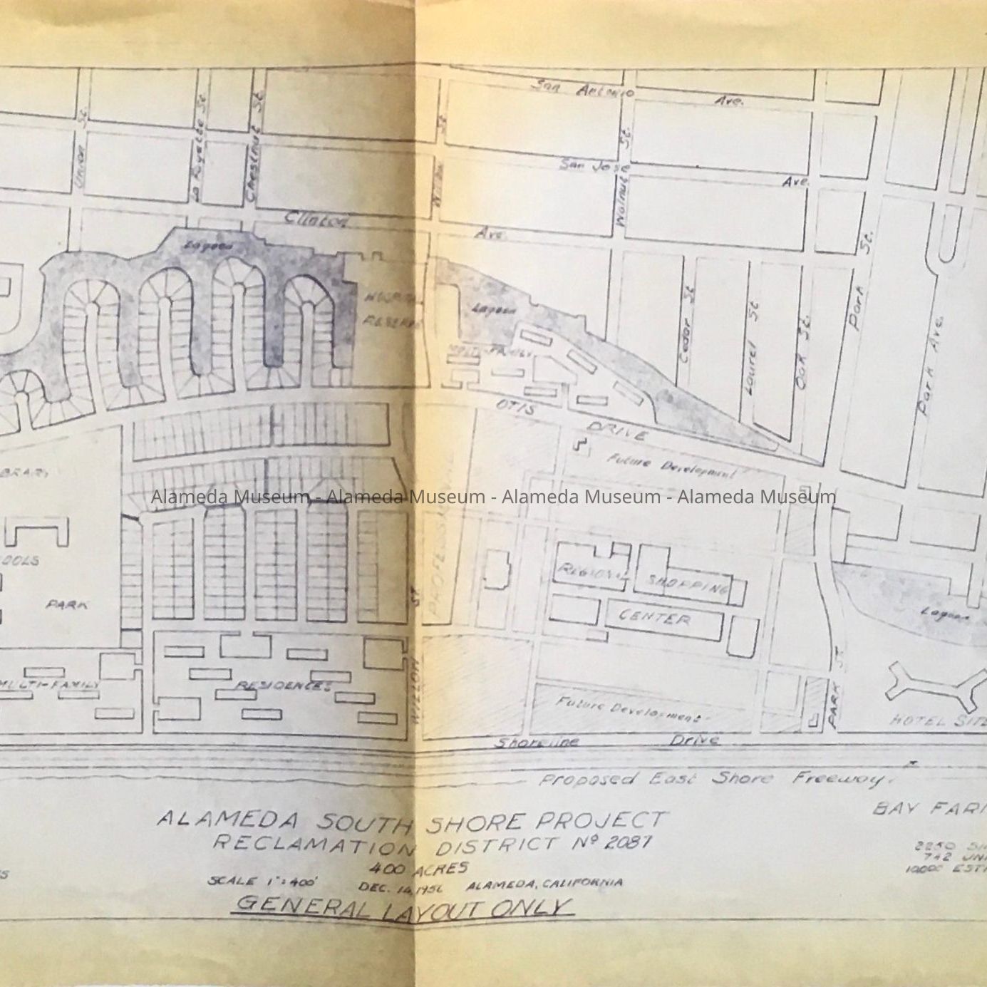
Map of South Shore Project, General Layout, 1956Entry/Object ID
2024.80.1Description
Acc. No. 24.80.1
Subject Category: City of Alameda, Planning, South Shore; Ballena Bay Island
Date or Period: 1956
Object: report
Description: A reproduced map on yellowing paper with dark purple-blue and originally handdrawn lettering, central legend: Alameda South Shore Project / Reclamation District No. 2087 / General Layout Only, with to left, heading ' South Shore / 400 acres' and to the right 'Bay Farm Island Project / 890 acres'.
Size: L 32 1/2 by 12 inches.
History of Object: General layout plan for the South Shore development, showing lagoons, a hotel, park, schools, library, shopping center, a proposed freeway and beach, and roads laid out for single residences.
No particular reason for the donor to have the map was given.
Acquired from: Susan Espinoza
Donation Date: 10/12/2024
Catalog Date: 10/28/2024