Name/Title
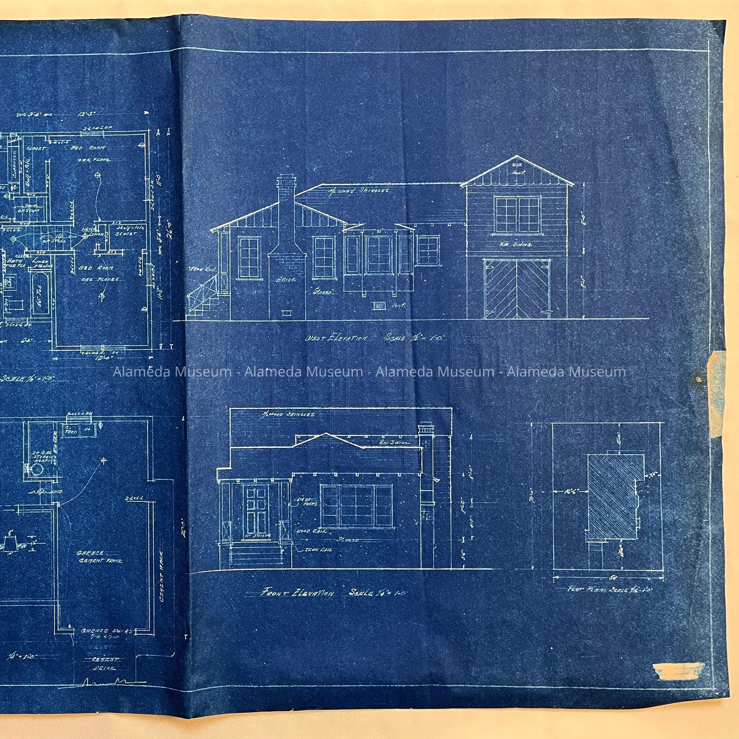
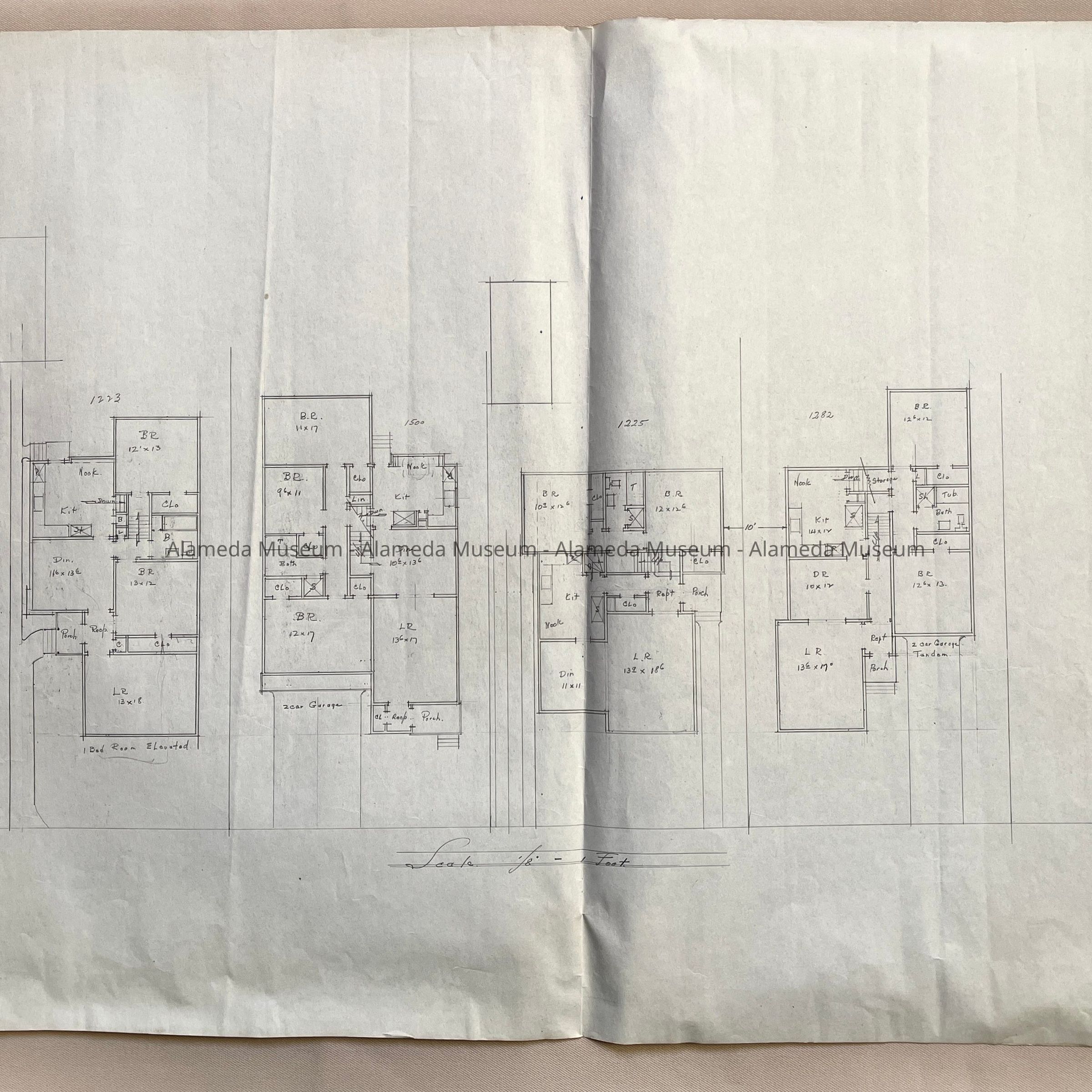
Blueprint of a house and map of 4 floor plans, c. 1920s-1930sEntry/Object ID
2025.38.29Description
Acc. No. 25.38.29
Subject Category: Homes of Alameda
Date or Period: 1920s-1930s
Object: drawing, architectural
Description: Blueprint of a split-level house, with foundation plan, floor plan, front elevation and West elevation of a home on a corner lot. No information regarding date, architect, builder, nor address. Verso has a hand-drawn map of 4 houses, with numbers 1223, 1500, 1225, and 1282 - presumably combined floor space for each house. Street not specified.
Size: L 30 x W 20 1/2 inches.
History of Objects: A blueprint and map likely from the attic of the Office of H.G. or C.G. Mehrtens, real estate brokers. The address of the house on the blueprint, and the houses on the reverse, are unknown.
Donor: unknown
Catalog Date: 2/26/2025