Name/Title
Subdivision map, Oak / Blanding / Buena Vista, 1870sEntry/Object ID
2002.80.6Description
Acc. No. 02.80.6
Subject: Maps
Date/Period: 1870's
Object: Maps, Subdivision
Description:
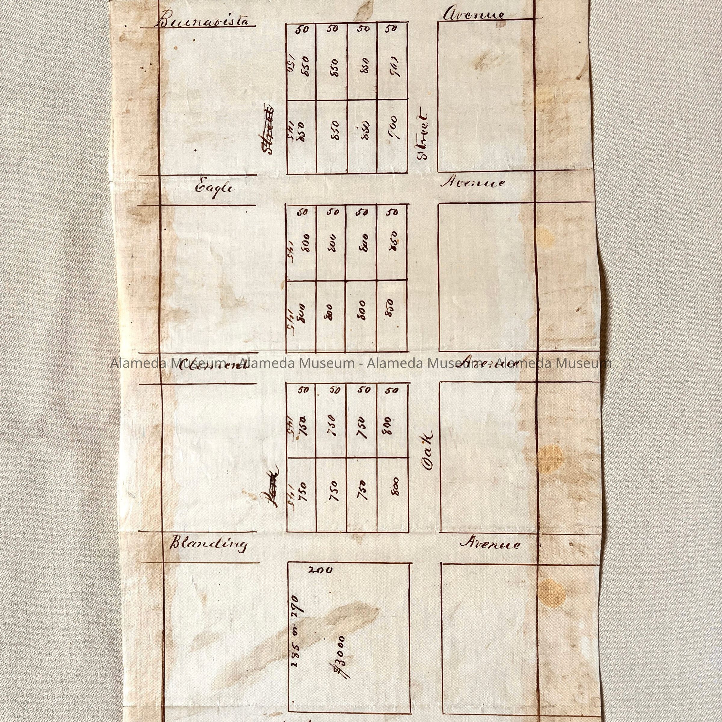
Hand-drawn map in sepia-colored ink on polished white-colored linen paper.
Size: L15-3/4 x W8 inches.
History:
Subdivision map of property located in the blocks west of Oak Street, bounded by Blanding and Buena Vista Avenues. Lots have numbers that appear to be the possible sales price.
This collection of maps, etc., found in the attic of City Hall prior to the rehabilitation and seismic upgrades in the late 1990's.
Acquired From: City of Alameda
Date: 7/28/02