Name/Title
Subdivision Map of Everett Street, 1890Entry/Object ID
2002.80.1Description
Acc. No. 02.80.1
Subject: Maps
Date/Period: 1890
Object: Maps, Subdivision
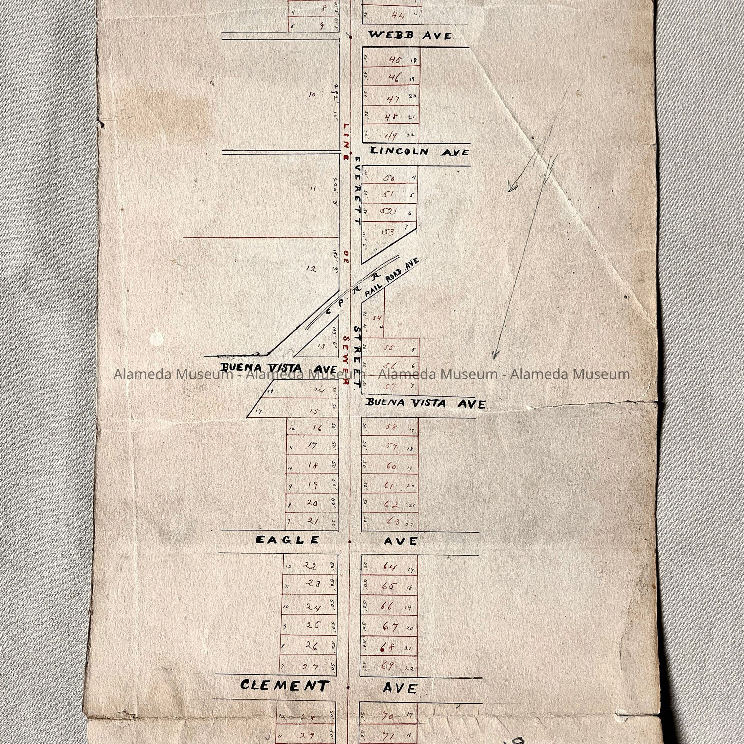
Description:
Hand-drawn map in black and red colored ink.
Size: L14 x W7-1/4.
History:
Map of Everett Street with numbered individual lots. Map extends from Santa Clara to Blanding Avenue.
This collection of maps, etc., found in the attic of City Hall prior to the rehabilitation and seismic upgrades in the late 1990's.
Acquired From: City of Alameda
Date: 7/28/02