Name/Title
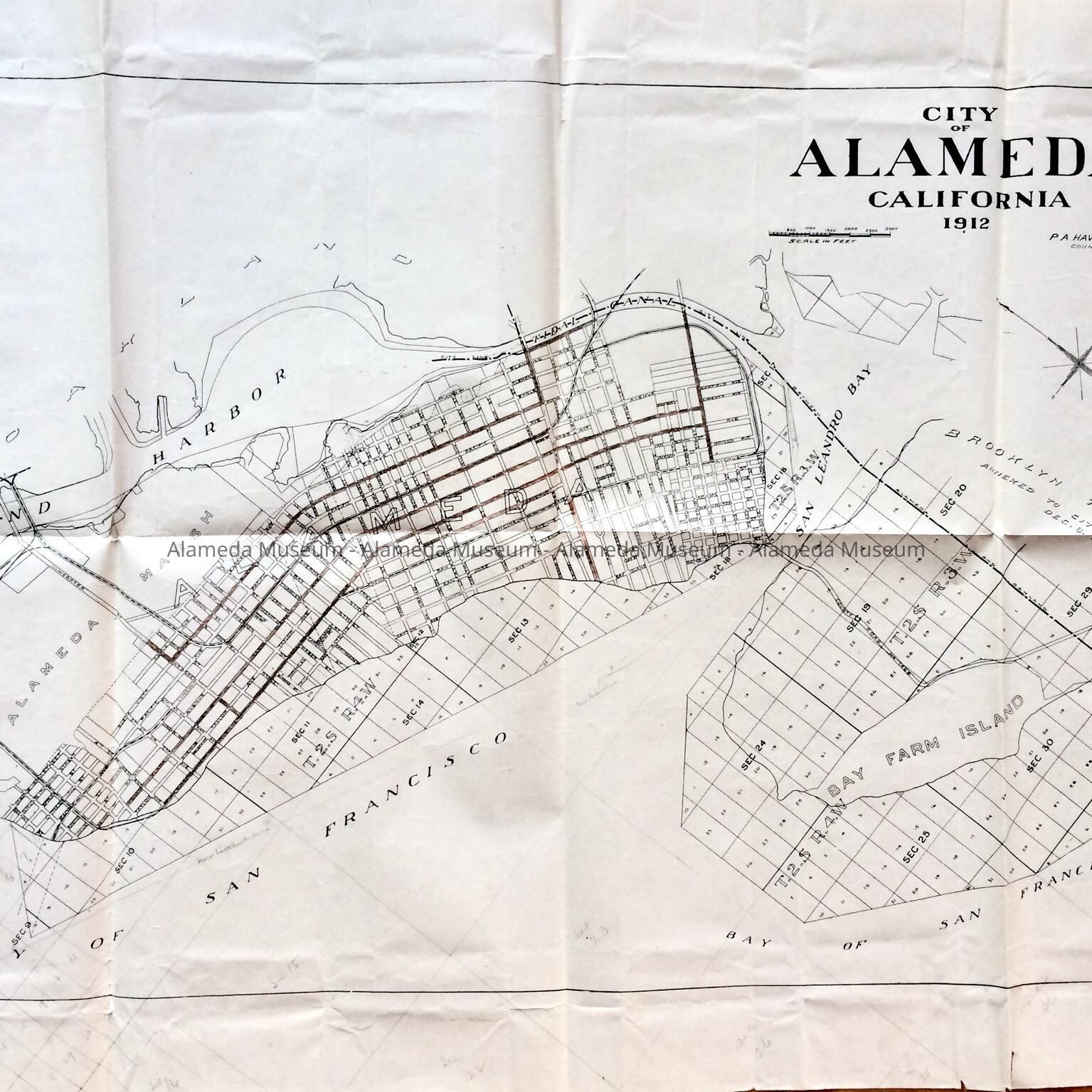
Map of City of Alameda, 1912Entry/Object ID
2011.39.6Description
Acc. No. 11.39.6
Subject Category: City of Alameda
Date or Period: 1912
Object: Map
Description: Paper map of Alameda, caption "City of Alameda 1912", including Bay Farm Island. Map shows subdivisions and future location for Waterside Terrace, but not yet named. See area on map above Garfield Avenue. Lots in the Bay have been partially added in pencil. Some streets have been colored in reddish-brown pencil, for use in documents of item 2180. County Road No. 1468 is indicated on Bay Farm Island. Map is signed P.A. Haviland, County Surveyor. Map has stamped number 85-2 on the lower right, and 2180-3 handwritten in black ink on the back.
L 20” X W29 1/2"
History of Object: Map is part of a collection of documents found in the Attic of City Hall during remodeling in the 1990s. This map was part of the documents relating to street improvements undertaken after election of Mayor Frank Otis (1913), filed under item 2180-3, now part of Acc. No. 11.39.5.
Acquired from: City of Alameda
Date: August 20, 2011