Name/Title
Photocopy of a map of Woodstock, 1878, 1922.Entry/Object ID
2023.35.2Description
Acc. No. 23.35.2
Subject Category: Woodstock, Real Estate
Date or Period: 1878, 1922
Object: Map, Photocopy
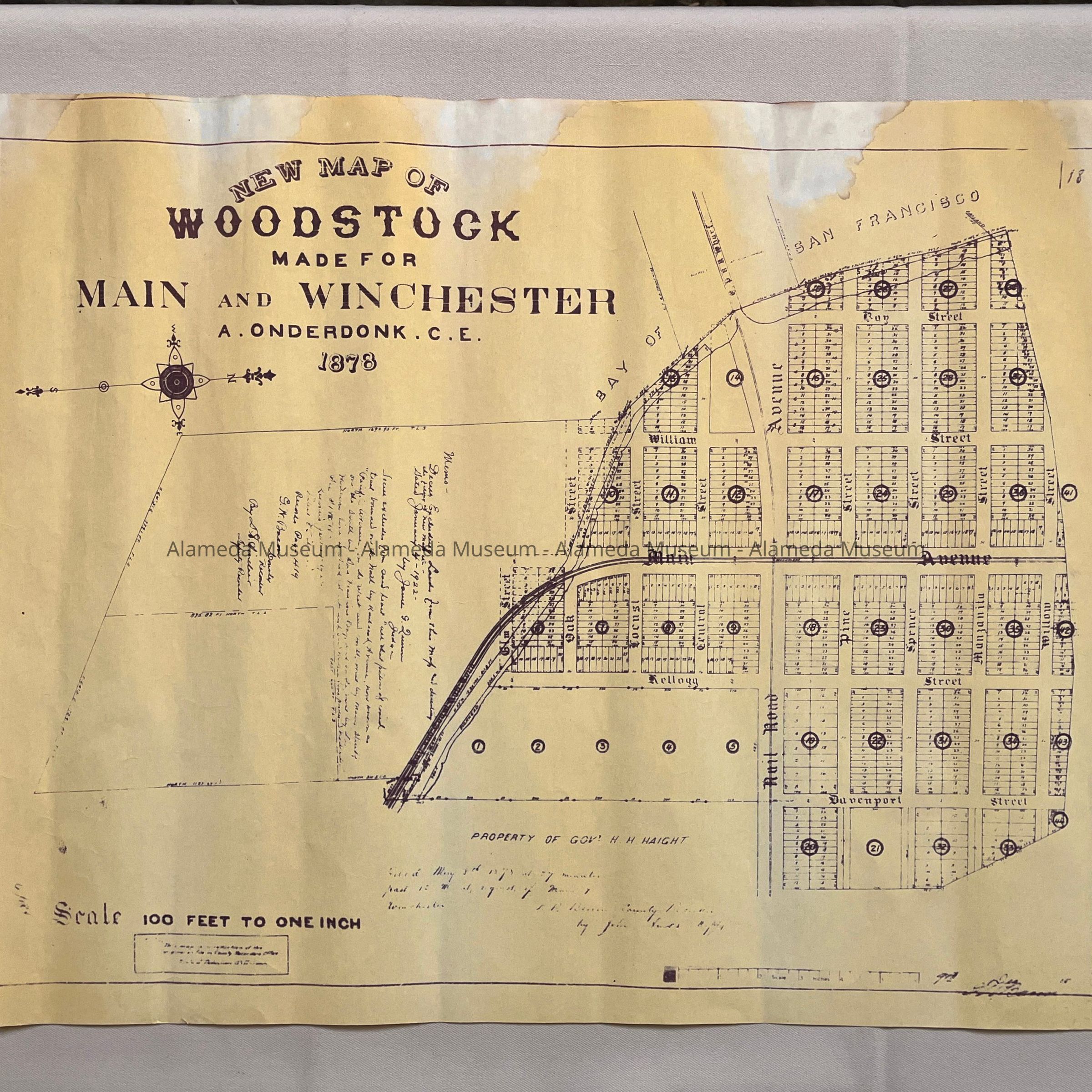
Description: a photocopy in purple type on yellowish-tan colored paper of a monochromatic map titled 'New Map of / Woodstock / made for / Main and Winchester / A. Onderdonk C.E. / 1878', scale 100 feet to one inch. Showing Elm, Locust, William, Manzanita, Davenport, Kellogg and Boy streets and the CPRR Wharf. Property of Gov. H.H. Haight is explicitly written in. The copied handwritten text reflects a date of January 4, 1922, signed by James G. Quinn, Judge, and is also signed by G. N. Bacon and D.S. Sinclair, deputy recorders.
Size: L 19 1/4 x W 23 3/4 inches
History of object: photocopy found, unlabeled, unmarked, without further information, among the cataloged maps. The quality of the photocopy is mediocre, the copied handwriting barely legible. It appears to be a copy of a map used in a 1922 court proceeding.
Acquired from: unknown
Catalog Date: 11/13/2023