Name/Title
Map of Santa Clara Ave. from Park Street to Webster Street, 1876Entry/Object ID
2002.85.15Description
Acc. No. 02.85.15
Subject Category: City of Alameda
Date or Period: 1876
Object: maps and plans
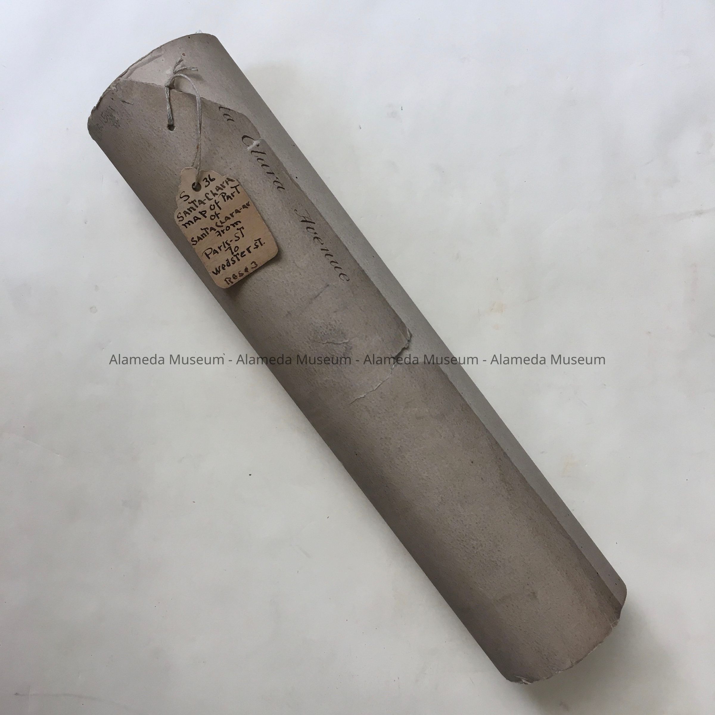
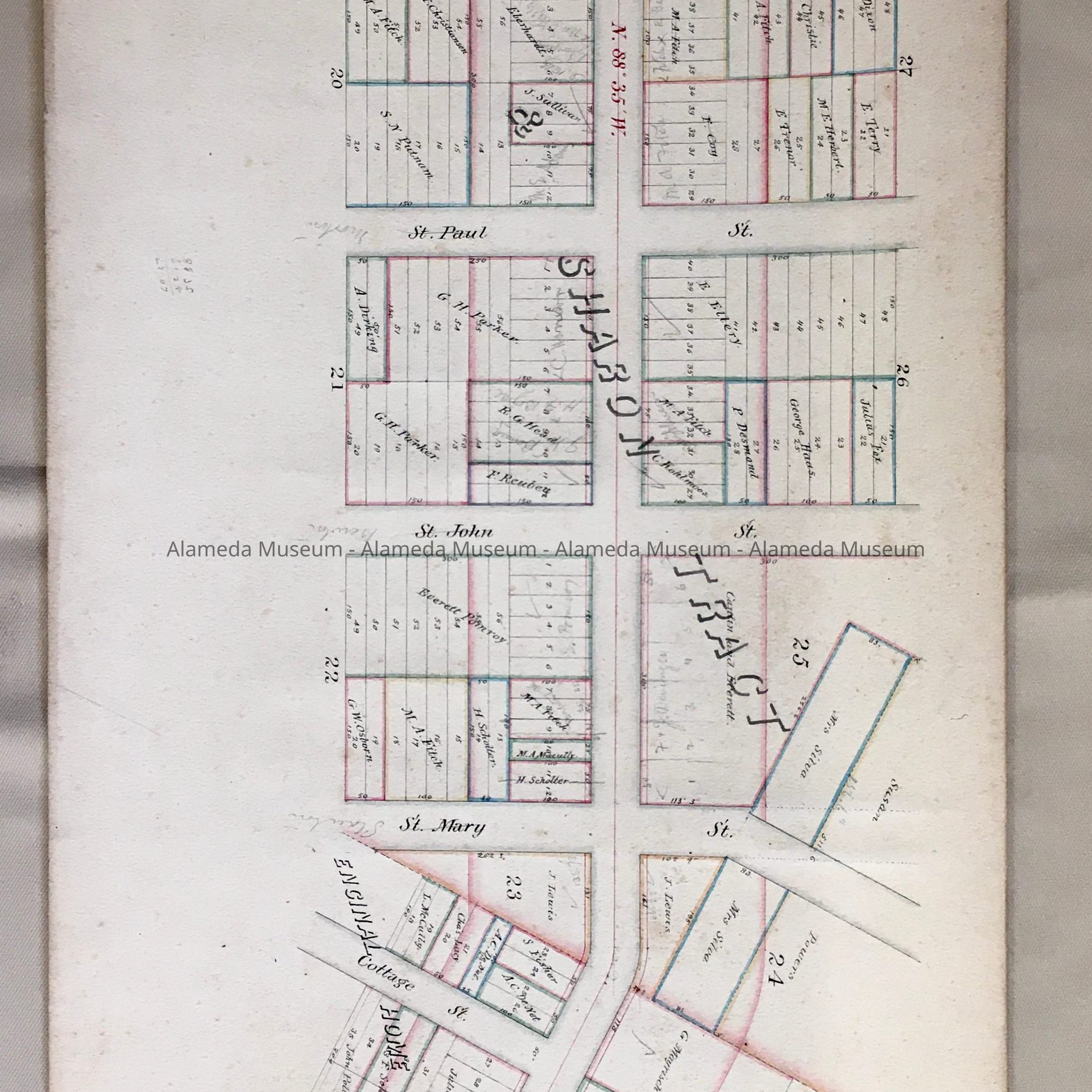
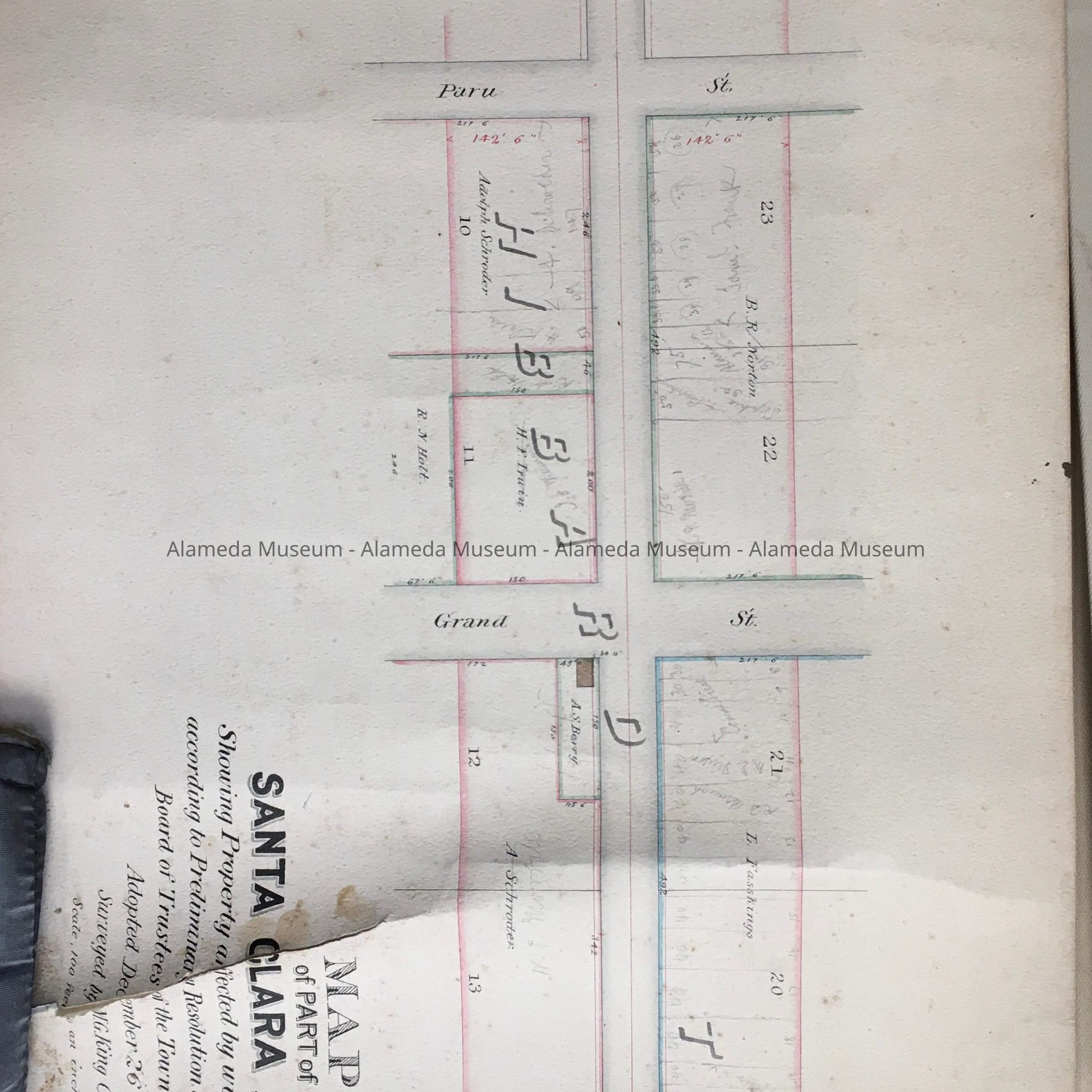
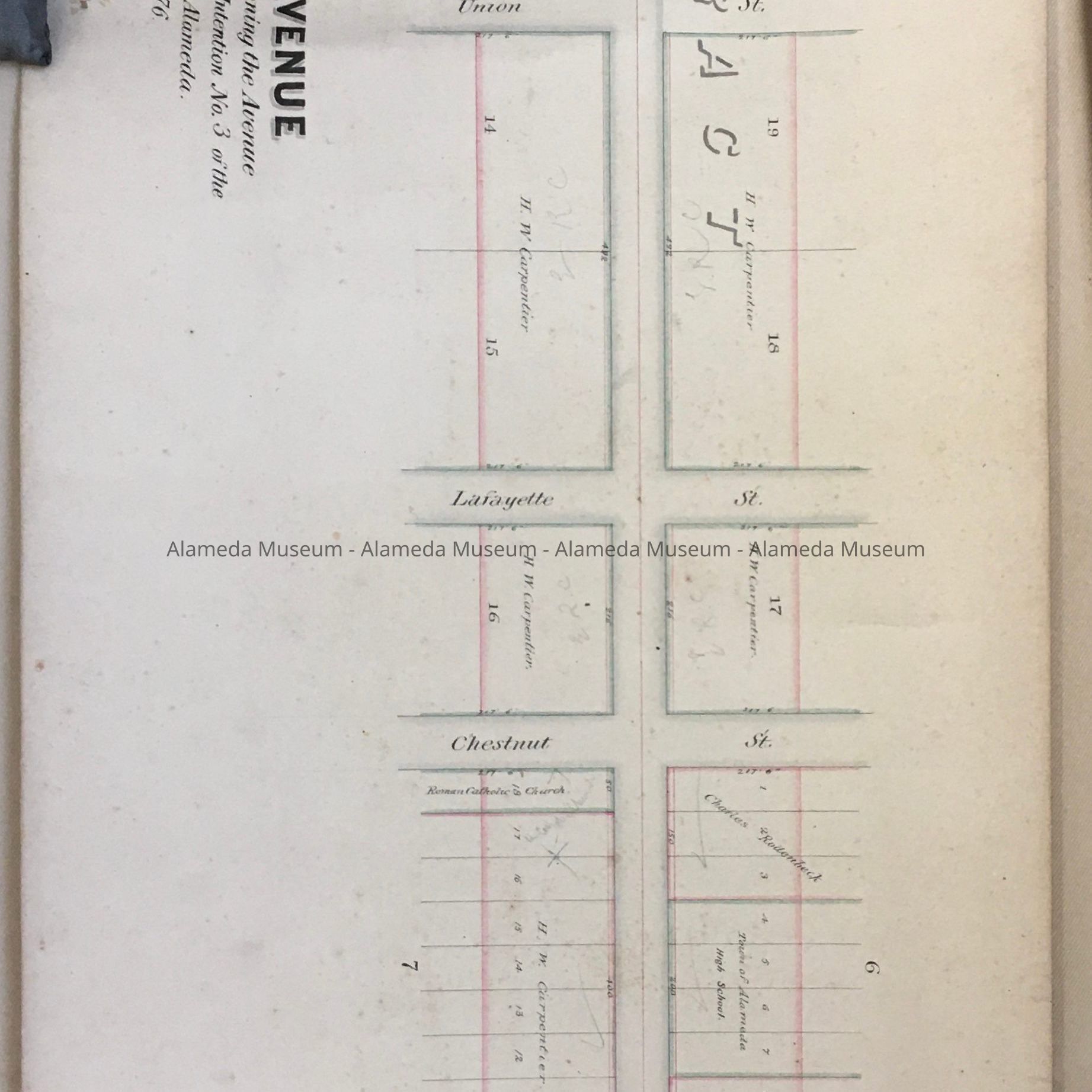
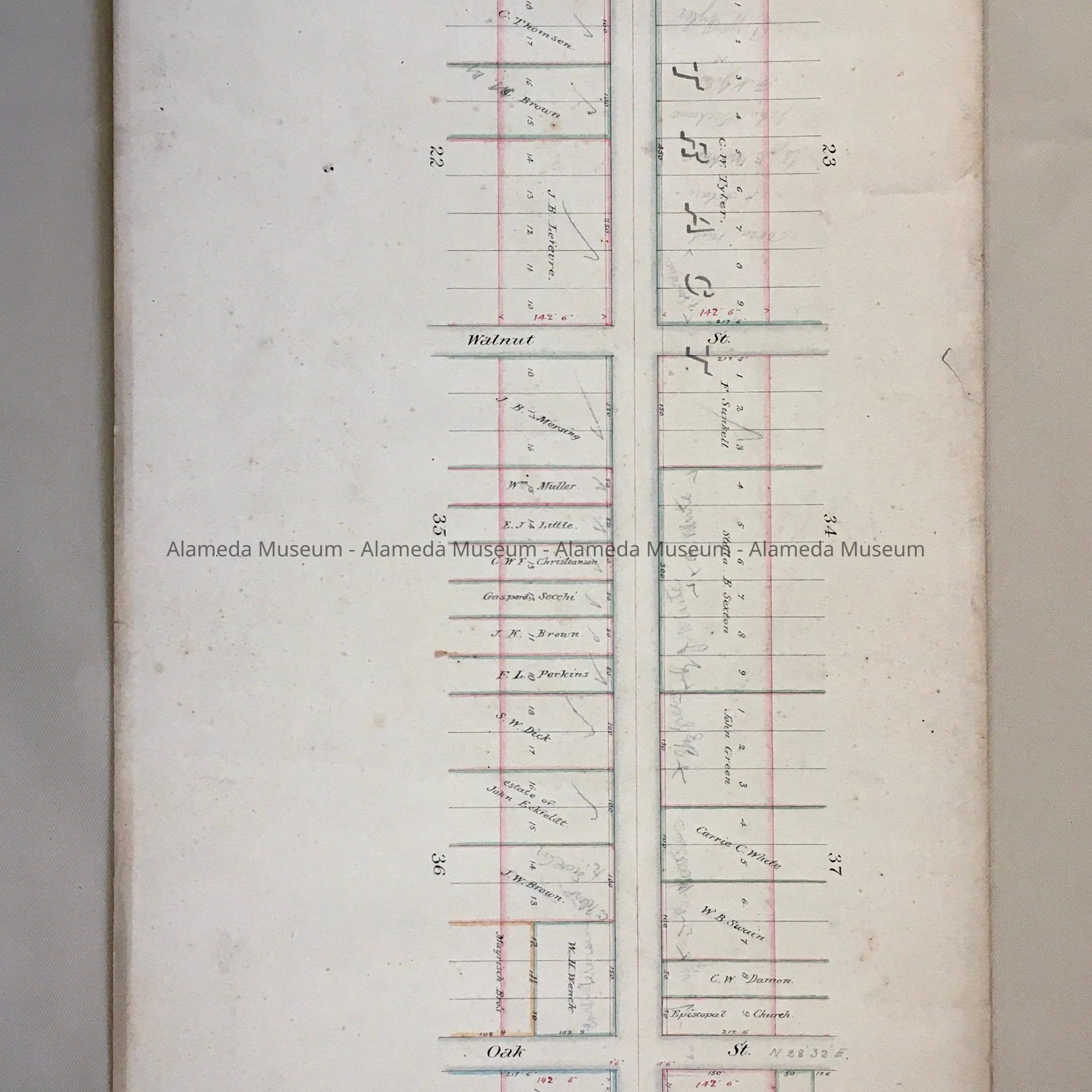
Description: rolled up paper, with on the edge of the scroll in ink: '[Sant]a Clara Avenue. A tag, appears to be original, is attached, stating handwritten: 'S 36, Santa-Clara/map of Part of Santa Clara Av. from Park-St to Webster St./Rese3'.
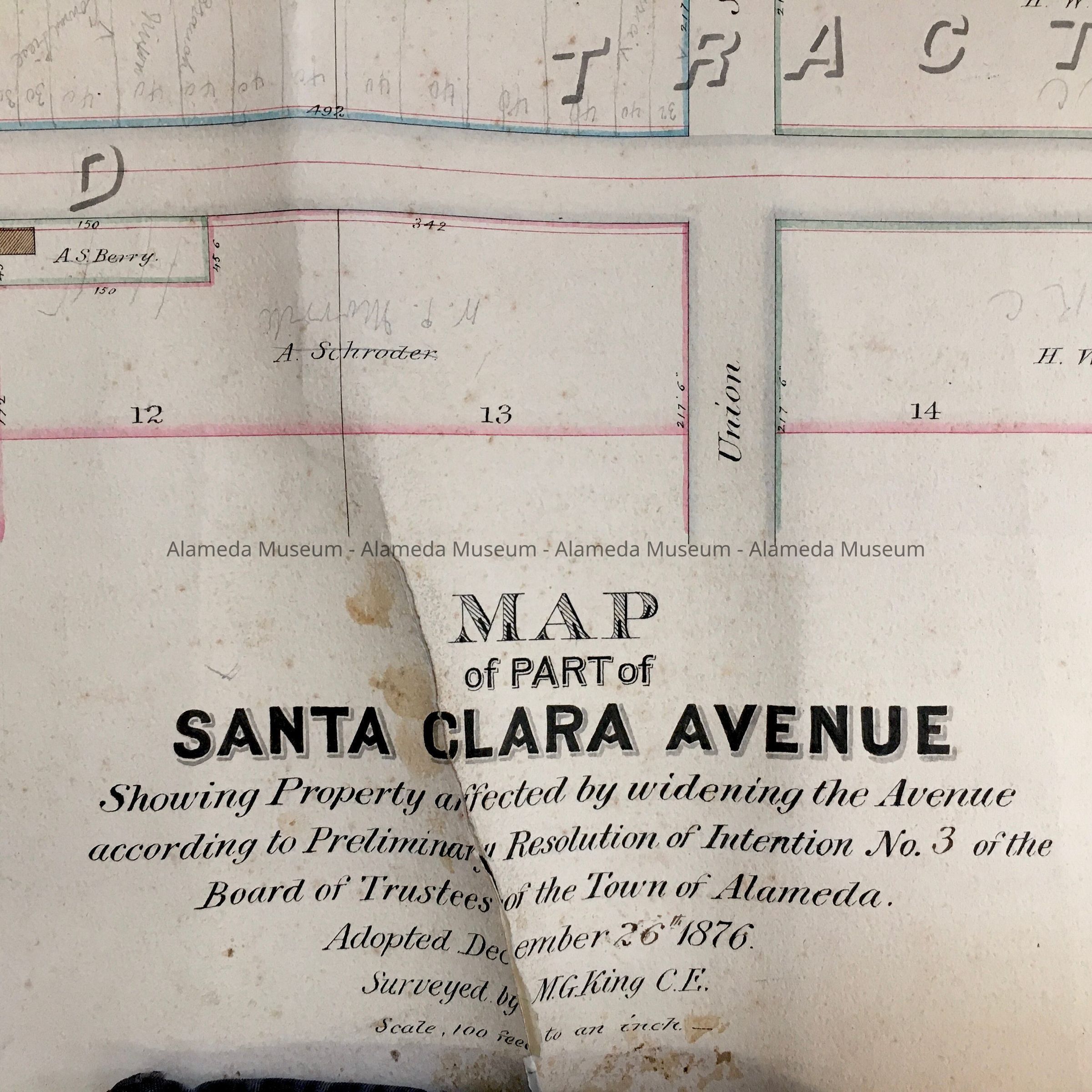
When opened, the title is: Map/of Part of/SANTA CLARA AVE/Showing Property affected by widening the Avenue according to Preliminary Resolution of Intention No. 3 of the/Board of Trustees of the Town of Alameda./Adopted December 1876/Surveyed by M.G. King C.E.'
Size: L 116" x W 11 1/2"
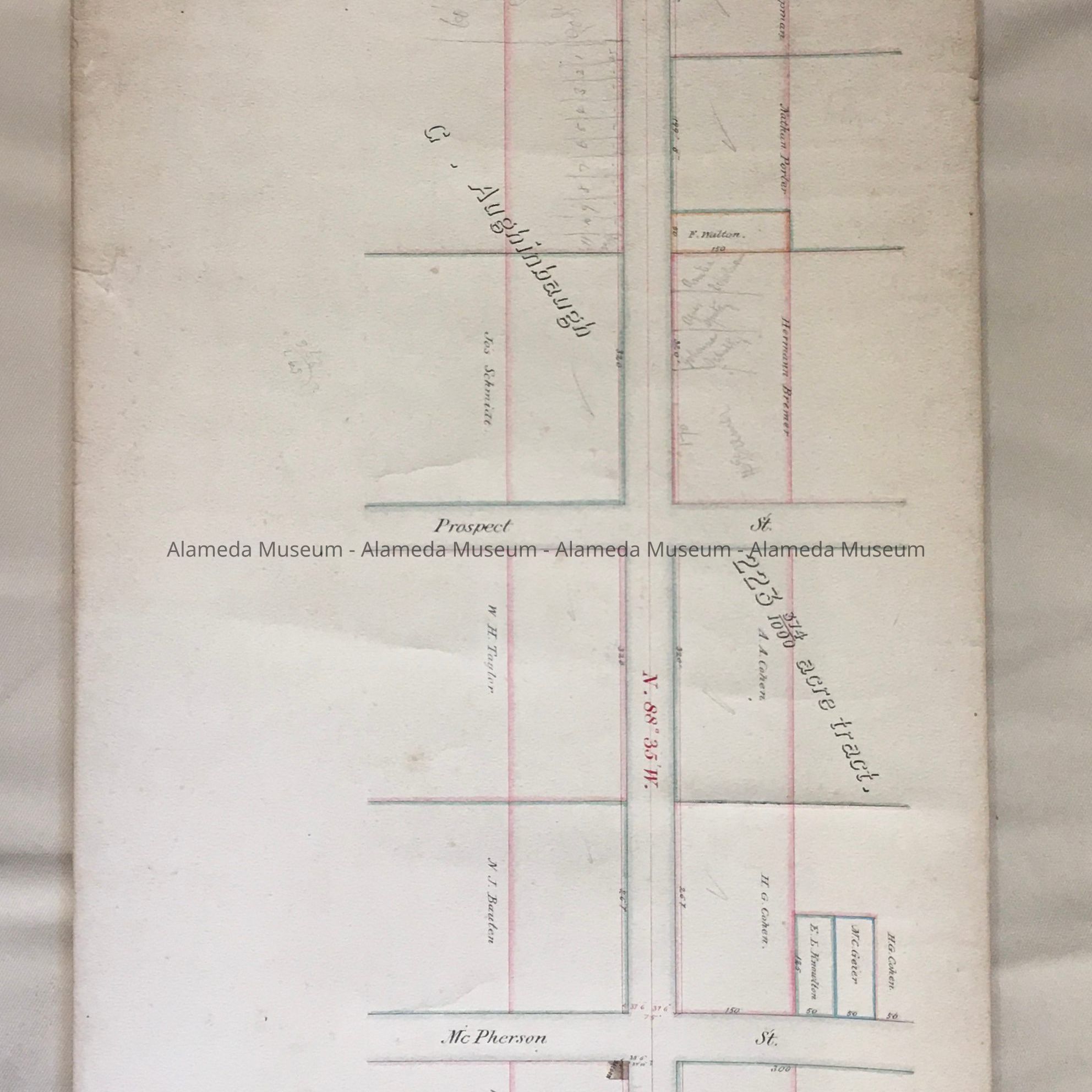
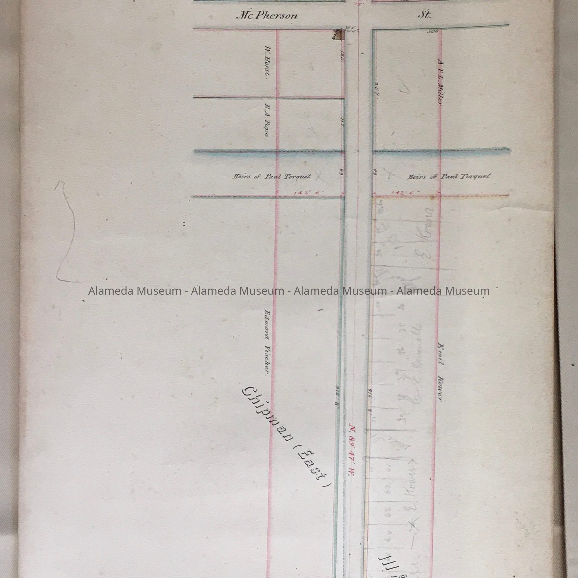
History of Object: Map of Santa Clara Ave, from Park Street to Webster Street, created as part of the work to widen Santa Clara Ave.
Acquired from: City of Alameda
Cataloged: August 24, 2002