Name/Title
Subdivision Map Santa Clara / Central / Park / Everett, c. 1870s-1880sEntry/Object ID
2002.80.9Description
Acc. No. 02.80.9
Subject: Maps
Date or Period: circa 1870's – 1880's
Object: Maps, Subdivision
Description:
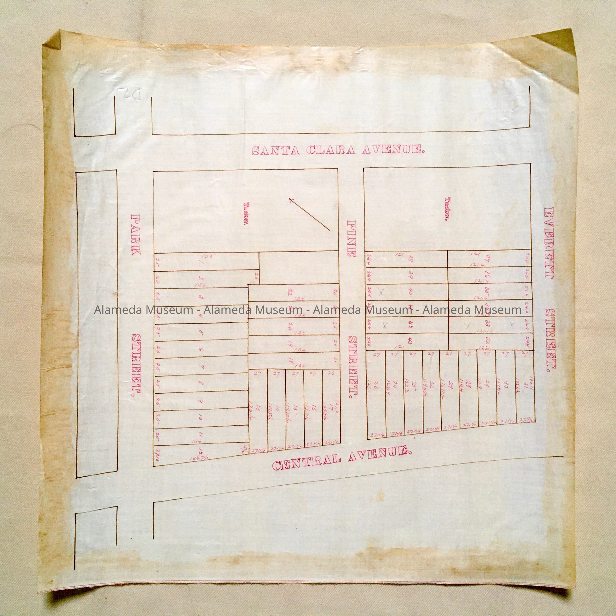
Hand-drawn map in sepia and red colored ink on white-colored polished linen paper.
Size: L15 x W15-1/2 inches.
History:
Subdivision map depicting property bounded by Santa Clara and Central Avenues, Park and Everett Streets. A street running between Santa Clara and Central and labeled Pine Street is now known as Park Avenue.
This collection of maps, etc., found in the attic of City Hall prior to the rehabilitation and seismic upgrades in the late 1990's.
Acquired From: City of Alameda
Date: 7/28/02